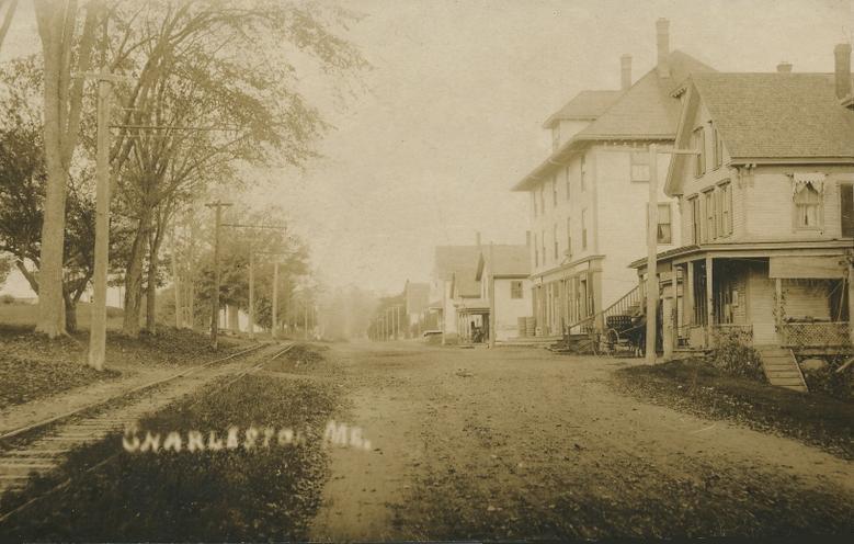
- Charleston, Maine
-
Charleston, Maine — Town — 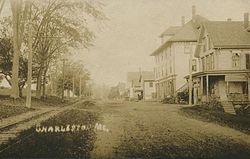 Location within the state of Maine
 Charleston, Maine
Coordinates: 45°3′39″N 69°2′7″W / 45.06083°N 69.03528°WCoordinates: 45°3′39″N 69°2′7″W / 45.06083°N 69.03528°W Country United States State Maine County Penobscot Incorporated 1811 Area - Total 40.2 sq mi (104.2 km2) - Land 40.2 sq mi (104.1 km2) - Water 0.0 sq mi (0.0 km2) Elevation 318 ft (97 m) Population (2000) - Total 1,397 - Density 34.7/sq mi (13.4/km2) Time zone Eastern (EST) (UTC-5) - Summer (DST) EDT (UTC-4) ZIP code 04422 Area code(s) 207 FIPS code 23-12105 GNIS feature ID 0582404 Charleston is a town in Penobscot County, Maine, United States. It is part of the Bangor, Maine Metropolitan Statistical Area. The population was 1,397 at the 2000 census. Home to the Higgins Classical Institute, Charleston includes the village of West Charleston.
Contents
History
It was first settled as early as 1795 by Charles Vaughan. The land was granted on July 14, 1802 by the Massachusetts General Court to John Lowell. Known as T2 R5 NWP, or Township 2, Range 4, North of the Waldo Patent, it was incorporated on February 16, 1811 as New Charlestown, to distinguish it from Charlestown when Massachusetts included the province of Maine. But in 1820, Maine achieved statehood, so any confusion between the two ceased. Consequently, in 1827 the name was shortened to Charleston.
Sawmills were established to operate by water power at the streams. But Charleston was primarily an agricultural town. Its large farms were noted for raising horses and cattle. In 1837, the Higgins Classical Institute was founded. By 1870, the community had a population of 1,191. Between 1901-1930, the Bangor Railway & Electric Company operated trolleys on an electric railway between Bangor and Charleston.
In late 1950, construction began on the Charleston Air Force Station, part of the Aerospace Defense Command. Known as Bull Hill for its location in the town, the station was completed in early 1951, and fully manned and operational in 1952. After the base closed, it was transformed into the Charleston Correctional Facility, which opened in 1980.
Geography
According to the United States Census Bureau, the town has a total area of 40.2 square miles (104 km2), of which, 40.2 square miles (104 km2) of it is land and 0.04 square miles (0.10 km2) of it (0.05%) is water. Charleston is drained by Rollins Brook and South Gate Brook.
The town is located near the intersection of Charleston Road and South Stagecoach Road-Atkinson Road, between Route 15 (Bangor Road) and Route 221, halfway between Schoodic Lake and Sebasticook Lake.
Demographics
As of the census[1] of 2000, there were 1,397 people, 431 households, and 334 families residing in the town. The population density was 34.7 people per square mile (13.4/km²). There were 470 housing units at an average density of 11.7 per square mile (4.5/km²). The racial makeup of the town was 98.28% White, 0.72% African American, 0.29% Native American, 0.21% Asian, and 0.50% from two or more races. Hispanic or Latino of any race were 0.21% of the population.
There were 431 households out of which 34.6% had children under the age of 18 living with them, 66.6% were married couples living together, 5.8% had a female householder with no husband present, and 22.3% were non-families. 18.3% of all households were made up of individuals and 5.8% had someone living alone who was 65 years of age or older. The average household size was 2.65 and the average family size was 2.92.
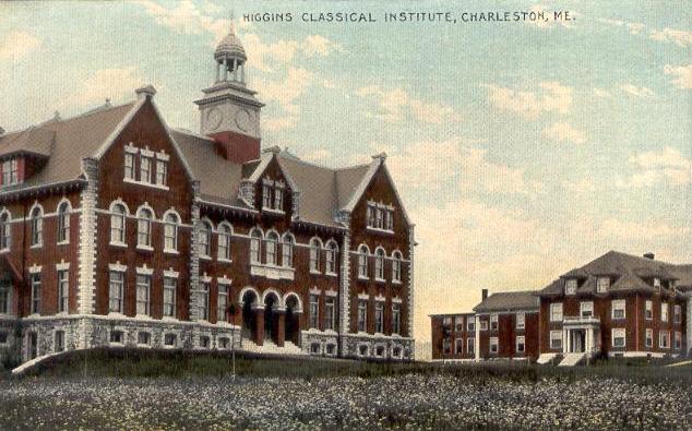
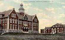 Higgins Classical Institute in 1905
In the town the population was spread out with 24.1% under the age of 18, 10.1% from 18 to 24, 34.3% from 25 to 44, 24.2% from 45 to 64, and 7.4% who were 65 years of age or older. The median age was 36 years. For every 100 females there were 109.8 males. For every 100 females age 18 and over, there were 115.7 males.
The median income for a household in the town was $36,053, and the median income for a family was $39,625. Males had a median income of $31,250 versus $20,735 for females. The per capita income for the town was $14,832. About 6.7% of families and 10.5% of the population were below the poverty line, including 14.8% of those under age 18 and 4.0% of those age 65 or over.
References
- ^ "American FactFinder". United States Census Bureau. http://factfinder.census.gov. Retrieved 2008-01-31.
External links
Municipalities and communities of Penobscot County, Maine Cities 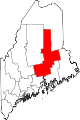
Towns Alton | Bradford | Bradley | Burlington | Carmel | Charleston | Chester | Clifton | Corinna | Corinth | Dexter | Dixmont | East Millinocket | Eddington | Edinburg | Enfield | Etna | Exeter | Garland | Glenburn | Greenbush | Hampden | Hermon | Holden | Howland | Hudson | Kenduskeag | Lagrange | Lakeville | Lee | Levant | Lincoln | Lowell | Mattawamkeag | Maxfield | Medway | Milford | Millinocket | Mount Chase | Newburgh | Newport | Orono | Orrington | Passadumkeag | Patten | Plymouth | Springfield | Stacyville | Stetson | Veazie | Winn | Woodville
Plantations Unorganized
territoriesArgyle | East Central Penobscot | Kingman | North Penobscot | Prentiss | Twombly | Whitney
CDPs Dexter | East Millinocket | Hampden | Howland | Lincoln | Milford | Millinocket | Newport | Orono
Indian
reservationCategories:- Towns in Penobscot County, Maine
- Populated places established in 1795


Wikimedia Foundation. 2010.