- Drew Plantation, Maine
-
Drew Plantation is a plantation in Penobscot County, Maine, United States. The population was 57 at the 2000 census. It is part of the Bangor, Maine Metropolitan Statistical Area.
Geography
According to the United States Census Bureau, the plantation has a total area of 38.8 square miles (100 km2), of which, 37.6 square miles (97 km2) of it is land and 1.2 square miles (3.1 km2) of it (3.02%) is water.
Demographics
As of the census[1] of 2000, there were 57 people, 17 households, and 12 families residing in the plantation. The population density was 1.5 people per square mile (0.6/km²). There were 37 housing units at an average density of 1.0 per square mile (0.4/km²). The racial makeup of the plantation was 91.23% White, 5.26% African American, and 3.51% from two or more races.
There were 17 households out of which 35.3% had children under the age of 18 living with them, 70.6% were married couples living together, and 29.4% were non-families. 23.5% of all households were made up of individuals and 23.5% had someone living alone who was 65 years of age or older. The average household size was 3.35 and the average family size was 4.00.
In the plantation the population was spread out with 33.3% under the age of 18, 5.3% from 18 to 24, 28.1% from 25 to 44, 17.5% from 45 to 64, and 15.8% who were 65 years of age or older. The median age was 35 years. For every 100 females there were 119.2 males. For every 100 females age 18 and over, there were 90.0 males.
The median income for a household in the plantation was $26,667, and the median income for a family was $43,125. Males had a median income of $32,500 versus $100,000 for females. The per capita income for the plantation was $15,249. There were no families and 3.1% of the population living below the poverty line, including no under eighteens and none of those over 64.
References
- ^ "American FactFinder". United States Census Bureau. http://factfinder.census.gov. Retrieved 2008-01-31.
- "Plantation of Drew". Geographic Names Information System, U.S. Geological Survey. 1 September 1995. http://geonames.usgs.gov/pls/gnispublic/f?p=gnispq:3:::NO::P3_FID:582447. Retrieved 2010-03-09.
Municipalities and communities of Penobscot County, Maine Cities 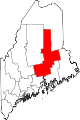
Towns Alton | Bradford | Bradley | Burlington | Carmel | Charleston | Chester | Clifton | Corinna | Corinth | Dexter | Dixmont | East Millinocket | Eddington | Edinburg | Enfield | Etna | Exeter | Garland | Glenburn | Greenbush | Hampden | Hermon | Holden | Howland | Hudson | Kenduskeag | Lagrange | Lakeville | Lee | Levant | Lincoln | Lowell | Mattawamkeag | Maxfield | Medway | Milford | Millinocket | Mount Chase | Newburgh | Newport | Orono | Orrington | Passadumkeag | Patten | Plymouth | Springfield | Stacyville | Stetson | Veazie | Winn | Woodville
Plantations Carroll Plantation | Drew Plantation | Seboeis Plantation | Webster Plantation
Unorganized
territoriesArgyle | East Central Penobscot | Kingman | North Penobscot | Prentiss | Twombly | Whitney
CDPs Dexter | East Millinocket | Hampden | Howland | Lincoln | Milford | Millinocket | Newport | Orono
Indian
reservationCategories:- Plantations in Penobscot County, Maine

Wikimedia Foundation. 2010.