- Millinocket, Maine
-
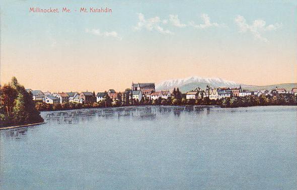
Millinocket, Maine — Town — Millinocket and Mount Katahdin in 1907

SealLocation within the state of Maine
 Millinocket, Maine
Coordinates: 45°39′29″N 68°42′1″W / 45.65806°N 68.70028°W Country United States State Maine County Penobscot Settled 1829 Incorporated March 16, 1901 Area - Total 18.3 sq mi (47.4 km2) - Land 15.9 sq mi (41.1 km2) - Water 2.4 sq mi (6.2 km2) Elevation 351 ft (107 m) Population (2000) - Total 5,203 - Density 327.5/sq mi (126.4/km2) Time zone Eastern (EST) (UTC-5) - Summer (DST) EDT (UTC-4) ZIP code 04462 Area code(s) 207 FIPS code 23-45810 GNIS feature ID 0582596 Millinocket is a former mill town in Penobscot County, Maine, United States. The population was 5,203 at the 2000 census. Millinocket is both a forest products and recreational area.
Contents
History
It was first settled in 1829 by Thomas Fowler and his family, who cleared land for a farm. When the Bangor and Aroostook Railroad extended service to Houlton in 1894, the line ran through the area, opening it to development. Charles W. Mullen, an engineering graduate from the University of Maine, proposed a hydroelectric dam on the Penobscot River. He recognized the falls as an ideal water power source to operate a large pulp and paper mill. Mullen contacted Garret Schenck, vice-president of the International Paper mill at Rumford Falls and an expert in the industry, about building a pulp and paper mill near the dam. Mr. Schenck agreed, and set about obtaining the necessary financial backing.[1]
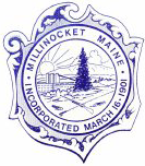
After securing land rights, the chosen site was at the junction of the West Branch of the Penobscot River and Millinocket Stream, where it stands today. Things moved quickly, and on May 15, 1899, construction began on the Great Northern mill. As the location was not near existing towns, it became necessary to build one. Millinocket, meaning "the land of many islands" after all the islands in the Penobscot River (and having nothing to do with the mill), was incorporated on March 16, 1901.[2]
Garret Schenck contracted bonded labor, especially stonemasons from Italy. The term bonded in this case referred to the fact that the Italians owed for the passage to America and were in debt the minute they set foot in this country. Italian masons were largely responsible for the construction of the Millinocket mill.[3]
Throughout the 20th century, the community prospered. It developed a reputation as a small but successful rural town, mostly due to the paper industry, but also to its proximity to Mount Katahdin, Maine's tallest mountain, and Moosehead Lake, Maine's largest lake.
In early 2003, however, Great Northern Paper announced it had filed for bankruptcy protection for its Millinocket and East Millinocket mills. Since then, the mill town has struggled to reshape its economy, while receiving significant help from the state government and local economic development efforts. Shortly after closing the mills, a Canadian corporation purchased the bankrupt paper mills in both Millinocket and East Millinocket. Currently, the paper mill employs over 600 workers in the two towns. In additional to the traditional forest products industry, Millinocket has been growing a service economy, and has grown into a major four season tourist attraction. The region is also served by the Millinocket Municipal Airport, which sells both 100LL avgas and jet fuel.[4]
-
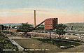
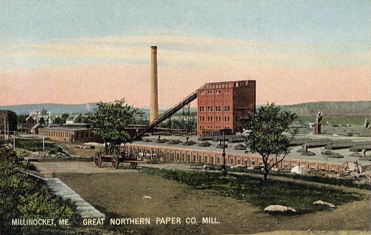
Great Northern Paper Co. mill in 1907
-

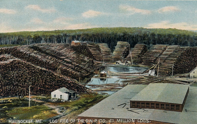
Log pile in 1908
-

Great Northern Hotel in 1906
Geography
According to the United States Census Bureau, the town has a total area of 18.3 square miles (47.4 km²), of which, 15.9 square miles (41.2 km²) of it is land and 2.4 square miles (6.2 km²) of it (13.17%) is water. Millinocket Lake is drained by the West Branch Penobscot River and Millinocket Stream. Millinocket Lake and Mount Katahdin, elevation 5,270 feet (1,606 m), are in the northwest.
The town is crossed by State Routes 11 and 157. It borders the town of East Millinocket to the east.
Demographics
As of the census[5] of 2000, there were 5,203 people, 2,295 households, and 1,556 families residing in the town. The population density was 327.5 people per square mile (126.4/km²). There were 2,679 housing units at an average density of 168.6 per square mile (65.1/km²). The racial makeup of the town was 98.52% White, 0.10% Black or African American, 0.54% Native American, 0.37% Asian, 0.02% from other races, and 0.46% from two or more races. Hispanic or Latino of any race were 0.23% of the population.
There were 2,295 households, out of which 25.7% had children under the age of 18 living with them, 55.7% were married couples living together, 9.1% had a female householder with no husband present, and 32.2% were non-families. 28.3% of all households were made up of individuals and 14.5% had someone living alone who was 65 years of age or older. The average household size was 2.25 and the average family size was 2.69.
In the town the population was spread out with 21.1% under the age of 18, 4.9% from 18 to 24, 25.0% from 25 to 44, 29.7% from 45 to 64, and 19.4% who were 65 years of age or older. The median age was 44 years. For every 100 females there were 93.9 males. For every 100 females age 18 and over, there were 90.5 males.
The median income for a household in the town was $29,318, and the median income for a family was $40,893. Males had a median income of $41,218 versus $23,289 for females. The per capita income for the town was $17,130. About 11.8% of families and 14.8% of the population were below the poverty line, including 20.4% of those under age 18 and 12.4% of those age 65 or over. Students attend Stearns High School, mascot the Minutemen.
Education
Schools in Millinocket are under the jurisdiction of the Millinocket School Department. The town's primary school is the Granite Street School, the middle school is Millinocket Middle School; the secondary school is Stearns High School.[6]
Media
Millinocket has two newspapers that serve the area:
- Katahdin Press, a weekly newspaper, was formed in 2005, through a merger of the Katahdin Times and the Community Press.
- Magic City Morning Star, which has published since 2002.
Regionally, the Bangor Daily News is also circulated throughout the area.
The area is served by several radio stations, mainly Millinocket licensed WSYY-FM 94.9 (classic hits/adult contemporary) and WSYY 1240(ESPN Sports Radio). Stations from Bangor and the more powerful stations from Presque Isle are also heard. Cable television is provided by Beeline Cable, which provides most of the network affiliates from Bangor.
Television
Millinocket is currently home to the Discovery Channel TV show American Loggers which showcases the logging efforts of Gerald Pelletier Incorporated. The television show, when in season, is on Friday nights at 10:00 PM Eastern/Pacific.[7]
Sites of interest
Notable people
- Harry A. Corey, entrepreneur, Canadian politician
- Mary Kathryn Gonya, Miss Maine (1966)
- Jane Harragan, Miss Maine (1950)
- Andrew St. John, actor
- Joe Whalen, tennis player
- Ervin Williams, musician
References
- ^ History of Millinocket, Maine
- ^ "Brief History of Millinocket, Maine," Millinocket Historical Society
- ^ "Brief History of Millinocket, Maine," Millinocket Historical Society
- ^ "Area History", Katahdin Area Chamber of Commerce
- ^ "American FactFinder". United States Census Bureau. http://factfinder.census.gov. Retrieved 2008-01-31.
- ^ Millinocket page on GreatSchools
- ^ American Loggers on Discovery
External links
- Town of Millinocket, Maine
- Millinocket Memorial Library
- Jo Mary Riders Snowmobile Club
- Northern Timber Cruisers Snowmobile Club
- Katahdin Regional Wiki: Millinocket
- What Happened To Lieutenant Hare?
- Katahdin Area Chamber of Commerce
Coordinates: 45°39′26″N 68°42′37″W / 45.65722°N 68.71028°W
Municipalities and communities of Penobscot County, Maine County seat: Bangor Cities 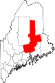
Towns Alton | Bradford | Bradley | Burlington | Carmel | Charleston | Chester | Clifton | Corinna | Corinth | Dexter | Dixmont | East Millinocket | Eddington | Edinburg | Enfield | Etna | Exeter | Garland | Glenburn | Greenbush | Hampden | Hermon | Holden | Howland | Hudson | Kenduskeag | Lagrange | Lakeville | Lee | Levant | Lincoln | Lowell | Mattawamkeag | Maxfield | Medway | Milford | Millinocket | Mount Chase | Newburgh | Newport | Orono | Orrington | Passadumkeag | Patten | Plymouth | Springfield | Stacyville | Stetson | Veazie | Winn | Woodville
Plantations Unorganized
territoriesArgyle | East Central Penobscot | Kingman | North Penobscot | Prentiss | Twombly | Whitney
CDPs Dexter | East Millinocket | Hampden | Howland | Lincoln | Milford | Millinocket | Newport | Orono
Indian
reservationCategories:- Company towns in Maine
- Towns in Penobscot County, Maine
- Millinocket, Maine
-


Wikimedia Foundation. 2010.