- Corinna, Maine
-
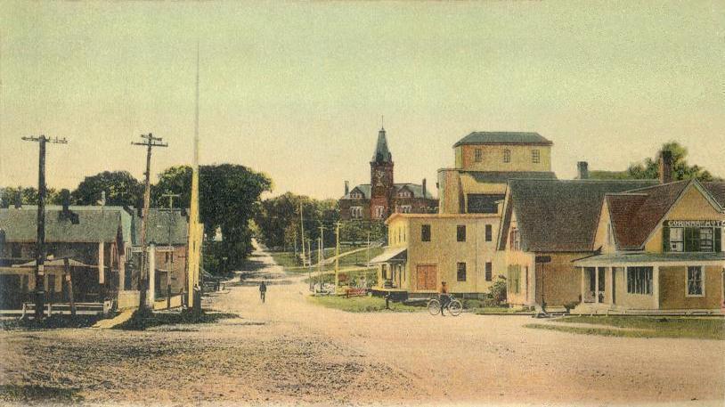
Corinna, Maine — Town — Downtown in 1908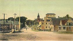 Location within the state of Maine
 Corinna, Maine
Coordinates: 44°56′44″N 69°15′23″W / 44.94556°N 69.25639°WCoordinates: 44°56′44″N 69°15′23″W / 44.94556°N 69.25639°W Country United States State Maine County Penobscot Incorporated 1816 Area – Total 39.4 sq mi (102.2 km2) – Land 38.7 sq mi (100.1 km2) – Water 0.8 sq mi (2.0 km2) Elevation 312 ft (95 m) Population (2000) – Total 2,145 – Density 55.5/sq mi (21.4/km2) Time zone Eastern (EST) (UTC-5) – Summer (DST) EDT (UTC-4) ZIP code 04928 Area code(s) 207 FIPS code 23-14310 GNIS feature ID 0582419 Corinna is a town in Penobscot County, Maine, United States. The population was 2,145 at the 2000 census. It is part of the Bangor, Maine metropolitan statistical area.
Contents
History
It was first called T4 R4 NWP (or Township 4, Range 4, North of the Waldo Patent). On June 30, 1804, Dr. John Warren of Boston bought 23,040 acres (93 km2) on speculation from Massachusetts for two cents an acre, or $460.80. To encourage settlement, he gave away some land and built a combination gristmill and sawmill. The town would be incorporated on December 11, 1816 as Corinna, named after Dr. Warren's daughter.[1]
The first homes were built of hewn logs. Corinna developed into a farming community, with water powered mills at the outlet of Corundel Lake. After the arrival of the Dexter and Newport Railroad in 1865-1866, the village developed into a small mill town. Industries would include sawmills, planing mills, woolen textile mills, and a door, sash and blind factory. There were also boot and shoemaking shops and an iron foundry.[2] The Eastland Woolen Mill manufactured woolen materials from the 1930s until it closed in 1997, after which it was demolished.[3] The town is now largely a bedroom community of Bangor.
-

Soldiers' Monument c. 1912
-
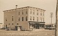
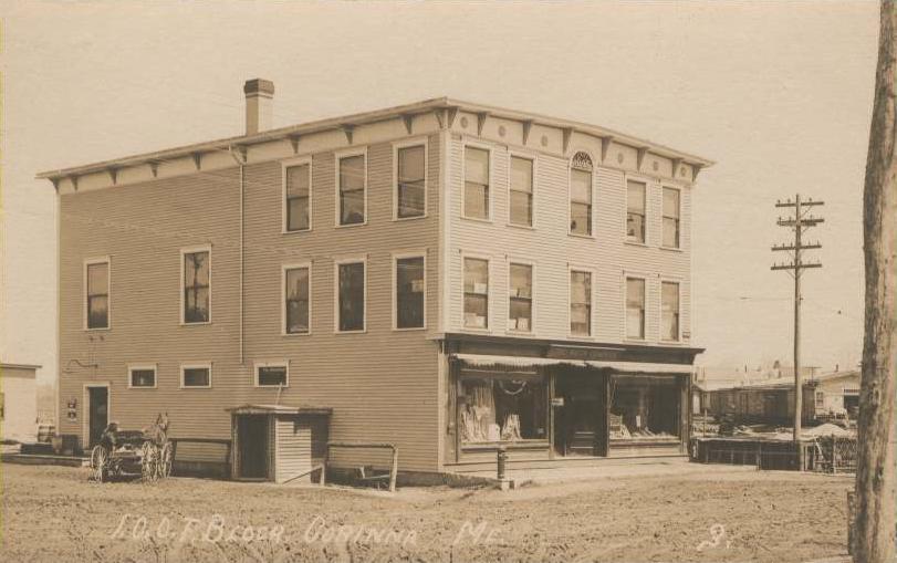
Odd Fellows' Hall c. 1912
-

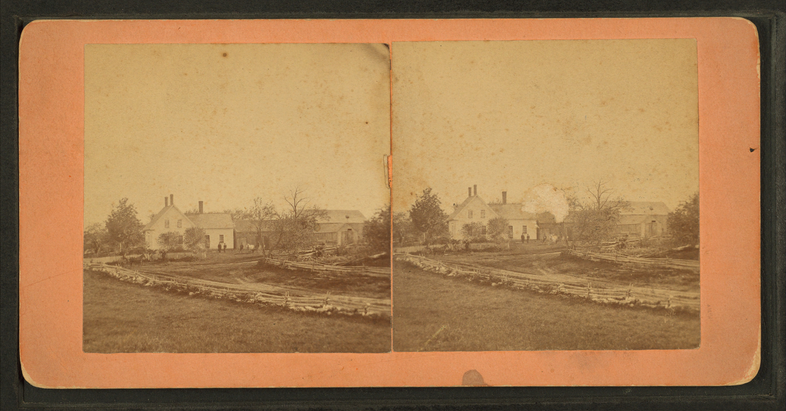
Fisher residence c. 1870
Historic building
 Stewart Free Library c. 1920
The Stewart Free Library (1898), a gift to the town by Corinna-born Minneapolis millionaire Levi M. Stewart, was designed by Minneapolis architect William Harrison Grimshaw. The library is listed on the National Register of Historic Places, and contains well-preserved historic interiors as well as a majestic facade with clocktower. It resembles a mid-western county courthouse more than a typical small-town Maine library.[1]
A memorial dedicated to the soldiers that have died in the War on Terror is located near the river. It is made out of marble and incised with the names of fallen soldiers.
Geography
According to the United States Census Bureau, the town has a total area of 39.4 square miles (102 km2), of which, 38.7 square miles (100 km2) of it is land and 0.8 square miles (2.1 km2) of it (1.98%) is water. Situated beside Corundel Lake, Corinna is drained by the Sebasticook River and Alder Stream.
The town is located at the intersection of Route 7 (Dexter Road), Route 11 (Exeter Road) and Route 43 (St. Albans Road), and is centered between the towns of Exeter, St. Albans, Dexter and Newport, about 8 miles (13 km) north of Interstate 95. Corinna is also located on the Newport/Dover-Foxcroft Rail Trail, which was developed along a former Maine Central Railroad line after tracks and ties were removed in 1993.[4]
Demographics
As of the census[5] of 2000, there were 2,145 people, 842 households, and 621 families residing in the town. The population density was 55.5 people per square mile (21.4/km²). There were 981 housing units at an average density of 25.4 per square mile (9.8/km²). The racial makeup of the town was 98.18% White, 0.42% African American, 0.14% Native American, 0.09% Asian, 0.23% from other races, and 0.93% from two or more races. Hispanic or Latino of any race were 0.51% of the population.
There were 842 households out of which 31.0% had children under the age of 18 living with them, 60.0% were married couples living together, 8.2% had a female householder with no husband present, and 26.2% were non-families. 21.0% of all households were made up of individuals and 10.7% had someone living alone who was 65 years of age or older. The average household size was 2.55 and the average family size was 2.89.
In the town the population was spread out with 24.9% under the age of 18, 7.4% from 18 to 24, 28.0% from 25 to 44, 24.4% from 45 to 64, and 15.4% who were 65 years of age or older. The median age was 39 years. For every 100 females there were 99.5 males. For every 100 females age 18 and over, there were 99.6 males.
The median income for a household in the town was $32,115, and the median income for a family was $37,900. Males had a median income of $28,707 versus $17,500 for females. The per capita income for the town was $17,345. About 14.1% of families and 19.5% of the population were below the poverty line, including 26.4% of those under age 18 and 8.5% of those age 65 or over.
Site of interest
Notable people
- Mark Chadbourne, composer, recording artist[citation needed]
- Gilbert Patten, author
References
- ^ Coolidge, Austin J.; John B. Mansfield (1859). A History and Description of New England. Boston, Massachusetts. p. 96. http://books.google.com/books?id=OcoMAAAAYAAJ&lpg=PA9&dq=coolidge%20mansfield%20history%20description%20new%20england%201859&pg=PA96#v=onepage&q&f=false.
- ^ Varney, George J. (1886), Gazetteer of the state of Maine. Corinna, Boston: Russell, http://history.rays-place.com/me/corinna-me.htm
- ^ Eastland Woolen Mill -- "Wiping the Slate Clean: Corinna's New Horizon"
- ^ Maine State Planning Office, "Newport/Dover-Foxcroft Rail Trail"
- ^ "American FactFinder". United States Census Bureau. http://factfinder.census.gov. Retrieved 2008-01-31.
External links
- Town of Corinna, Maine
- Stewart Free Library
- Maine State Planning Office page for Newport/Dover-Foxcroft Rail Trail
- Natural Resources Council of Maine page on Newport/Dover-Foxcroft Rail Trail
Municipalities and communities of Penobscot County, Maine Cities 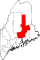
Towns Alton | Bradford | Bradley | Burlington | Carmel | Charleston | Chester | Clifton | Corinna | Corinth | Dexter | Dixmont | East Millinocket | Eddington | Edinburg | Enfield | Etna | Exeter | Garland | Glenburn | Greenbush | Hampden | Hermon | Holden | Howland | Hudson | Kenduskeag | Lagrange | Lakeville | Lee | Levant | Lincoln | Lowell | Mattawamkeag | Maxfield | Medway | Milford | Millinocket | Mount Chase | Newburgh | Newport | Orono | Orrington | Passadumkeag | Patten | Plymouth | Springfield | Stacyville | Stetson | Veazie | Winn | Woodville
Plantations Unorganized
territoriesArgyle | East Central Penobscot | Kingman | North Penobscot | Prentiss | Twombly | Whitney
CDPs Dexter | East Millinocket | Hampden | Howland | Lincoln | Milford | Millinocket | Newport | Orono
Indian
reservationCategories:- Towns in Penobscot County, Maine
-


Wikimedia Foundation. 2010.