- Orrington, Maine
-
Orrington, Maine — Town — Location within the state of Maine
 Orrington, Maine
Coordinates: 44°43′17″N 68°47′21″W / 44.72139°N 68.78917°W Country United States State Maine County Penobscot Area – Total 27.5 sq mi (71.2 km2) – Land 25.4 sq mi (65.8 km2) – Water 2.1 sq mi (5.4 km2) Elevation 118 ft (36 m) Population (2000) – Total 3,526 – Density 138.8/sq mi (53.6/km2) Time zone Eastern (EST) (UTC-5) – Summer (DST) EDT (UTC-4) ZIP code 04474 Area code(s) 207 FIPS code 23-55680 GNIS feature ID 0582652 Website www.orrington.govoffice.com Orrington is a town in Penobscot County, Maine, United States. The population was 3,526 at the 2000 census.
Contents
History
Orrington was originally part of Condustiegg (or Kenduskeag) Plantation, which also included the present-day cities of Bangor and Brewer. Orrington was incorporated as a town in 1788 with its major village at Brewer, then called "New Worcester". Bangor incorporated three years later in 1791. Brewer broke away from Orrington in 1812 to form a separate town.
The name "Orrington" reportedly resulted from a spelling mistake. The settlers intended to name it "Orangetown" after Orangetown, Maryland, but it was written on the record-books in distant Massachusetts, of which Maine was then a territory, as "Orrington". "Orring" was a not unreasonable phonetic rendering of "orange" before the standardization of spelling.[1]
Geography
According to the United States Census Bureau, the town has a total area of 27.5 square miles (71 km2), of which, 25.4 square miles (66 km2) of it is land and 2.1 square miles (5.4 km2) of it (7.64%) is water.
Demographics
As of the census[2] of 2000, there were 3,526 people, 1,396 households, and 1,042 families residing in the town. The population density was 138.8 people per square mile (53.6/km²). There were 1,489 housing units at an average density of 58.6 per square mile (22.6/km²). The racial makeup of the town was 99.09% White, 0.20% African American, 0.11% Native American, 0.23% Asian, 0.03% from other races, and 0.34% from two or more races. Hispanic or Latino of any race were 0.14% of the population.
There were 1,396 households out of which 32.7% had children under the age of 18 living with them, 64.3% were married couples living together, 7.1% had a female householder with no husband present, and 25.3% were non-families. 19.3% of all households were made up of individuals and 8.7% had someone living alone who was 65 years of age or older. The average household size was 2.52 and the average family size was 2.89.
In the town the population was spread out with 23.6% under the age of 18, 5.8% from 18 to 24, 29.8% from 25 to 44, 28.8% from 45 to 64, and 12.1% who were 65 years of age or older. The median age was 40 years. For every 100 females there were 99.9 males. For every 100 females age 18 and over, there were 96.7 males.
The median income for a household in the town was $44,327, and the median income for a family was $47,803. Males had a median income of $35,250 versus $27,381 for females. The per capita income for the town was $19,290. About 2.4% of families and 4.3% of the population were below the poverty line, including 3.6% of those under age 18 and 5.8% of those age 65 or over.
Notable people
- Ebenezer M. Chamberlain (1805–1861), congressman from Indiana.
- Greenleaf A. Goodale, brig. general in Spanish-American War
- Stephen King, author.[citation needed]
- Molly Kool, first female master mariner in North America.
- Benjamin Franklin Mudge (1817–1879), geologist, paleontologist.
- Enoch Mudge, first American-born Methodist minister, state congressman.[citation needed]
- Thomas H. Mudge, Methodist minister, professor of theology.
- Zachariah A. Mudge, Methodist clergyman, author.
- Edward A. Pierce, Wall St. banker, one of founders of Merrill, Lynch, Pierce, Fenner, and Smith, Inc., now Merrill Lynch
References
- ^ George J. Varney, Gazetteer of the State of Maine (Boston, 1886)
- ^ "American FactFinder". United States Census Bureau. http://factfinder.census.gov. Retrieved 2008-01-31.
External links
Municipalities and communities of Penobscot County, Maine Cities 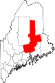
Towns Alton | Bradford | Bradley | Burlington | Carmel | Charleston | Chester | Clifton | Corinna | Corinth | Dexter | Dixmont | East Millinocket | Eddington | Edinburg | Enfield | Etna | Exeter | Garland | Glenburn | Greenbush | Hampden | Hermon | Holden | Howland | Hudson | Kenduskeag | Lagrange | Lakeville | Lee | Levant | Lincoln | Lowell | Mattawamkeag | Maxfield | Medway | Milford | Millinocket | Mount Chase | Newburgh | Newport | Orono | Orrington | Passadumkeag | Patten | Plymouth | Springfield | Stacyville | Stetson | Veazie | Winn | Woodville
Plantations Unorganized
territoriesArgyle | East Central Penobscot | Kingman | North Penobscot | Prentiss | Twombly | Whitney
CDPs Dexter | East Millinocket | Hampden | Howland | Lincoln | Milford | Millinocket | Newport | Orono
Indian
reservationCoordinates: 44°43′52″N 68°49′35″W / 44.73111°N 68.82639°W
Categories:- Towns in Penobscot County, Maine


Wikimedia Foundation. 2010.