- Mattawamkeag, Maine
-
Mattawamkeag, Maine — Town — Location within the state of Maine
 Mattawamkeag, Maine
Coordinates: 45°31′0″N 68°19′0″W / 45.516667°N 68.316667°W Country United States State Maine County Penobscot Area – Total 37.8 sq mi (97.9 km2) – Land 37.4 sq mi (96.9 km2) – Water 0.4 sq mi (0.9 km2) Elevation 413 ft (126 m) Population (2000) – Total 825 – Density 22.0/sq mi (8.5/km2) Time zone Eastern (EST) (UTC-5) – Summer (DST) EDT (UTC-4) ZIP code 04459 Area code(s) 207 FIPS code 23-44270 GNIS feature ID 0582585 Mattawamkeag is a town in Penobscot County, Maine, United States located where the Mattawamkeag River joins the Penobscot River.[1] The population was 825 at the 2000 census.
Contents
Railroad history
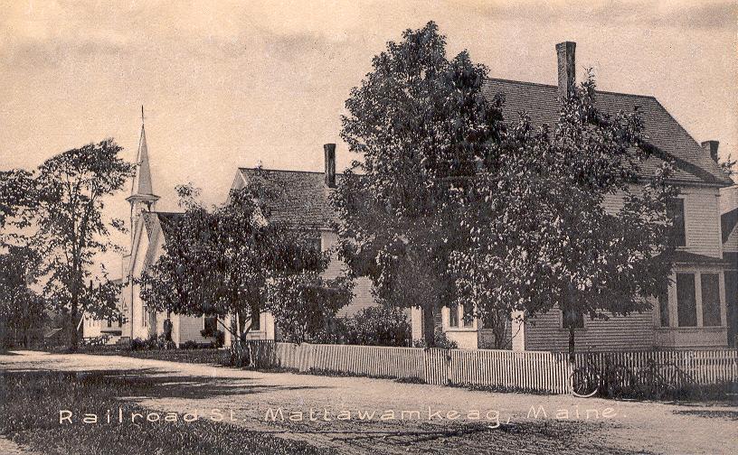
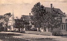 Railroad Street in c. 1910
Mattawamkeag's history is inextricably linked to the railroad.
The European & North American Railway built up the Penobscot River valley from Bangor and reached Mattawamkeag in 1869. By October 1871 the line was completed from Mattawamkeag to Vanceboro where it connected through to Saint John, New Brunswick, Canada. The Maine Central Railroad leased the Bangor-Vanceboro E&NA in 1882 and purchased it in 1955.
In 1889 the International Railway of Maine was completed between Megantic, Quebec, Canada to Mattawamkeag, where it interchanged with the Maine Central. The parent company of the International Railway, Canadian Pacific, obtained running rights from Maine Central for Mattawamkeag to Vanceboro where it regained CPR trackage in New Brunswick. This placed Mattawamkeag on the transcontinental mainline of the Canadian Pacific, running from Saint John to Vancouver, British Columbia, Canada. In 1974, CPR purchased the Mattawamkeag-Vanceboro railway tracks from Maine Central. In 1988, CPR transferred trackage east of Megantic to its subsidiary Canadian Atlantic Railway. In 1994, Canadian Atlantic was sold, with the line running through Mattawamkeag being purchased by J.D. Irving and is now operated as Eastern Maine Railway.
Maine Central was purchased by Guilford Transportation Industries in 1981 and became part of Guilford Rail System. Mattawamkeag is the eastern terminus of GRS, running west to Upstate New York through the states of Maine, New Hampshire and Massachusetts.
Historic building
The George W. Smith Homestead (1874) in Mattawamkeag is listed on the National Register of Historic Places [2]
Geography
According to the United States Census Bureau, the town has a total area of 37.8 square miles (98 km2), of which, 37.4 square miles (97 km2) of it is land and 0.4 square miles (1.0 km2) of it (0.98%) is water.
Demographics
As of the census[3] of 2000, there were 825 people, 338 households, and 234 families residing in the town. The population density was 22.0 people per square mile (8.5/km²). There were 393 housing units at an average density of 10.5 per square mile (4.1/km²). The racial makeup of the town was 98.06% White, 0.36% Native American, and 1.58% from two or more races. Hispanic or Latino of any race were 0.12% of the population.
There were 338 households out of which 31.1% had children under the age of 18 living with them, 58.0% were married couples living together, 7.4% had a female householder with no husband present, and 30.5% were non-families. 26.9% of all households were made up of individuals and 13.9% had someone living alone who was 65 years of age or older. The average household size was 2.44 and the average family size was 2.96.
In the town the population was spread out with 25.2% under the age of 18, 5.1% from 18 to 24, 28.0% from 25 to 44, 24.6% from 45 to 64, and 17.1% who were 65 years of age or older. The median age was 40 years. For every 100 females there were 95.5 males. For every 100 females age 18 and over, there were 95.3 males.
The median income for a household in the town was $23,403, and the median income for a family was $32,000. Males had a median income of $27,857 versus $19,063 for females. The per capita income for the town was $12,573. About 7.8% of families and 12.9% of the population were below the poverty line, including 12.3% of those under age 18 and 12.0% of those age 65 or over.
References
- ^ Maine League of Historical Societies and Museums (1970). Doris A. Isaacson. ed. Maine: A Guide 'Down East'. Rockland, Me: Courier-Gazette, Inc.. pp. 352.
- ^ [1]
- ^ "American FactFinder". United States Census Bureau. http://factfinder.census.gov. Retrieved 2008-01-31.
External links
Municipalities and communities of Penobscot County, Maine Cities 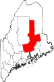
Towns Alton | Bradford | Bradley | Burlington | Carmel | Charleston | Chester | Clifton | Corinna | Corinth | Dexter | Dixmont | East Millinocket | Eddington | Edinburg | Enfield | Etna | Exeter | Garland | Glenburn | Greenbush | Hampden | Hermon | Holden | Howland | Hudson | Kenduskeag | Lagrange | Lakeville | Lee | Levant | Lincoln | Lowell | Mattawamkeag | Maxfield | Medway | Milford | Millinocket | Mount Chase | Newburgh | Newport | Orono | Orrington | Passadumkeag | Patten | Plymouth | Springfield | Stacyville | Stetson | Veazie | Winn | Woodville
Plantations Unorganized
territoriesArgyle | East Central Penobscot | Kingman | North Penobscot | Prentiss | Twombly | Whitney
CDPs Dexter | East Millinocket | Hampden | Howland | Lincoln | Milford | Millinocket | Newport | Orono
Indian
reservationCoordinates: 45°30′49″N 68°21′16″W / 45.51361°N 68.35444°W
Categories:- Towns in Penobscot County, Maine


Wikimedia Foundation. 2010.