- Medway, Maine
-
Medway, Maine — Town — Location within the state of Maine
 Medway, Maine
Coordinates: 45°36′12″N 68°31′23″W / 45.60333°N 68.52306°W Country United States State Maine County Penobscot Area – Total 41.7 sq mi (108.1 km2) – Land 41.0 sq mi (106.1 km2) – Water 0.8 sq mi (2.0 km2) Elevation 305 ft (93 m) Population (2000) – Total 1,489 – Density 36.4/sq mi (14.0/km2) Time zone Eastern (EST) (UTC-5) – Summer (DST) EDT (UTC-4) ZIP code 04460 Area code(s) 207 FIPS code 23-45005 GNIS feature ID 0582590 Medway is a town in Penobscot County, Maine, United States. The population was 1,489 at the 2000 census.
Contents
Geography
According to the United States Census Bureau, the town has a total area of 41.7 square miles (108 km2), of which, 41.0 square miles (106 km2) of it is land and 0.8 square miles (2.1 km2) of it (1.89%) is water. The town is at the confluence of the East and West Branches of the Penobscot River
History
One of the largest sawmills then on the Penobscot River was built in Medway in 1820 by Gen. Boyd, who owned half the township. A second large mill was built soon after near what is now Medway Center, attracting settlers. Sawmills remained there as late as the 1920s. Boyd originally incorporated the town as "Kilmarnock", but the name was changed to Medway in 1854.[1]
Historic buildings
The Congregational Church of Medway (1874), designed and built by Mansford Cushman, is listed on the National Register of Historic Places[2]
Demographics
As of the census[3] of 2000, there were 1,489 people, 587 households, and 437 families residing in the town. The population density was 36.4 people per square mile (14.0/km²). There were 651 housing units at an average density of 15.9 per square mile (6.1/km²). The racial makeup of the town was 99.13% White, 0.07% African American, 0.27% Native American, 0.13% Asian, and 0.40% from two or more races. Hispanic or Latino of any race were 0.27% of the population.
There were 587 households out of which 35.3% had children under the age of 18 living with them, 64.1% were married couples living together, 5.8% had a female householder with no husband present, and 25.4% were non-families. 20.8% of all households were made up of individuals and 7.0% had someone living alone who was 65 years of age or older. The average household size was 2.54 and the average family size was 2.92.
In the town the population was spread out with 24.9% under the age of 18, 6.5% from 18 to 24, 29.1% from 25 to 44, 29.1% from 45 to 64, and 10.4% who were 65 years of age or older. The median age was 39 years. For every 100 females there were 111.2 males. For every 100 females age 18 and over, there were 104.8 males.
The median income for a household in the town was $33,646, and the median income for a family was $40,063. Males had a median income of $42,353 versus $18,917 for females. The per capita income for the town was $15,264. About 8.6% of families and 11.5% of the population were below the poverty line, including 12.4% of those under age 18 and 11.2% of those age 65 or over.
References
- ^ Lewiston Evening Journal, Jan. 24, 1924, p. 10
- ^ [1]
- ^ "American FactFinder". United States Census Bureau. http://factfinder.census.gov. Retrieved 2008-01-31.
Municipalities and communities of Penobscot County, Maine Cities 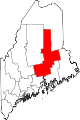
Towns Alton | Bradford | Bradley | Burlington | Carmel | Charleston | Chester | Clifton | Corinna | Corinth | Dexter | Dixmont | East Millinocket | Eddington | Edinburg | Enfield | Etna | Exeter | Garland | Glenburn | Greenbush | Hampden | Hermon | Holden | Howland | Hudson | Kenduskeag | Lagrange | Lakeville | Lee | Levant | Lincoln | Lowell | Mattawamkeag | Maxfield | Medway | Milford | Millinocket | Mount Chase | Newburgh | Newport | Orono | Orrington | Passadumkeag | Patten | Plymouth | Springfield | Stacyville | Stetson | Veazie | Winn | Woodville
Plantations Unorganized
territoriesArgyle | East Central Penobscot | Kingman | North Penobscot | Prentiss | Twombly | Whitney
CDPs Dexter | East Millinocket | Hampden | Howland | Lincoln | Milford | Millinocket | Newport | Orono
Indian
reservationCoordinates: 45°36′32″N 68°31′51″W / 45.60889°N 68.53083°W
Categories:- Towns in Penobscot County, Maine


Wikimedia Foundation. 2010.