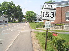
- Maine State Route 153
-
State Route 153 Route information Maintained by MaineDOT Length: 4.66 mi (7.50 km) Existed: 1925 – present Major junctions South end: 
 SR 6 / SR 16 in Dover-Foxcroft
North end: Smith Lane in Dover-Foxcroft Location Counties: Piscataquis Highway system ←  SR 152
SR 154  →
→State Route 153 is part of Maine's system of numbered state highways. It runs 4.66 miles (7.50 km) from an intersection with State Route 16 to an intersection with Smith Lane near Sebec Lake in Dover-Foxcroft. The route is also known as Greeley's Landing Road.
Junction list
The entire route is in Dover-Foxcroft, Piscataquis County.
Mile Destinations Notes 0.00 
 SR 6 / SR 16 (Summer Street / North Street)
Southern terminus of Route 153. 4.66 Smith Lane Northern terminus of Route 153. 1.000 mi = 1.609 km; 1.000 km = 0.621 mi External links
Categories:- State highways in Maine
- Transportation in Piscataquis County, Maine
Wikimedia Foundation. 2010.


