- Plainville, Massachusetts
Infobox Settlement
official_name = Plainville, Massachusetts
nickname =
motto =
imagesize =
image_caption =
image_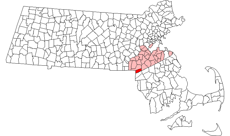
mapsize = 250px
map_caption = Location in Norfolk County in Massachusetts
mapsize1 =
map_caption1 =
subdivision_type = Country
subdivision_name =United States
subdivision_type1 = State
subdivision_name1 =Massachusetts
subdivision_type2 = County
subdivision_name2 = Norfolk
established_title = Settled
established_date = 1661
established_title2 = Incorporated
established_date2 = 1905
established_title3 =
established_date3 =
government_type =Open town meeting
leader_title =
leader_name =
leader_title1 =
leader_name1 =
area_magnitude =
area_total_km2 = 29.9
area_total_sq_mi = 11.6
area_land_km2 = 28.6
area_land_sq_mi = 11.1
area_water_km2 = 1.3
area_water_sq_mi = 0.5
population_as_of = 2007
settlement_type = Town
population_total = 8,311
population_density_km2 = 290.6
population_density_sq_mi = 748.3
elevation_m = 76
elevation_ft = 250
timezone = Eastern
utc_offset = -5
timezone_DST = Eastern
utc_offset_DST = -4
latd = 42 |latm = 00 |lats = 15 |latNS = N
longd = 71 |longm = 20 |longs = 00 |longEW = W
website = http://www.plainville.ma.us
postal_code_type = ZIP code
postal_code = 02762
area_code = 508 / 774
blank_name = FIPS code
blank_info = 25-54100
blank1_name = GNIS feature ID
blank1_info = 0618327
footnotes =Plainville is a town in Norfolk County,
Massachusetts ,United States . The population was 7,683 at the 2000 census. It is formally a part of theProvidence metropolitan area .cite web|url=http://www.whitehouse.gov/omb/bulletins/fy2007/b07-01.pdf|title=Update of Statistical area Definitions and Guidance on Their Uses|publisher=whitehouse.gov|accessdate=2007-06-11|pages=52,108,150]History
Plainville was first settled in 1661 as part of the vast lands of the town of Dedham. It separated from Dedham as part of Wrentham upon that town's founding in 1673. It was officially incorporated in 1905. It is the youngest town by date of incorporation in Norfolk County, and third youngest in the state, behind Millville (1916) and East Brookfield (1920).
Geography
According to the
United States Census Bureau , the town has a total area of 11.6square mile s (29.9km² ), of which, 11.1 square miles (28.6 km²) of it is land and 0.5 square miles (1.3 km²) of it (4.24%) is water.Plainville Borders the towns of Wrentham, Foxboro, Mansfield, North Attleboro and Cumberland RI.
Demographics
As of the
census GR|2 of 2000, there were 7,683 people, 3,009 households, and 2,040 families residing in the town. Thepopulation density was 268.2/km² (694.6/mi²). There were 3,111 housing units at an average density of 108.6/km² (281.3/mi²). The racial makeup of the town was 96.77% White, 0.70% African American, 1.63% Asian, 0.25% from other races, and 0.65% from two or more races. Hispanic or Latino of any race were 0.95% of the population.There were 3,009 households out of which 33.4% had children under the age of 18 living with them, 56.8% were married couples living together, 7.9% had a female householder with no husband present, and 32.2% were non-families. 26.2% of all households were made up of individuals and 9.1% had someone living alone who was 65 years of age or older. The average household size was 2.53 and the average family size was 3.11.
In the town the population was spread out with 25.5% under the age of 18, 6.2% from 18 to 24, 33.1% from 25 to 44, 23.1% from 45 to 64, and 12.1% who were 65 years of age or older. The median age was 37 years. For every 100 females, there are 97.6 males. For every 100 females age 18 and over, there were 95.4 males.
The median income for a household in the town was $57,155, and the median income for a family was $68,640. Males had a median income of $50,708 versus $32,377 for females. The
per capita income for the town was $25,816. About 2.4% of families and 4.0% of the population were below thepoverty line , including 3.6% of those under age 18 and 8.5% of those age 65 or over.Points of interest
* Emerald Square Limousine
* Angle Tree Stone
* Plainridge Race Track
* Plainville House of Pizza
* Don's Diner
* Yen Ching
* J&M Sports Pub
* Target Plaza
* The Rock (Berry Street)
* Plainville Truck StopNotable residents
*
Seattle Seahawks LinebackerLofa Tatupu
* Jim Renner PGA golfer
* Jake Cacciapaglia Founder of http://www.goswoop.com
* Scott Maloney, motivational speaker http://www.scottmaloney.com
* Josh England, gay rights actovistReferences
External links
* [http://www.plainville.ma.us Town website]
* [http://home.comcast.net/~merigold/ Weather]
* [http://www.plainvilleforums.com Plainville Forums]
Wikimedia Foundation. 2010.