- East Brookfield, Massachusetts
Infobox Settlement
official_name = East Brookfield, Massachusetts
nickname =
motto =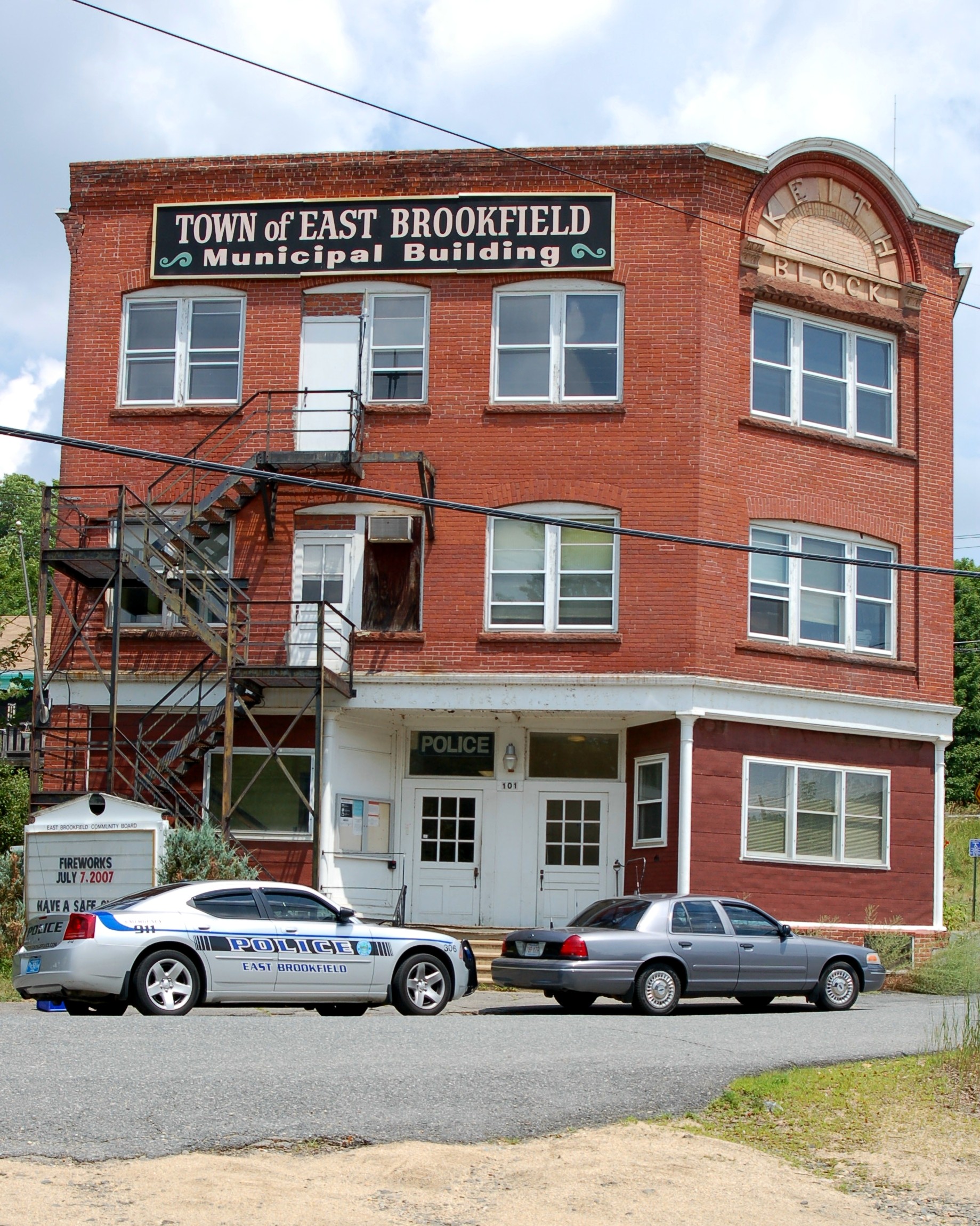
imagesize = 250px
image_caption = The old East Brookfield Municipal Building, will eventually be torn down because it is in disrepair
image_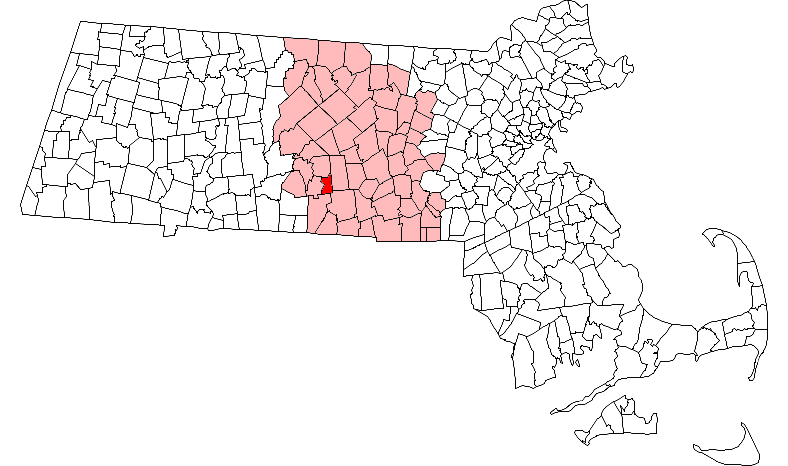
mapsize = 250px
map_caption = Location in Worcester County in Massachusetts
mapsize1 =
map_caption1 =
subdivision_type = Country
subdivision_name =United States
subdivision_type1 = State
subdivision_name1 =Massachusetts
subdivision_type2 = County
subdivision_name2 = Worcester
established_title = Settled
established_date = 1664
established_title2 = Incorporated
established_date2 = 1920
established_title3 =
established_date3 =
government_type =Open town meeting
leader_title = Town Secretary
leader_name = Deborah A. Morgan
leader_title1 =
leader_name1 = Leo Fayard
Joseph Fish
Keith J. McInnes
area_magnitude =
area_total_km2 = 26.9
area_total_sq_mi = 10.4
area_land_km2 = 25.5
area_land_sq_mi = 9.8
area_water_km2 = 1.4
area_water_sq_mi = 0.5
population_as_of = 2000
settlement_type = Town
population_total = 2097
population_density_km2 = 82.2
population_density_sq_mi = 213.0
elevation_m = 189
elevation_ft = 620
timezone = Eastern
utc_offset = -5
timezone_DST = Eastern
utc_offset_DST = -4
latd = 42 |latm = 13 |lats = 31 |latNS = N
longd = 72 |longm = 02 |longs = 49 |longEW = W
website = [http://www.eastbrookfieldma.us/ www.eastbrookfieldma.us]
postal_code_type = ZIP code
postal_code = 01515
area_code = 508 / 774
blank_name = FIPS code
blank_info = 25-18560
blank1_name = GNIS feature ID
blank1_info = 0618362
footnotes =East Brookfield is a town in Worcester County,
Massachusetts ,United States . The population was 2,097 at the 2000 census.For geographic and demographic information on the
census-designated place East Brookfield, please see the article East Brookfield (CDP),Massachusetts .History
East Brookfield was first settled in 1664 as part of the Quabog Plantation lands. It became part of the new town of Brookfield in 1673, and was officially incorporated as a separate town in 1920, making it the "newest" town (by date of incorporation) in
Massachusetts . The town was the birth place of Connie Mack, the manager of thePhiladelphia Athletics .Geography
According to the
United States Census Bureau , the town has a total area of 10.4square mile s (26.9km² ), of which, 9.8 square miles (25.5 km²) of it is land and 0.5 square miles (1.4 km²) of it (5.11%) is water. East Brookfield is bordered on the north by North Brookfield, on the west by Brookfield, on the south by Sturbridge and Charlton, and on the east by Spencer.Most community life in East Brookfield centers around Main Street (Route 9), particularly the stretch closest to
Lake Lashaway , on the road from Spencer to North Brookfield. Within a block of this stretch are found all of the town's churches, its school and former schools, most of its retail businesses and its current and former municipal office buildings. The latter is on Depot Square, a triangular crossroads near the post office and Redmans Hall, the site of the Senior Center and some town meetings.West of the town center is the
Quaboag River plains, known locally as "the Flats." TheCSX Boston-to-Selkirk rail line runs parallel to Main Street through this section. North of Main Street is the town's main water body,Lake Lashaway . Southwest of the town center are the Quaboag and Quacumquasit Ponds (also known as North and South ponds). Bordering the ponds, in the geographic center of town, is a sparsely populated marshland. South of the marshes is sparsely populated woodland, formerly a village called Podunk -- today marked only by a small cemetery along Podunk Road near the Sturbridge town line -- and a hilly area called High Rocks.Demographics
As of the
census GR|2 of 2000, there were 2,097 people, 778 households, and 599 families residing in the town. Thepopulation density was 213.0 people per square mile (82.3/km²). There were 849 housing units at an average density of 86.2/sq mi (33.3/km²). The racial makeup of the town was 98.52% White, 0.43% Black or African American, 0.24% Native American, 0.14% Asian, 0.14% from other races, and 0.52% from two or more races. Hispanic or Latino of any race were 0.76% of the population.There were 778 households out of which 32.6% had children under the age of 18 living with them, 65.7% were married couples living together, 8.2% had a female householder with no husband present, and 22.9% were non-families. 18.9% of all households were made up of individuals and 9.6% had someone living alone who was 65 years of age or older. The average household size was 2.70 and the average family size was 3.07.
In the town the population was spread out with 25.6% under the age of 18, 6.3% from 18 to 24, 30.0% from 25 to 44, 24.7% from 45 to 64, and 13.3% who were 65 years of age or older. The median age was 39 years. For every 100 females there were 98.8 males. For every 100 females age 18 and over, there were 96.2 males.
The median income for a household in the town was $51,860, and the median income for a family was $57,500. Males had a median income of $41,739 versus $28,250 for females. The
per capita income for the town was $22,629. About 2.8% of families and 3.9% of the population were below thepoverty line , including 3.6% of those under age 18 and 9.2% of those age 65 or over.Education
Infobox Mass Town Govt
county= Worcester
align = right
wraparound = yes
clerk_courts = Dennis P. McManus (D)
cty_treasurer = Position Eliminated
da = Joseph D. Early, Jr. (D)
deeds = Anthony J. Vigliotti (D)
probate = Stephen Abraham (D)
sheriff = Guy W. Glodis (D)
state_rep = Geraldo Alicea (D)
state_sen = Stephen M. Brewer (D)
gov_councilors = Thomas J. Foley (D)
fed_rep =Richard E. Neal (D-2nd District),
fed_sen =Edward Kennedy (D)John Kerry (D)There is only one school in East Brookfield. It is East Brookfield Elementary School. In 2002, they closed down two older schools, Lashaway Junior High (built in 1882, also known as the Hodgkins School), which at the time of closing served grades 3-6, and Memorial School, built in 1952. East Brookfield is regionalized K-12 with Spencer, and East Brookfield students also attend Knox Trail Junior High School (grades 7-8) and David Prouty High School (grades 9-12) in Spencer.Points of interest
The Hodgekins School, also known as the Lashaway Middle School, was at the time of its closing in 2002, the oldest operating public school in the nation. It is now the home of the East Brookfield Historical Museum, the Quaboag Valley Railroaders Club, and the Massasoit Art Guild. It is also the meeting place for Boy Scout Troop 238.
Also, East Brookfield contains (according to Cecil Adams of the Straight Dope) the mythical location of "Podunk", the archetypical "backwater" town.
Notable residents
References
External links
* [http://www.eastbrookfieldma.us/Historical-Commission.htm Town of East Brookfield]
Wikimedia Foundation. 2010.