- North Brookfield, Massachusetts
-
North Brookfield, Massachusetts — Town — North Brookfield Town Hall Location in Worcester County in Massachusetts
Coordinates: 42°16′00″N 72°05′00″W / 42.2666667°N 72.0833333°WCoordinates: 42°16′00″N 72°05′00″W / 42.2666667°N 72.0833333°W Country United States State Massachusetts County Worcester Settled 1664 Incorporated 1812 Government – Type Open town meeting – Administrative Assistant Leslie Scott Burton – Board of
SelectmenRobert Filipkowski, Jason Petraitis, Mary Walter Area – Total 21.7 sq mi (56.3 km2) – Land 21.1 sq mi (54.5 km2) – Water 0.7 sq mi (1.7 km2) Elevation 915 ft (279 m) Population (2010) – Total 4,680 – Density 215.3/sq mi (83.1/km2) Time zone Eastern (UTC-5) – Summer (DST) Eastern (UTC-4) ZIP code 01535 Area code(s) 508 / 774 FIPS code 25-47135 GNIS feature ID 0618377 Website http://www.northbrookfield.net/ North Brookfield is a town in Worcester County, Massachusetts, United States. The population was 4,680 at the 2010 census.
For geographic and demographic information on the census-designated place North Brookfield, please see the article North Brookfield (CDP), Massachusetts.
Contents
History
North Brookfield was first settled in 1664 and was officially incorporated in 1812, splitting from neighboring Brookfield.
Geography
According to the United States Census Bureau, the town has a total area of 21.7 square miles (56 km2), of which 21.1 square miles (55 km2) are land and 0.7 square miles (1.8 km2), or 3.04%, is water. North Brookfield is bounded on the east by Spencer, on the south by East Brookfield and Brookfield, on the west by West Brookfield, and on the north by New Braintree.
Demographics
Historical populations Year Pop. ±% 1850 1,939 — 1860 2,760 +42.3% 1870 3,343 +21.1% 1880 4,459 +33.4% 1890 3,871 −13.2% 1900 4,587 +18.5% 1910 3,075 −33.0% 1920 2,610 −15.1% 1930 3,013 +15.4% 1940 3,304 +9.7% 1950 3,444 +4.2% 1960 3,616 +5.0% 1970 3,967 +9.7% 1980 4,150 +4.6% 1990 4,683 +12.8% 2000 4,708 +0.5% 2001* 4,810 +2.2% 2002* 4,897 +1.8% 2003* 4,964 +1.4% 2004* 5,004 +0.8% 2005* 5,027 +0.5% 2006* 5,044 +0.3% 2007* 5,088 +0.9% 2008* 5,025 −1.2% 2009* 5,054 +0.6% 2010 4,680 −7.4% * = population estimate.
Source: United States Census records and Population Estimates Program data.[1][2][3][4][5][6][7][8][9][10]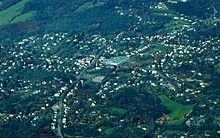 North Brookfield looking north
As of the census[11] of 2000, there were 4,683 people, 1,811 households, and 1,235 families residing in the town. The population density was 222.3 people per square mile (85.9/km²). There were 1,902 housing units at an average density of 90.3 per square mile (34.9/km²). The racial makeup of the town was 97.65% White, 0.34% Black or African American, 0.26% Native American, 0.21% Asian, 0.36% from other races, and 1.17% from two or more races. Hispanic or Latino of any race were 1.09% of the population.
There were 1,811 households, of which 33.3% had children under the age of 18 living with them, 53.5% were married couples living together, 10.8% had a female householder with no husband present, and 31.8% were non-families. 25.8% of all households were made up of individuals and 11.4% had someone living alone who was 65 years of age or older. The average household size was 2.55 and the average family size was 3.09.
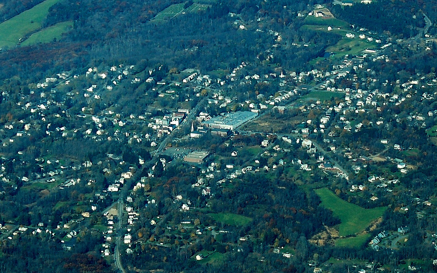
 North Brookfield center
In the town the population was spread out with 27.2% under the age of 18, 7.0% from 18 to 24, 29.4% from 25 to 44, 23.4% from 45 to 64, and 12.9% who were 65 years of age or older. The median age was 37 years. For every 100 females there were 96.4 males. For every 100 females age 18 and over, there were 92.9 males.
The median income for a household in the town was $44,286, and the median income for a family was $51,750. Males had a median income of $37,647 versus $30,324 for females. The per capita income for the town was $20,205. About 4.1% of families and 5.5% of the population were below the poverty line, including 7.8% of those under age 18 and 5.0% of those age 65 or over.
Government
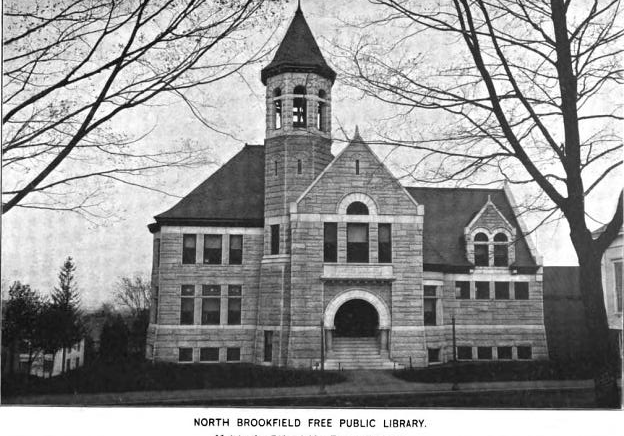
County government: Worcester County Clerk of Courts: Dennis P. McManus (D) District Attorney: Joseph D. Early, Jr. (D) Register of Deeds: Anthony J. Vigliotti (D) Register of Probate: Stephen Abraham (D) County Sheriff: Lew Evangelidis (R) State government State Representative(s): Anne M. Gobi (D) State Senator(s): Stephen M. Brewer(D) Governor's Councilor(s): Jen Caissie (R) Federal government U.S. Representative(s): Richard E. Neal (D-2nd District), U.S. Senators: John Kerry (D), Scott Brown (R)  North Brookfield Public Library, 1899
Library
The North Brookfield public library was established in 1879.[12][13] In fiscal year 2008, the town of North Brookfield spent 0.84% ($92,958) of its budget on its public library—some $19 per person.[14]
Education
There are two public schools in North Brookfield, North Brookfield Elementary School, serving grades K-6, and North Brookfield Junior-Senior High School. The school system is one of the smallest in the region, as almost all nearby towns of similar size joined regional districts.
The private Valley View School and Mad Brook Academy are also located in North Brookfield.

First Congregational Church Points of interest
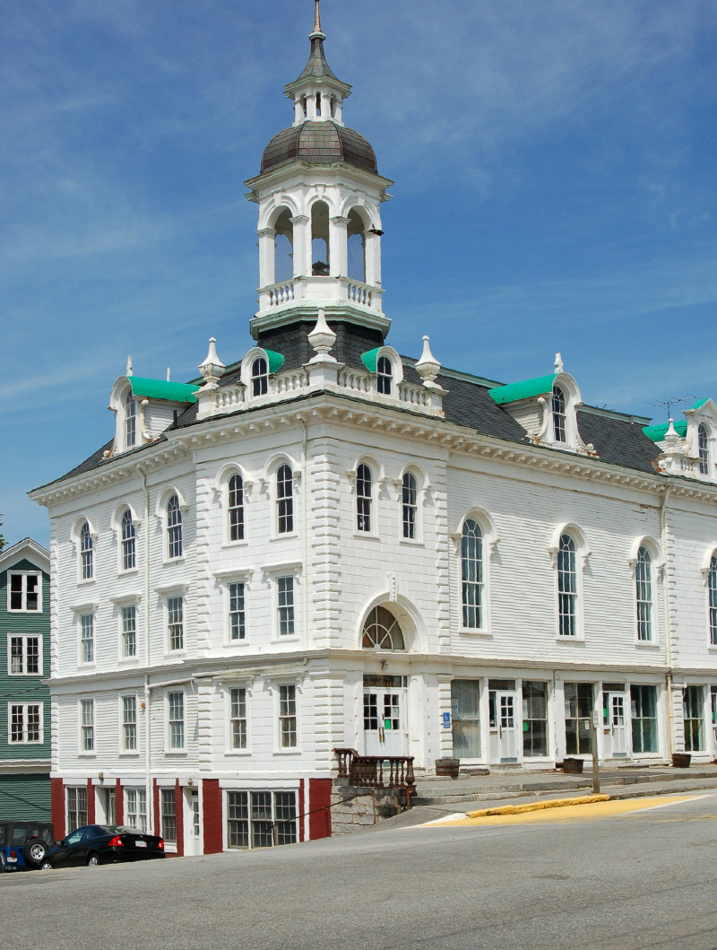
- Town Hall
- First Congregational Church of North Brookfield
Notable residents
- Tryphosa Bates-Batcheller (1876–1952), writer, socialite and singer
- Bill Bergen, National League baseball player with the Cincinnati Reds and the Brooklyn Dodgers, younger brother of Marty Bergen
- Marty Bergen, Boston Beaneaters player, triple murderer
- William Cullen Bryant poet, journalist and editor of the New York Evening Post.
- George M. Cohan, entertainer, playwright, composer, lyricist, actor, singer, dancer, director
- Frank Cooke, optics designer and manufacturer
- Big Al Downing, country and rockabilly musician
- Richard B. Johnson, author of Abominable Firebug (ISBN 0-595-38667-9) which details his childhood in North Brookfield, attending the “Yellow School” across from the “Asbestos Shop.” Later he writes about the Lyman School for Boys, the reform school he attended.
- Amasa Walker, Economist, United States Representative and father of Francis Amasa Walker
- Francis Amasa Walker, economist, statistician, journalist, educator, president of MIT, and military officer in the Union Army.
References
- ^ "TOTAL POPULATION (P1), 2010 Census Summary File 1, All County Subdivisions within Massachusetts". United States Census Bureau. http://factfinder2.census.gov/bkmk/table/1.0/en/DEC/10_SF1/P1/0400000US25.06000. Retrieved September 13, 2011.
- ^ "Massachusetts by Place and County Subdivision - GCT-T1. Population Estimates". United States Census Bureau. http://factfinder.census.gov/servlet/GCTTable?_bm=y&-geo_id=04000US25&-_box_head_nbr=GCT-T1&-ds_name=PEP_2009_EST&-_lang=en&-format=ST-9&-_sse=on. Retrieved July 12, 2011.
- ^ "1990 Census of Population, General Population Characteristics: Massachusetts". US Census Bureau. December 1990. Table 76: General Characteristics of Persons, Households, and Families: 1990. 1990 CP-1-23. http://www.census.gov/prod/cen1990/cp1/cp-1-23.pdf. Retrieved July 12, 2011.
- ^ "1980 Census of the Population, Number of Inhabitants: Massachusetts". US Census Bureau. December 1981. Table 4. Populations of County Subdivisions: 1960 to 1980. PC80-1-A23. http://www2.census.gov/prod2/decennial/documents/1980a_maABC-01.pdf. Retrieved July 12, 2011.
- ^ "1950 Census of Population". Bureau of the Census. 1952. Section 6, Pages 21-10 and 21-11, Massachusetts Table 6. Population of Counties by Minor Civil Divisions: 1930 to 1950. http://www2.census.gov/prod2/decennial/documents/23761117v1ch06.pdf. Retrieved July 12, 2011.
- ^ "1920 Census of Population". Bureau of the Census. Number of Inhabitants, by Counties and Minor Civil Divisions. Pages 21-5 through 21-7. Massachusetts Table 2. Population of Counties by Minor Civil Divisions: 1920, 1910, and 1920. http://www2.census.gov/prod2/decennial/documents/41084506no553ch2.pdf. Retrieved July 12, 2011.
- ^ "1890 Census of the Population". Department of the Interior, Census Office. Pages 179 through 182. Massachusetts Table 5. Population of States and Territories by Minor Civil Divisions: 1880 and 1890. http://www2.census.gov/prod2/decennial/documents/41084506no553ch2.pdf. Retrieved July 12, 2011.
- ^ "1870 Census of the Population". Department of the Interior, Census Office. 1872. Pages 217 through 220. Table IX. Population of Minor Civil Divisions, &c. Massachusetts. http://www2.census.gov/prod2/decennial/documents/1870e-05.pdf. Retrieved July 12, 2011.
- ^ "1860 Census". Department of the Interior, Census Office. 1864. Pages 220 through 226. State of Massachusetts Table No. 3. Populations of Cities, Towns, &c.. http://www2.census.gov/prod2/decennial/documents/1860a-08.pdf. Retrieved July 12, 2011.
- ^ "1850 Census". Department of the Interior, Census Office. 1854. Pages 338 through 393. Populations of Cities, Towns, &c.. http://www2.census.gov/prod2/decennial/documents/1850c-11.pdf. Retrieved July 12, 2011.
- ^ "American FactFinder". United States Census Bureau. http://factfinder.census.gov. Retrieved 2008-01-31.
- ^ C.B. Tillinghast. The free public libraries of Massachusetts. 1st Report of the Free Public Library Commission of Massachusetts. Boston: Wright & Potter, 1891. Google books
- ^ Haston Free Public Library. Retrieved 2010-11-10
- ^ July 1, 2007 through June 30, 2008; cf. The FY2008 Municipal Pie: What’s Your Share? Commonwealth of Massachusetts, Board of Library Commissioners. Boston: 2009. Available: Municipal Pie Reports. Retrieved 2010-08-04
Further reading
- Temple, Josiah Howard; Adams, Charles, History of North Brookfield, Massachusetts: Preceded by an account of old Quabaug, Indian and English occupation, 1647-1676; Brookfield records, 1686-1783, Pub. by the town [Boston, printed], 1887
External links
Categories:- Towns in Worcester County, Massachusetts


Wikimedia Foundation. 2010.