- Hubbardston, Massachusetts
Infobox Settlement
official_name = Hubbardston, Massachusetts
nickname =
motto =
imagesize =
image_caption =
image_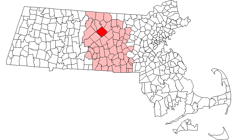
mapsize = 250px
map_caption = Location in Worcester County in Massachusetts
mapsize1 =
map_caption1 =
subdivision_type = Country
subdivision_name =United States
subdivision_type1 = State
subdivision_name1 =Massachusetts
subdivision_type2 = County
subdivision_name2 = Worcester
established_title = Settled
established_date = 1734
established_title2 = Incorporated
established_date2 = 1775
established_title3 =
established_date3 =
government_type =Open town meeting
leader_title =Town Administrator
leader_name = Debra A, Roussel
leader_title1 =
leader_name1 = Paul Hale
Kristie Casey
Matthew Castriotta
area_magnitude =
area_total_km2 = 108.7
area_total_sq_mi = 42.0
area_land_km2 = 106.3
area_land_sq_mi = 41.0
area_water_km2 = 2.4
area_water_sq_mi = 0.9
population_as_of = 2000
settlement_type = Town
population_total = 3909
population_density_km2 = 36.8
population_density_sq_mi = 95.3
elevation_m = 303
elevation_ft = 993
timezone = Eastern
utc_offset = -5
timezone_DST = Eastern
utc_offset_DST = -4
latd = 42 |latm = 28 |lats = 25 |latNS = N
longd = 72 |longm = 00 |longs = 24 |longEW = W
website = http://www.hubbardstonma.us/
postal_code_type = ZIP code
postal_code = 01452
area_code = 351 / 978
blank_name = FIPS code
blank_info = 25-31435
blank1_name = GNIS feature ID
blank1_info = 0618367
footnotes =Hubbardston is a town in Worcester County,
Massachusetts ,United States .It is bounded on the northwest by Phillipston and Templeton; on the northeast by Gardner and Westminster; on the southeast by Princeton and Rutland; and on the southwest by Barre.As of the
2000 census, the town population was 3,909.History
Originally called the "Northeast Quarter", Hubbardston was part of Rutland until it became a town in 1767. It was named for Thomas Hubbard, one of the original proprietors. The first European settlers were recorded in 1737. The community has been described by historians as a poor town in its early years, sparsely settled and almost solely agricultural. By the 18th century, there were sawmills potash works and cottage industries, including the making of palm leaf hats, chairs, cabinets, shoes, and horse blankets.
By the 19th century, dairy and berry farming and market gardening were major enterprises. Immigrants from Ireland, French Canada, England, Sweden and Finland moved to town to work on local farms. Year Incorporated - 1767
--------------------------------------------------------------------------------
The town's early economy was based on agriculture and small-scale chair, boot and shoe manufacturing. It is described by historians as a poor town, sparsely settled and almost wholly agricultural, but having sawmills, potash works and cottage industries such as the making of palm leaf hats. Dairy and berry farming and market gardening were major pursuits in the town.
--------------------------------------------------------------------------------
Hubbardston was sympathetic to
Shays's Rebellion , an armed uprising in Central andWestern Massachusetts .cite web
title = Welcome to Hubbardston
author = eHubbardston
url = http://ehubbardston.com/
accessdate = 2008-08-20] One of the leaders of the rebellion, Captain Adam Wheeler, was from Hubbardston. In 1786, eighty men from the town marched to Worcester under Wheeler's command and, joining hundreds of other farmers, took control of the courthouse to protest the widespread foreclosures and seizures of property by creditors that occurred during the cash poor 18th centry.cite web
title = Shays Rebellion
author = History.com Encyclopedia
url = http://www.history.com/encyclopedia.do?vendorId=FWNE.fw..sh098200.a#FWNE.fw..sh098200.a
accessdate = 2008-08-20]--------------------------------------------------------------------------------
On June 22, 1981, a confirmed F3 tornado touched down in Hubbardston northwest of the town center, causing significant damage to property along a swath stretching from the Southwest across Williamsville Rd to the Northeast side of Gardner Rd (Rte 68). No deaths were reported. Many homes along the path of the tornado were severely damaged and two homes on the Williamsville Rd were completely destroyed. Town Statistics
--------------------------------------------------------------------------------
POPULATION - 4,606 (01/01/07) REGISTERED VOTERS - 2,754 SCHOOL ENROLLMENT Center School - 474 Quabbin Regional Middle / High School - 1,366 TAX RATE - $9.43 OPERATING BUDGET - $6,398,646 FORM OF GOVERNMENT Open town meeting 3 Selectboard Members AREA - 41.03 square miles ROAD MILES - 88
Geography
According to the
United States Census Bureau , the town has a total area of 42.0square mile s (108.7km² ), of which, 41.0 square miles (106.3 km²) of it is land and 0.9 square miles (2.4 km²) of it (2.19%) is water.Demographics
As of the
census GR|2 of 2000, there were 3,909 people, 1,308 households, and 1,071 families residing in the town. Thepopulation density was 95.3 people per square mile (36.8/km²). There were 1,360 housing units at an average density of 33.1/sq mi (12.8/km²). The racial makeup of the town was 98.39% White, 0.15% African American, 0.08% Native American, 0.49% Asian, 0.28% from other races, and 0.61% from two or more races. Hispanic or Latino of any race were 1.33% of the population.There were 1,308 households out of which 43.8% have children under the age of 18 living with them, 73.2% were married couples living together, 5.4% had a female householder with no husband present, and 18.1% were non-families. 13.7% of all households were made up of individuals and 4.5% had someone living alone who was 65 years of age or older. The average household size was 2.97 and the average family size was 3.28.
In the town the population was spread out with 31.1% under the age of 18, 4.8% from 18 to 24, 34.6% from 25 to 44, 22.6% from 45 to 64, and 6.9% who were 65 years of age or older. The median age was 36 years. For every 100 females there were 102.3 males. For every 100 females age 18 and over, there were 100.9 males.
The median income for a household in the town was $61,462, and the median income for a family was $66,058. Males had a median income of $48,730 versus $33,654 for females. The
per capita income for the town was $23,072. About 2.1% of families and 3.7% of the population were below thepoverty line , including 3.4% of those under the age of 18 and 7.9% of those 65 and older.Government
Infobox Mass Town Govt
county= Worcester
clerk_courts = Dennis P. McManus (D)
cty_treasurer = Position Eliminated
da = Joseph D. Early, Jr. (D)
deeds = Anthony J. Vigliotti (D)
probate = Stephen Abraham (D)
sheriff = Guy W. Glodis (D)
state_rep = Lewis G. Evangelidis (R)
state_sen = Stephen M. Brewer (D)
gov_councilors = Thomas J. Foley (D)
fed_rep =John W. Olver (D-1st District),
fed_sen =Edward Kennedy (D)John Kerry (D)References
Wikimedia Foundation. 2010.