- Douglas, Massachusetts
-
Douglas, Massachusetts — Town — 
SealNickname(s): D-town Douglas Location in Worcester County in Massachusetts
Coordinates: 42°03′15″N 71°44′24″W / 42.05417°N 71.74°WCoordinates: 42°03′15″N 71°44′24″W / 42.05417°N 71.74°W Country United States State Massachusetts County Worcester Settled 1721 Incorporated 1746 Government – Type Open town meeting Area – Total 37.7 sq mi (97.7 km2) – Land 36.4 sq mi (94.2 km2) – Water 1.3 sq mi (3.5 km2) Elevation 582 ft (177 m) Population (2010) – Total 8,471 – Density 224.6/sq mi (86.7/km2) Time zone Eastern (UTC-5) – Summer (DST) Eastern (UTC-4) ZIP code 01516 Area code(s) 508 / 774 FIPS code 25-17300 GNIS feature ID 0619479 Website www.douglasma.org [1] Douglas is a town in Worcester County, Massachusetts, United States. The population was 8,471 as of the 2010 census. It includes the sizable Douglas State Forest, managed by the Massachusetts Department of Conservation and Recreation (DCR).
Contents
History
The name of Douglas was first given to the territory of the town in the year 1746. New Sherburn or "New Sherburn Grant" had previously been its designation, since its first occupancy by the English settlers which was as early as 1715. The original settlers came primarily from Sherburn, although many hailed from Natick as well. The name was given in 1746, when Dr. William Douglas, an eminent physician of Boston, in consideration of the privilege of naming the township offered the inhabitants the sum of $500.00 as a fund for the establishment of free schools together with a tract of 30 acres (12 ha) of land with a dwelling house and barn thereon.
Douglas's forests gave rise to a woodcutting industry and the Douglas axe company.[1] A woolen manufacturing company, on the Mumford River in East Douglas, in recent times held by the Schuster family, has been prominent in the history of this community. General Lafayette, of France, stopped here during the Revolutionary War, to change horses, on his way to Boston to join General Washington. Lafayette was a hero of the American Revolution and the French Revolution.
From a very early period reaching beyond 1635, bands of Native Americans, principally the Nipmuc tribe, dominated this region of Worcester County. The Blackstone River was once called the Nipmuc River. Most of Douglas is part of the Blackstone River Valley National Heritage Corridor.[1]
The underlying geology consists of rocks rich in quartz, feldspar, and mica. Boulders are plentifully scattered all over town, and gold and silver ores are said to be found in some localities. Large quantities of building and ornamental stone are quarried from the granite ledges found in the center of town which is shipped to almost every section of New England.[citation needed]
Police Chief Patrick Foley of Douglas was elected Vice President of the International Association of Chiefs of Police (IACP), at the annual convention in Denver, Colorado, in 2009.
A common misconception in Douglas is in regard to the New England Trunkline Trail. Many believe that railroad tracks were laid here for commuting from northern Connecticut to northern Massachusetts. In fact, they were used to haul ice from Wallum Lake as interstate commerce. Today you can hike these trails through Massachusetts and Connecticut. The New England trunkline was originally planned as a railroad, but the financier died in the sinking of the Titanic.[citation needed]
E.L. Jenckes Store and Museum
-

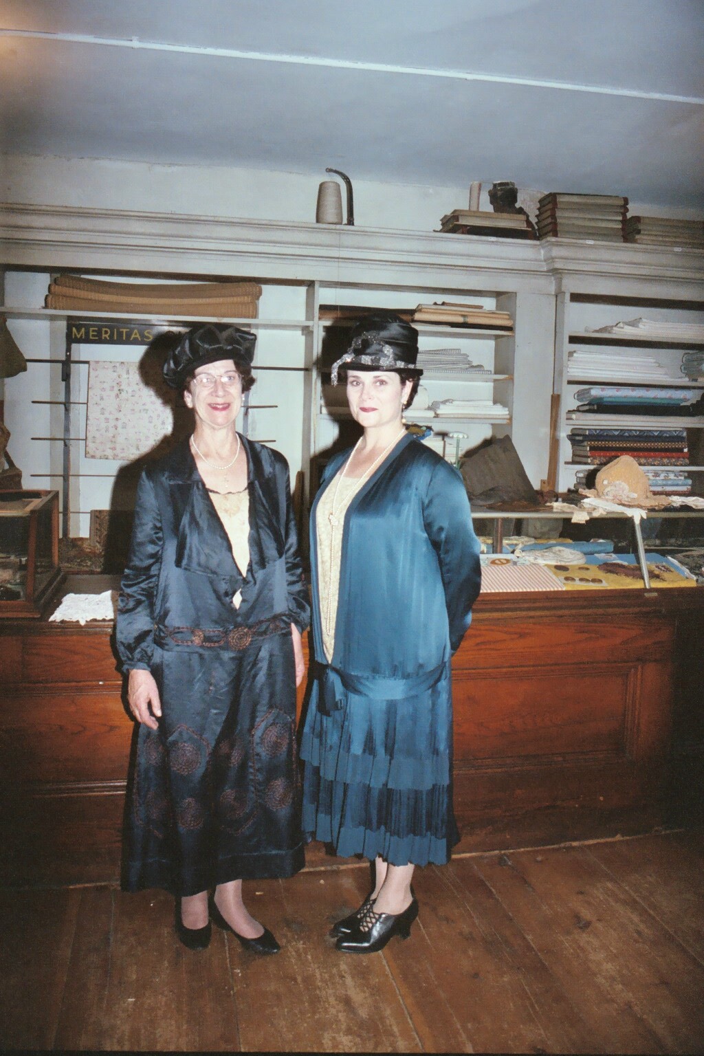
Reenactors of Malma & Helen during Octoberfest
-

Jenckes Store as it appeared in the 1800s
The E.L. Jenckes store and museum sits on Main Street in the village of East Douglas.[1] During the 1830s, when East Douglas was becoming the economic center of the town, Ebenezer Balkcom opened a small store at the corner of Main and Pleasant (now Depot) streets.
Later, Gardner Chase bought the property and enlarged the building as his business expanded to meet the needs of the growing community. Apparently, Mr. Chase's extraordinary efforts ruined his health. On his doctor's orders he retired and leased the business to a series of entrepreneurs until Edward L. Jenckes bought the business and building from Mr. Chase's widow in 1884. Mr. Jenckes made several more additions. By 1895, the building looked like the museum as it appears today.
The store of the 1890s was far different from a modern supermarket. The smell of a smoky wood stove, the kerosene lamps, the boxes of salt codfish, and the pickling brine mingled with the aroma of ground coffee, spices, and fancy soaps. The presence of horses, hitched to the posts in front, was also quite evident.
In addition to the sewing supplies and the food which could not be raised locally, the store carried a variety of housewares. Included were from kettles, tin pans, enamelware coffee pots, glass, canning jars, and ceramic items, generally referred to as "crockey." Mr. Jenckes also stocked inexpensive furniture and floor coverings.
In the horse and buggy era, the store was a busy place. Four men and a woman clerk were needed to carry on business. After Mr. Jencke's two daughters E. Mialma and Helen R. - graduated from Wellesley College, one of them was always in the store because no woman customer would ever consider mentioning her personal needs to a male clerk.
Two of the men spent much of their time going from house to house, taking orders from the customers one day and delivering their purchases the next. Goods from the wholesalers had to be moved from the freight house to the store, a job known as "drawing freight." One man was need in the store because a customer might stop for a bag of grain or some other item too heavy for a woman to lift.
After Mr. Jenckes's death in 1924, his daughters continued to run the show. During the Great Depression, the Jenckes sisters extended credit to many families because they could not live with the knowledge that people, especially children, were Hungry. The business was also important during the gasoline rationing of World Warr II, when customers were allotted on three gallons a week, and could save fuel by having their groceries delivered.
After 1945, business declined rapidly but the sisters did not forget their long-time customers. Orders still were taken by telephone and delivered. If anyone wanted meat, flashlights, batteries, or anything the Jenckes Store no longer stocked, these items were purchased as a local market or the Goodness Store (another mainstay in the Village) and delivered along with bread, soup, and other groceries still available at the Jenckes Sote. Examples of this arrangement are found in store ledgers, the last of which was written in 1964, when the business closed its doors.
The store remained closed until 1972 when Mrs. Jenckes gave the property to the Douglas Historical Society as a memorial to their father. Because the store was neither dismantled nor converted to another use, it remains - after careful restoration by the Douglas Historical Society - a fine example of the general store of a hundred years ago.[2]
Geography
According to the United States Census Bureau, the town has a total area of 37.7 square miles (98 km2), of which 36.4 square miles (94 km2) is land and 1.3 square miles (3.4 km2), or 14.55%, is water. It includes the Douglas State Forest and is home to Wallum Lake and Whitins Reservoir.
The town is bounded on the north by Oxford, Sutton and Uxbridge, on the east by Sutton and Uxbridge, on the south by Burrillville, Rhode Island, and on the west by Webster, Massachusetts and a small portion of Thompson, Connecticut.
The principal elevations are Bald Hill, 711 feet (217 m), Wallum Pond Hill, 778 feet (237 m), and Mount Daniel, 735 feet (224 m). The largest of the numerous ponds is Wallum Pond in the southwest section, covering about 150 acres (61 ha); Badluck Pond in the western part of town, covering about 110 acres (45 ha); Reservoir Pond also in the western part of town, covering about 400 acres (160 ha); and Manchaug Pond in the northern part, about 93 acres (38 ha).
Neighborhoods
Demographics
Historical populations Year Pop. ±% 1850 1,878 — 1860 2,442 +30.0% 1870 2,182 −10.6% 1880 2,241 +2.7% 1890 1,908 −14.9% 1900 2,113 +10.7% 1910 2,152 +1.8% 1920 2,181 +1.3% 1930 2,195 +0.6% 1940 2,617 +19.2% 1950 2,624 +0.3% 1960 2,559 −2.5% 1970 2,947 +15.2% 1980 3,730 +26.6% 1990 5,438 +45.8% 2000 7,045 +29.6% 2001* 7,391 +4.9% 2002* 7,560 +2.3% 2003* 7,705 +1.9% 2004* 7,807 +1.3% 2005* 7,921 +1.5% 2006* 8,021 +1.3% 2007* 8,078 +0.7% 2008* 8,023 −0.7% 2009* 8,091 +0.8% 2010 8,471 +4.7% * = population estimate.
Source: United States Census records and Population Estimates Program data.[3][4][5][6][7][8][9][10][11][12]As of the census[13] of 2000, there were 7,045 people, 2,476 households, and 1,936 families residing in the town. The population density was 193.7 people per square mile (74.8/km²). There were 2,588 housing units at an average density of 71.2 per square mile (27.5/km²). The racial makeup of the town was 97.36% White, 0.48% African American, 0.13% Native American, 0.64% Asian, 0.07% Pacific Islander, 0.28% from other races, and 1.04% from two or more races. Hispanic or Latino of any race were 0.95% of the population.
There were 2,476 households out of which 43.1% had children under the age of 18 living with them, 66.6% were married couples living together, 8.1% had a female householder with no husband present, and 21.8% were non-families. 17.3% of all households were made up of individuals and 6.7% had someone living alone who was 65 years of age or older. The average household size was 2.85 and the average family size was 3.23.
In the town the population was spread out with 29.6% under the age of 18, 6.1% from 18 to 24, 36.4% from 25 to 44, 20.1% from 45 to 64, and 7.7% who were 65 years of age or older. The median age was 34 years. For every 100 females there were 100.7 males. For every 100 females age 18 and over, there were 97.7 males.
The median income for a household in the town was $60,529, and the median income for a family was $67,210. Males had a median income of $45,893 versus $31,287 for females. The per capita income for the town was $23,036. About 2.3% of families and 4.6% of the population were below the poverty line, including 4.4% of those under age 18 and 13.0% of those age 65 or over.
Government
County government: Worcester County Clerk of Courts: Dennis P. McManus (D) District Attorney: Joseph D. Early, Jr. (D) Register of Deeds: Anthony J. Vigliotti (D) Register of Probate: Stephen Abraham (D) County Sheriff: Lew Evangelidis (R) State government State Representative(s): Kevin Kuros (R) State Senator(s): Richard T. Moore (D) Governor's Councilor(s): Jen Caissie (R) Federal government U.S. Representative(s): Richard E. Neal (D-2nd District), U.S. Senators: John Kerry (D), Scott Brown (R) Points of interest
- Douglas is the starting point for the Rhode Island North-South Trail and Massachusetts Midstate Trail.
- Jenckes Store & Museum
See also
Notes
- ^ a b c "Plan your visit/valley sites/Douglas, Northbridge, Sutton". National Park Service. http://www.nps.gov/blac/planyourvisit/valley-sites-douglas-sutton-northbridge.htm. Retrieved 2007-12-26.
- ^ By Marieta Howard, reprinted from the Time & The Town 1996 commemorative book
- ^ "TOTAL POPULATION (P1), 2010 Census Summary File 1, All County Subdivisions within Massachusetts". United States Census Bureau. http://factfinder2.census.gov/bkmk/table/1.0/en/DEC/10_SF1/P1/0400000US25.06000. Retrieved September 13, 2011.
- ^ "Massachusetts by Place and County Subdivision - GCT-T1. Population Estimates". United States Census Bureau. http://factfinder.census.gov/servlet/GCTTable?_bm=y&-geo_id=04000US25&-_box_head_nbr=GCT-T1&-ds_name=PEP_2009_EST&-_lang=en&-format=ST-9&-_sse=on. Retrieved July 12, 2011.
- ^ "1990 Census of Population, General Population Characteristics: Massachusetts". US Census Bureau. December 1990. Table 76: General Characteristics of Persons, Households, and Families: 1990. 1990 CP-1-23. http://www.census.gov/prod/cen1990/cp1/cp-1-23.pdf. Retrieved July 12, 2011.
- ^ "1980 Census of the Population, Number of Inhabitants: Massachusetts". US Census Bureau. December 1981. Table 4. Populations of County Subdivisions: 1960 to 1980. PC80-1-A23. http://www2.census.gov/prod2/decennial/documents/1980a_maABC-01.pdf. Retrieved July 12, 2011.
- ^ "1950 Census of Population". Bureau of the Census. 1952. Section 6, Pages 21-10 and 21-11, Massachusetts Table 6. Population of Counties by Minor Civil Divisions: 1930 to 1950. http://www2.census.gov/prod2/decennial/documents/23761117v1ch06.pdf. Retrieved July 12, 2011.
- ^ "1920 Census of Population". Bureau of the Census. Number of Inhabitants, by Counties and Minor Civil Divisions. Pages 21-5 through 21-7. Massachusetts Table 2. Population of Counties by Minor Civil Divisions: 1920, 1910, and 1920. http://www2.census.gov/prod2/decennial/documents/41084506no553ch2.pdf. Retrieved July 12, 2011.
- ^ "1890 Census of the Population". Department of the Interior, Census Office. Pages 179 through 182. Massachusetts Table 5. Population of States and Territories by Minor Civil Divisions: 1880 and 1890. http://www2.census.gov/prod2/decennial/documents/41084506no553ch2.pdf. Retrieved July 12, 2011.
- ^ "1870 Census of the Population". Department of the Interior, Census Office. 1872. Pages 217 through 220. Table IX. Population of Minor Civil Divisions, &c. Massachusetts. http://www2.census.gov/prod2/decennial/documents/1870e-05.pdf. Retrieved July 12, 2011.
- ^ "1860 Census". Department of the Interior, Census Office. 1864. Pages 220 through 226. State of Massachusetts Table No. 3. Populations of Cities, Towns, &c.. http://www2.census.gov/prod2/decennial/documents/1860a-08.pdf. Retrieved July 12, 2011.
- ^ "1850 Census". Department of the Interior, Census Office. 1854. Pages 338 through 393. Populations of Cities, Towns, &c.. http://www2.census.gov/prod2/decennial/documents/1850c-11.pdf. Retrieved July 12, 2011.
- ^ "American FactFinder". United States Census Bureau. http://factfinder.census.gov. Retrieved 2008-01-31.
Further reading
- Emerson, William A. History of Douglas. 1879.
External links
- Douglas official website
- John H. Chafee Blackstone River Valley National Heritage Corridor: Valley sites - Douglas, Sutton, Northbridge (National Park Service)
- Manchaug Pond Association and Foundation
- Nipmuck Nation
Categories:- Towns in Worcester County, Massachusetts
-


Wikimedia Foundation. 2010.