- Upton, Massachusetts
Infobox Settlement
official_name = Upton, Massachusetts
nickname =
motto =
imagesize =
image_caption =
image_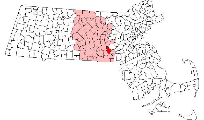
mapsize = 250px
map_caption = Location in Worcester County in Massachusetts
mapsize1 =
map_caption1 =
subdivision_type = Country
subdivision_name =United States
subdivision_type1 = State
subdivision_name1 =Massachusetts
subdivision_type2 = County
subdivision_name2 = Worcester
established_title = Settled
established_date = 1728
established_title2 = Incorporated
established_date2 = 1735
established_title3 =
established_date3 =
government_type =Open town meeting
leader_title = Administrative Clerk
leader_name = Karen L. Varney
leader_title1 = Board of
Selectmen
leader_name1 = Robert J. Fleming
Marsha A. Paul
Joan E. Shanahan
area_magnitude =
area_total_km2 = 56.3
area_total_sq_mi = 21.7
area_land_km2 = 55.7
area_land_sq_mi = 21.5
area_water_km2 = 0.5
area_water_sq_mi = 0.2
population_as_of = 2000
settlement_type = Town
population_total = 5642
population_density_km2 = 101.2
population_density_sq_mi = 262.2
elevation_m = 92
elevation_ft = 301
timezone = Eastern
utc_offset = -5
timezone_DST = Eastern
utc_offset_DST = -4
latd = 42 |latm = 10 |lats = 28 |latNS = N
longd = 71 |longm = 36 |longs = 10 |longEW = W
website = http://www.upton.ma.us/
postal_code_type = ZIP code
postal_code = 01568
area_code = 508 / 774
blank_name = FIPS code
blank_info = 25-71480
blank1_name = GNIS feature ID
blank1_info = 0618386
footnotes =Upton is a town in Worcester County,
Massachusetts ,United States . The population was 5,642 at the 2000 census.For geographic and demographic information on the
census-designated place Upton-West Upton, please see the article Upton-West Upton,Massachusetts .History
Upton was originally the home of the
Nipmuc who inhabited most of central Massachusetts. Upton was first settled in 1728 and was officially incorporated in 1735. Upton was home to a number of members of theTaft family including anAmerican Revolutionary War soldier namedSamuel Taft , who was born in Upton.cite book|last=Mass.|first=Uxbridge|authorlink=|title="Vital Records of Uxbridge, Massachusetts to the Year 1850|pages= p.409,|date=1851|publisher=Thomas Williams Baldwin|url=http://books.google.com/books?id=6lj7wmu0U2IC&dq=Samuel+Taft+of+Uxbridge&pg=PA235&ots=kbl8tM2at5&sig=MW5Zl5YQwXgYUawOVq1iwYpt-bU&prev=http://www.google.com/search%3Fhl%3Den%26q%3DSamuel%2BTaft%2Bof%2BUxbridge&sa=X&oi=print&ct=result&cd=2&cad=legacy#PPA321,M1|accessdate=2007-10-27] . Samuel Taft had 22 children and hosted PresidentGeorge Washington on his innaugural tour ofNew England in 1789. Three term mayor of Worcester, historian,Judge Henry Chapin , was born here on May 13, 1811.cite book |last= Chapin |first= Judge Henry |authorlink= |coauthors= |title= Address Delivered at the Unitarian Church in Uxbridge; 1864 |publisher= Charles Hamilton Press (Harvard Library; from Google Books) |date= 1881 |location= Worcester, Mass. |pages= |url= |doi= |id= |isbn= ] A hat factory was well known in Upton in the 1950 and 60's.Geography
According to the
United States Census Bureau , the town has a total area of 21.7square mile s (56.3km² ), of which, 21.5 square miles (55.7 km²) of it is land and 0.2 square miles (0.5 km²) of it (0.97%) is water.Adjacent towns
Upton is located in Eastern Massachusetts, bordered by:
*Hopkinton on the northeast
*Westborough on the north
*Milford on the east
*Mendon on the south
*Grafton on the west
*Hopedale on the southeast
*Northbridge on the southwestDemographics
As of the
census GR|2 of 2000, there were 5,642 people, 2,042 households, and 1,562 families residing in the town. Thepopulation density was 262.2 people per square mile (101.2/km²). There were 2,084 housing units at an average density of 96.9/sq mi (37.4/km²). The racial makeup of the town was 97.34% White, 0.48% African American, 0.07% Native American, 0.97% Asian, 0.30% from other races, and 0.83% from two or more races. Hispanic or Latino of any race were 0.73% of the population.There were 2,042 households out of which 42.1% had children under the age of 18 living with them, 67.9% were married couples living together, 6.7% had a female householder with no husband present, and 23.5% were non-families. 19.0% of all households were made up of individuals and 7.6% had someone living alone who was 65 years of age or older. The average household size was 2.74 and the average family size was 3.17.
In the town the population was spread out with 29.1% under the age of 18, 4.3% from 18 to 24, 35.0% from 25 to 44, 22.2% from 45 to 64, and 9.5% who were 65 years of age or older. The median age was 37 years. For every 100 females there were 95.6 males. For every 100 females age 18 and over, there were 92.7 males.
The median income for a household in the town was $78,595, and the median income for a family was $89,251. Males had a median income of $66,734 versus $39,224 for females. The
per capita income for the town was $34,924. About 1.8% of families and 3.5% of the population were below thepoverty line , including 4.1% of those under age 18 and 4.7% of those age 65 or over.chools
There are three different schools in Upton. Memorial Elementary School and Nipmuc Regional High School are part of the public school system of Mendon-Upton Regional School District. Blackstone Valley Technicial Vocational School is a trade school open to the surrounding towns.
Government
Infobox Mass Town Govt
county= Worcester
clerk_courts = Dennis P. McManus (D)
cty_treasurer = Position Eliminated
da = Joseph D. Early, Jr. (D)
deeds = Anthony J. Vigliotti (D)
probate = Stephen Abraham (D)
sheriff = Guy W. Glodis (D)
state_rep =George N. Peterson (R)
state_sen = Edward M. Augustus,Jr, (D)
gov_councilors = Thomas J. Foley (D)
fed_rep =Richard E. Neal (D-2nd District),
fed_sen =Edward Kennedy (D)John Kerry (D)References
External links
* [http://www.upton.ma.us/ Upton official website]
Wikimedia Foundation. 2010.