- Milford, Massachusetts
-
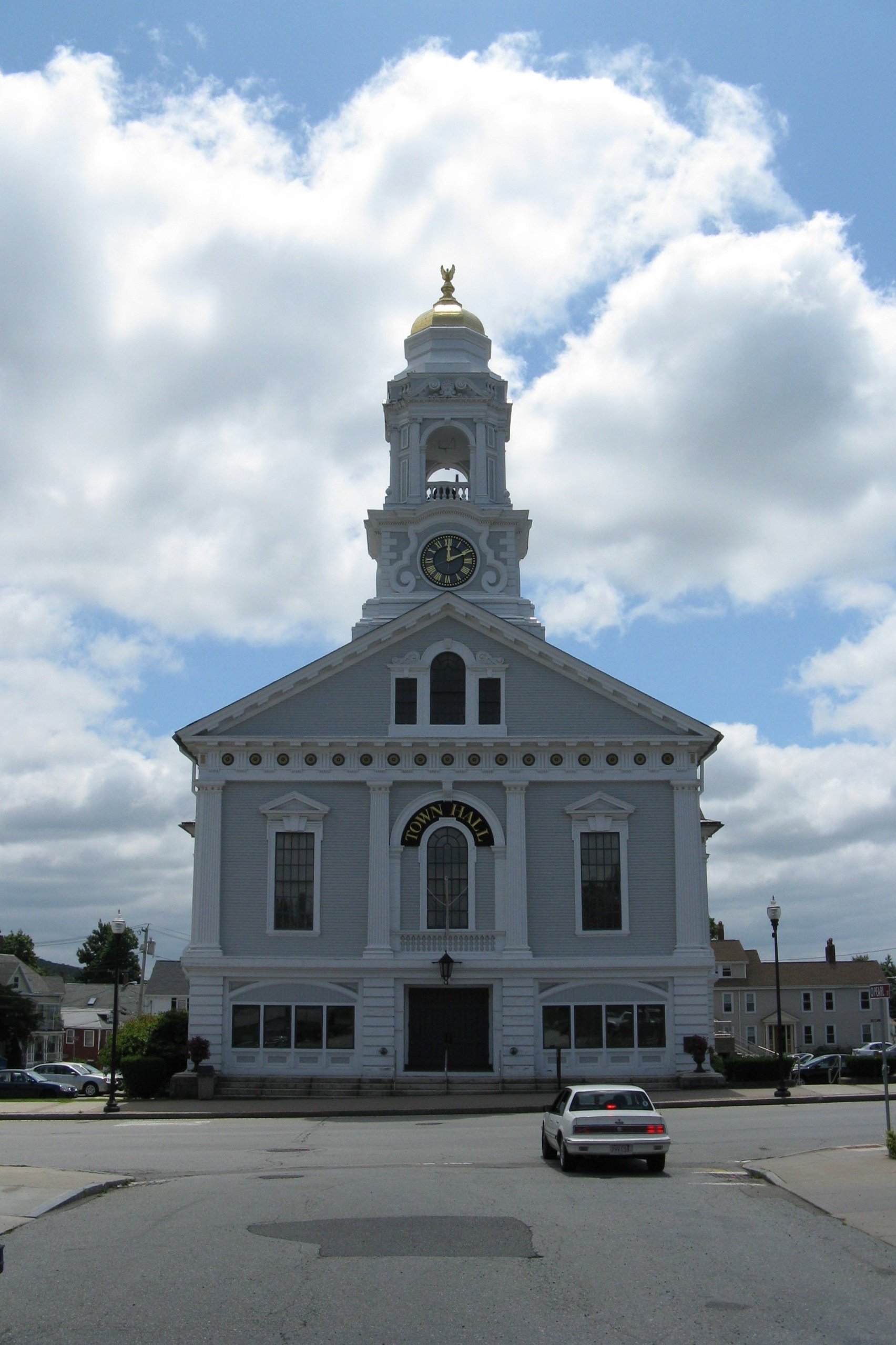
Milford, Massachusetts — Town — Town Hall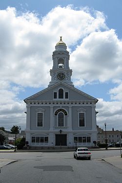
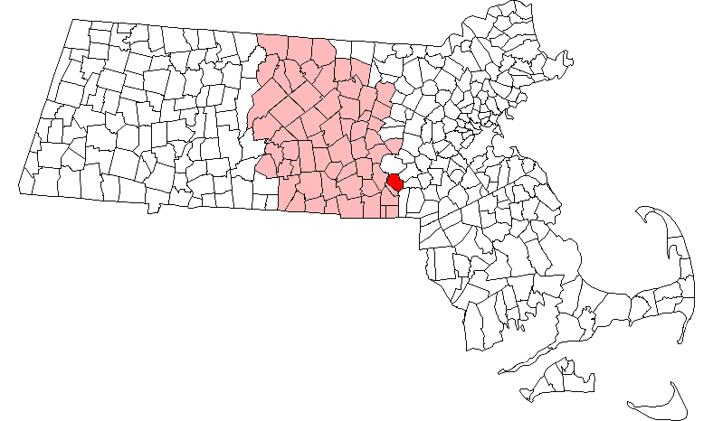
SealLocation in Worcester County in Massachusetts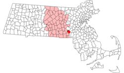
Coordinates: 42°08′23″N 71°31′00″W / 42.13972°N 71.5166667°WCoordinates: 42°08′23″N 71°31′00″W / 42.13972°N 71.5166667°W Country United States State Massachusetts County Worcester Settled 1662 Incorporated 1780 Government – Type Representative town meeting Area – Total 14.9 sq mi (38.5 km2) – Land 14.6 sq mi (37.8 km2) – Water 0.3 sq mi (0.7 km2) Elevation 307 ft (94 m) Population (2010) – Total 27,999 – Density 1,883.6/sq mi (727.2/km2) Time zone Eastern (UTC-5) – Summer (DST) Eastern (UTC-4) ZIP code 01757 Area code(s) 508 FIPS code 25-41165 GNIS feature ID 0618372 Website http://www.milford.ma.us/ Milford is a town in Worcester County, Massachusetts, United States. It had a population of 27,999 at the 2010 census.
For geographic and demographic information on the census-designated place Milford, constituting the center of the town, please see the article Milford (CDP), Massachusetts.
Contents
History
Milford was first settled in 1662 and was officially incorporated in 1780. It was originally the eastern part of Mendon, called "Mill River".
Milford is renowned for its pink Milford granite, discovered in 1870. Some of this granite has been used for buildings in New York City, Washington, D.C., and Paris, along with a number of war memorials and other monuments, including the Battle Monument at West Point.
Today, it is recognized, in part, for its health care facility - the Milford Regional Medical Center. In January 2008, the Center opened a cancer treatment facility with the Dana–Farber Cancer Institute. The Center is affiliated with UMass Medical Center as a teaching hospital.
Milford is also the home of the "My One Wish" foundation, started in 1984.
-
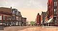
Lincoln Square in 1907
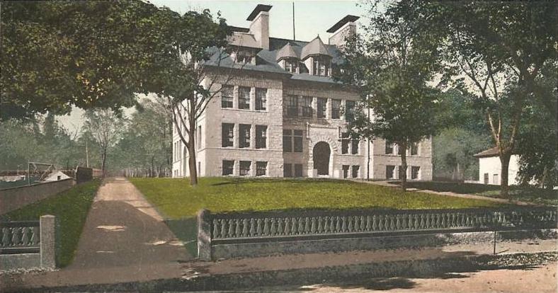
-

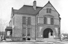
Old High School in 1907
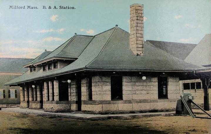
-
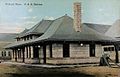
B. & A. Station c. 1913
Geography
According to the United States Census Bureau, the town has a total area of 14.9 square miles (39 km2), of which 14.6 square miles (38 km2) is land and 0.3 square miles (0.78 km2), or 1.82%, is water. Milford is drained by the Charles River.
The town is crossed by Interstate 495, as well as state routes 16, 85, and 109.
Adjacent towns
Milford is located in Central Massachusetts, bordered by:
- Hopkinton on the north
- Holliston on the northeast
- Medway on the east
- Bellingham on the south
- Hopedale on the southwest
- Upton on the west
Demographics
Historical populations Year Pop. ±% 1850 4,819 — 1860 9,132 +89.5% 1870 9,890 +8.3% 1880 9,310 −5.9% 1890 8,780 −5.7% 1900 11,376 +29.6% 1910 13,055 +14.8% 1920 13,471 +3.2% 1930 14,741 +9.4% 1940 15,388 +4.4% 1950 15,442 +0.4% 1960 15,749 +2.0% 1970 19,352 +22.9% 1980 23,390 +20.9% 1990 25,355 +8.4% 2000 26,799 +5.7% 2001* 27,196 +1.5% 2002* 27,381 +0.7% 2003* 27,521 +0.5% 2004* 27,536 +0.1% 2005* 27,613 +0.3% 2006* 27,706 +0.3% 2007* 27,766 +0.2% 2008* 27,468 −1.1% 2009* 27,588 +0.4% 2010 27,999 +1.5% * = population estimate.
Source: United States Census records and Population Estimates Program data.[1][2][3][4][5][6][7][8][9][10]As of the census[11] of 2000, there were 26,799 people, 10,420 households, and 7,200 families residing in the town. The population density was 1,835.6 people per square mile (708.7/km²). There were 10,713 housing units at an average density of 733.8 per square mile (283.3/km²). The racial makeup of the town was 92.95% White, 1.35% Black or African American, 0.11% Native American, 1.76% Asian, 0.06% Pacific Islander, 1.99% from other races, and 1.77% from two or more races. Hispanic or Latino of any race were 4.36% of the population.
There were 10,420 households out of which 33.4% had children under the age of 18 living with them, 54.0% were married couples living together, 11.2% had a female householder with no husband present, and 30.9% were non-families. 25.6% of all households were made up of individuals and 9.5% had someone living alone who was 65 years of age or older. The average household size was 2.54 and the average family size was 3.08.
In the town the population was spread out with 24.8% under the age of 18, 6.5% from 18 to 24, 33.2% from 25 to 44, 22.6% from 45 to 64, and 12.9% who were 65 years of age or older. The median age was 37 years. For every 100 females there were 94.3 males. For every 100 females age 18 and over, there were 90.6 males.
The median income for a household in the town was $50,856, and the median income for a family was $61,029. Males had a median income of $42,173 versus $30,989 for females. The per capita income for the town was $23,742. About 5.8% of families and 7.2% of the population were below the poverty line, including 8.9% of those under age 18 and 10.4% of those age 65 or over.
Economy
Milford has been growing at a fast rate since the introduction of Interstate 495 decades ago. Since then, major retailers have opened in town, including Kmart, Kohl's, Target, Lowe's, and Sports Authority. Other retailers which recently opened stores in Milford include Friendly's, T.G.I. Friday's, Bed Bath & Beyond, Staples, Petco, and Best Buy. Milford was fictitiously featured in a 2008 episode of the Fox television series Fringe.[12]
Government and infrastructure
County government: Worcester County Clerk of Courts: Dennis P. McManus (D) District Attorney: Joseph D. Early, Jr. (D) Register of Deeds: Anthony J. Vigliotti (D) Register of Probate: Stephen Abraham (D) County Sheriff: Lew Evangelidis (R) State government State Representative(s): John V. Fernandes (D) State Senator(s): Richard T. Moore (D) Governor's Councilor(s): Jen Caissie (R) Federal government U.S. Representative(s): Richard E. Neal (D-2nd District), U.S. Senators: John Kerry (D), Scott Brown (R) The core of Milford's governing system is the Open Town Meeting, where citizens can voice their opinions, but more importantly, directly affect changes in the community. Along with a Board of Selectmen, Town Administrator, Planning Board, Finance Committee, etc., the citizens of Milford have direct input into how the town is run.
The Massachusetts Department of Correction and the Massachusetts National Guard have their headquarters in Milford.[13]
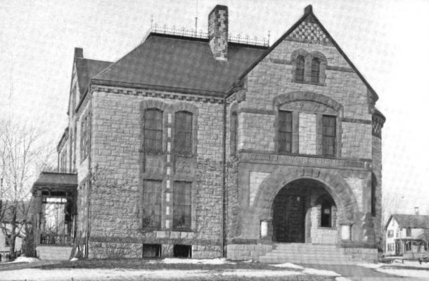
 Milford Town Library, 1899
Library
The Milford Public Library was established in 1858.[14][15] In fiscal year 2008, the town of Milford spent 1.5% ($966,758) of its budget on its public library—some $35 per person.[16]
Schools
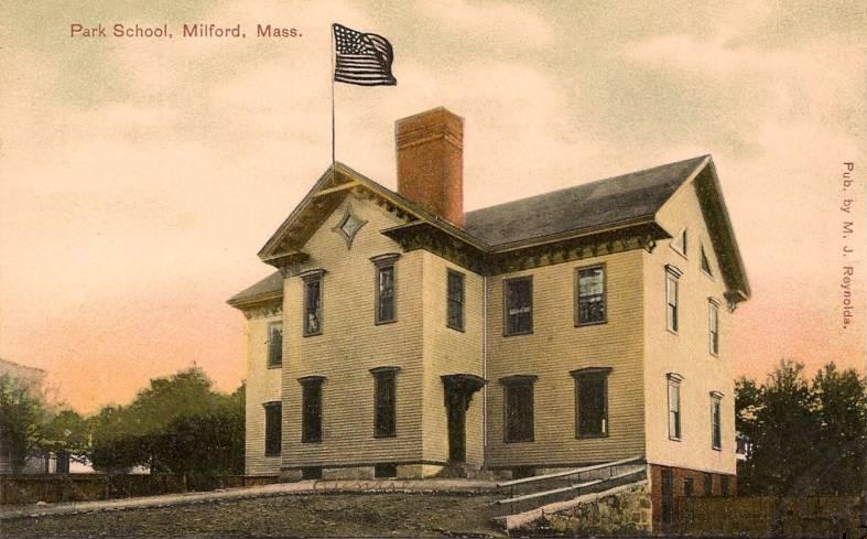
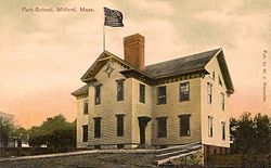 Old Park School in 1909
Milford Public Schools operates seven public schools [1] and one catholic school.
Public schools:
- Pre-K - Shining Star Early Childhood Center
- K-2 - Brookside Elementary School
- K-2 - Memorial Elementary School
- 3-4 - Woodland Elementary School
- 5-7 - Stacy Middle School
- 8 - Middle School East (MSE)
- 9-12 - Milford High School (MHS)
Catholic schools:
- K-6 - Milford Catholic Elementary School (MCES)
Vocational schools:
- 9-12 - Blackstone Valley Regional Vocational Technical High School (eligible town) (located in Upton, Massachusetts)
Annual events
- Independence Day fireworks, held on Plains Park within a day of July 4
- Portuguese Picnic - A two-night festival held at the Portuguese Club
 Irish Round Tower, Milford, MA
Sites of interest
- Memorial Hall, home and museum of the Milford Historical Commission
- Ted's Diner, placed on the National Register of Historic Places in 2000, was the oldest diner built by the Tierney Diner Company. Ted's was left abandoned by the town and vandalized, eventually moved to make way for a new fire station.
- St. Mary's Cemetery holds the only Irish round tower in the United States, built from local granite.
Media
- The Milford Daily News is a daily newspaper covering Milford and several nearby towns in Norfolk and Worcester counties.
- WMRC 1490AM is a radio station licensed to serve Milford.
- Two non-profit Public, educational, and government access (PEG) cable TV stations serving Milford-area subscribers on Channels 8 and 11. Channel 8 is the Milford town Public-access television station that produces and runs a variety of local shows, and Channel 11 is the Milford Educational-access television station and runs School Committee meetings as well as projects made by students in the high school's video production classes..
Notable residents
- Nathan Barnatt, actor and comedian
- Michael Bavaro, producer of Rex Trailer's Boomtown
- Albert Fitch Bellows, artist
- Al Cass, musician and inventor
- Horace Brigham Claflin, merchant
- William Claflin, industrialist, philanthropist and governor
- Vincent Connare, designer of the Comic Sans and Trebuchet fonts
- Ezekiel Cornell, member of Continental Congress 1780-1782
- Paul Coyne, Emmy-nominated producer of numerous television series
- John Davoren, politician
- Greg Dickerson, sports broadcaster
- William F. Draper, U.S. Representative, U.S. Ambassador to Italy
- Brian Fair, lead singer of the metal band Shadows Fall
- Rich Gotham, president of the Boston Celtics
- George F. Johnson, businessman
- Art Kenney, pitcher for the Boston Bees {later renamed the Boston Braves} in 1938
- Charles Laquidara, radio disc jockey
- Howie Long, NFL Hall of Famer, TV broadcaster and actor
- Virginia Martinez, Republican National Committeewoman from Louisiana from 1977 to 1992; landed the Republican convention in 1988 in her adopted city of New Orleans
- Leonard Chapin Mead, college president
- Richard T. Moore, politician
- Joseph E. Murray, pioneer in the area of organ transplants, 1990 recipient of the Nobel Prize for medicine
- John Ritto Penniman, decorative painter, portraitist and decorator; his works are currently displayed in several notable museums, such as the Boston Museum of Fine Arts and the Art Institute of Chicago
- Gerard Phelan, football player who caught the famous 63 yard game winning touchdown pass (thrown by Doug Flutie) for the Boston College Eagles in an NCAA game against the Miami Hurricanes.
- Ruth Pointer, singer and member of The Pointer Sisters
- Jim Pyne, former NFL player
- Jorge Rivera, mixed martial artist, UFC middleweight contender
- Brian Skerry, underwater photo-journalist
- Erik Per Sullivan, actor from Malcolm in the Middle, Cider House Rules and Christmas with the Kranks
- Michael Videira, midfielder for the New England Revolution (Major League Soccer)
References
- ^ "TOTAL POPULATION (P1), 2010 Census Summary File 1, All County Subdivisions within Massachusetts". United States Census Bureau. http://factfinder2.census.gov/bkmk/table/1.0/en/DEC/10_SF1/P1/0400000US25.06000. Retrieved September 13, 2011.
- ^ "Massachusetts by Place and County Subdivision - GCT-T1. Population Estimates". United States Census Bureau. http://factfinder.census.gov/servlet/GCTTable?_bm=y&-geo_id=04000US25&-_box_head_nbr=GCT-T1&-ds_name=PEP_2009_EST&-_lang=en&-format=ST-9&-_sse=on. Retrieved July 12, 2011.
- ^ "1990 Census of Population, General Population Characteristics: Massachusetts". US Census Bureau. December 1990. Table 76: General Characteristics of Persons, Households, and Families: 1990. 1990 CP-1-23. http://www.census.gov/prod/cen1990/cp1/cp-1-23.pdf. Retrieved July 12, 2011.
- ^ "1980 Census of the Population, Number of Inhabitants: Massachusetts". US Census Bureau. December 1981. Table 4. Populations of County Subdivisions: 1960 to 1980. PC80-1-A23. http://www2.census.gov/prod2/decennial/documents/1980a_maABC-01.pdf. Retrieved July 12, 2011.
- ^ "1950 Census of Population". Bureau of the Census. 1952. Section 6, Pages 21-10 and 21-11, Massachusetts Table 6. Population of Counties by Minor Civil Divisions: 1930 to 1950. http://www2.census.gov/prod2/decennial/documents/23761117v1ch06.pdf. Retrieved July 12, 2011.
- ^ "1920 Census of Population". Bureau of the Census. Number of Inhabitants, by Counties and Minor Civil Divisions. Pages 21-5 through 21-7. Massachusetts Table 2. Population of Counties by Minor Civil Divisions: 1920, 1910, and 1920. http://www2.census.gov/prod2/decennial/documents/41084506no553ch2.pdf. Retrieved July 12, 2011.
- ^ "1890 Census of the Population". Department of the Interior, Census Office. Pages 179 through 182. Massachusetts Table 5. Population of States and Territories by Minor Civil Divisions: 1880 and 1890. http://www2.census.gov/prod2/decennial/documents/41084506no553ch2.pdf. Retrieved July 12, 2011.
- ^ "1870 Census of the Population". Department of the Interior, Census Office. 1872. Pages 217 through 220. Table IX. Population of Minor Civil Divisions, &c. Massachusetts. http://www2.census.gov/prod2/decennial/documents/1870e-05.pdf. Retrieved July 12, 2011.
- ^ "1860 Census". Department of the Interior, Census Office. 1864. Pages 220 through 226. State of Massachusetts Table No. 3. Populations of Cities, Towns, &c.. http://www2.census.gov/prod2/decennial/documents/1860a-08.pdf. Retrieved July 12, 2011.
- ^ "1850 Census". Department of the Interior, Census Office. 1854. Pages 338 through 393. Populations of Cities, Towns, &c.. http://www2.census.gov/prod2/decennial/documents/1850c-11.pdf. Retrieved July 12, 2011.
- ^ "American FactFinder". United States Census Bureau. http://factfinder.census.gov. Retrieved 2008-01-31.
- ^ Plot Synopsis for FOX's Fringe (Season 1, Episode 6: "The Cure", Original Air Date: 21 October 2008).
- ^ "Massachusetts Department of Correction." Massachusetts Executive Office of Public Safety and Security. Retrieved on December 7, 2009.
- ^ C.B. Tillinghast. The free public libraries of Massachusetts. 1st Report of the Free Public Library Commission of Massachusetts. Boston: Wright & Potter, 1891. Google books
- ^ Milford Town Library. Retrieved 2010-11-10
- ^ July 1, 2007 through June 30, 2008; cf. The FY2008 Municipal Pie: What’s Your Share? Commonwealth of Massachusetts, Board of Library Commissioners. Boston: 2009. Available: Municipal Pie Reports. Retrieved 2010-08-04
External links
- Town of Milford, Massachusetts
- Milford Town Library
- Milford Historical Commission
- Milford Performing Arts Center
- Upper Charles Trail
Categories:- Towns in Worcester County, Massachusetts
- Milford, Massachusetts
-


Wikimedia Foundation. 2010.