- Blackstone, Massachusetts
-
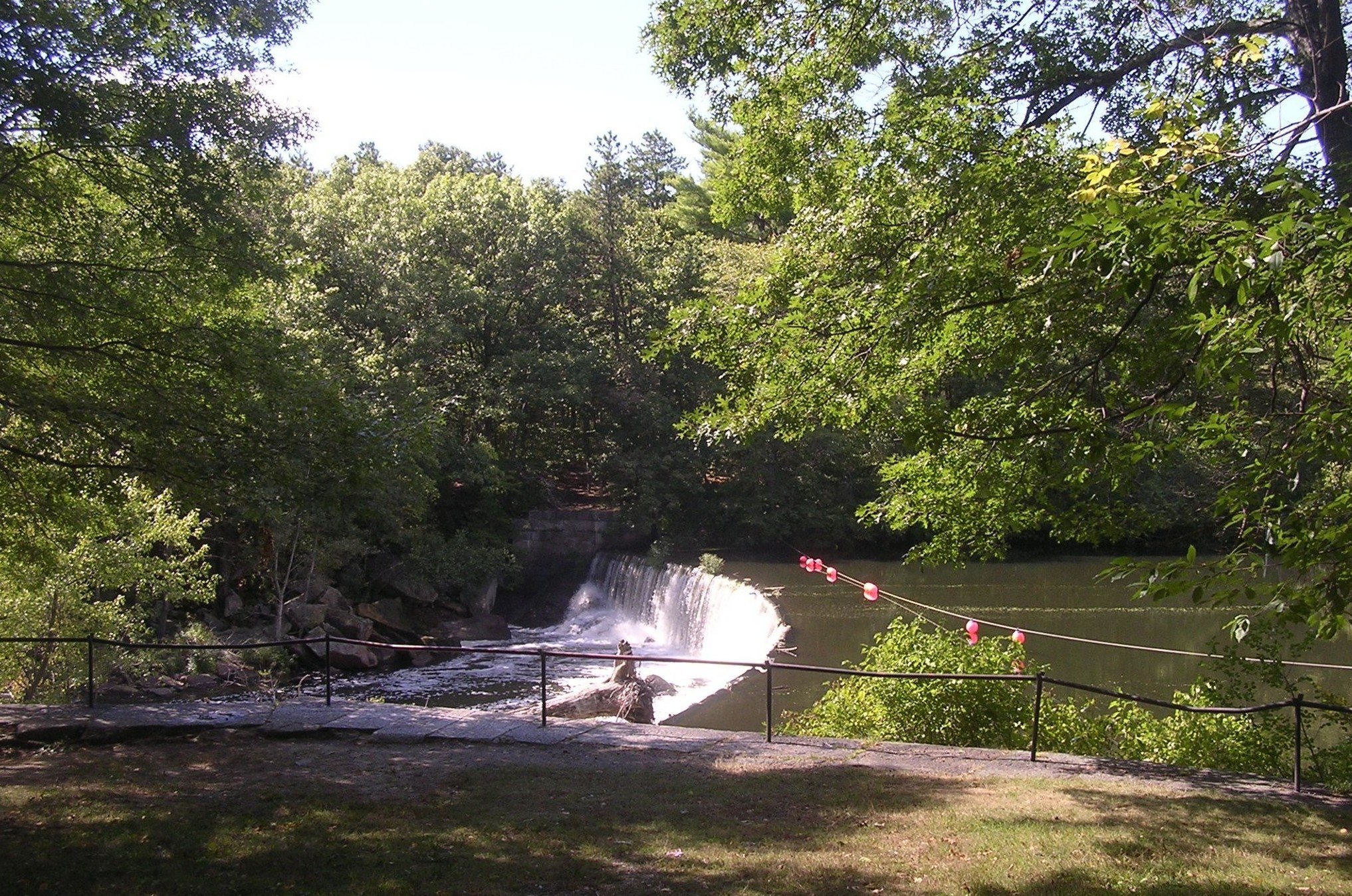
Blackstone, Massachusetts — Town — Rolling Dam on the Blackstone River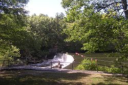

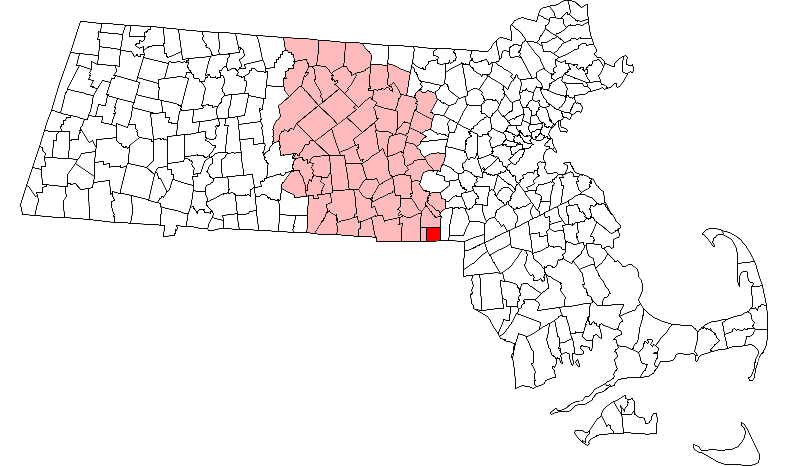
SealMotto: "Do well and doubt not." Location in Worcester County in Massachusetts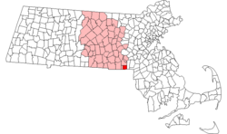
Coordinates: 42°01′04″N 71°32′30″W / 42.01778°N 71.54167°WCoordinates: 42°01′04″N 71°32′30″W / 42.01778°N 71.54167°W Country United States State Massachusetts County Worcester Settled 1662 Incorporated 1845 Government - Type Open town meeting - Town Administrator Vacant - Board of
SelectmenRobert J. Dubois, Chairman
Charles Sawyer, Vice-Chairman
Constance D. Perreault
Joseph Marchand
John WozniakArea - Total 11.2 sq mi (29.1 km2) - Land 10.9 sq mi (28.2 km2) - Water 0.3 sq mi (0.9 km2) Elevation 186 ft (57 m) Population (2010) - Total 9,026 - Density 803.3/sq mi (310.2/km2) Time zone Eastern (UTC-5) - Summer (DST) Eastern (UTC-4) ZIP code 01504 Area code(s) 508 / 774 FIPS code 25-06015 GNIS feature ID 0619477 Website www.townofblackstone.org Blackstone is a town in Worcester County, Massachusetts, United States. The population was 9,026 at the 2010 census. It is formally a part of the Providence metropolitan area.[1] Blackstone is the only municipality in Massachusetts to employ automatic cameras in traffic enforcement.[2]
Contents
History
This region was originally inhabited by the Nipmuc. Blackstone was first settled in 1662 and was officially incorporated in 1845. It was named after William Blaxton, the first settler in Boston and Rhode Island.[citation needed] Initially, the town was part of Mendon, Massachusetts, before becoming a separate municipality. Prior to 1915, Blackstone contained the area to the west that would break away and become Millville, Massachusetts. Blackstone is within the area of the John H. Chaffee Blackstone River Valley National Heritage Corridor of Massachusetts and Rhode Island. It has recently been determined by the Blackstone River Valley Historical Society that in the late 1850s to the early 1920s French and Irish immigrants were feudal rivals and would often have war-like brawls at the area known as The Five Corners. It is still unknown how many battles were fought and how many people died from them.[citation needed]
Geography
According to the United States Census Bureau, the town has a total area of 11.2 square miles (29 km2), of which 10.9 square miles (28 km2) is land and 0.3 square miles (0.78 km2), or 2.94%, is water. The Blackstone River, birthplace of the Industrial Revolution in the United States,[3] meanders west to southeast, on the south border of town.
The town is bordered by North Smithfield, Rhode Island and Woonsocket, Rhode Island to the south; Millville, Massachusetts to the west; Mendon, Massachusetts to the north, and Bellingham, Massachusetts (Norfolk County) to the east.
Named places in the town include:[4]
- Blackstone Village
- Central Village
- East Blackstone
- Farnum's Gate
- Five Corners
- High Rocks
- Millerville
- New City
- Privilege
- Rural District
- Waterford
- Wheelockville
- Woonsocket Junction (New York and New England Railroad junction)
An East Blackstone railroad station was formerly located in Bellingham.
Demographics
Historical populations Year Pop. ±% 1850 4,391 — 1860 5,453 +24.2% 1870 5,421 −0.6% 1880 4,907 −9.5% 1890 6,138 +25.1% 1900 5,721 −6.8% 1910 5,648 −1.3% 1920 4,299 −23.9% 1930 4,674 +8.7% 1940 4,566 −2.3% 1950 4,968 +8.8% 1960 5,130 +3.3% 1970 6,566 +28.0% 1980 6,570 +0.1% 1990 8,023 +22.1% 2000 8,804 +9.7% 2001* 8,988 +2.1% 2002* 9,069 +0.9% 2003* 9,119 +0.6% 2004* 9,111 −0.1% 2005* 9,101 −0.1% 2006* 9,110 +0.1% 2007* 9,143 +0.4% 2008* 9,025 −1.3% 2009* 9,733 +7.8% 2010 9,026 −7.3% * = population estimate.
Source: United States Census records and Population Estimates Program data.[5][6][7][8][9][10][11][12][13][14]As of the census[15] of 2000, there were 8,804 people, 3,235 households, and 2,355 families residing in the town. The population density was 807.4 people per square mile (311.9/km²). There were 3,331 housing units at an average density of 305.5 per square mile (118.0/km²). The racial makeup of the town was 97.39% White, 0.33% African American, 0.24% Native American, 0.76% Asian, 0.01% Pacific Islander, 0.24% from other races, and 1.03% from two or more races. Hispanic or Latino of any race were 1.03% of the population.
There were 3,235 households out of which 38.2% had children under the age of 18 living with them, 58.9% were married couples living together, 9.9% had a female householder with no husband present, and 27.2% were non-families. 22.4% of all households were made up of individuals and 8.5% had someone living alone who was 65 years of age or older. The average household size was 2.71 and the average family size was 3.20.
In the town the population was spread out with 27.7% under the age of 18, 7.5% from 18 to 24, 33.7% from 25 to 44, 20.9% from 45 to 64, and 10.1% who were 65 years of age or older. The median age was 35 years. For every 100 females there were 98.2 males. For every 100 females age 18 and over, there were 94.5 males.
The median income for a household in the town was $55,163, and the median income for a family was $61,633. Males had a median income of $42,100 versus $27,448 for females. The per capita income for the town was $20,936. About 1.8% of families and 3.7% of the population were below the poverty line, including 2.2% of those under age 18 and 12.0% of those age 65 or over.
Education
Blackstone is home to the Blackstone-Millville Regional High School. School choice is available, upon approval, for any student living within the state of Massachusetts. 54% of students have attended a 4 year college while another 26% have attended a junior college or higher education. 60% of the high schools juniors take the SATS and score averages are 505 verbal and 496 in math.
Adjacent city and towns
- Woonsocket, Rhode Island
- Millville, Massachusetts
- North Smithfield, Rhode Island
- Mendon, Massachusetts
- Bellingham, Massachusetts
Government
County government: Worcester County Clerk of Courts: Dennis P. McManus (D) District Attorney: Joseph D. Early, Jr. (D) Register of Deeds: Anthony J. Vigliotti (D) Register of Probate: Stephen Abraham (D) County Sheriff: Lew Evangelidis (R) State government State Representative(s): Ryan Fattman (R) State Senator(s): Richard T. Moore (D) Governor's Councilor(s): Jen Caissie (R) Federal government U.S. Representative(s): Richard E. Neal (D-2nd District), U.S. Senators: John Kerry (D), Scott Brown (R) See also
- Blackstone Public Library (Massachusetts)
References
- ^ "Update of Statistical area Definitions and Guidance on Their Uses". whitehouse.gov. pp. 52, 108, 150. Archived from the original on 2007-06-04. http://web.archive.org/web/20070604212956/http://www.whitehouse.gov/omb/bulletins/fy2007/b07-01.pdf. Retrieved 2007-06-11.
- ^ "Research: Communities using automated enforcement". IIHS. http://www.iihs.org/research/topics/auto_enforce_cities.html. Retrieved 2009-03-29.
- ^ "Blackstone River Valley National Heritage Corridor - History & Culture". National Park Service. http://www.nps.gov/blac/historyculture/index.htm.
- ^ CIS: Unincorporated and Unofficial Names of Massachusetts Communities
- ^ "TOTAL POPULATION (P1), 2010 Census Summary File 1, All County Subdivisions within Massachusetts". United States Census Bureau. http://factfinder2.census.gov/bkmk/table/1.0/en/DEC/10_SF1/P1/0400000US25.06000. Retrieved September 13, 2011.
- ^ "Massachusetts by Place and County Subdivision - GCT-T1. Population Estimates". United States Census Bureau. http://factfinder.census.gov/servlet/GCTTable?_bm=y&-geo_id=04000US25&-_box_head_nbr=GCT-T1&-ds_name=PEP_2009_EST&-_lang=en&-format=ST-9&-_sse=on. Retrieved July 12, 2011.
- ^ "1990 Census of Population, General Population Characteristics: Massachusetts". US Census Bureau. December 1990. Table 76: General Characteristics of Persons, Households, and Families: 1990. 1990 CP-1-23. http://www.census.gov/prod/cen1990/cp1/cp-1-23.pdf. Retrieved July 12, 2011.
- ^ "1980 Census of the Population, Number of Inhabitants: Massachusetts". US Census Bureau. December 1981. Table 4. Populations of County Subdivisions: 1960 to 1980. PC80-1-A23. http://www2.census.gov/prod2/decennial/documents/1980a_maABC-01.pdf. Retrieved July 12, 2011.
- ^ "1950 Census of Population". Bureau of the Census. 1952. Section 6, Pages 21-10 and 21-11, Massachusetts Table 6. Population of Counties by Minor Civil Divisions: 1930 to 1950. http://www2.census.gov/prod2/decennial/documents/23761117v1ch06.pdf. Retrieved July 12, 2011.
- ^ "1920 Census of Population". Bureau of the Census. Number of Inhabitants, by Counties and Minor Civil Divisions. Pages 21-5 through 21-7. Massachusetts Table 2. Population of Counties by Minor Civil Divisions: 1920, 1910, and 1920. http://www2.census.gov/prod2/decennial/documents/41084506no553ch2.pdf. Retrieved July 12, 2011.
- ^ "1890 Census of the Population". Department of the Interior, Census Office. Pages 179 through 182. Massachusetts Table 5. Population of States and Territories by Minor Civil Divisions: 1880 and 1890. http://www2.census.gov/prod2/decennial/documents/41084506no553ch2.pdf. Retrieved July 12, 2011.
- ^ "1870 Census of the Population". Department of the Interior, Census Office. 1872. Pages 217 through 220. Table IX. Population of Minor Civil Divisions, &c. Massachusetts. http://www2.census.gov/prod2/decennial/documents/1870e-05.pdf. Retrieved July 12, 2011.
- ^ "1860 Census". Department of the Interior, Census Office. 1864. Pages 220 through 226. State of Massachusetts Table No. 3. Populations of Cities, Towns, &c.. http://www2.census.gov/prod2/decennial/documents/1860a-08.pdf. Retrieved July 12, 2011.
- ^ "1850 Census". Department of the Interior, Census Office. 1854. Pages 338 through 393. Populations of Cities, Towns, &c.. http://www2.census.gov/prod2/decennial/documents/1850c-11.pdf. Retrieved July 12, 2011.
- ^ "American FactFinder". United States Census Bureau. http://factfinder.census.gov. Retrieved 2008-01-31.
External links
Categories:- Towns in Worcester County, Massachusetts

Wikimedia Foundation. 2010.