- Oxford, Massachusetts
-
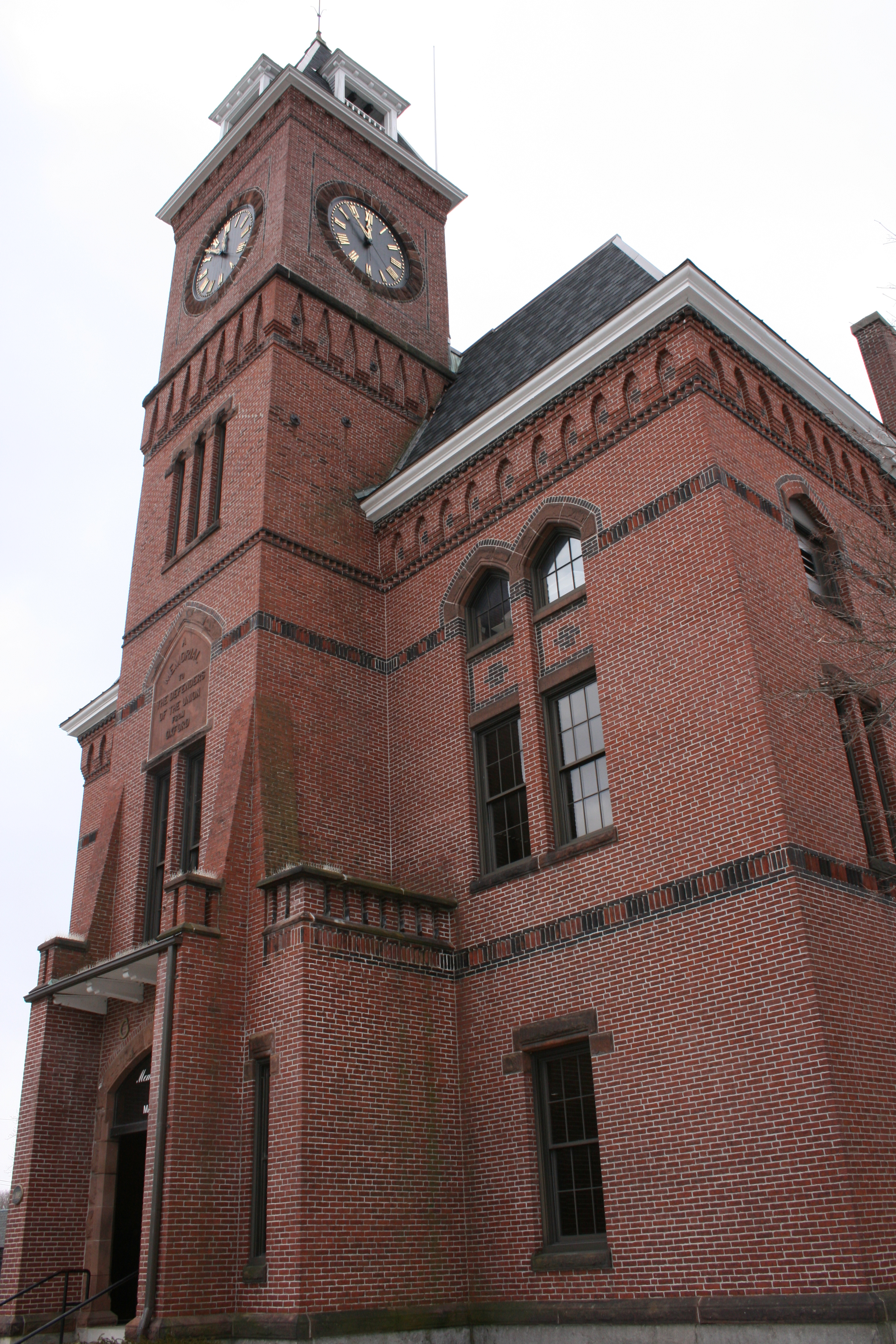
Oxford, Massachusetts — Town — Oxford Town Hall
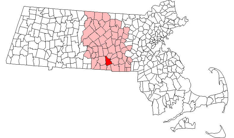
SealLocation in Worcester County in Massachusetts
Coordinates: 42°07′00″N 71°51′55″W / 42.1166667°N 71.86528°WCoordinates: 42°07′00″N 71°51′55″W / 42.1166667°N 71.86528°W Country United States State Massachusetts County Worcester Settled 1687 Incorporated 1713 Government – Type Open town meeting – Town
ManagerJoseph M. Zeneski Area – Total 27.5 sq mi (71.3 km2) – Land 26.6 sq mi (69.0 km2) – Water 0.9 sq mi (2.3 km2) Elevation 508 ft (155 m) Population (2010) – Total 13,709 – Density 498/sq mi (192.3/km2) Time zone Eastern (UTC-5) – Summer (DST) Eastern (UTC-4) ZIP code 01537, 01540 Area code(s) 508 / 774 FIPS code 25-51825 GNIS feature ID 0618379 Website http://www.town.oxford.ma.us/ Oxford is a town in Worcester County, Massachusetts, United States. The population was 13,709 at the 2010 census.
For geographic and demographic information on the census-designated place Oxford, please see the article Oxford (CDP), Massachusetts.
Contents
History
Oxford was first settled in 1686 and was officially incorporated in 1713. It was the birthplace of Clara Barton, the first president and founder of the American Red Cross. Oxford was originally settled by Huguenots in two waves, the original settlement having been abandoned after four residents (John Johnson and his three children, Peter, Andrew and Mary) were killed in a violent confrontation with local Native Americans. This event, the Johnson Massacre, is commemorated near the south end of town on Main Street. The remains of the Huguenot Fort (built in 1686) still exist off Huguenot Road.[1]
The first town clerk of Oxford was John Town, who also served as selectman and as a church deacon.
Geography
According to the United States Census Bureau, the town has a total area of 27.5 square miles (71 km2), of which 26.6 square miles (69 km2) is land and 0.9 square miles (2.3 km2), or 3.20%, is water. The town sits in a valley, and much of its area lies in the flood plain of the French River, which runs through the town. A substantial parcel north and west of Oxford Center is held, for flood control purposes, by the U.S. Army Corps of Engineers. The land, known as Greenbriar, also serves as a nature preserve.
It also serves to cut off east-west travel on former roads through the site. Route 20 runs east-west through North Oxford; running north-south Route 12, locally called Main Street; less than a mile of Route 56, connecting North Oxford with points north; and Interstate 395, linking Oxford to Worcester and eastern Connecticut with three local exits: Depot Road in North Oxford; Sutton Avenue, the main east-west street in Oxford Center; and Cudworth Road, on the Webster town line.
The town used to include much of what is now Webster, on its southern border, but Oxford and neighboring Dudley both gave portions of their land to allow the creation of that town. Other towns bordering Oxford are Charlton on the west, Leicester and Auburn on the north, Millbury and Sutton on the east, and Douglas on the southeast.
Demographics
As of the census[2] of 2000, there were 13,352 people, 5,058 households, and 3,596 families residing in the town. The population density was 501.5 inhabitants per square mile (193.6 /km2). There were 5,228 housing units at an average density of 196.4 per square mile (75.8 /km2). The racial makeup of the town was 96.62% White, 0.87% Black or African American, 0.25% Native American, 0.84% Asian, 0.02% Pacific Islander, 0.32% from other races, and 1.07% from two or more races. 1.97% of the population were Hispanic or Latino of any race.
There were 5,058 households out of which 34.6% had children under the age of 18 living with them, 56.0% were married couples living together, 11.6% had a female householder with no husband present, and 28.9% were non-families. 23.6% of all households were made up of individuals and 8.6% had someone living alone who was 65 years of age or older. The average household size was 2.62 and the average family size was 3.12.
In the town the population was spread out with 26.1% under the age of 18, 7.5% from 18 to 24, 32.4% from 25 to 44, 22.8% from 45 to 64, and 11.2% who were 65 years of age or older. The median age was 37 years. For every 100 females there were 93.5 males. For every 100 females age 18 and over, there were 89.6 males.
The median income for a household in the town was $52,233, and the median income for a family was $58,973. Males had a median income of $41,727 versus $30,828 for females. The per capita income for the town was $21,828. 7.8% of the population and 5.5% of families were below the poverty line. 12.5% of those under the age of 18 and 7.6% of those 65 and older were living below the poverty line.
Government
County government: Worcester County Clerk of Courts: Dennis P. McManus (D) District Attorney: Joseph D. Early, Jr. (D) Register of Deeds: Anthony J. Vigliotti (D) Register of Probate: Stephen Abraham (D) County Sheriff: Lew Evangelidis (R) State government State Representative(s): Peter Durant (R), Paul K. Frost (R), Kevin Kuros (R) State Senator(s): Richard T. Moore (D) Governor's Councilor(s): Jen Caissie (R) Federal government U.S. Representative(s): Richard E. Neal (D-2nd District), U.S. Senators: John Kerry (D), Scott Brown (R) Library
The Oxford public library was established in 1869.[3][4] In fiscal year 2008, the town of Oxford spent 1.5% ($468,609) of its budget on its public library—some $34 per person.[5]
Education
Oxford has a public school system with two elementary schools, one middle school and one high school.
Elementary schools include Clara Barton School, which serves the north side of town (including the village of North Oxford) and Alfred M. Chaffee School in the south.Clara Barton School serves Pre-School, 3rd, and 4th. Alfres M. Chaffee serves Kindergarten, 1st, and 2nd. All public school students in Oxford attend Oxford Middle School for grades 5-8. Oxford High School serves grades 9-12.
Points of interest
-
This list is incomplete; you can help by expanding it.
- Bartlett's Bridge
- Barton Center for Diabetes Education, site of the Clara Barton Camp for Diabetic Girls and the Clara Barton Birthplace Museum
- Bigelow Carpet Company Woolen Mills
- Carl's Oxford Diner
- Hodges Village Dam
- Hudson House
- Huguenot Fort
- Oxford High School
- Oxford Public Library
Notable residents
-
This list is incomplete; you can help by expanding it.
- Michael Bartlett, Bartlett was one of America’s most popular tenors, starring in films, opera, Broadway, radio, concerts, and recitals
- Clara Barton, American teacher, nurse, humanitarian best remembered for organizing the American Red Cross during the Civil War
- Nelson H. Davis, brigadier general during the American Civil War
- Tom Herrion, former head basketball coach at the College of Charleston, assistant coach at the University of Pittsburgh, currently head coach at Marshall University
- Elliott P. Joslin, doctor, pioneer in diabetes research
- Ebenezer Learned, general in the American Revolutionty
References
- ^ "Historical Oxford, settled by the French Huguenots", p.2 Oxford Historical Commission, 1984
- ^ "American FactFinder". United States Census Bureau. http://factfinder.census.gov. Retrieved 2008-01-31.
- ^ C.B. Tillinghast. The free public libraries of Massachusetts. 1st Report of the Free Public Library Commission of Massachusetts. Boston: Wright & Potter, 1891. Google books
- ^ Oxford Free Public Library. Retrieved 2010-11-10
- ^ July 1, 2007 through June 30, 2008; cf. The FY2008 Municipal Pie: What’s Your Share? Commonwealth of Massachusetts, Board of Library Commissioners. Boston: 2009. Available: Municipal Pie Reports. Retrieved 2010-08-04
External links
Categories:- Towns in Worcester County, Massachusetts
-

Wikimedia Foundation. 2010.