- Grafton, Massachusetts
-
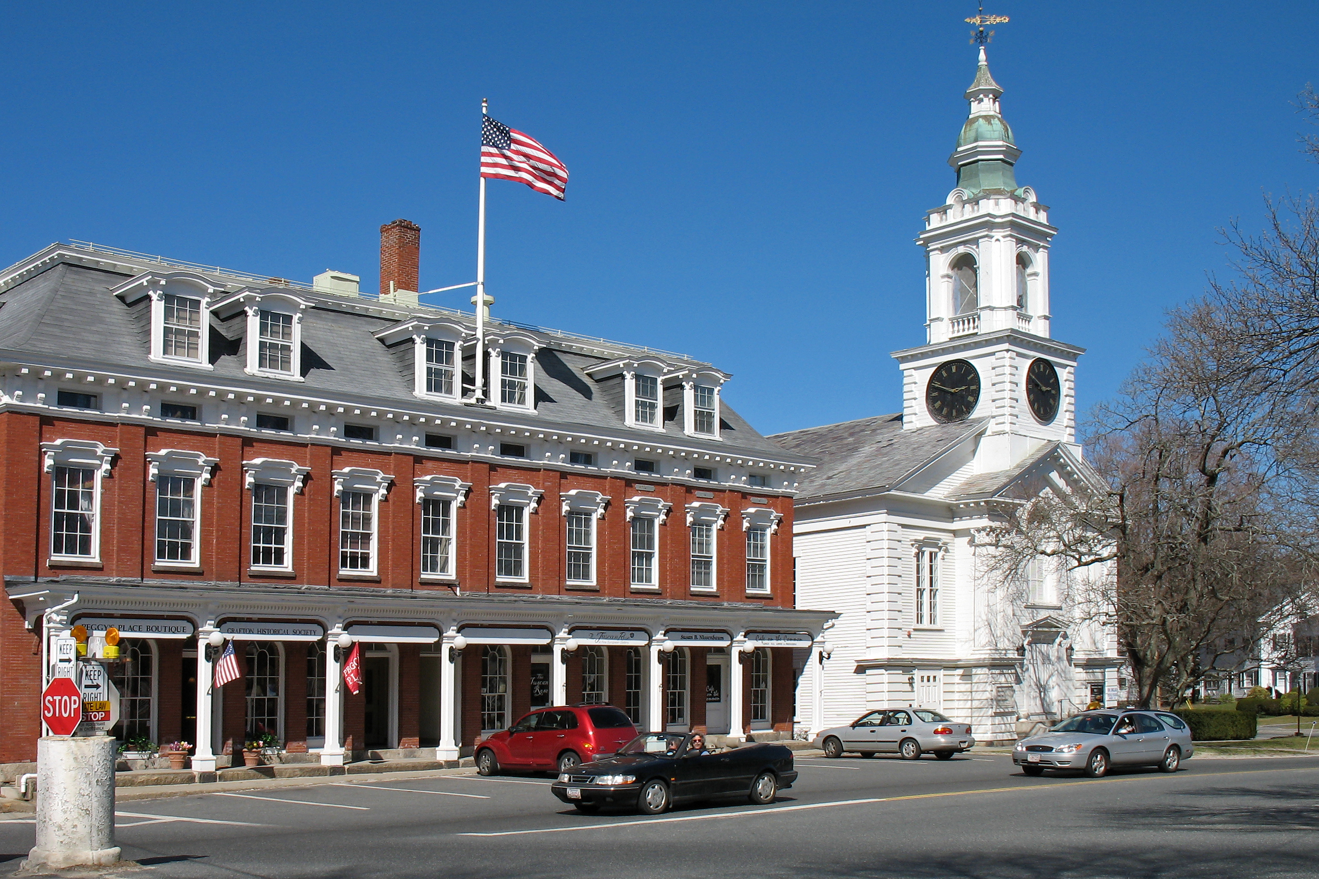
Grafton, Massachusetts — Town — Grafton center in 2006 Location in Worcester County in Massachusetts
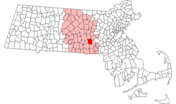
Coordinates: 42°12′25″N 71°41′10″W / 42.20694°N 71.68611°WCoordinates: 42°12′25″N 71°41′10″W / 42.20694°N 71.68611°W Country United States State Massachusetts County Worcester Settled 1718 Incorporated 1735 Government - Type Open town meeting - Town
AdministratorTimothy McInerney - Board of
SelectmenPeter J. Adams
Christopher R. LeMay
Brook Padgett
Mary Ann Cotton
Dave Ross- Finance Committee Dave Libbey (Chair)
Don Davison (Clerk)
Sue Robbins
Bob Foley
Heather McCue
Lisa Rice- Town Moderator Roger Trahan Area - Total 23.3 sq mi (60.3 km2) - Land 22.7 sq mi (58.9 km2) - Water 0.5 sq mi (1.4 km2) Elevation 425 ft (130 m) Population (2010) - Total 17,765 - Density 763/sq mi (294.6/km2) Time zone Eastern (UTC-5) - Summer (DST) Eastern (UTC-4) ZIP code 01519, 01536, 01560 Area code(s) 508 / 774 FIPS code 25-26430 GNIS feature ID 0619480 Website http://www.town.grafton.ma.us/ Grafton is a town in Worcester County, Massachusetts, United States. The population was 17,765 at the 2010 census. Grafton is the home of a Nipmuc village known as Hassanamisco Reservation, the Willard House and Clock Museum, and the Tufts University Cummings School of Veterinary Medicine.
Contents
History
Bands of the Nipmuc tribe were the indigenous inhabitants, and maintain a state-recognized reservation known as Hassanamessit, or Hassanamisco, which was formerly a Praying Indian village.[1] Grafton was first settled by Europeans in 1718 and was officially incorporated in 1735.
Grafton stands tall in the industrialization of the Blackstone Valley. Its Northeast Village was once known as "New England Village". The following is an excerpt from the Blackstone Daily about the history of the town:
Grafton has been a significant contributor in the success and progress of the American Industrial Revolution that was started in 1793 by Samuel Slater with his cotton mill in Pawtucket. North Grafton's Upper Mill, now known as the Washington Mills complex that still produces abrasives, was once known as the New England Manufacturing Company. This was part of the New England Village as North Grafton was known for generations. This part of the mill was built in 1826 and was part of a much larger complex, but most of that is now gone, mostly due to serious fires. Mill housing was built at 12, 14 and 16 Overlook Street. These central chimney style homes were boarding houses with ornate trim that has since been lost.[2]
The town is named for Charles FitzRoy, 2nd Duke of Grafton,[3] a title created for the illegitimate son of King Charles II of England. Ethan Allen ran a gun factory in Grafton in the early 19th century. In the 1930s, a movie, Ah, Wilderness!, was filmed in the town. The moviemakers built a bandstand on the town common which still stands there today. Grafton Common has many historic homes, churches and buildings and is considered the most quintessential common in the Blackstone Valley. The town is part of the Blackstone River Valley National Heritage Corridor, the oldest industrialized region in the U.S.
North Grafton is the home of the Wyman Gordon Company. In 1955, the United States Air Force installed a 50,000 ton metal forge in North Grafton as part of its Heavy Press Program[4] in a plant operated by Wyman Gordon. It was the largest metal forge, and indeed the largest machine, in the world at the time it was built.[5] This forge is used to form strategic metals used in commercial and military aircraft for turbine disks, shafts, and blades, landing struts and other aircraft parts where light weight and extreme strength are needed. The entire undercarriage of the space shuttles were forged in Grafton of magnesium.
From 1901 to 1973, North Grafton was home to the Grafton State Hospital. Originally an offshoot of the Worcester State Hospital, Grafton State Hospital served as a "farm colony" where chronically insane patients could live and work in somewhat normal surroundings. The campus was made up of several clusters of buildings and eventually encompassed 1,200 acres (490 ha) in Grafton, Shrewsbury, and Westborough.[6] The hospital was closed in 1973, and the campus, including many of the original buildings, was taken over by the Cummings School of Veterinary Medicine (part of Tufts University) and the Grafton Job Corps center.
Geography
According to the United States Census Bureau, the town has a total area of 23.3 square miles (60 km2), of which 22.7 square miles (59 km2) is land and 0.5 square miles (1.3 km2), or 2.28%, is water. Grafton is located 30 miles (48 km) west of Boston and 5 miles (8.0 km) southeast of Worcester.
Demographics
Historical populations Year Pop. ±% 1850 3,904 — 1860 4,317 +10.6% 1870 4,594 +6.4% 1880 4,030 −12.3% 1890 5,002 +24.1% 1900 4,869 −2.7% 1910 5,705 +17.2% 1920 6,887 +20.7% 1930 7,030 +2.1% 1940 7,457 +6.1% 1950 8,281 +11.1% 1960 10,627 +28.3% 1970 11,659 +9.7% 1980 11,238 −3.6% 1990 13,035 +16.0% 2000 14,894 +14.3% 2001* 15,407 +3.4% 2002* 15,838 +2.8% 2003* 16,071 +1.5% 2004* 16,382 +1.9% 2005* 16,947 +3.4% 2006* 17,512 +3.3% 2007* 17,820 +1.8% 2008* 17,663 −0.9% 2009* 17,782 +0.7% 2010 17,765 −0.1% * = population estimate.
Source: United States Census records and Population Estimates Program data.[7][8][9][10][11][12][13][14][15][16]As of the census[17] of 2000, there were 14,894 people, 5,694 households, and 3,951 families residing in the town. The population density was 655.0 inhabitants per square mile (252.9 /km2). There were 5,828 housing units at an average density of 256.3 per square mile (99.0 /km2). The racial makeup of the town was 95.92% White, 1.25% African American, 0.11% Native American, 1.45% Asian, 0.24% from other races, and 1.03% from two or more races. Hispanic or Latino residents of any race composed 1.91% of the population.
There were 5,694 households out of which 34.1% had children under the age of 18 living with them, 58.1% were married couples living together, 8.5% had a female householder with no husband present, and 30.6% were non-families. 24.6% of all households were made up of individuals and 8.1% had someone living alone who was 65 years of age or older. The average household size was 2.54 and the average family size was 3.07.
In the town the population was spread out with 25.8% under the age of 18, 7.2% from 18 to 24, 33.5% from 25 to 44, 22.3% from 45 to 64, and 11.2% who were 65 years of age or older. The median age was 36 years. For every 100 females there were 93.5 males. For every 100 females age 18 and over, there were 89.3 males.
The median income for a household in the town was $56,020, and the median income for a family was $66,396. Males had a median income of $48,016 versus $32,347 for females. The per capita income for the town was $26,952. About 2.3% of families and 5.6% of the population were below the poverty line, including 1.6% of those under age 18 and 6.1% of those age 65 or over.
Government
County government: Worcester County Clerk of Courts: Dennis P. McManus (D) District Attorney: Joseph D. Early, Jr. (D) Register of Deeds: Anthony J. Vigliotti (D) Register of Probate: Stephen Abraham (D) County Sheriff: Lew Evangelidis (R) State government State Representative(s): George N. Peterson, Jr (R) State Senator(s): Michael O. Moore (D) Governor's Councilor(s): Jen Caissie (R) Federal government U.S. Representative(s): Richard E. Neal (D-2nd District), U.S. Senators: John Kerry (D), Scott Brown (R) Transportation
Commuter rail service from Boston's South Station is provided by the MBTA with the Grafton station on its Framingham/Worcester Line.
The Grafton and Upton Railroad currently operates a freight line through the town connecting the Framingham/Worcester Line to the Franklin Line in Milford.
Library
The Grafton Free Public Library opened in 1867.[18] The current building was built in 1927 with money donated by Jerome Wheelock, a local inventor. In fiscal year 2008, the town of Grafton spent 1.33% ($482,226) of its budget on its public library—some $27 per person.[19]
Notable residents
- Bethany Hart, 2006 women's USA Olympic Bobsled team member[20]
- Joel H. Johnson (1802–1883), Mormon pioneer, published poet and gospel hymn writer, Utah politician, founded the Utah towns of Enoch and Johnson
- Gordon M. Nelson (d. 1993), chairman of the Massachusetts Republican State Committee from 1976 to 1980
- Frank O'Hara, avant-garde poet and playwright
- Marc Orrell, former guitarist for the band Dropkick Murphys
- Steve Spagnuolo, head coach of the St. Louis Rams
- John Adams Whipple, pioneer photographer and inventor
- Simon Willard and his brothers, clock makers
- Earl Tupper, a NH native, who pioneered Tupperware in Farnumsville, South Grafton, in the 1940's[21]
See also
References
- ^ "Martin Issues Final Determination". Archived from the original on 2006-09-29. http://web.archive.org/web/20060929073126/http://www.doi.gov/news/nipmuc.html.
- ^ "New England Village/Walking Tours". Blackstone Daily.com. http://www.blackstonedaily.com/Outdoors&Nature/WTnevillage.htm. Retrieved 2007-12-11.
- ^ "Profile for Grafton, Massachusetts". ePodunk. http://www.epodunk.com/cgi-bin/genInfo.php?locIndex=2957. Retrieved 2010-04-24.
- ^ "Heavy Duty Work", Time, 1955-05-16, http://www.time.com/time/magazine/article/0,9171,866385,00.html, retrieved 2010-12-28
- ^ American Society of Mechanical Engineers (October 20, 1983), Dedication Program, National Historic Mechanical Engineering Landmark, The Wyman-Gordon 50,000 ton Forging Press, American Society of Mechanical Engineers, http://files.asme.org/ASMEORG/Communities/History/Landmarks/5662.pdf
- ^ Schuleit, Anna. "Grafton State Hospital". 1856.org. http://www.1856.org/grafton/grafton.html. Retrieved 27 February 2011.
- ^ "TOTAL POPULATION (P1), 2010 Census Summary File 1, All County Subdivisions within Massachusetts". United States Census Bureau. http://factfinder2.census.gov/bkmk/table/1.0/en/DEC/10_SF1/P1/0400000US25.06000. Retrieved September 13, 2011.
- ^ "Massachusetts by Place and County Subdivision - GCT-T1. Population Estimates". United States Census Bureau. http://factfinder.census.gov/servlet/GCTTable?_bm=y&-geo_id=04000US25&-_box_head_nbr=GCT-T1&-ds_name=PEP_2009_EST&-_lang=en&-format=ST-9&-_sse=on. Retrieved July 12, 2011.
- ^ "1990 Census of Population, General Population Characteristics: Massachusetts". US Census Bureau. December 1990. Table 76: General Characteristics of Persons, Households, and Families: 1990. 1990 CP-1-23. http://www.census.gov/prod/cen1990/cp1/cp-1-23.pdf. Retrieved July 12, 2011.
- ^ "1980 Census of the Population, Number of Inhabitants: Massachusetts". US Census Bureau. December 1981. Table 4. Populations of County Subdivisions: 1960 to 1980. PC80-1-A23. http://www2.census.gov/prod2/decennial/documents/1980a_maABC-01.pdf. Retrieved July 12, 2011.
- ^ "1950 Census of Population". Bureau of the Census. 1952. Section 6, Pages 21-10 and 21-11, Massachusetts Table 6. Population of Counties by Minor Civil Divisions: 1930 to 1950. http://www2.census.gov/prod2/decennial/documents/23761117v1ch06.pdf. Retrieved July 12, 2011.
- ^ "1920 Census of Population". Bureau of the Census. Number of Inhabitants, by Counties and Minor Civil Divisions. Pages 21-5 through 21-7. Massachusetts Table 2. Population of Counties by Minor Civil Divisions: 1920, 1910, and 1920. http://www2.census.gov/prod2/decennial/documents/41084506no553ch2.pdf. Retrieved July 12, 2011.
- ^ "1890 Census of the Population". Department of the Interior, Census Office. Pages 179 through 182. Massachusetts Table 5. Population of States and Territories by Minor Civil Divisions: 1880 and 1890. http://www2.census.gov/prod2/decennial/documents/41084506no553ch2.pdf. Retrieved July 12, 2011.
- ^ "1870 Census of the Population". Department of the Interior, Census Office. 1872. Pages 217 through 220. Table IX. Population of Minor Civil Divisions, &c. Massachusetts. http://www2.census.gov/prod2/decennial/documents/1870e-05.pdf. Retrieved July 12, 2011.
- ^ "1860 Census". Department of the Interior, Census Office. 1864. Pages 220 through 226. State of Massachusetts Table No. 3. Populations of Cities, Towns, &c.. http://www2.census.gov/prod2/decennial/documents/1860a-08.pdf. Retrieved July 12, 2011.
- ^ "1850 Census". Department of the Interior, Census Office. 1854. Pages 338 through 393. Populations of Cities, Towns, &c.. http://www2.census.gov/prod2/decennial/documents/1850c-11.pdf. Retrieved July 12, 2011.
- ^ "American FactFinder". United States Census Bureau. http://factfinder.census.gov. Retrieved 2008-01-31.
- ^ C.B. Tillinghast. The free public libraries of Massachusetts. 1st Report of the Free Public Library Commission of Massachusetts. Boston: Wright & Potter, 1891. Google books
- ^ July 1, 2007 through June 30, 2008; cf. The FY2008 Municipal Pie: What’s Your Share? Commonwealth of Massachusetts, Board of Library Commissioners. Boston: 2009. Available: Municipal Pie Reports. Retrieved 2010-08-04
- ^ Nine chosen for U.S. bobsled, skeleton spots in Torino. USA Today. Posted: 1/15/2006.
- ^ Dempsey, James (March 4, 1992). "Many Changes Since Tupper Started Ware". Worcester Telegram and Gazette. http://freepages.history.rootsweb.ancestry.com/~history/grafton/TupperwareNewsclippings.html. Retrieved August 11, 2011.
External links
- Grafton official website
- Grafton, Massachusetts History, Photos, and Info
- TheDailyGrafton.com
- Grafton News
- Grafton275.org
- Grafton Daily at the Blackstone Daily
- Grafton Public Schools
- Grafton Public Library
- Willard Clock House and Museum
- Grafton Group on Flickr
- Nipmuck Nation
- Grafton Community Television
Categories:- Towns in Worcester County, Massachusetts
- Populated places established in 1718


Wikimedia Foundation. 2010.