- Massachusetts Route 152
-
Route 152 Route information Length: 14.89 mi[1] (23.96 km) Existed: 1939 – present Major junctions South end:  RI Route 152 in East Providence, RI
 I-95 (via Robert Toner Boulevard) in Attleboro/North Attleborough
North end:  U.S. 1 in Plainville
Highway system Massachusetts State Highway Routes
←  Route 151
Route 159  →
→Route 152 is a south–north state highway in southeastern Massachusetts.
Route description
Route 152 is a continuation of R.I. Route 152. The highway runs close to the Rhode Island border for the duration of its run. The highway enters the Bay State in Seekonk, and goes through Attleboro, North Attleborough, and ends at U.S. Route 1 in Plainville.
-
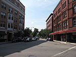
Northbound in Attleboro
Junction list
County Location Milepost Roads Intersected Notes  enters Massachusetts from Rhode Island
Bristol Seekonk Brook Street Unsigned  Route 15.
To R.I. Route 15.
Attleboro  Route 123
To  Route 118.
Robert Toner Boulevard To  I-95, Exit 5 in North Attleborough.
North Attleborough  I-95
I-95No access between Route 152 and I-95. Norfolk Plainville  Route 106
14.89  US 1
US 1Northern terminus of Route 152.
To I-495 Exit 14.
References
- ^ Executive Office of Transportation, Office of Transportation Planning - 2007 Road Inventory
Categories:- Numbered routes in Massachusetts
-
Wikimedia Foundation. 2010.


