- North Adams, Massachusetts
-
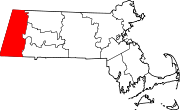
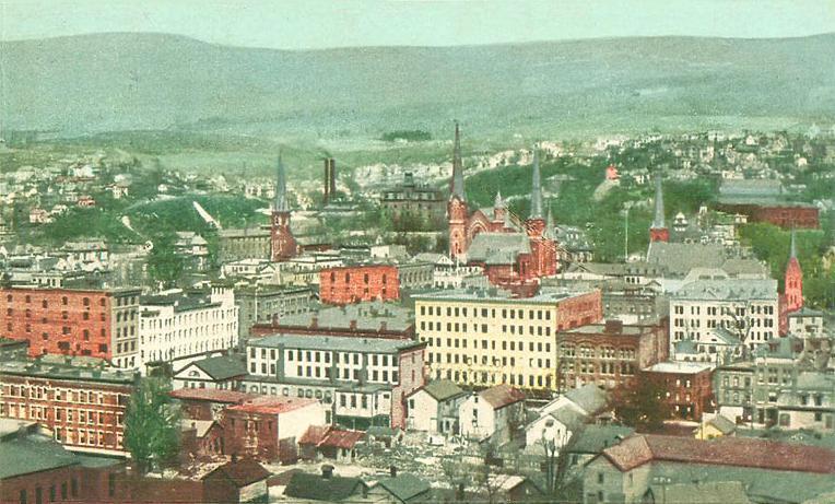
North Adams, Massachusetts — City — Bird's eye view of North Adams, 1905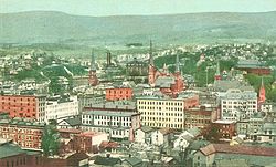 Location in Berkshire County in Massachusetts
Coordinates: 42°42′03″N 73°06′33″W / 42.70083°N 73.10917°WCoordinates: 42°42′03″N 73°06′33″W / 42.70083°N 73.10917°W Country United States State Massachusetts County Berkshire Settled 1745 Incorporated 1878 Government - Type Mayor-council city - Mayor Richard Alcombright (D) Area - Total 20.6 sq mi (53.3 km2) - Land 20.4 sq mi (52.9 km2) - Water 0.1 sq mi (0.3 km2) Elevation 707 ft (215 m) Population (2010) - Total 13,708 - Density 665.4/sq mi (257.2/km2) Time zone Eastern (UTC-5) - Summer (DST) Eastern (UTC-4) ZIP code 01247 Area code(s) 413 FIPS code 25-46225 GNIS feature ID 0607610 Website www.northadams-ma.gov North Adams is a city in Berkshire County, Massachusetts, United States. It is part of the Pittsfield, Massachusetts Metropolitan Statistical Area. The population was 13,708 as of the 2010 census, making it the least populous city in the state. Best known as the home of the largest contemporary art museum in the United States, the Massachusetts Museum of Contemporary Art, North Adams has in recent years become a center for tourism, culture and recreation.
Contents
History
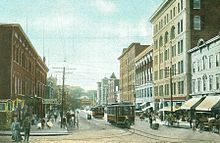 Main Street in 1906
North Adams was first settled in 1745 during King Georges War.[1] During the war, the Canadiens and Indians laid siege to Fort Massachusetts (located at the present-day Price Choppers), thirty prisoners were taken to Quebec and half died in captivity.
The town was separately incorporated from Adams in 1878. The city is named in honor of Samuel Adams, a leader in the American Revolution, signer of the Declaration of Independence, and governor of Massachusetts.
For much of its existence, North Adams was a mill town. Manufacturing began in the city before the Revolutionary War, as its location at the confluence of the two branches of the Hoosic River provided water power for diverse, small-scale industries. By the late 18th and early 19th centuries, businesses included wholesale shoe manufacturers; a brick yard; a saw mill; cabinet-makers; hat manufacturers; machine shops for the construction of mill machines; marble works; wagon and sleigh-makers; and an ironworks, which provided the pig iron for armor plates on the Civil War ship, the Monitor. North Adams would be headquarters for construction of the Hoosac Tunnel.
In 1860, the O. Arnold and Company was established with the latest equipment for printing cloth. Large government contracts to supply fabric for the Union Army helped the business prosper. During the next four decades, Arnold Print Works became one of the world's leading manufacturers of printed textiles. It also became the largest employer in North Adams, with some 3,200 workers by 1905. Despite decades of success, however, falling cloth prices and the lingering effects of the Great Depression forced Arnold Print Works to close its Marshall Street operation in 1942, consolidating at smaller facilities in Adams.
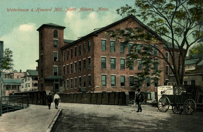
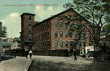 Waterhouse & Howard Mill in c. 1908
Later that year, the Sprague Electric Company bought the former print works site. Sprague physicists, chemists, electrical engineers, and skilled technicians were called upon by the U.S. government during World War II to design and manufacture crucial components of some of its most advanced high-tech weapons systems, including the atomic bomb.
With state-of-the-art equipment, Sprague was a major research and development center, conducting studies on the nature of electricity and semi-conducting materials. After the war, its products were used in the launch systems for Gemini moon missions, and by 1966 Sprague employed 4,137 workers in a community of 18,000, existing almost as a city within a city. From the post-war years to the mid-1980s, Sprague produced electrical components for the booming consumer electronics market, but competition from abroad led to declining sales and, in 1985, the company closed operations on Marshall Street.
Massachusetts Museum of Contemporary Art & the "Renaissance"
The closure of Sprague Electric devastated the local economy. Unemployment rates rose and population declined. In 1986, just a year after the factory's closing, the business and political leaders of North Adams were seeking ways to creatively re-use the vast complex. Williams College Museum of Art director Thomas Krens, who would later become Director of the Solomon R. Guggenheim Museum, was looking for space to exhibit large works of contemporary art that would not fit in conventional museum galleries. When Mayor John Barrett III (serving 1983-2009) suggested the vast Marshall Street complex as a possible exhibition site, the idea of creating a contemporary arts center in North Adams began to take shape.
The campaign to build political and community support for the proposed institution, which would serve as a platform for the creation and presentation of contemporary art, and develop links to the region's myriad cultural institutions, began in earnest. The Massachusetts legislature announced its support for the project in 1988. Subsequent economic upheaval in Massachusetts threatened the project, but broad-based support from the community and the private sector, which pledged more than $8 million, ensured that it continued to move forward.
The eventual proposal utilized the unparalleled scale and versatility of the complex's industrial spaces, while establishing a dialogue between the facility's past and the new life it would have as the country's largest center for contemporary visual and performing arts.
Since its opening MASS MoCA has provided the catalyst and anchor for a larger economic transformation in the region centered on cultural, recreational, and educational offerings. North Adams has become home for several new restaurants, contemporary art galleries and cultural organizations. In addition, once shuttered area factories and mills have been rehabilitated as live/work lofts for artists.
Geography
 North Adams and the surrounding mountains.
North Adams is located at 42°41′38″N 73°6′54″W / 42.69389°N 73.115°W (42.693899, -73.115096).[2]
According to the United States Census Bureau, the city has a total area of 20.6 square miles (53 km2), of which, 20.4 square miles (53 km2) of it is land and 0.1 square miles (0.26 km2) of it (0.63%) is water. North Adams is bordered by Clarksburg to the north, Florida to the east, Adams to the south, and Williamstown to the west.
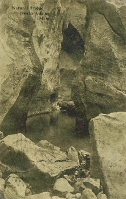
North Adams is located in the valley created by the Hoosic River, which has been walled and floored with concrete in portions to prevent floods. The city's Natural Bridge State Park contains the only natural white marble bridge in North America. Formed by glacial melt by 11,000 BC, the arch and abandoned quarry have long attracted attention from hikers, including Nathaniel Hawthorne in 1838, who wrote of it (among other local features) in his An American Notebook. To the east, the city is bordered by the western face of the Hoosac Range, with visibility on its West Summit extending throughout the tri-state area. To the southwest, the city has the northern end of Mount Greylock State Reservation, ending at Mount Williams, which at 2,951 feet (899 m) above sea level is the highest point in the city. The Appalachian Trail passes through the western part of the city, crossing the summit of Mount Williams and briefly passing through Williamstown before heading north towards Vermont.
North Adams is the western terminus of the Mohawk Trail, which ascends to the West Summit along a steep, curving road. While the trail ends here, Route 2, which the trail is coextensive with, continues westward into Williamstown and towards New York. Route 8 also passes through the city, passing from Adams, through the city and northward into Clarksburg. Route 8A, also known as 8A-U (for "upper"), runs parallel to Route 8 east of the main route, and is located entirely within city limits.
The city is the northern terminus of several lines of the Berkshire Regional Transit Authority, and also has regional service. The freight rail line which passes through the city extends through the Hoosac Tunnel towards the east. North Adams is also home to Harriman and West Airport, a small regional airport. The nearest interstate is Interstate 91 to the east, almost an hour away, and the nearest airport with national service is Albany International Airport.
Demographics
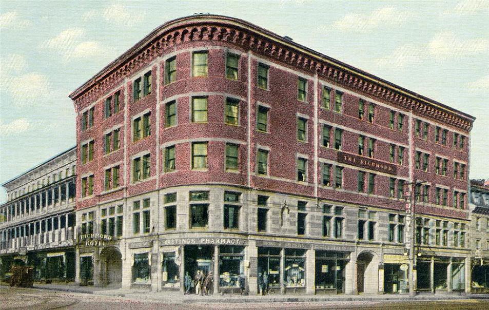
Historical populations Year Pop. ±% 1880 10,191 — 1890 16,074 +57.7% 1900 24,200 +50.6% 1910 22,019 −9.0% 1920 22,282 +1.2% 1930 21,621 −3.0% 1940 22,213 +2.7% 1950 21,567 −2.9% 1960 19,905 −7.7% 1970 19,195 −3.6% 1980 18,063 −5.9% 1990 16,797 −7.0% 2000 14,681 −12.6% 2001* 14,554 −0.9% 2002* 14,440 −0.8% 2003* 14,332 −0.7% 2004* 14,225 −0.7% 2005* 14,122 −0.7% 2006* 14,029 −0.7% 2007* 13,874 −1.1% 2008* 13,849 −0.2% 2009* 13,816 −0.2% 2010 13,708 −0.8% * = population estimate. Source: United States Census records and Population Estimates Program data.[3][4][5][6][7][8][9]  The Richmond Hotel in c. 1912
As of the census[10] of 2010, there were 13,708 people, 5,652 households, and 3,156 families residing in the city. The city, which is the smallest in Massachusetts, ranks second (after Pittsfield) out of 32 cities and towns in Berkshire County by population. The population density was 665.4 people per square mile (257.2/km²), ranking it 2nd in the county. There were 6,523 housing units at an average density of 316.7 per square mile (122.4/km²). The racial makeup of the city was 93.0% White, 1.8% African American, 0.4% Native American, 1.1% Asian, 0.2% Pacific Islander, 0.8% from other races, and 2.8% from two or more races. Hispanic or Latino of any race were 2.4% of the population.
There were 5,652 households out of which 23.6% had children under the age of 18 living with them, 38.4% were married couples living together, 12.5% had a female householder with no husband present, and 44.2% were non-families. 39.7% of all households were made up of individuals and 15.0% had someone living alone who was 65 years of age or older. The average household size was 2.21 and the average family size was 2.98.
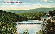 Beaver Dam in c. 1912
In the city the population was spread out with 21.74% under the age of 18, 16.9% from 18 to 24, 21.4% from 25 to 44, 23.7% from 45 to 64, and 16.4% who were 65 years of age or older. The median age was 38 years. For every 100 females there were 91.2 males. For every 100 females age 18 and over, there were 89.75 males.
The median income for a household in the city was $35,020, and the median income for a family was $57,522. The per capita income for the city was $19,857. About 9.0% of families and 22.3% of the population were below the poverty line, including 15.6% of those under age 18 and 11.0% of those age 65 or over.
Government
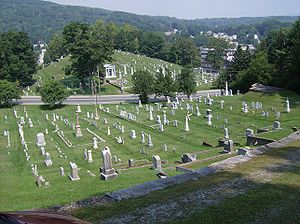 Hillside Cemetery on West Main Street in North Adams.
North Adams is governed by the mayor-council form of government under Mayor Richard Alcombright. The city has its own services, including police, fire and public works. The city is also home to North Adams Regional Hospital. The city's public library is the largest in northern Berkshire County, and also has access to the regional library networks.
On the state level, North Adams is represented in the Massachusetts House of Representatives by the First Berkshire district, which covers northern Berkshire County, as well as portions of Franklin County. In the Massachusetts Senate, the city is represented by the Berkshire, Hampshire and Franklin district, which includes all of Berkshire County and western Hampshire and Franklin Counties.[11] The city is patrolled by the Fourth (Cheshire) Station of Barracks "B" of the Massachusetts State Police.[12]
On the national level, North Adams is represented in the United States House of Representatives as part of Massachusetts's 1st congressional district, and has been represented by John Olver of Amherst since June 1991. Massachusetts is currently represented in the United States Senate by senior Senator John Kerry and junior Senator Scott Brown.
Voter Registration and Party Enrollment as of October 15, 2008[13] Party Number of Voters Percentage Democratic 3,168 34.99% Republican 696 7.69% Unaffiliated 5,091 56.22% Minor Parties 100 1.10% Total 9,055 100% Education
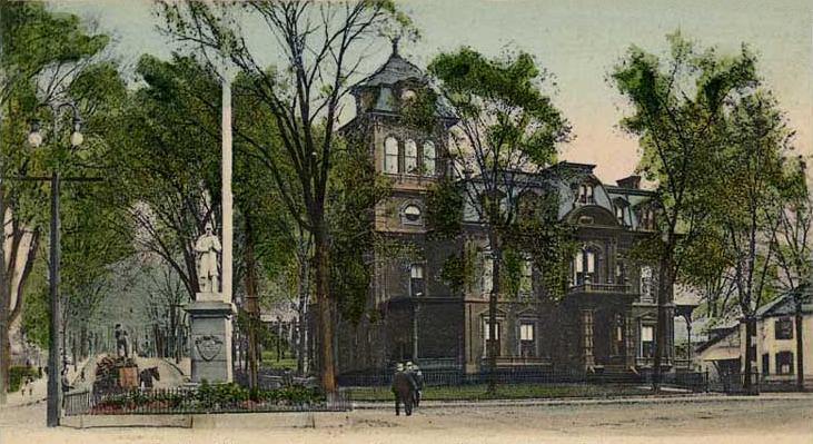
 Public Library and Monument Square in 1907
North Adams operates its own public school system, with three elementary schools (Brayton Elementary School, Greylock Elementary School and Sullivan Elementary School),Conte Middle School, and Drury High School, which also serves several neighboring towns. The city is also home to Charles H. McCann Technical High School, as well as several private and parochial schools.
North Adams Public Schools Enrollment School 2001 2002 2003 2004 2005 2006 2007 2008 2009 estimate 2010 estimate Drury High School 610 645 608 625 622 583 593 544 620(incld. 8th) 625(incld. 8th) Conte Middle School 526 499 509 511 475 417 352 323 N/A N/A Brayton Elementary 499 471 466 429 400 342 356 364 468(incld. 6th+7th) 480(incld. 6th+7th) Sullivan Elementary 320 316 311 286 269 256 253 224 275(incld. 6th+7th) 270(incld. 6th+7th) Greylock Elementary 237 213 230 226 231 221 235 229 265(incld. 6th+7th) 266(incld. 6th+7th) Total: 2,192 2,144 2,124 2,077 1,997 1,819 1,789 1,684 1,628 1,641 Avg. students per grade: 156.57 153.14 151.71 148.36 142.64 129.93 127.79 120.29 116.29 117.21 Northern Berkshire Vocational Regional School District Enrollment School 2001 2002 2003 2004 2005 2006 2007 2008 2009 2010 Charles H. McCann Technical High School 440 427 427 440 468 491 516 511 510 491 Avg. students per grade: 110 106.75 106.75 110 117 122.75 129 127.75 127.5 122.75 Massachusetts College of Liberal Arts (MCLA) enrolls about 1,980 students. The most popular programs are English/Communications, Business, Education, History, Fine & Performing Arts, Psychology, and Sociology. Founded in 1894 as North Adams Normal School, in 1932 the Normal School became the State Teachers College of North Adams. In 1960, the college changed its name to North Adams State College and added professional degrees in Business Administration and Computer Science. In 1997, the name changed to Massachusetts College of Liberal Arts, reflective of specialty school status within the Massachusetts State College system. In recent years, MCLA has begun to develop more academic programming in the fields of fine arts and arts management, reflecting the region's growth as a center of arts and cultural affairs.
Beyond MCLA, the nearest state university is the University of Massachusetts Amherst. The nearest private college is Williams College, in neighboring Williamstown, Massachusetts
Culture
Sports
The city is home to the North Adams SteepleCats of the New England Collegiate Baseball League (NECBL). The SteepleCats play at Joe Wolfe Field in North Adams. The SteepleCats hold the NECBL record for highest single-game attendance. The record was made on July 4, 2006, in a game against the Holyoke Giants in front of 6,714 fans.[14] Holyoke won the game 3-2.[15]
North Adams also has many athletic complexes and recreational fields scattered throughout the city including the Noel Field Atheltic Complex, just south of the downtown, and the newly built Alcombright Field, in the city's west end.
Sites and events of interest
- Fall Foliage Festival
- The Berkshire Hills Internship Program
- Hoosac Tunnel
- Massachusetts College of Liberal Arts
- MCLA Gallery 51
- DownStreet Art > http://www.downstreetart.org/
- Massachusetts Museum of Contemporary Art
- Natural Bridge State Park
- North Adams Museum of History & Science -- North Adams Historical Society
- Western Gateway Heritage State Park
- Congregation Beth Israel
- Solid Sound Festival
- Develop North Adams
Notable residents
 Natural Bridge in 1911
- Martha Coakley, Massachusetts attorney general
- Caitlin Kittredge, author
- Caleb Atwater, archeologist, politician
- Andrea Barrett, novelist
- Daniel E. Bosley, state representative
- Jack Chesbro (1874–1931), Hall of Fame pitcher
- Jeremiah Colegrove (1758–1836), early leading citizen
- Howard Cruse, cartoonist
- John M. Darby, botanist, chemist
- Will Durant, philosopher, historian
- Paul Farmer, physician, anthropologist
- Joseph F. Finnegan (1904–1964), labor mediator
- Van Hansis, actor
- Peter Laird, comic book artist
- Amy Lee, saxophonist
- Martin Melcher, film producer and husband of Doris Day
- Harrison Potter (1891–1984), classical pianist
- Allan Rockwell McCann, vice admiral
- Hiram Sibley, industrialist, philanthropist
- Frank J. Sprague electrical engineer, inventor
- Jane Swift, governor
- Oswald Tower, basketball official
- Frank Vincent, actor
- Ashley B. Wright, U.S. congressman
- John Henry Schwarz, theoretical physicist
- Jonah Bayliss, baseball player
- John Henry Haynes, (1849-1910) archaeologist and photographer
References
- ^ http://openlibrary.org/books/OL7071051M/History_of_North_Adams_Mass._1749-1885 W. F. Spear, "History of North Adams, Mass. 1749-1885", 1885, p. 12
- ^ "US Gazetteer files: 2010, 2000, and 1990". United States Census Bureau. 2011-02-12. http://www.census.gov/geo/www/gazetteer/gazette.html. Retrieved 2011-04-23.
- ^ "TOTAL POPULATION (P1), 2010 Census Summary File 1, All County Subdivisions within Massachusetts". United States Census Bureau. http://factfinder2.census.gov/bkmk/table/1.0/en/DEC/10_SF1/P1/0400000US25.06000. Retrieved September 13, 2011.
- ^ "Massachusetts by Place and County Subdivision - GCT-T1. Population Estimates". United States Census Bureau. http://factfinder.census.gov/servlet/GCTTable?_bm=y&-geo_id=04000US25&-_box_head_nbr=GCT-T1&-ds_name=PEP_2009_EST&-_lang=en&-format=ST-9&-_sse=on. Retrieved July 12, 2011.
- ^ "1990 Census of Population, General Population Characteristics: Massachusetts". US Census Bureau. December 1990. Table 76: General Characteristics of Persons, Households, and Families: 1990. 1990 CP-1-23. http://www.census.gov/prod/cen1990/cp1/cp-1-23.pdf. Retrieved July 12, 2011.
- ^ "1980 Census of the Population, Number of Inhabitants: Massachusetts". US Census Bureau. December 1981. Table 4. Populations of County Subdivisions: 1960 to 1980. PC80-1-A23. http://www2.census.gov/prod2/decennial/documents/1980a_maABC-01.pdf. Retrieved July 12, 2011.
- ^ "1950 Census of Population". Bureau of the Census. 1952. Section 6, Pages 21-10 and 21-11, Massachusetts Table 6. Population of Counties by Minor Civil Divisions: 1930 to 1950. http://www2.census.gov/prod2/decennial/documents/23761117v1ch06.pdf. Retrieved July 12, 2011.
- ^ "1920 Census of Population". Bureau of the Census. Number of Inhabitants, by Counties and Minor Civil Divisions. Pages 21-5 through 21-7. Massachusetts Table 2. Population of Counties by Minor Civil Divisions: 1920, 1910, and 1920. http://www2.census.gov/prod2/decennial/documents/41084506no553ch2.pdf. Retrieved July 12, 2011.
- ^ "1890 Census of the Population". Department of the Interior, Census Office. Pages 179 through 182. Massachusetts Table 5. Population of States and Territories by Minor Civil Divisions: 1880 and 1890. http://www2.census.gov/prod2/decennial/documents/41084506no553ch2.pdf. Retrieved July 12, 2011.
- ^ "American FactFinder". United States Census Bureau. http://factfinder.census.gov. Retrieved 2008-01-31.
- ^ Senators and Representatives by City and Town
- ^ Station B-4, SP Cheshire
- ^ "Registration and Party Enrollment Statistics as of October 15, 2008" (PDF). Massachusetts Elections Division. http://www.sec.state.ma.us/ele/elepdf/st_county_town_enroll_breakdown_08.pdf. Retrieved 2010-05-08.
- ^ NECBL Record Book at necbl.com, URL accessed August 16, 2009
- ^ NA v. HOL Boxscore 7/4/06 at necbl.com, URL accessed August 16, 2009
Sources
- History of Monument Square
- History of North Adams, Massachusetts (1749-1885)
- History of North Adams Public Library
- History of Sprague Electric/MASS MoCA site
External links
- City of North Adams, Massachusetts
- Massachusetts Museum of Contemporary Art
- Contemporary Artists Center, North Adams - CAC relocated in Troy, NY > link http://www.cactroy.org/
- Massachusetts College of Liberal Arts
- MCLA Berkshire Cultural Resource Center
- North Adams Transcript (newspaper)
- Chamber of Commerce (newspaper)
- American Notes -- Nathaniel Hawthorne travelogue (1838)
- North Adams Public Library
- Drury Drama Team
- Congregation Beth Israel
- North Adams SteepleCats
- McCann Technical High School
- Articles about North Adams and photos of the city by author and historian Joe Manning
- North Adams Neighborhoods History (pdf)
- North Adams History, Old Newspaper Articles, Genealogy
Municipalities and communities of Berkshire County, Massachusetts Cities North Adams | Pittsfield
Towns Adams | Alford | Becket | Cheshire | Clarksburg | Dalton | Egremont | Florida | Great Barrington | Hancock | Hinsdale | Lanesborough | Lee | Lenox | Monterey | Mount Washington | New Ashford | New Marlborough | Otis | Peru | Richmond | Sandisfield | Savoy | Sheffield | Stockbridge | Tyringham | Washington | West Stockbridge | Williamstown | Windsor
CDPs Adams | Great Barrington | Housatonic | Lee | Lenox | Williamstown
Other
villagesCategories:- Populated places established in 1745
- Cities in Massachusetts
- Populated places in Berkshire County, Massachusetts
- Early American industrial centers
- North Adams, Massachusetts


Wikimedia Foundation. 2010.