- Williamstown, Massachusetts
Infobox Settlement
official_name = Williamstown, Massachusetts
nickname =
motto =
imagesize =
image_caption =
image_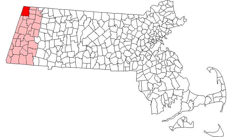
mapsize = 250px
map_caption = Location in Berkshire County in Massachusetts
mapsize1 =
map_caption1 =
subdivision_type = Country
subdivision_name =United States
subdivision_type1 = State
subdivision_name1 =Massachusetts
subdivision_type2 = County
subdivision_name2 = Berkshire
established_title = Settled
established_date = 1749
established_title2 = Incorporated
established_date2 = 1765
established_title3 =
established_date3 =
government_type =Open town meeting
leader_title =
leader_name =
leader_title1 =
leader_name1 =
area_magnitude =
area_total_km2 = 121.5
area_total_sq_mi = 46.9
area_land_km2 = 121.4
area_land_sq_mi = 46.9
area_water_km2 = 0.1
area_water_sq_mi = 0.0
population_as_of = 2000
settlement_type = Town
population_total = 8424
population_density_km2 = 69.4
population_density_sq_mi = 179.7
elevation_m = 194
elevation_ft = 638
timezone = Eastern
utc_offset = -5
timezone_DST = Eastern
utc_offset_DST = -4
latd = 42 |latm = 42 |lats = 43 |latNS = N
longd = 73 |longm = 12 |longs = 15 |longEW = W
website = http://williamstown.net/
postal_code_type = ZIP code
postal_code = 01267
area_code = 413
blank_name = FIPS code
blank_info = 25-79985
blank1_name = GNIS feature ID
blank1_info = 0619430
footnotes =Williamstown is a town in Berkshire County, in the northwest corner of
Massachusetts . It shares a border withVermont to the north andNew York to the west. It is part of the Pittsfield,Massachusetts Metropolitan Statistical Area . The population was 8,424 at the 2000 census. A college town, it is home toWilliams College , theClark Art Institute and the Tony-awarded Williamstown Theatre Festival, which runs every July and August.History
Originally called West Hoosac, the area was first settled in 1749. Fort West Hoosac, a
blockhouse andstockade , was built in 1756. The town was incorporated in 1765 as Williamstown afterEphraim Williams , who was killed in theFrench and Indian War . He bequeathed a significant sum to the town on the condition that it were named after him and started a free school. In 1791, the school opened, becomingWilliams College in 1793.The primary industry was
agriculture , particularlydairy farming , sheep herding andwool production.Sawmill s andgristmill s operated bywater power at the streams. Eventually larger mills were added, including the Walley Mill and Williamstown Manufacturing Company (Station Mill), both of which producedtextile s. The A. Loop & Company (Water Street Mill) producedtwine . With the opening of therailroad , tourists arrived. Several inns and hotels were established, including the Idlewild Hotel and Greylock Hotel. In the late 1930s and 1940s, E. Parmelee Prentice and his wife Alta, the daughter ofJohn D. Rockefeller , created Mount Hope Farm. With a mansion designed byJames Gamble Rogers , it was one of the outstanding experimental farms in the country. Today, it belongs to Williams College.Geography
According to the
United States Census Bureau , the town has a total area of 46.9square mile s (121.5km² ), of which, 46.9 square miles (121.4 km²) of it is land and 0.04 square miles (0.1 km²) of it (0.04%) is water. Located in the Berkshires, Williamstown is drained by theHoosic River .Williamstown is the northwesternmost town in
Massachusetts . The town is bordered on the north by Pownal,Vermont , on the east by Clarksburg, North Adams and Adams, on the south by New Ashford and Hancock, and on the west by Berlin,New York and Petersburg, New York.The town lies at the confluence of Green River into the Hoosac River. Several other brooks emanate from both, spreading out through town. To the west, the
Taconic Range lines the state border, and is also where Taconic Trail State Park is located. Brodie Mountain rises to the south of town, andMount Greylock State Reservation occupies the southwest corner of town, with the peak being just over the line in Adams. TheAppalachian Trail skirts the town twice, near the southwest corner of town and again along the North Adams border. To the northeast, Pine Cobble lies along the Clarksburg town line, and to the north lies Green Mountain National Forest.U.S. Route 7 passes from north to south through the town, crossing into Vermont to the north and New Ashford to the south. Route 2 begins in the town, starting fromNew York State Route 2 at the Petersburg Pass, then combining with Rte. 7 for a stretch before heading east into North Adams. From Rte. 7 westward, it is known as theTaconic Trail ; the road does not become theMohawk Trail in the east until passing through North Adams. Route 43 also begins at Route 2 and heads southward towards Hancock, crossing Route 7 near the fork of the east and west branches of the Green River.Town bus service is provided by Berkshire Regional Transit Authority. There is a freight rail which passes from the north to the east into North Adams and the
Hoosac Tunnel . The nearest small-craft airport is Harriman and West Airport in North Adams, and the nearest airport with national flights isAlbany International Airport .Demographics
"See also:" Williamstown (CDP),
Massachusetts As of thecensus GR|2 of 2000, there were 8,424 people, 2,753 households, and 1,693 families residing in the town. Williamstown is the fourth-largest town in Berkshire County, and ranks 189th out of the 351 cities and towns in Massachusetts by population. Thepopulation density was 179.7 people per square mile (69.4/km²), ranking it 7th in the county and 264th in the Commonwealth. There were 3,053 housing units at an average density of 65.1/sq mi (25.1/km²). The racial makeup of the town was 90.79% White, 2.72% Black or African American, 0.11% Native American, 3.12% Asian, 0.12% Pacific Islander, 0.77% from other races, and 2.37% from two or more races. Hispanic or Latino of any race were 2.77% of the population.There were 2,753 households out of which 24.7% had children under the age of 18 living with them, 51.3% were married couples living together, 7.9% had a female householder with no husband present, and 38.5% were non-families. 32.7% of all households were made up of individuals and 15.7% had someone living alone who was 65 years of age or older. The average household size was 2.21 and the average family size was 2.80.
In the town the population was spread out with 15.3% under the age of 18, 27.5% from 18 to 24, 16.6% from 25 to 44, 21.0% from 45 to 64, and 19.6% who were 65 years of age or older. The median age was 36 years. For every 100 females there were 87.8 males. For every 100 females age 18 and over, there were 85.8 males.
The median income for a household in the town was $51,875, and the median income for a family was $67,589. Males had a median income of $50,011 versus $32,845 for females. The
per capita income for the town was $26,039. About 1.7% of families and 5.5% of the population were below thepoverty line , including 1.3% of those under age 18 and 6.8% of those age 65 or over.Government
Williamstown is governed by the
open town meeting form of government, and is governed by aboard of selectmen and a town manager. The town has its own police department and a volunteer fire department. The town has its own library, Milne Public Library, and other public services. The nearest hospital, North Adams Regional Hospital, is located in neighboring North Adams.On the state level, Williamstown is represented in the
Massachusetts House of Representatives by the First Berkshire district, which covers northern Berkshire County, as well as portions of Franklin County. In theMassachusetts Senate , the town is represented by the Berkshire, Hampshire and Franklin district, which includes all of Berkshire County and western Hampshire and Franklin Counties. [ [http://www.mass.gov/legis/citytown.htm Senators and Representatives by City and Town] ] The town is patrolled by the Fourth (Cheshire) Station of Barracks "B" of theMassachusetts State Police . [ [http://www.mass.gov/?pageID=eopsterminal&L=5&L0=Home&L1=Law+Enforcement+%26+Criminal+Justice&L2=Law+Enforcement&L3=State+Police+Troops&L4=Troop+B&sid=Eeops&b=terminalcontent&f=msp_divisions_field_services_troops_troop_b_msp_field_troop_b_station_b4&csid=Eeops Station B-4, SP Cheshire] ]On the national level, Williamstown is represented in the
United States House of Representatives as part ofMassachusetts's 1st congressional district , and has been represented byJohn Olver of Amherst since June 1991. Massachusetts is represented in theUnited States Senate by senior SenatorTed Kennedy and junior SenatorJohn Kerry .Education
The town has its own elementary school, Williamstown Elementary School, which serves students from pre-kindergarten through sixth grade. The town is home to Mount Greylock Regional High School, which also serves the neighboring towns of New Ashford, Lanesborough and portions of Hancock. The school's colors are red and white, and the sports teams are nicknamed the Mounties. Williamstown is also home to Pine Cobble School, a private school serving students from pre-kindergarten through ninth grade, as well as The Buxton School, a private boarding school serving high school students.
Williamstown is home of
Williams College , a private, liberal arts college. The nearest community college isBerkshire Community College , located in Pittsfield. The nearest public college isMassachusetts College of Liberal Arts in neighboring North Adams, and the nearest university is theUniversity of Massachusetts Amherst .ites of interest
* [http://www.clarkart.edu/ Clark Art Institute]
* [http://www.wcma.org/ Williams College Museum of Art]
* [http://www.wtfestival.org/ Willamstown Theatre Festival]
* [http://www.williamstownrealty.com/ Real Estate Listings - Courtesy of Williamstown Realty Group]Notable residents
*
Herbert A. Allen , businessman
*Bernard Blair , congressman
*James MacGregor Burns , historian & biographer
*Albert Cummings , blues guitarist
*Daniel Dewey , congressman
*Dick Farley , football player & coach
*Carol Holloway , actress
*Peter H. Hunt , producer & director
*Prince Hussain Aga Khan , son ofAga Khan IV
*Elizabeth Kolbert , journalist & author
*Joe McGinniss , author
*Reza Pahlavi , son of the last shah of Iran
*John Bennett Perry , actor
* Matthew Perry, actor
*Cole Porter , songwriter
*Roger Rees , actor
*Christopher Reeve , actor
*Dick Sabot , economist
*Jane Swift , acting governor
*William Henry Vanderbilt III , statesman
*Fay Vincent , baseball commissionerReferences
* [http://www.williams.edu/go/elmtreehouse/history.htm History of Elm Tree House & Mount Hope Farm]External links
* [http://williamstown.net Town of Williamstown, Massachusetts]
* [http://www.milnelibrary.org/ Milne Public Library]
* [http://www.williams.edu/ Williams College]
Wikimedia Foundation. 2010.