- New Marlborough, Massachusetts
-
New Marlborough, Massachusetts — Town — Entering New Marlborough - Inc. 1759 Location in Berkshire County in Massachusetts
Coordinates: 42°07′22″N 73°13′45″W / 42.12278°N 73.22917°WCoordinates: 42°07′22″N 73°13′45″W / 42.12278°N 73.22917°W Country United States State Massachusetts County Berkshire Settled 1738 Incorporated 1759 Government – Type Open town meeting Area – Total 47.9 sq mi (124.0 km2) – Land 47.2 sq mi (122.2 km2) – Water 0.7 sq mi (1.8 km2) Elevation 1,351 ft (412 m) Population (2000) – Total 1,494 – Density 31.7/sq mi (12.2/km2) Time zone Eastern (UTC-5) – Summer (DST) Eastern (UTC-4) ZIP code 01244 Area code(s) 413 FIPS code 25-45420 GNIS feature ID 0618272 Website http://www.new-marlborough.ma.us/ New Marlborough is a town in Berkshire County, Massachusetts, United States. It is part of the Pittsfield, Massachusetts Metropolitan Statistical Area. The population was 1,494 at the 2000 census. New Marlborough consists of five villages: Clayton, Hartsville, Mill River, New Marlborough Village and Southfield.
Contents
History
New Marlborough was first settled in 1738 as one of the four townships opened up along the road between Sheffield and Westfield. The town was officially incorporated in 1775, and presumably named for Marlborough, Massachusetts. The town grew as a combination of agriculture in the area around the town center, and mills along the rivers in town. Today it is mostly rural, with little industry.
Geography
According to the United States Census Bureau, the town has a total area of 47.9 square miles (124 km2), of which, 47.2 square miles (122 km2) of it is land and 0.7 square miles (1.8 km2) of it (1.44%) is water. New Marlborough is bordered on the north by Monterey, on the east by Sandisfield, on the south by Norfolk and North Canaan, Connecticut, on the west by Sheffield, and on the northwest by Great Barrington. New Marlborough is located 26 miles (42 km) south of Pittsfield, 42 miles (68 km) west of Springfield and 128 miles (206 km) west-southwest of Boston.
New Marlborough is located in the lower Berkshires, dotted by several peaks. Several rivers, including the Konkapot River, Umpachene River, and Whiting River, flow through the town, all of which feed into the Housatonic River. There are also several swamps and ponds, including Lake Buel on the Monterey line, and the Thousand Acre Swamp in the southeast corner. The swamp lies along the border of Campbells Falls State Park, named for the falls along the Whiting River. Parts of Sandisfield State Forest also lie in the town.
The town lies along Route 183, which passes from Lenox and Great Barrington towards Sandisfield and the Connecticut border. For the northern half of the route, Route 183 is combined with Route 57, which splits near the geographic center of town to head east towards Sandisfield and its eventual terminus in Agawam.
The nearest interstate, Interstate 90 (the Massachusetts Turnpike) passes several miles north of the town, with the nearest exit, Exit 2 in Lee, being fifteen miles (24 km) away. The nearest bus service is in Great Barrington, and the nearest rail service (along the Lake Shore Line of Amtrak) being in Pittsfield. The nearest small airport is in Great Barrington, with the nearest national air service being at Bradley International Airport in Windsor Locks, Connecticut.
Demographics
Historical populations Year Pop. ±% 1850 1,847 — 1860 1,782 −3.5% 1870 1,855 +4.1% 1880 1,876 +1.1% 1890 1,305 −30.4% 1900 1,282 −1.8% 1910 1,124 −12.3% 1920 1,010 −10.1% 1930 864 −14.5% 1940 956 +10.6% 1950 989 +3.5% 1960 1,083 +9.5% 1970 1,031 −4.8% 1980 1,160 +12.5% 1990 1,240 +6.9% 2000 1,494 +20.5% 2001* 1,498 +0.3% 2002* 1,489 −0.6% 2003* 1,486 −0.2% 2004* 1,500 +0.9% 2005* 1,508 +0.5% 2006* 1,513 +0.3% 2007* 1,514 +0.1% 2008* 1,508 −0.4% 2009* 1,507 −0.1% 2010 1,509 +0.1% * = population estimate.
Source: United States Census records and Population Estimates Program data.[1][2][3][4][5][6][7][8][9][10]As of the census[11] of 2000, there were 1,494 people, 582 households, and 403 families residing in the town. By population, the town ranks 17th out of the 32 cities and towns in Berkshire County, and 307th out of the 351 cities and towns in Massachusetts. The population density was 31.7 people per square mile (12.2/km²), which ranks 23rd in the county and 329th in the Commonwealth. There were 963 housing units at an average density of 20.4 per square mile (7.9/km²). The racial makeup of the town was 97.52% White, 1.67% African American, 0.13% Asian, 0.13% from other races, and 0.54% from two or more races. Hispanic or Latino of any race were 1.14% of the population.
There were 582 households out of which 28.5% had children under the age of 18 living with them, 58.1% were married couples living together, 6.5% had a female householder with no husband present, and 30.6% were non-families. 25.1% of all households were made up of individuals and 8.8% had someone living alone who was 65 years of age or older. The average household size was 2.42 and the average family size was 2.88.
In the town the population was spread out with 24.7% under the age of 18, 6.6% from 18 to 24, 25.2% from 25 to 44, 29.0% from 45 to 64, and 14.5% who were 65 years of age or older. The median age was 41 years. For every 100 females there were 106.4 males. For every 100 females age 18 and over, there were 104.5 males.
The median income for a household in the town was $46,875, and the median income for a family was $56,944. Males had a median income of $34,205 versus $25,972 for females. The per capita income for the town was $25,658. About 3.7% of families and 6.4% of the population were below the poverty line, including 8.7% of those under age 18 and 7.1% of those age 65 or over.
Government
 New Marlborough Town Hall
New Marlborough employs the open town meeting form of government, and is led by a board of selectmen and an executive assistant. The town has its own police, fire and public works departments. The town library, located in Mill River, is connected to the regional library network, and the town has two post offices, in Mill River and Southfield. The nearest hospital, Fairview Hospital, is in neighboring Great Barrington.
On the state level, New Marlborough is represented in the Massachusetts House of Representatives by the Fourth Berkshire district, which covers southern Berkshire County, as well as the westernmost towns in Hampden County. In the Massachusetts Senate, the town is represented by the Berkshire, Hampshire and Franklin district, which includes all of Berkshire County and western Hampshire and Franklin Counties.[12] The town is patrolled by the First (Lee) Station of Barracks "B" of the Massachusetts State Police.[13]
On the national level, New Marlborough is represented in the United States House of Representatives as part of Massachusetts's 1st congressional district, and has been represented by John Olver of Amherst since June 1991. Massachusetts is currently represented in the United States Senate by senior Senator John Kerry and junior senator Scott Brown.
Education
New Marlborough is one of five towns that operate the Southern Berkshire Regional School District (a sixth town, Mount Washington, also sends students to the district's schools). Students attend the New Marlborough Central School from pre-kindergarten through fourth grades, while all students in the district attend Undermountain Elementary School in Sheffield for fifth and sixth grades, and Mount Everett Regional School in Sheffield for grades 7-12.[14] There are private schools in Great Barrington and other nearby towns.
The nearest community college is the South County Center of Berkshire Community College in Great Barrington. The nearest state college is Westfield State College, and the nearest state university is the University of Massachusetts Amherst. The nearest private college is Bard College at Simon's Rock in Great Barrington.
References
- ^ "TOTAL POPULATION (P1), 2010 Census Summary File 1, All County Subdivisions within Massachusetts". United States Census Bureau. http://factfinder2.census.gov/bkmk/table/1.0/en/DEC/10_SF1/P1/0400000US25.06000. Retrieved September 13, 2011.
- ^ "Massachusetts by Place and County Subdivision - GCT-T1. Population Estimates". United States Census Bureau. http://factfinder.census.gov/servlet/GCTTable?_bm=y&-geo_id=04000US25&-_box_head_nbr=GCT-T1&-ds_name=PEP_2009_EST&-_lang=en&-format=ST-9&-_sse=on. Retrieved July 12, 2011.
- ^ "1990 Census of Population, General Population Characteristics: Massachusetts". US Census Bureau. December 1990. Table 76: General Characteristics of Persons, Households, and Families: 1990. 1990 CP-1-23. http://www.census.gov/prod/cen1990/cp1/cp-1-23.pdf. Retrieved July 12, 2011.
- ^ "1980 Census of the Population, Number of Inhabitants: Massachusetts". US Census Bureau. December 1981. Table 4. Populations of County Subdivisions: 1960 to 1980. PC80-1-A23. http://www2.census.gov/prod2/decennial/documents/1980a_maABC-01.pdf. Retrieved July 12, 2011.
- ^ "1950 Census of Population". Bureau of the Census. 1952. Section 6, Pages 21-10 and 21-11, Massachusetts Table 6. Population of Counties by Minor Civil Divisions: 1930 to 1950. http://www2.census.gov/prod2/decennial/documents/23761117v1ch06.pdf. Retrieved July 12, 2011.
- ^ "1920 Census of Population". Bureau of the Census. Number of Inhabitants, by Counties and Minor Civil Divisions. Pages 21-5 through 21-7. Massachusetts Table 2. Population of Counties by Minor Civil Divisions: 1920, 1910, and 1920. http://www2.census.gov/prod2/decennial/documents/41084506no553ch2.pdf. Retrieved July 12, 2011.
- ^ "1890 Census of the Population". Department of the Interior, Census Office. Pages 179 through 182. Massachusetts Table 5. Population of States and Territories by Minor Civil Divisions: 1880 and 1890. http://www2.census.gov/prod2/decennial/documents/41084506no553ch2.pdf. Retrieved July 12, 2011.
- ^ "1870 Census of the Population". Department of the Interior, Census Office. 1872. Pages 217 through 220. Table IX. Population of Minor Civil Divisions, &c. Massachusetts. http://www2.census.gov/prod2/decennial/documents/1870e-05.pdf. Retrieved July 12, 2011.
- ^ "1860 Census". Department of the Interior, Census Office. 1864. Pages 220 through 226. State of Massachusetts Table No. 3. Populations of Cities, Towns, &c.. http://www2.census.gov/prod2/decennial/documents/1860a-08.pdf. Retrieved July 12, 2011.
- ^ "1850 Census". Department of the Interior, Census Office. 1854. Pages 338 through 393. Populations of Cities, Towns, &c.. http://www2.census.gov/prod2/decennial/documents/1850c-11.pdf. Retrieved July 12, 2011.
- ^ "American FactFinder". United States Census Bureau. http://factfinder.census.gov. Retrieved 2008-01-31.
- ^ Senators and Representatives by City and Town
- ^ Station B-1, SP Lee
- ^ Southern Berkshire Regional School District homepage
Municipalities and communities of Berkshire County, Massachusetts Cities 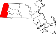
Towns Adams | Alford | Becket | Cheshire | Clarksburg | Dalton | Egremont | Florida | Great Barrington | Hancock | Hinsdale | Lanesborough | Lee | Lenox | Monterey | Mount Washington | New Ashford | New Marlborough | Otis | Peru | Richmond | Sandisfield | Savoy | Sheffield | Stockbridge | Tyringham | Washington | West Stockbridge | Williamstown | Windsor
CDPs Adams | Great Barrington | Housatonic | Lee | Lenox | Williamstown
Other
villagesCategories:- Towns in Berkshire County, Massachusetts
- New Marlborough, Massachusetts


Wikimedia Foundation. 2010.