- Massachusetts Route 57
-
Route 57
Route information Length: 45.42 mi[citation needed] (73.10 km) Existed: by 1930[1] – present Major junctions West end: 
 Routes 23/183 in Monterey
 Route 8 in Sandisfield

 US 202/Route 10 in Southwick
East end:  US 5 in Agawam
Highway system Massachusetts State Highway Routes
←  Route 56
Route 58  →
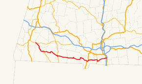
→Route 57 is an east–west Massachusetts state route that runs from Monterey to Agawam. The eastern 5.0 miles[2] (8.1 km) in Agawam is a freeway that runs from Route 187 to the route's eastern terminus at U.S. Route 5.[3]
Contents
Route description
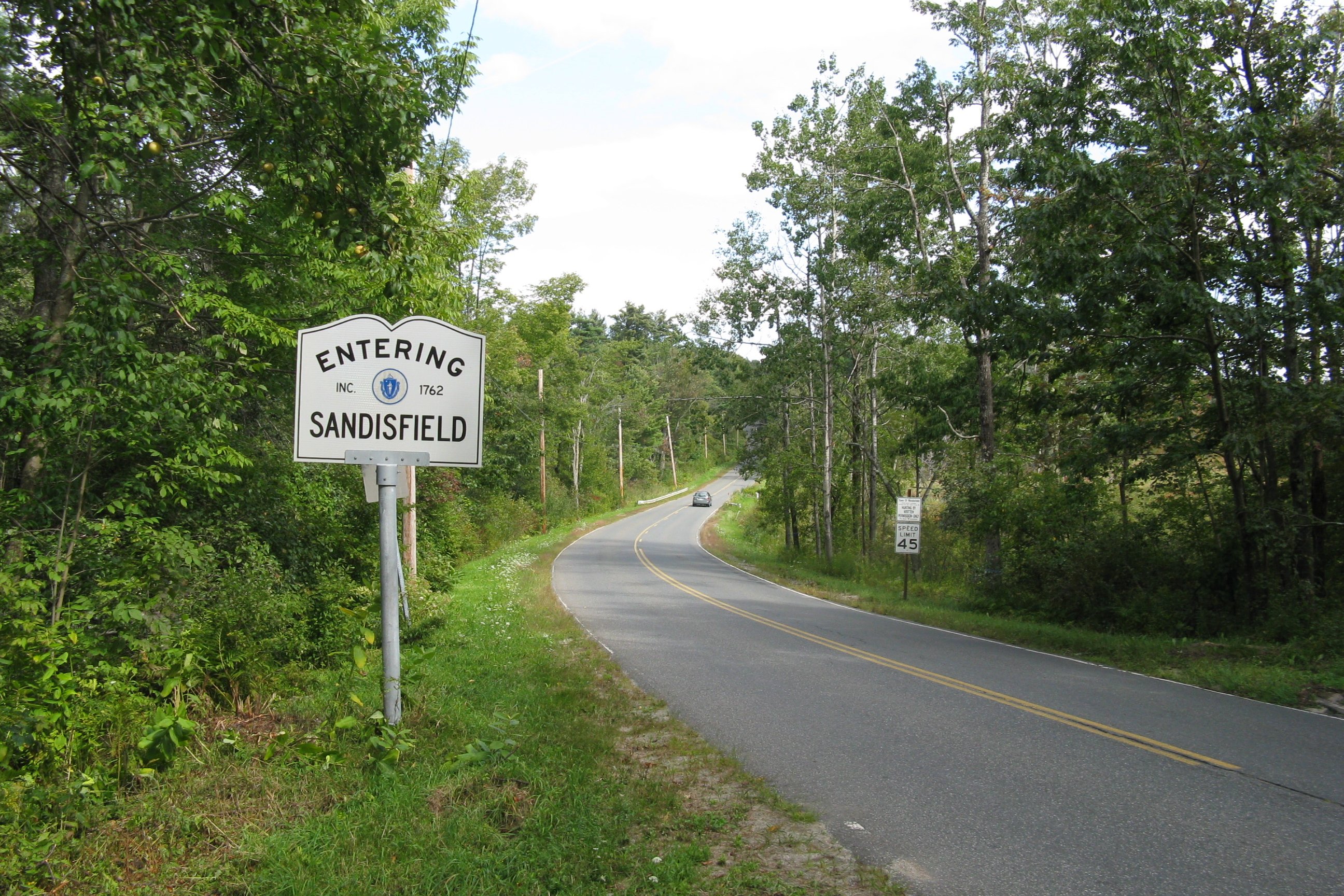
 Eastbound entering Sandisfield
The route begins in Monterey, at its intersection with routes 23 and 183.[4] The section from there to New Marlborough (which is a concurrency with Route 183) primarily takes a southeastern path that passes several stretches of farmland.[3] In New Marlborough, Route 57 splits from Route 183 and follows a mainly easterly route with frequent curves, passing more farmland.[3] During this stretch, there is a brief concurrency with Route 8 in Sandisfield to cross the Farmington River's west branch.[5]
In Southwick, Route 57 starts to enter a more suburban area.[3] There are more concurrencies during this stretch, first with U.S. Route 202 and Massachusetts Route 10 in Southwick, and then with Route 187 in Agawam.[3]
When Route 57 splits off from Route 187, it becomes a freeway,[3] the Henry E. Bodurtha Highway.[2] It has five exits before terminating in a rotary that is served by an interchange from U.S. Route 5.[4]
History
 Crossing the Clam River in Sandisfield
Route 57 (which was formed by 1930[1]) initially went from Southwick to West Springfield.[1] It was extended to Sandisfield in the mid 1930s and Monterey in the late 1940s.[1]
Construction on the freeway portion began in 1958,[2] with the first portion (to today's Route 159,[1] then called Route 5A[6]) opening in 1961.[2] It was extended to past Route 75 in 1966, with Route 57 being moved to the freeway around this time (the old alignment became Route 147).[1] In 1991, work to extend the freeway to Route 187 began, with the new section opening in 1995.[2] A further extension to Southwick has been proposed, but it was put on hold by then-Governor Mitt Romney in June 2005; nevertheless, Agawam's city council continues to urge the state to construct the extension.[2]
Junction list
County Location Mile Roads intersected Notes Berkshire Monterey 0.0 Route 23
Route 183 NorthNorthern end of Route 57 at Route 23.
Beginning of concurrency with Route 183.New Marlborough 6.0 Route 183 SouthEnd of concurrency with Route 183. Sandisfield 15.2 Route 8Concurrency for 175 yards (160 m) Hampden Granville 27.8  Route 189
Northern end of Route 189. Southwick 34.3 U.S. Route 202 / Route 10Beginning of concurrency with US 202/Rte. 10. 34.9 U.S. Route 202 / Route 10End of concurrency with US 202/Rte. 10. Agawam 39.6  Route 187 North
Beginning of concurrency with Route 187. 40.4 Route 187 SouthEnd of concurrency with Route 187.
Beginning of Bodurtha Highway.41.8 Garden St. Westbound exit / Eastbound Exit only 42.5 Tennis Rd Eastbound entrance from Mill Rd. 42.7 Mill Rd Westbound exit only 43.1  Route 75
Full exit 43.9  Route 159
Westbound exit / Eastbound Exit only 45.4 U.S. Route 5Rotary junction at eastern end of Route 57.
Southbound US 5 to I-91
I-91References
- ^ a b c d e f Kelley, Neil. "MA 57". Massachusetts Route Log. neilbert.com. http://www.neilbert.com/findroute.php?route=57. Retrieved 2007-07-06.
- ^ a b c d e f Anderson, Steve. "Henry E Bodurtha Highway (MA 57)". bostonroads.com. Eastern Roads. http://www.bostonroads.com/roads/MA-57/. Retrieved 2007-07-06.
- ^ a b c d e f Google, Inc. Google Maps – Massachusetts Route 57 (Map). Cartography by Google, Inc. http://maps.google.com/maps?f=q&hl=en&geocode=&q=&sll=42.070099,-72.843175&sspn=0.015005,0.043259&ie=UTF8&ll=42.102298,-72.927933&spn=0.223142,0.692139&t=h&z=11&om=1. Retrieved 2007-07-06.
- ^ a b Moraseski, Dan. "MA routes 50-59". MA route log. web.mit.edu. Archived from the original on 2004-12-06. http://web.archive.org/web/20041206181602/web.mit.edu/spui/www/boston/sr/5x.html#57. Retrieved 2007-07-06.
- ^ DeLorme (1998). Massachusetts Atlas and Gazeteer (Map). 1" = 1.3 miles, (1st ed.). p. 45, section J21. ISBN 0-89933-220-X.
- ^ Kelley, Neil. "US 5A". Massachusetts Route Log. neilbert.com. http://www.neilbert.com/findroute.php?route=5A. Retrieved 2007-07-06.
External links
Categories:- Numbered routes in Massachusetts


Wikimedia Foundation. 2010.