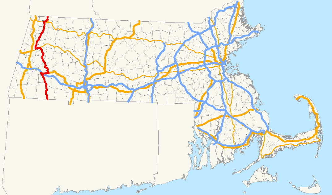
- New England Interstate Route 8
-
New England Route 8
Route information Length: 147.08 mi (236.70 km)
Connecticut: 67.34[1] mi (108.37 km)
Massachusetts: 66.58[2] mi (107.16 km)
Vermont: 13.16 miles (21.18 km)[3]Existed: 1922 – 1930s Major junctions South end: Bridgeport, CT  U.S. Route 44 in Winchester, CT
 U.S. Route 20 in Becket, MA
 Route 2 in North Adams, MA
North end:  Route 9 in Searsburg, VT
Highway system Route 8 is a multi-state north–south state highway in the New England region of the United States, running from Bridgeport, Connecticut, through Massachusetts to Searsburg, Vermont. Its number dates from 1922, when it was a New England Interstate Route, also known as the Stratford-Waterbury-North Adams Route (for the cities the original route connected). Most of the old route in Connecticut has been upgraded to a freeway and is a major transportation link between the cities of Bridgeport and Waterbury.
The highway has kept its number for most of its routing, and in these sections now exists as Connecticut Route 8, Massachusetts Route 8, and Vermont Route 8. North of Searsburg, VT, the old routing exists as part of Vermont Route 100 and all of Vermont Route 155 (which both used to be part of VT-8).
Contents
Route description
Connecticut
Main article: Connecticut Route 8Connecticut Route 8 begins as a freeway in the city of Bridgeport co-signed with Route 25. It has junctions with the Merritt Parkway in Trumbull and Interstate 84 in Waterbury. The freeway continues through the city of Torrington up to US 44 in Winsted. North of Winsted, Route 8 becomes a minor rural road through Colebrook into Massachusetts. The freeway portion of Route 8 is 58 miles (93 km) long.
Massachusetts
 Route 8 in Massachusetts
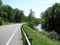
Southbound
in Clarksburg, MassachusettsMassachusetts Route 8 crosses the border from Connecticut into Sandisfield, Massachusetts. It runs for 66.6 miles (107.2 km) northward, through the western Massachusetts towns of Otis, Becket, Washington, Hinsdale, Dalton, Pittsfield, Lanesborough, Cheshire, Adams, North Adams and Clarksburg. The entire route in Massachusetts is in Berkshire County.
An old alignment in North Adams is now the upper segment of Route 8A.
County Location Mile Roads intersected Notes Berkshire Sandisfield 0.00  CT Route 8
Southern terminus of Route 8, continues southbound into Colebrook, CT. 4.1  Route 57
120-yard overlap with Route 57 Otis 12.1 
 Route 23 East
Southern terminus of Route 8/23 concurrency. 12.3 
Route 23 WestNorthern terminus of Route 8/23 concurrency. Becket 17.7
U.S. Route 20 WestWestern terminus of US-20/Route 8 concurrency.
To Mass Pike (I-90).
22.9
U.S. Route 20 EastWestern terminus of US-20/Route 8 concurrency. Hinsdale 38.1  Route 143
Western terminus of Route 143. Dalton 41.8  Route 8A(L)
 Route 9 East
Southern terminus of Route 8A (L Segment).
Eastern terminus of Route 8/9 concurrency.Pittsfield 44.1
Route 9 WestWestern terminus of Route 8/9 concurrency.
To U.S. Route 7/U.S. Route 20.
Adams 56.3  Route 116
Northern terminus of Route 116. North Adams 59.5 Route 8A(U)Southern terminus of Route 8A (U Segment). 62.3
Route 2 WestWestern terminus of Route 2/8 concurrency. 62.4 Route 8A(U)Northern terminus of Route 8A (U Segment). 63.1
Route 2 EastEastern terminus of Route 2/8 concurrency. To Mohawk Trail. Clarksburg 66.58  VT Route 8
 VT Route 100
Northern terminus of Route 8, continues northbound into Stamford, VT.
Southern terminus of VT Route 100.Vermont
Vermont Route 8 begins in Stamford, Vermont, where a concurrency with Vermont Route 100 begins at the Massachusetts state line. VT Routes 8 and 100 split in Readsboro, with VT Route 8 continuing north to end at Vermont Route 9 in Searsburg. (VT Route 100, the original alignment of Route 8, takes a more circuitous route, heading southeast and east from the split before turning north to intersect VT Route 9 in Wilmington.)
The entire route is in Bennington County.Location Mile[3] Destinations Notes Stamford 0.000  Route 8
VT 100Route 8 is continuation into Massachusetts; southern terminus of VT 100; southern terminus of VT 8 / VT 100 overlap Readsboro 7.945 VT 100 northNorthern terminus of overlap; old Route 8 continues on VT 100 Searsburg 13.155 VT 91.000 mi = 1.609 km; 1.000 km = 0.621 mi
Concurrency terminus • Closed • UnopenedHistory
The original Route 8 began in Stratford, Connecticut, running along the west bank of the lower Housatonic River until Shelton. The southern end of Route 8 was relocated in 1951 to its current Bridgeport terminus as part of the freeway upgrading. The old surface road is now parts of Route 113 and Route 110. North of Shelton, the old surface road (where it still exists) generally parallels the freeway, much of it still state-maintained.
In the late 1940s, a four-lane bypass was built south of North Adams, Massachusetts and designated as Route 8A. Around 1975, Routes 8 and 8A were swapped, with the original route now designated as Route 8A and the bypass route as Route 8.
Though the original Route 8 in Vermont did not run north of Wilmington, Route 8 was extended north to Londonderry by 1927 along present Vermont Route 100, and by 1938 to Weston and along Vermont Route 155 to Wallingford. This was still Route 8 in 1961, with Route 100 ending at Route 8 north of Weston. Route 100 was later extended south along Route 8 to the Massachusetts state line. The short piece of Route 8 between Weston and Wallingford became Vermont Route 155, and the Route 8 designation was assigned to its current alignment. (The piece of current Route 8 between Route 100 at Heartwellville and Route 9 at Searsburg had been unnumbered.)[4][5][6][7]
See also
- Route 8A (Massachusetts) - The lower segment of Route 8A is an alternate route beginning at Dalton, Massachusetts towards Whitingham, Vermont
- Vermont Route 8A
References
- ^ Connecticut State Numbered Routes and Roads as of December 31, 2004 (PDF)
- ^ Executive Office of Transportation, Office of Transportation Planning - 2005 Road Inventory
- ^ a b "2006 (Route Log) AADTs – State Highways" (PDF). Vermont Agency of Transportation. June 2007. http://www.aot.state.vt.us/Planning/Documents/TrafResearch/Publications/2006%20Route%20Log%20AADTs%20State%20Highways-Final.pdf. Retrieved May 17, 2009.
- ^ 1954 USGS Wilmington quadrangle
- ^ 1957 USGS Londonderry quadrangle
- ^ 1955 USGS Wallingford quadrangle
- ^ 1961 Gousha Massachusetts-Connecticut-Rhode Island map
External links
Browse numbered routes ← US 7CT Route 9  →
→←  Route 7A
MA Route 8A →←  VT 7A
VT 7AVT VT 8A  →
→←  Route 7
N.E. Route 9  →Categories:
- New England Interstate Routes
- Numbered routes in Massachusetts
- State highways in Vermont


Wikimedia Foundation. 2010.