- Massachusetts Route 23
-
Route 23
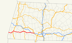
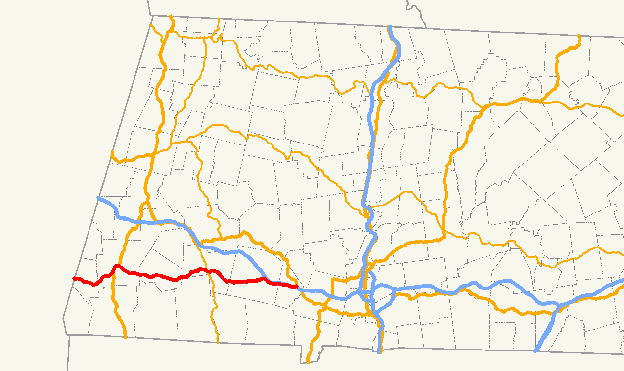
Route information Length: 38.4283 mi[1] (61.8444 km) Major junctions West end:  NY 23 in Hillsdale, New York
 Route 41 in Egremont
 Route 71 in Great Barrington
 U.S. Route 7 in Great Barrington
 Route 183 in Great Barrington
 Route 57 in Monterey
 Route 8 in Otis
East end:  U.S. Route 20 in Russell
Highway system Massachusetts State Highway Routes
←  Route 22
Route 24  →
→Route 23 is a west–east route in the western Massachusetts counties of Berkshire and Hampden. The entire route is 38.43 miles (61.85 km). The vast majority of the road (approximately 31.2 miles) follows the Knox Trail, the historic route of General Henry Knox took to bring cannon from Fort Ticonderoga on Lake Champlain in New York to aid in ending the Siege of Boston in the winter of 1775-76.[2]
Contents
Route description
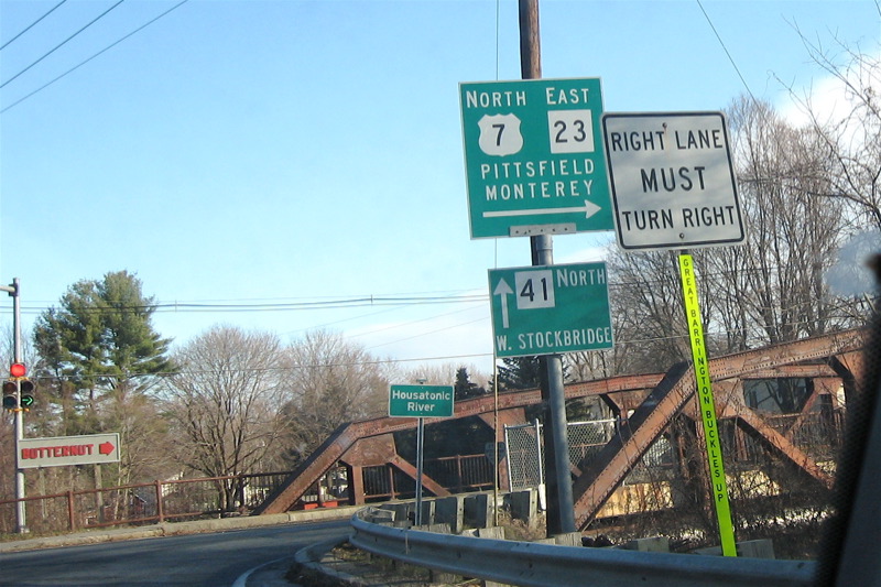
Route 23 begins at the New York state border at Egremont, Massachusetts, as a continuation of New York State Route 23 from Hillsdale. The road passes Catamount Ski Area and the village of South Egremont before merging with Route 41, just west of Great Barrington. It passes the Egremont Country Club and the Great Barrington Airport before passing the eastern terminus of Route 71. At this point the road becomes the Knox Trail. From there the road heads towards the town center, merging with U.S. Route 7, following that road for one mile (1.6 km) before leaving Route 41, with Routes 7 and 23 turning eastward, crossing the Housatonic River. After another half-mile, U.S. Route 7 heads northward, leaving Route 23 to head eastward, this time combined with Route 183. (There is a Knox Trail marker at this point.) The two pass Butternut Basin Ski Area before crossing the Appalachian Trail and entering Monterey. Just east of the line, Route 183 heads south at the western terminus of Route 57, leaving Route 23 alone. From there, the road passes through Monterey, running parallel to and eventually crossing the Konkapot River near the center of town. The road passes Lake Garfield and Chestnut Hill before crossing into Otis. The road crosses through a section of Otis State Forest and passes the Otis Ridge Ski Area before merging for a short time with Route 8 through the town's center. From there, the road heads eastward again, passing between Big Pond, Benton Pond and the Otis Reservoir (this area is also the site of another Knox Trail marker) towards the Hampden County line and the town of Blandford. Once in Blandford, the road heads due east, passing Miller Swamp, Jackson Hill and Blair Pond before entering the town's center, at which point the road begins to runs parallel to the south of Interstate 90 (the Massachusetts Turnpike). Route 23 enters Russell, heading south of Punchbowl Mountain. The Knox Trail leaves the route at Knox Mountain Road, and the route crosses an overpass over the interstate before finally ending 1.1 miles (1.8 km) east at the junction of U.S. Route 20 near the town's center.
Junction list
County Location Mile Routes Intersected Notes Berkshire Egremont 0.0 NY 23Western end of Massachusetts Route 23.
Road continues into New York as NY Route 23.3.2 Route 41Beginning of concurrency with Route 41. Great Barrington 5.6 Route 71 westEastern end of Route 71.
Henry Knox Trail joins Route 23.7.1 US 7Begin triple concurrency. 8.1 Route 41Route 41 leaves triple concurrency.
Concurrency between Route 23 & US 7 continues eastward.8.6 US 7 north / Route 183 northEnd of concurrency with US 7.
Beginning of concurrency with Route 183.Monterey 12.1 Route 57 east / Route 183 southEnd of concurrency with Route 183.
Beginning of concurrency between Routes 57 & 183.Otis 23.3 Route 8 northBeginning of concurrency with Routes 8 & 23. 23.5 Route 8 southEnd of concurrency with Routes 8 & 23 Hampden Russell 36.7 General Knox Road Henry Knox Trail leaves Route 23.  I-90
I-90No access between Route 23 & the Mass Pike. 38.43 US 20Eastern end of Route 23. 1.000 mi = 1.609 km; 1.000 km = 0.621 mi
Concurrency terminus • Closed/Former • Incomplete access • UnopenedGallery
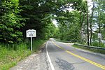
-

Route 23 and US 7 leave Route 41 in Great Barrington.
-
Route 23 enters Otis.
-

A Knox Trail stone along Route 23 in East Otis.
-
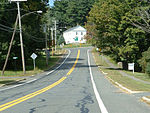
Looking westbound along Route 23 in Blandford.
References
Categories:- Numbered routes in Massachusetts
-


Wikimedia Foundation. 2010.