- Massachusetts Route 25
-
Route 25
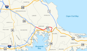
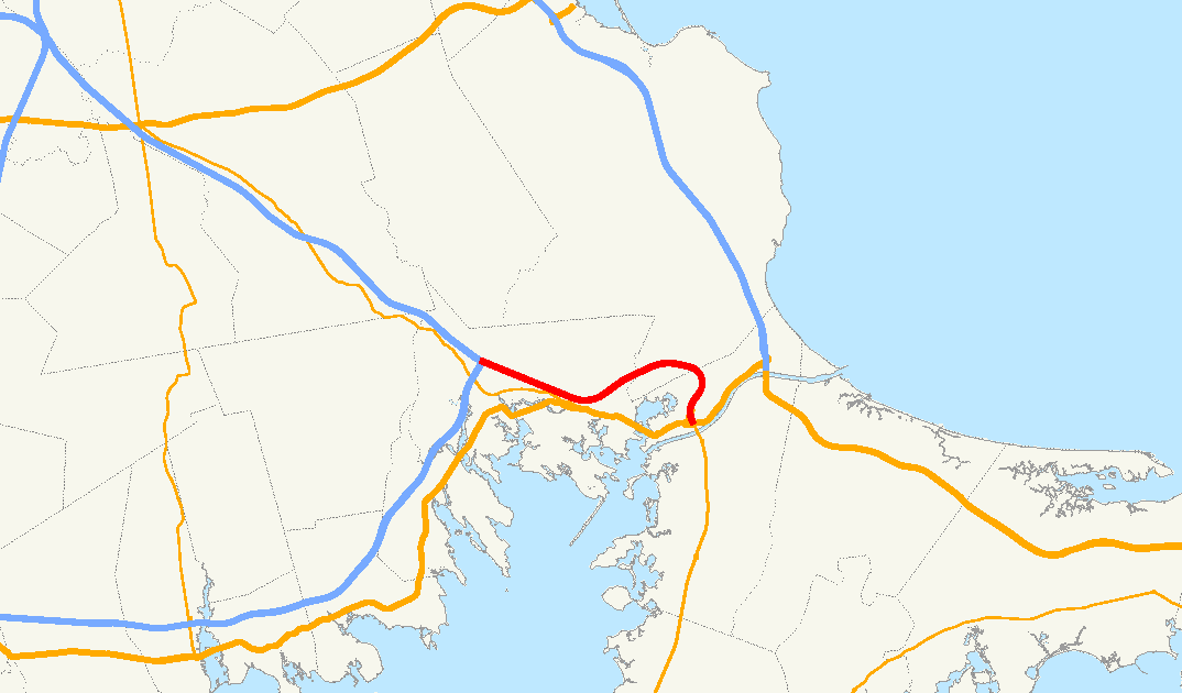
Highways in the Wareham area with Route 25 in redRoute information Maintained by MassHighway Length: 10.0 mi[1] (16.1 km) Existed: 1957 – present Major junctions West end: 
 I-195 / I-495 in Wareham
 US 6 / Route 28 in Wareham and Bourne
East end: Route 28 in BourneLocation Counties: Plymouth, Barnstable Highway system Massachusetts State Highway Routes
←  Route 24
Route 27  →
→Route 25 is a numbered state highway located in Plymouth County and Barnstable County, Massachusetts, United States. The route is a nominally east–west freeway for its entire length, and less commonly known as the Blue Star Memorial Highway. An eastward continuation of Interstate 495, Route 25 provides freeway access to Cape Cod. The route's western terminus is at a trumpet interchange with I-495 and I-195 in Wareham. The route has three numbered interchanges along its 10.0-mile (16.1 km) length before terminating at the northern end of the Bourne Bridge in Bourne; the mainline of Route 25 continues across the bridge and over the Cape Cod Canal as Massachusetts Route 28 south.
Prior to 1982, the Route 25 designation was also given to a segment of what is now I-495 from Route 24 in Raynham to the interchange with I-195 in Wareham. The freeway was redesignated as I-495 in various stages during the 1970s and 1980s, eventually reducing Route 25 to a 2.5-mile (4 km) segment that continued eastward from I-495 to the modern location of Exit 2 in Downtown Wareham. Construction of an eastern continuation of Route 25 to the Bourne Bridge was delayed for nearly three decades due to property disputes and environmental concerns, but the final 7.5-mile (12 km) segment opened in 1987. The freeway was originally planned to continue over the Bourne Bridge into Cape Cod as part of the Southside Connector, but this plan was abandoned by the Massachusetts Highway Department (MassHighway) in the late 1970s.
Contents
Route description
 Western terminus of Route 25 in Wareham. I-495 begins underneath the bridge in the background.
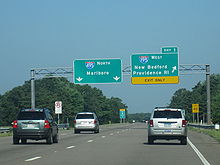
Route 25 begins at a trumpet interchange with I-495 and I-195 in Wareham, Massachusetts; the two left lanes of Route 25 west mainline onto Route 495 north, with the right-hand lane serving I-195 via Exit 1. From I-195, Route 25 east is accessible via Exit 22A; I-195 terminates at the interchange. Interstate 495 also terminates at its junction with Route 25; the two southbound lanes of I-495 default onto Route 25 east.[2] After the interchange with I-195 and I-495, Route 25 begins to head in a southeastern direction into the town of Wareham as a six-lane freeway. The route passes under Tihonet Road and through Maple Swamp, located at the northern end of Parker Mills Pond.[3]
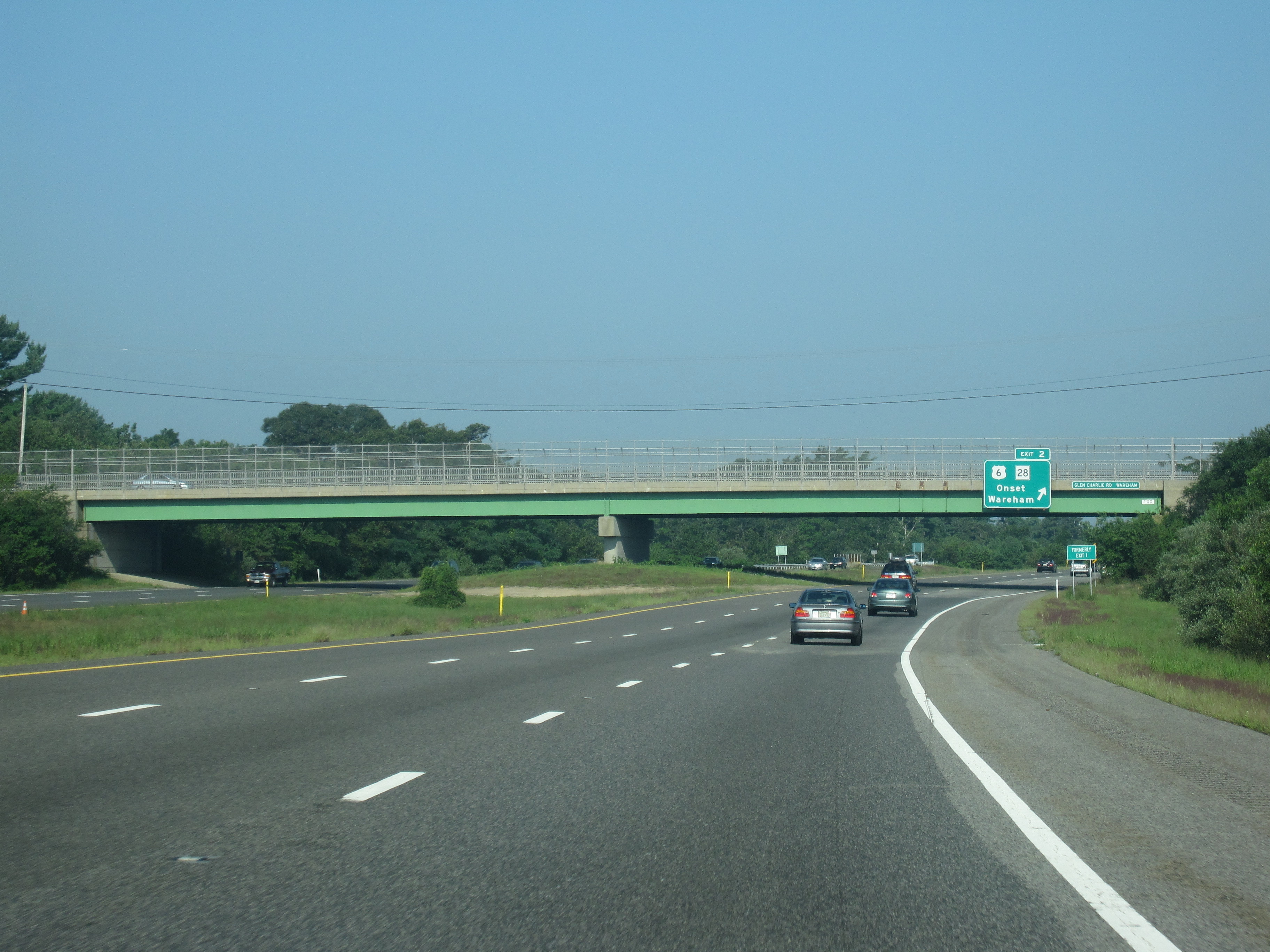
After the Tihonet Road overpass, the route continues on a southeastern projection, passing close to several farms and cranberry bogs in Wareham. After passing under Charge Pond Road, Route 25 enters a densely populated region of Wareham with an alignment parallel to Route 28 (Cranberry Highway). Eastbound Route 25 has its first interchange with Maple Springs Road, a local road that connects to US 6 and Route 28 and is used to access Wareham and the village of Onset.[3] Shortly after the interchange, numbered as Exit 2 (formerly Exit 1), Route 25 proceeds across Agawam Mill Pond via a short causeway.[2] Exit 2 off Route 25 west is located to the east of Agawam Mill Pond and connects to US 6 and Route 28 via Glen Charlie Road, an unnumbered route that also serves the village of White Island Shores.[2]
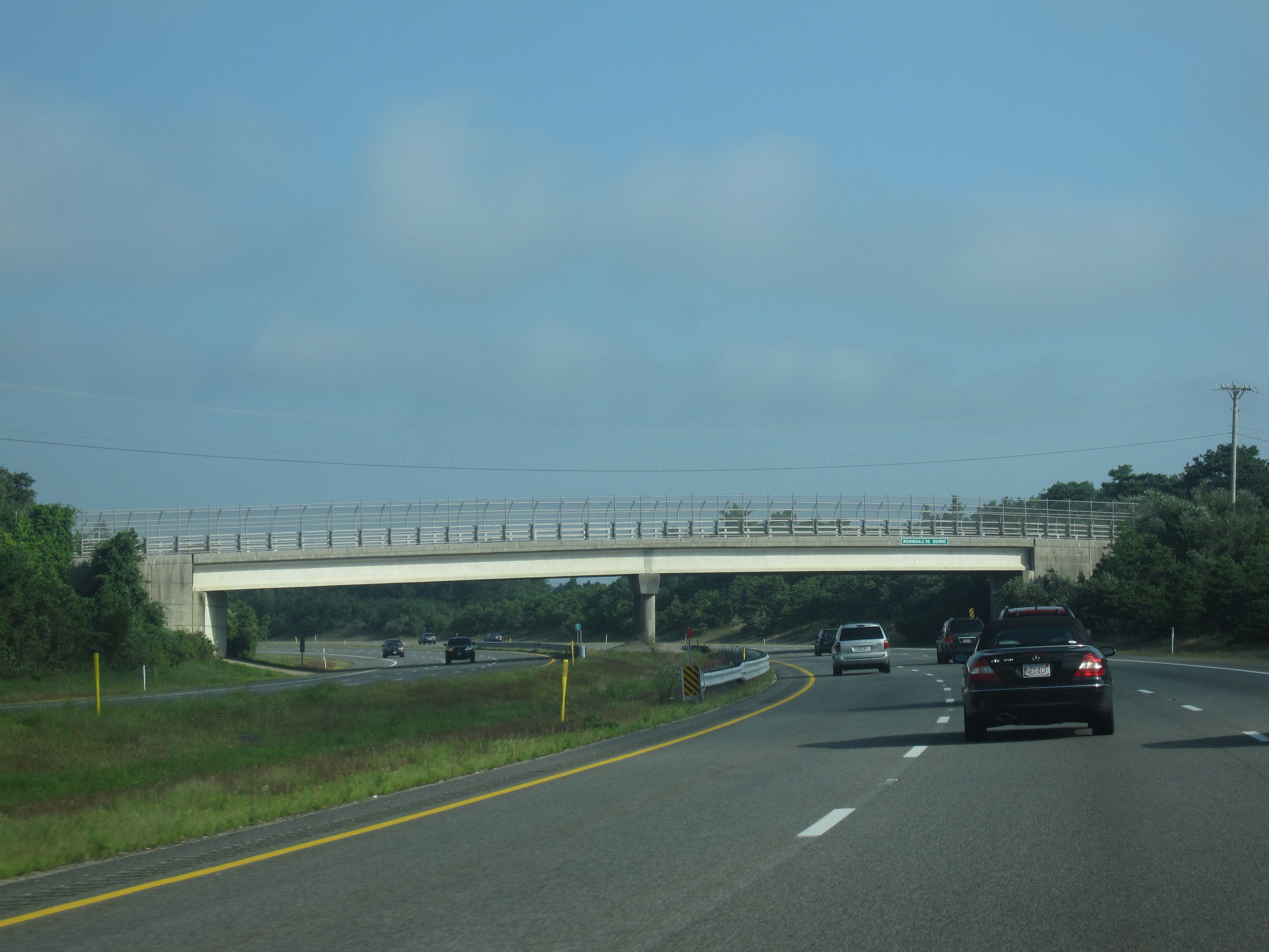
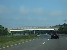 Westbound Route 25 at the Bournedale Road overpass
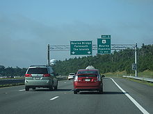
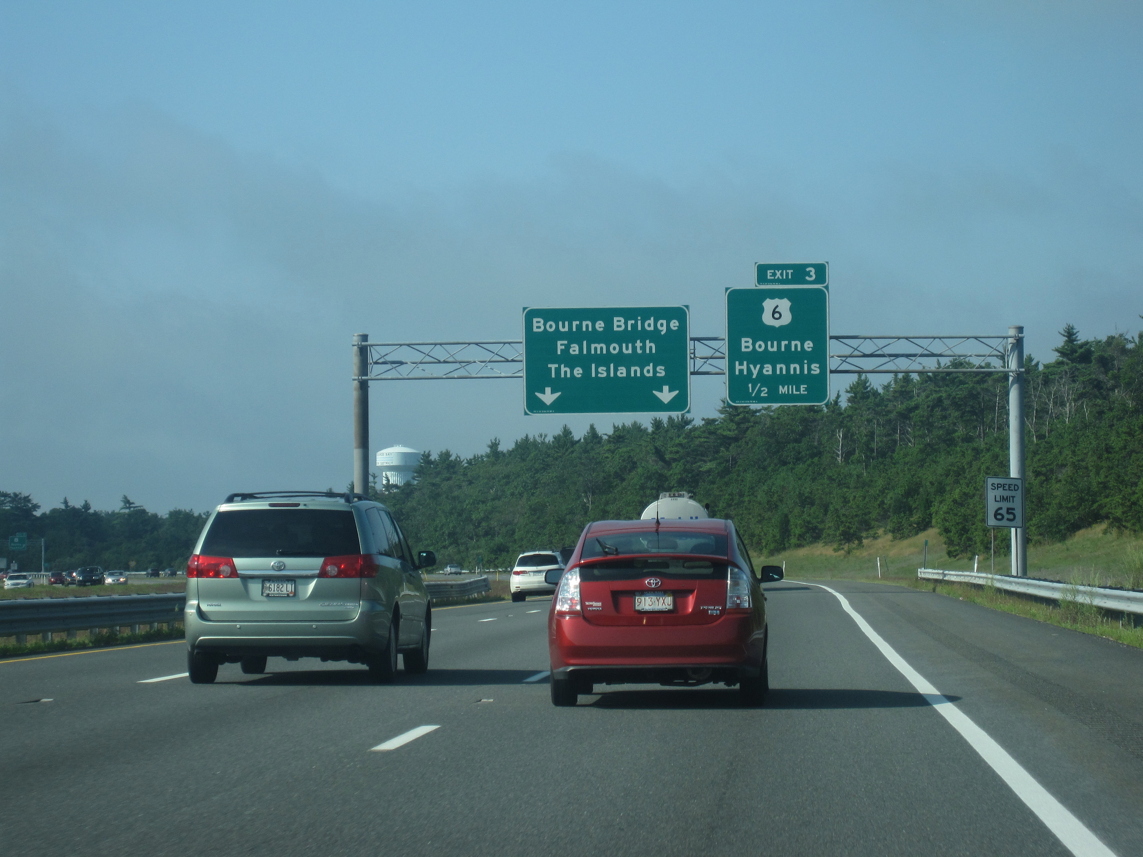
After Exit 2, Route 25 bends to the northeast, bypassing Buttermilk Bay and the densely populated village of Buzzards Bay to the south. The route passes Union Pond and Dicks Pond to the south and Spectacle Pond and Sandy Pond to the north before entering the town of Plymouth. In Plymouth, Route 25 passes to the north of several cranberry bogs and small ponds.[3] While the freeway has no interchanges in Plymouth, a rest area is located off eastbound Route 25 in the town; the area is inaccessible from westbound Route 25. Due to state funding cutbacks, services at the rest area are limited to summer weekends (Friday to Sunday) as of 2010. After the rest area, Route 25 passes over Bourne Road and turns sharply to head in a southwestern direction. The route passes under Bournedale Road after entering the town of Bourne. In Bourne, Route 25 has its final interchange; Exit 3 (formerly Exit 2) serves the villages of Buzzards Bay and Sagamore, connecting to US 6 (Scenic Highway) and Route 28 north.[2] From Exit 3, US 6 is used to access the Sagamore Bridge in northern Bourne and the towns of Hyannis and Provincetown on Cape Cod.[3]
After Exit 3, the Route 25 designation continues for 0.6 miles (1 km). The six-lane freeway narrows into a four-lane undivided highway shortly before the approach ramps to the Bourne Bridge. Route 25 is concurrent with Route 28 from Exit 3 until the US 6 underpass, at which point the Route 25 designation officially ends; the two eastbound lanes of Route 25 continue as Route 28 south over the Bourne Bridge and the Cape Cod Canal and onto Cape Cod.[3] Route 28 continues southward to the town of Falmouth and then eastward to Hyannis and Orleans.[2] An estimated daily average of over 35,000 motorists utilized the Route 25 expressway in 2008.[1]
History
Early alignment
 Route 25 west at Exit 2 and the Glen Charlie Road overpass in Wareham
The origins of Route 25 date back to 1947, when the Massachusetts Department of Public Works (MassDPW) announced plans for an expressway that would link I-95 in Foxborough with Cape Cod.[4] The planned route was given the Route 25 designation northwest of a planned interchange with the Fall River Expressway (Route 24) in Raynham and the Route 28 designation to the southeast of Route 24.[5] After ten years of planning studies, the route received preliminary approval from the MassDPW in 1957, and construction began in 1958; the entire route was designated as Route 25 in 1962, with Route 28 instead being aligned on local roads.[6] The portion of the freeway between Route 24 in Raynham and I-195 in Wareham was completed in 1967. In 1969, MassDPW extended the freeway eastward to US 6 in Wareham.[6]
In the 1970s, the MassDPW changed the planned designation of the unconstructed Route 25 expressway northwest of Route 24 to I-495. When this portion of I-495 was completed in 1982, the state also designated the existing alignment of Route 25 between Route 24 and the I-195 interchange in Wareham as I-495.[7] After the reassignment, Route 25 was shortened to a 2.5-mile (4 km) stretch from I-195 east to Downtown Wareham.[7]
From 1969 until 1987, the eastern terminus of Route 25 was at a junction with Maple Springs Road, US 6 and Route 28 in Wareham near the modern location of Exit 2. The MassDPW and the Massachusetts Highway Department (MassHighway) had plans to extend the freeway eastward to Cape Cod as early as 1953, when the route was included in the proposed Cape Cod Expressway that would connect New York City with Cape Cod.[6] Route 25 was originally planned to connect to the Sagamore Bridge, which carried US 6 over the Cape Cod Canal and was used to access the towns of Hyannis and Provincetown. In 1962, however, the MassDPW conducted traffic studies on the two bridges crossing the canal and found that the Sagamore Bridge was above vehicular capacity, whereas the more southern Bourne Bridge had excess capacity.[6] The Route 25 freeway was then redesigned to cross over the Bourne Bridge and connect with the Mid-Cape Highway (US 6) on the southern side of the canal via the proposed "Southside Connector".[6] The connector would have been constructed through the Otis Air National Guard Base in Bourne, but was canceled by the MassDPW and MassHighway in 1977 when environmental tests indicated the freeway would disturb underground aquifers serving as water sources for the region. MassDPW instead changed the proposed eastern terminus of the Route 25 expressway to the approach ramps of the Bourne Bridge.[7][8]
Completion of the freeway
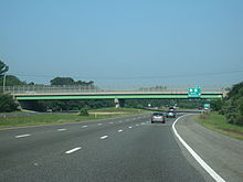
 Eastbound Route 25 near Exit 3 and the freeway's eastern terminus. Route 28 is unsigned at this interchange.
Construction of Route 25 east of Wareham, however, was delayed for nearly three decades to property disputes, environmental concerns and resistance from business owners in Buzzards Bay village, who claimed the freeway would divert all the traffic, and their business, elsewhere, leaving a ghost town in its wake. The proposed alignment ran through land where much of the state's cranberry harvest was located, and this led to lengthy lawsuits and delays.[7] In particular, farmers were concerned that salt runoff from winter ice removal would harm cranberry harvests.[7] Throughout the 1970s and 1980s, the MassDPW developed several proposals to control storm water runoff and avoid potential damage to the cranberry crops.[9] Engineers for the department developed four different drainage systems to be used along the length of the freeway that would divert runoff away from the Wareham River basin.[9] In addition, the freeway was planned with a thicker asphalt pavement that was largely impervious to water.[7]
The freeway was also delayed due to a larger property dispute with Hope Ingersoll, the owner of the 900-acre (364 ha) Grazing Fields Farm on Bournedale Road in Bourne, well-known in the region as an artists' colony and a producer of organic food.[10] MassDPW proposed constructing Route 25 through the center of the farm, but Ingersoll hired engineers to develop an alternate routing. In 1978, MassDPW rejected Ingersoll's design, instead approving the alignment that ran through farmland seized by eminent domain. In 1980, a state judge ruled that MassDPW had to conduct environmental studies on both the original routing and Ingersoll's proposal. MassDPW eventually opted to construct Ingersoll's design, giving Route 25 a longer alignment that arced to the north and east of Grazing Fields Farm before turning westward toward the Buzzards Bay business district and the Bourne Bridge.[11] The route finally began construction in 1982, and in 1989 the MassDPW was forced to pay Ingersoll $2.6 million (1982 USD) for 90 acres (36 ha) of farmland seized for the expressway's construction.[12]
In 1987, the final 7.5-mile (12 km) segment of Route 25 from Maple Springs Road in Wareham to the Bourne Bridge was completed. A rest area and information center in Plymouth also opened with the freeway. The new expressway relieved congestion along US 6 and Route 28 in the Buzzards Bay business district, greatly reducing the number of accidents along the approach to the Bourne Bridge.[13] In 2007, MassHighway completed a renumbering of the three interchanges along the length of Route 25 as part of a signing upgrade project;[14] the previously unnumbered I-195 interchange was given the new Exit 1 designation.[2][3]
Exit list
County Town Mile[1] Old # New # Destinations Notes Plymouth Wareham 0.0 Route 25 begins at I-195 / I-495 0.0 I-495 north – MarlboroRoute 25 west transitions directly onto I-495 north 0.1 1 I-195 west – New Bedford, ProvidenceWestbound exit and eastbound entrance; exit number is shared with I-495 south 2.6 1 2 US 6 / Route 28 (via Maple Springs Road) – Onset, WarehamEastbound exit and westbound entrance 3.4 1 2 US 6 / Route 28 (via Glen Charlie Road) – Onset, WarehamWestbound exit and eastbound entrance Plymouth 6.6 Eastbound Rest Area Barnstable Bourne 9.4 2 3 US 6 / Route 28 north – Bourne, Sagamore, Hyannis, Provincetown, Buzzards BayWest end of Route 28 overlap; Route 28 is unsigned eastbound 10.0 Route 28 south — Bourne Bridge, Falmouth, The IslandsEast end of Route 28 overlap; Route 25 designation ends at US 6 underpass; mainline continues as Route 28 south 10.0 Route 25 ends; Route 28 continues as a surface road See also
- Massachusetts Route 3
- Southside Connector
References
- ^ a b c "Road Inventory File". Office of Transportation Planning. Executive Office of Transportation. http://www.eot.state.ma.us/default.asp?pgid=content/plan02&sid=about. Retrieved 2009-08-18.
- ^ a b c d e f Metro Boston, Eastern Massachusetts Street Atlas (7th ed.). American Map. 2006.
- ^ a b c d e f Yahoo! Inc. Yahoo! Maps – Overview map of Massachusetts Route 25 (Map). Cartography by NAVTEQ. http://maps.yahoo.com/#mvt=h&lat=41.767885&lon=-70.659295&zoom=13&q1=41.783813,-70.732494&q2=41.751965,-70.592289. Retrieved 2009-08-19.
- ^ "New England Road Project Backed". The New York Times. 1953-10-29.
- ^ New England South Shore Highway. Interstate Study Committee. 1953.
- ^ a b c d e The Massachusetts Highway Story (1949-1969). Massachusetts Department of Public Works. 1969.
- ^ a b c d e f Proposed Route 25 and Route 28: Final Environmental Impact and Section 4(f) Statement. Federal Highway Administration and Massachusetts Department of Public Works. 1977.
- ^ Freed, John C. (1985-07-21). "Wareham Sets a New Goal". The New York Times.
- ^ a b Church, Peter E.; Friesz, Paul I. (1993). "Effectiveness of Highway Drainage Systems in Preventing Road Salt Contamination of Groundwater: Preliminary Findings". Transportation Research Board. The National Academies Press. http://books.nap.edu/openbook.php?isbn=NI000009&page=3. Retrieved 2009-08-19.
- ^ Lindsay, Leon (1993-06-27). "Maturing Parkland, Booming Development". The Christian Science Monitor.
- ^ "Farmer Wins 25-Year Fight Over Cape Road". The New York Times. 1982-10-10.
- ^ Richard, Ray; Longcope, Kay (1989-10-11). "Bourne Woman Wins $2.6 Million in Land Battle". The Boston Globe.
- ^ McLaughlin, Jeff (1993-06-27). "Cape Cod: Driving for a Safer Highway". The Boston Globe.
- ^ "Project Information". Massachusetts Highway Department. http://www.mhd.state.ma.us//default.asp?pgid=content/projectsRoot&sid=wrapper&iid=http://www.mhd.state.ma.us//ProjectInfo/. Retrieved 2009-08-20.
External links
- Anderson, Steve. "MA 25 Expressway". Eastern Roads. http://www.bostonroads.com/roads/MA-25/. Retrieved 2009-08-18.
Road transportation infrastructure of Cape Cod U.S. Routes  State Routes
State Roads Bridges See also: Cape Cod Canal Tunnel · Southside ConnectorCategories:- Numbered routes in Massachusetts
- Freeways in the United States
- Transportation in Barnstable County, Massachusetts
- Transportation in Plymouth County, Massachusetts


Wikimedia Foundation. 2010.