- Falmouth, Massachusetts
Infobox Settlement
official_name = Falmouth, Massachusetts
nickname =
motto =
imagesize =
image_caption = Nobska Lighthouse, Falmouth
image_
mapsize = 250px
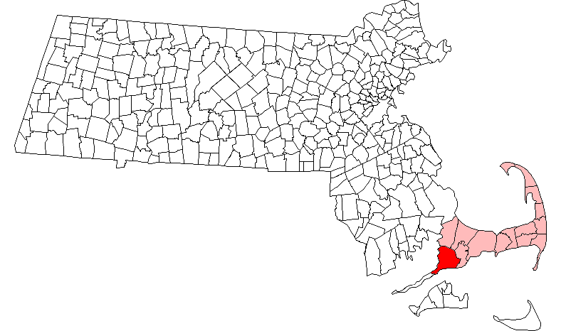
map_caption = Location in Barnstable County in Massachusetts
mapsize1 =
map_caption1 =
subdivision_type = Country
subdivision_name =United States
subdivision_type1 = State
subdivision_name1 =Massachusetts
subdivision_type2 = County
subdivision_name2 = Barnstable
established_title = Settled
established_date = 1660
established_title2 = Incorporated
established_date2 = 1686
established_title3 =
established_date3 =
government_type =Representative town meeting
leader_title = Town
Administrator
leader_name =Robert Whritenour
leader_title1 =
leader_name1 =
area_magnitude =
area_total_km2 = 141.0
area_total_sq_mi = 54.4
area_land_km2 = 114.6
area_land_sq_mi = 44.2
area_water_km2 = 26.4
area_water_sq_mi = 10.2
population_as_of = 2000
settlement_type = Town
population_total = 32,660
population_density_km2 = 285.0
population_density_sq_mi = 738.2
elevation_m = 3
elevation_ft = 10
timezone = Eastern
utc_offset = -5
timezone_DST = Eastern
utc_offset_DST = -4
latd = 41 |latm = 33 |lats = 05 |latNS = N
longd = 70 |longm = 36 |longs = 55 |longEW = W
website = [http://www.falmouthmass.us/ www.falmouthmass.us]
postal_code_type = ZIP code
postal_code = 02540
area_code = 508 / 774
blank_name = FIPS code
blank_info = 25-23105
blank1_name = GNIS feature ID
blank1_info = 0618253
footnotes =Falmouth is a town in Barnstable County,
Massachusetts ,United States ; Barnstable County is coextensive withCape Cod . The population was 32,660 at the 2000 census. Today Falmouth is well known as the terminal for theSteamship Authority ferries toMartha's Vineyard and as the home of several scientific organizations such as theWoods Hole Oceanographic Institution , [http://www.whoi.edu/ WHOI,] TheMarine Biological Laboratory (MBL) and theWoods Hole Research Center , [http://www.whrc.org/ WHRC.]For geographic and demographic information on specific parts of the town of Falmouth, please see the articles on East Falmouth, Falmouth Village, North Falmouth, Teaticket, West Falmouth, and Woods Hole. There are also the villages of Hatchville and Waquoit, which are not
census-designated place s and both fall within the village of East Falmouth based on postal service, as wellNew Silver Beach ,which falls within North Falmouth based as well on the aforementioned criteria.History
Falmouth was first settled by English colonists in 1660 and was officially incorporated in 1686, and named by
Bartholomew Gosnold forFalmouth, Cornwall ,England , his home port. Early principal activities were farming, salt works, whaling, shipping, and sheep.Sheep husbandry was very popular due to the introduction of Merino sheep and the beginnings of water-powered mills that could process the wool. In 1837, Falmouth averaged about 50 sheep per sq. mile.Falmouth saw brief action in the
War of 1812 when the area around Falmouth Heights, on its southern coast, was bombarded by several Britishfrigates andships of the line , andMassachusetts militia hastily entrenched themselves on the beaches to repulse a possible British landing which never came. By 1872 the train had come to Falmouth and Woods Hole and some of the first summer homes were established. By the late 1800scranberries were being cultivated andstrawberries were being raised for the Boston market. Large scale dairying was tried in the early 1900s in interior regions. After the improvement in highways, and thanks in part to the heavy use of neighboring Camp Edwards during WWII, population growth increased significantly. There were large home building booms in the 1970s followed by others in the 1980s and 1990s.It is the birthplace in
1859 ofKatharine Lee Bates , lyricist of "America the Beautiful ".Geography
According to the
United States Census Bureau , the town has a total area of 54.4square mile s (141.0km² ), of which, 44.2 square miles (114.6 km²) of it is land and 10.2 square miles (26.4 km²) of it (18.70%) is water. Most of Falmouth, like the rest of Cape Cod, sits on glacial sands composed of glacial outwash and morainal deposits. However the soil in the southern part of the town is more rocky and dense, like the rest ofNew England , and manyglacial erratic s are scattered about, dropped by the retreating glaciers. The climate is temperate marine. There is no exposed bedrock. Rainfall is evenly distributed throughout the year and averages 2 to 3 inches per month.Falmouth lies on the southwestern tip of Cape Cod. It is bordered by Bourne and Sandwich to the north, Mashpee to the east,
Vineyard Sound to the south, and Buzzards Bay to the west. At its closest point, Falmouth is approximately 560 yards fromNonamesset Island , the easternmost island of the town of Gosnold and theElizabeth Islands . It is also approximately 3-1/3 miles north-northwest ofMartha's Vineyard , the closest land to the island. Falmouth is approximately fourteen miles south of theBourne Bridge , twenty miles west of Barnstable, and seventy miles south-southeast of Boston.Falmouth's topography is similar to the rest of Cape Cod's, with many small ponds, creeks and inlets surrounded by the pines and oaks of the Cape and often rocky beachfront. Falmouth's southern shore is notable for a series of ponds and rivers spaced very closely together, all of which travel some distance into the town. These include, from west to east, Falmouth Inner Harbor, Little Pond, Great Pond (which leads to the Dexter and Coonamessett Rivers), Green Pond, Bourne's Pond, Eel Pond (which leads to
Childs River ), andWaquoit Bay , which lies along the Mashpee town line. The Buzzards Bay side of the town is similar, with the largest inlet being Megansett Cove along the Bourne town line.Transportation
Falmouth's main route is Route 28, which arcs through the town from the northwest corner to the southeast. From the Bourne town line until just south of its junction with Route 28A (which until that point runs parallel), Route 28 is a divided, limited-access highway. For the rest of its distance, it is a surface road, snaking its way through the town. As it is one of the two major east-west routes on the Cape, Route 28 is extremely busy. However, due to its passage through congested and built-up parts of town, it would be extremely challenging to widen the route.
Also important is Route 151, which runs from a point near the northwest corner of the town (where it connects with 28, which is still limited-access), and follows just south of the town line until crossing the eastern line into Mashpee (where it ends in a junction with 28).
Falmouth is also home to
The Woods Hole, Martha's Vineyard and Nantucket Steamship Authority . Daily ferry service brings tourists, residents and businesses alike from the mainland toNantucket andMartha's Vineyard . It is the main ferry line between the Vineyard and the mainland (as Nantucket is further west, its main line leavesHyannis ).The
Massachusetts Coastal Railroad provides rail freight service to North Falmouth, where a spur runs into Otis and services a trash transfer station. The nearest inter-city (Amtrak ) passenger rail stations are Providence and Boston'sSouth Station . The Middleborough/Lakeville and Kingston/Route 3 stations of the MBTA's commuter rail system provide the closest service to Boston.There is a private air park in East Falmouth [ [http://www.airnav.com/airport/5B6 airnav.com] ] , and the nearest national and international air service can be reached at
Logan International Airport in Boston.Demographics
As of the
census GR|2 of 2000, there were 32,660 people, 13,859 households, and 8,980 families residing in the town. Thepopulation density was 738.2 people per square mile (285.0/km²). There were 20,055 housing units at an average density of 453.3/sq mi (175.0/km²). The racial makeup of the town was 93.39% White, 1.82% Black or African American, 0.51% Native American, 0.92% Asian, 0.02% Pacific Islander, 1.44% from other races, and 1.91% from two or more races. Hispanic or Latino of any race were 1.28% of the population.There were 13,859 households out of which 24.2% had children under the age of 18 living with them, 52.0% were married couples living together, 10.1% had a female householder with no husband present, and 35.2% were non-families. 29.8% of all households were made up of individuals and 14.0% had someone living alone who was 65 years of age or older. The average household size was 2.30 and the average family size was 2.84.
In the town the population was spread out with 20.7% under the age of 18, 4.8% from 18 to 24, 24.5% from 25 to 44, 27.5% from 45 to 64, and 22.5% who were 65 years of age or older. The median age was 45 years. For every 100 females there were 87.6 males. For every 100 females age 18 and over, there were 83.9 males.
The median income for a household in the town was $48,191, and the median income for a family was $57,422. Males had a median income of $41,797 versus $28,867 for females. The
per capita income for the town was $27,548. About 4.5% of families and 6.9% of the population were below thepoverty line , including 8.8% of those under age 18 and 6.2% of those age 65 or over.Government
Falmouth is represented in the
Massachusetts House of Representatives as a part of two districts, the Third Barnstable (which also includes portions of Barnstable, Bourne and Mashpee), and the Barnstable, Dukes and Nantucket District, which includes all of Martha's Vineyard and Nantucket. The town is represented in theMassachusetts Senate as a part of the Plymouth and Barnstable district, which includes Bourne, Kingston, Pembroke, Plymouth, Plympton, Sandwich and portions of Barnstable. [ [http://www.mass.gov/legis/citytown.htm Index of Legislative Representation by City and Town, from Mass.gov] ] The town is patrolled by the Seventh (Bourne) Barracks of Troop D of theMassachusetts State Police . [ [http://www.mass.gov/?pageID=eopsterminal&L=5&L0=Home&L1=Law+Enforcement+%26+Criminal+Justice&L2=Law+Enforcement&L3=State+Police+Troops&L4=Troop+D&sid=Eeops&b=terminalcontent&f=msp_divisions_field_services_troops_troop_d_msp_field_troop_d_station_d7&csid=Eeops Station D-7, SP Bourne] ]On the national level, Falmouth is a part of
Massachusetts's 10th congressional district , and is currently represented byBill Delahunt . The state's senior (Class I) member of theUnited States Senate , re-elected in 2006, isTed Kennedy . The junior (Class II) Senator, up for re-election in 2008, isJohn Kerry .Falmouth is governed by the
representative town meeting form of government, led by aboard of selectmen . The town operates its own police and fire departments, with a central police station and five fire stations. The town's central library, recently reopened after renovations, is located downtown, and there are also four branches located throughout town. There are seven post offices in town for the sevenZIP code s, although several overlap and the main office handles the majority of the work. Falmouth is also the site of Falmouth Hospital, which serves the Upper Cape region.Education
Falmouth's public school system serves about 4,500 students yearly. There are four schools, East Falmouth, Mullen-Hall, North Falmouth, and Teaticket, which serve the elementary school population, from pre-kindergarten to fourth grade. The Morse Pond Middle School serves grades five and six, while the Lawrence Junior High School serves grades seven and eight.
Falmouth High School covers grades 9-12. (Prior to 1974 the 9-12 grades were in the Lawrence building and known as Lawrence High School.) FHS's athletics teams are nicknamed the Clippers, and their colors are maroon and white. They compete in the Atlantic Coast League, having moved recently from the Old Colony League. Their chief rival is nearby Barnstable High School. The public schools are supported in part by the Volunteers in Public Schools (VIPS), various PTO associations, the Falmouth Scholarship Association, the newly created [http://www.falmoutheducationfnd.org Falmouth Education Foundation] (FEF), and the [http://www.whoi.edu/whstep/ Woods Hole Science Technology Partnership] .Falmouth is also the home of two private schools:
Falmouth Academy , a private school which serves grades 7 through 12; and Heritage Christian Academy, a pre-kindergarten through eighth grade school which is affiliated with theAssemblies of God . Falmouth high school students may also choose to attend theUpper Cape Regional Technical School in Bourne free of charge, or Sturgis Charter Public School in Hyannis, also free of charge, pending academic acceptance.ports and Recreation
The
Falmouth Commodores of theCape Cod Baseball League play at Arnie Allen Diamond at Guv Fuller Field from mid-June to early August.Falmouth is the home of its namesake
Falmouth Road Race , an annual race started in 1973 that draws over 10,000 runners from all over the world.Notable residents
*
Casey Affleck , actor
*Katherine Lee Bates , writer of "America the Beautiful "
*Colleen Coyne , 1996 Olympic gold medalist, US women'sice hockey
*Jim Connors , Legendary Radio personality (d. Feb 24th 1987)
*Rob Cushing , national recording artist
*T. M. Murphy , novelistReferences
External links
* [http://www.falmouthmass.us/ Town of Falmouth official website]
* [http://www.falmouthchamber.com/ Falmouth Chamber of Commerce tourist information]
* [http://www.falcommodores.org/ Falmouth Commodores]
* [http://www.falmoutheducationfnd.org/ The Falmouth Education Foundation]
Wikimedia Foundation. 2010.