- Gosnold, Massachusetts
Infobox Settlement
official_name = Gosnold, Massachusetts
nickname =
motto =
imagesize =
image_caption =
image_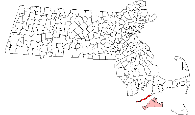
mapsize = 250px
map_caption = Location in Dukes County in Massachusetts
mapsize1 =
map_caption1 =
subdivision_type = Country
subdivision_name =United States
subdivision_type1 = State
subdivision_name1 =Massachusetts
subdivision_type2 = County
subdivision_name2 = Dukes
established_title = Settled
established_date =1641
established_title2 = Incorporated
established_date2 =1864
established_title3 =
established_date3 =
government_type =Open town meeting
leader_title =
leader_name =
leader_title1 =
leader_name1 =
area_magnitude =
area_total_km2 = 363.0
area_total_sq_mi = 140.2
area_land_km2 = 34.6
area_land_sq_mi = 13.3
area_water_km2 = 328.5
area_water_sq_mi = 126.8
population_as_of = 2000
settlement_type = Town
population_total = 86
population_density_km2 = 2.5
population_density_sq_mi = 6.4
elevation_m = 26
timezone = Eastern
utc_offset = -5
timezone_DST = Eastern
utc_offset_DST = -4
elevation_ft = 85
latd = 41 |latm = 28 |lats = 54 |latNS = N
longd = 70 |longm = 45 |longs = 25 |longEW = W
website =
postal_code_type = ZIP code
postal_code = 02713
area_code = 508 / 774
blank_name = FIPS code
blank_info = 25-26325
blank1_name = GNIS feature ID
blank1_info = 0618290
footnotes =Gosnold is a town that encompasses the
Elizabeth Islands in Dukes County,Massachusetts ,United States . As of the 2000 census, the town population was 86, making it the least populous town in Massachusetts. Most of the residents live in the village ofCuttyhunk , while most of the land in the town is owned by theForbes family .History
The earliest settlers of the
Elizabeth Islands were the Wampanoag Native Americans. The tribe did not settle permanently on the Elizabeth Islands, but used them insummer forhunting ,fishing , andgardening . Occasionally,arrowhead s orstone tool s are unsurfaced on the islands, and the islands' names come from the Wampanoag language.The Elizabeth Islands, including Cuttyhunk, were discovered in
1602 byBartholomew Gosnold . He and his crew attempted to establish atrading post on Cuttyhunk so they could trade with the natives; the first attempt byEurope ans to do so, the trading post was abandoned after only a few weeks, and Gosnold decided to return home. Upon his return toEngland , the island chain came under the jurisdiction of the British Crown.Gosnold was first settled in
1641 , the year of purchase of the islands by Thomas Mayhew, Sr. The islands were claimed by the Wampanoag until1658 , when the Wampanoagsachem transferred the deed of ownership to Mayhew. Constituting Dukes County,New York since1683 , the Elizabeth Islands,Martha's Vineyard , andNantucket , were transferred to the newly createdProvince of Massachusetts Bay in1691 . Gosnold was officially incorporated in1864 , having formerly belonged to the town of Chilmark. [ [http://capecodhistory.us/Mass1890/Gosnold1890.htm Gosnold, Massachsuetts 1890] ]Geography
According to the
United States Census Bureau , the town has a total area of 140.2square mile s (363.0km² ), of which, 13.3 square miles (34.6 km²) of it is land and 126.8 square miles (328.5 km²) of it (90.48%) is water. Gosnold ranks 272nd out of the 351 communities in the Commonwealth in terms of land area. It consists of the Elizabeth Islands, includingNonamesset Island ,Uncatena Island ,Naushon Island ,Pasque Island ,Nashawena Island ,Penikese Island ,Cuttyhunk Island and several smaller islands. The string of islands extend roughly southwest of the southwestern tip of Falmouth, with the closest island, Nonamesset, being less than a third of a mile away at its closest point. More than half the population lives on Cuttyhunk, with the majority of the rest living on Naushon.Demographics
As of the
census GR|2 of 2000, there were 86 people, 46 households, and 21 families residing in the town. Thepopulation density was 6.4 people per square mile (2.5/km²). There were 215 housing units at an average density of 16.1/sq mi (6.2/km²). The racial makeup of the town was 95.35% White, with noAfrican American s, Native Americans,Asia ns, or Pacific Islanders, and 4.65% from two or more races. None of the population is Hispanic or Latino of any race.There were 46 households out of which 17.4% had children under the age of 18 living with them, 34.8% were married couples living together, 8.7% had a female householder with no husband present, and 54.3% were non-families. 45.7% of all households were made up of individuals and 6.5% had someone living alone who was 65 years of age or older. The average household size was 1.87 and the average family size was 2.71.
In the town the population was spread out with 17.4% under the age of 18, 5.8% from 18 to 24, 32.6% from 25 to 44, 31.4% from 45 to 64, and 12.8% who were 65 years of age or older. The median age was 42 years. For every 100 females there were 138.9 males. For every 100 females age 18 and over, there were 144.8 males.
The median income for a household in the town was $22,344, and the median income for a family was $27,500. Males had a median income of $21,875 versus $30,625 for females. The
per capita income for the town was $15,265. There were 25.0% of families and 23.5% of the population living below thepoverty line , including 40.0% of under eighteens and 22.2% of those over 64.Despite its being the least populated community in the Commonwealth, Gosnold is not the least densely populated, with that title belonging to Mount Washington, at the southwestern corner of western Massachusetts.
Government
On the national level, Gosnold is a part of
Massachusetts's 10th congressional district , and is currently represented byBill Delahunt .On the state level, Gosnold is represented in the
Massachusetts House of Representatives as a part of the Barnstable, Dukes and Nantucket district, which includes all of Martha's Vineyard and Nantucket, as well as a portion of Falmouth. The town is represented in theMassachusetts Senate as a portion of the Cape and Islands district, which includes all of Martha's Vineyard, Nantucket and most of Barnstable County (with the exception of Bourne, Sandwich, Falmouth and a portion of Barnstable. [ [http://www.mass.gov/legis/citytown.htm Index of Legislative Representatives by City and Town] ] . All of Dukes County is patrolled by the Fifth (Oak Bluffs) Barracks of Troop D of theMassachusetts State Police . [ [http://www.mass.gov/?pageID=eopsterminal&L=5&L0=Home&L1=Law+Enforcement+%26+Criminal+Justice&L2=Law+Enforcement&L3=State+Police+Troops&L4=Troop+D&sid=Eeops&b=terminalcontent&f=msp_divisions_field_services_troops_troop_d_msp_field_troop_d_station_d5&csid=Eeops Station D-5, SP Oak Bluffs] ]Gosnold is governed on the local level by the
open town meeting form of government, and is led by aboard of selectmen .Education
The town currently has two students (as of the 2006-07 school year) attending school in Cuttyhunk, with several others attending private schools on the mainland. Penikese Island is also home to The Penikese School, a private school for troubled boys.
References
External links
*
* [http://www.danamorris.net/BB/cutty.html Images of Cuttyhunk Island]
* [http://www.danamorris.net/BB/hadleys_harbor.html Images of Hadley's Harbor]
* [http://www.cuttyhunkhistoricalsociety.org The Cuttyhunk Historical Society; The Museum of the Elizabeth Islands]Further reading
*The Cuttyhunk Historical Society. (2002). "Images of America: Cuttyhunk and the Elizabeth Islands". Charleston, SC: Arcadia Publishing. ISBN 0-7385-0980-9.
Wikimedia Foundation. 2010.