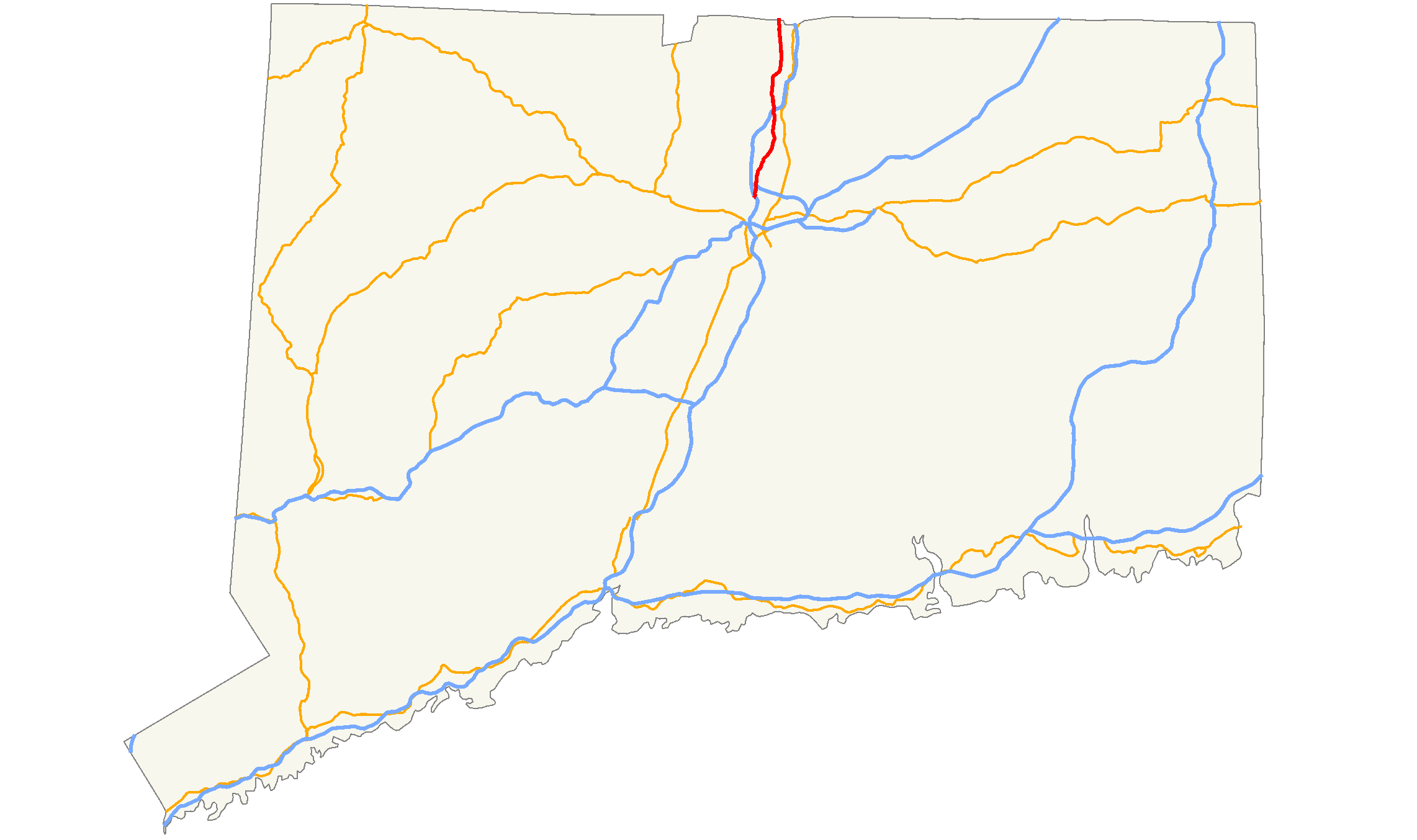
- Connecticut Route 159
-
Route 159


Route information Length: 21.14 mi[1] (34.02 km)
Connecticut: 16.82 mi[1]
Massachusetts: 4.32 mi[2]Existed: 1968 – present Major junctions South end: Main Street (near  I-91) at the Hartford-Windsor town line
 I-291 in Windsor
I-91 in Windsor Locks
 Route 57 in Agawam, MA
North end: 
 Route 75 / Route 147 in Agawam, MA
Highway system Routes in Connecticut
Special Service Roads • State Roads←  Route 157
Route 160  →
→←  Route 152
MA Route 168  →
→Route 159 is a state highway connecting the Hartford and Springfield areas in the U.S. states of Connecticut and Massachusetts. It begins as the northern extension of Main Street in Hartford and proceeds northward along the west bank of the Connecticut River towards Agawam, Massachusetts. The route ends at the junction of Route 147 and Route 75 in Agawam center just south of the West Springfield city line. The route was originally designated as U.S. Route 5A in 1932 and was renumbered to its modern designation in 1968.
Contents
Route description
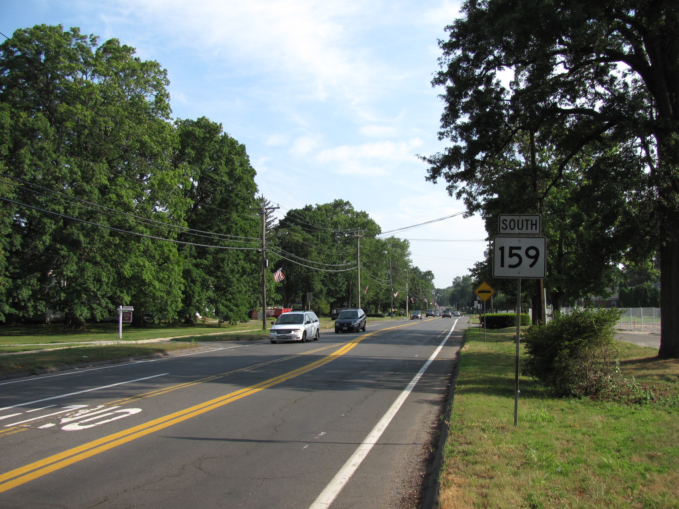
 Southbound in Agawam, Massachusetts
Route 159 officially begins at the Hartford-Windsor town line as Windsor Avenue, near an interchange with I-91. The road runs along the west bank of the Connecticut River, crossing Interstate 91 a second time. It goes through the towns of Windsor, Windsor Locks, and Suffield (bypassing Suffield center) before crossing the state line into the city of Agawam.[1] In Agawam, Route 159 signage ends at Route 57, but the official route continues north along Main Street to the intersection of Route 75 and Route 147 in downtown Agawam.[2]
Special designations
Route 159 in Windsor is also known as the Kasmir Pulaski Memorial Highway.[1]
History

Modern Route 159 roughly follows the path of the Upper Boston Post Road between Hartford and Springfield. In the 1920s, current Route 159 in Connecticut, with a few minor exceptions, was a primary state road designated as State Highway 110. Around 1930, the continuation in Massachusetts was numbered as State Route 5A, which ran along Main Street but continued north along River Road to the South End Bridge, where it crossed into Springfield to connect with U.S. Route 5. In the 1932 state highway renumbering, the route in both Connecticut and Massachusetts was designated as U.S. Route 5A. However, by 1938, Massachusetts redesignated its portion of the route as State Route 5A, truncating US 5A to the state line.[3] The new State Route 5A was also relocated to follow Main Street into West Springfield, then continuing along River Street, Park Street, and Elm Street, where it ended at US 5. In 1968, Connecticut decommissioned its U.S. Route 5A and the road was redesignated in both states as Route 159.[4] The portion in West Springfield, which was not state-maintained, became an unnumbered road.
Junction list
Mileposts reset at the state line.
County Location Mile[1] Destinations Notes Hartford Windsor 0.23 I-91 (Richard P. Horem Memorial Highway)1.20 I-291 (Vietnam Veterans Memorial Highway)1.24  Route 218 (Putnam Memorial Highway)
2.66  Route 178 (Park Avenue)
3.76  Route 75 (Poquonock Avenue)
Windsor Locks 8.52 I-919.12  Route 140 west (Elm Street)
9.42 Route 140 east (Bridge Street)Suffield 13.82  Route 190 (Hazard Avenue)
16.82
0.00Connecticut–Massachusetts state line Hampden Agawam 3.08 Route 574.32 Route 75
Route 1471.000 mi = 1.609 km; 1.000 km = 0.621 mi
Concurrency terminus • Closed/Former • Incomplete access • UnopenedReferences
- ^ a b c d e Connecticut State Highway Log
- ^ a b Executive Office of Transportation, Office of Transportation Planning - 2007 Road Inventory
- ^ Robert Droz, Alternate U.S. Routes
- ^ Connecticut Routes, Route 159
Categories:- State highways in Connecticut
- Transportation in Hartford County, Connecticut
- Numbered routes in Massachusetts


Wikimedia Foundation. 2010.