- Lee, Massachusetts
Infobox Settlement
official_name = Lee, Massachusetts
nickname =
motto = "Gateway to the Berkshires"
imagesize =
image_caption =
image_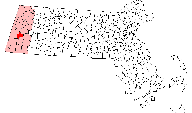
mapsize = 250px
map_caption = Location in Berkshire County in Massachusetts
mapsize1 =
map_caption1 =
subdivision_type = Country
subdivision_name =United States
subdivision_type1 = State
subdivision_name1 =Massachusetts
subdivision_type2 = County
subdivision_name2 = Berkshire
established_title = Settled
established_date = 1760
established_title2 = Incorporated
established_date2 = 1777
established_title3 =
established_date3 =
government_type =Representative town meeting
leader_title =
leader_name =
leader_title1 =
leader_name1 =
area_magnitude =
area_total_km2 = 70.0
area_total_sq_mi = 27.0
area_land_km2 = 68.4
area_land_sq_mi = 26.4
area_water_km2 = 1.6
area_water_sq_mi = 0.6
population_as_of = 2000
settlement_type = Town
population_total = 5985
population_density_km2 = 87.5
population_density_sq_mi = 226.7
elevation_m = 305
elevation_ft = 1000
timezone = Eastern
utc_offset = -5
timezone_DST = Eastern
utc_offset_DST = -4
latd = 42 |latm = 18 |lats = 15 |latNS = N
longd = 73 |longm = 14 |longs = 55 |longEW = W
website = http://www.lee.ma.us/
postal_code_type = ZIP code
postal_code = 01238
area_code = 413
blank_name = FIPS code
blank_info = 25-34655
blank1_name = GNIS feature ID
blank1_info = 0618268
footnotes =Lee is a town in Berkshire County,
Massachusetts ,United States . It is part of the Pittsfield,Massachusetts Metropolitan Statistical Area . The population was 5,985 which was determined in the 2000 census. Lee, which includes the villages of South and East Lee, is part of the Berkshiresresort area .History
This was once territory of the
Mahican Indians. It was first settled as Dodgetown in 1760, then incorporated in 1777 as Lee. Formed from parts of Great Barrington and Washington, it was named after GeneralCharles Lee . In the autumn of 1786 duringShay's Rebellion , about 250 followers ofDaniel Shays encountered state troops commanded by GeneralJohn Paterson near the village of East Lee. TheShaysites paraded a fakecannon crafted from ayarn beam, and the troops fled.Early industries included
agriculture andlumbering , with lime made inkiln s. Operated bywater power from theHousatonic River , mills producedtextile s andwire . Butpapermaking became the principal business, with the firstpaper mill , called the Eagle Mill, built in 1806 at South Lee by Samuel Church. The Columbia Mill was established in 1827, and would be the first to supply 100% groundwoodnewsprint to "The New York Times ". By 1857, there were 25 paper mills in Lee. The Smith Paper Company discovered how to manufacture paper solely fromwood pulp in 1867, and through the 1870s was the largest producer of paper in the country. Today, Lee has 3 large papermaking facilities owned by Schweitzer-Mauduit International, Inc., with another across the border in Lenox. The plants producecigarette paper,candy wrappers and other specialty paper. But Schweitzer-Mauduit announced in 2007 that the mills would close in 2008, putting nearly 170 people out of work.The town was also famous for the quality of its
marble , with the firstquarry established in 1852. Almost 500,000 cubic feet of marble was excavated and shipped in 1867 on theHousatonic Railroad . Buildings constructed of Lee marble include a wing of the Capitol in Washington and St. Patrick's Cathedral inNew York City .Lee's 19th-century prosperity left it with fine period architecture, including the town hall and library. South Lee has a
historic district listed on the National Register. The formermill town is now a popular tourist destination, noted both for its considerable Victorian charm and number ofbed and breakfast establishments. Lee was a filming location for "Before and After" (1996) and "The Cider House Rules" (1999).Geography
According to the
United States Census Bureau , the town has a total area of 27.0square mile s (70.0km² ), of which, 26.4 square miles (68.4 km²) of it is land and 0.6 square miles (1.6 km²) of it (2.33%) is water. Lee is bordered by Lenox to the northwest, Washington to the northeast, Becket to the east, Tyringham in the southeast, Great Barrington to the southwest, and Stockbridge to the west. Lee is ten miles south of Pittsfield, 42 miles west-northwest of Springfield, and 125 miles west of Boston.Lee is located in the southern section of the Berkshires, in a valley along the
Housatonic River . The town lies to the west of October Mountain State Forest, with two sections of the forest in Lee. In the southwest corner of town lies a portion of Beartown State Forest, where Burgoyne Pass crosses the northern end of the mountain. Hop Brook, a marshy brook which flows into Tyringham, flows into the Housatonic in the south, and other bodies of water include Laurel Lake to the north, and Goose Pond to the southeast. TheAppalachian Trail circumvents the eastern part of the town, passing through Tyringham, Becket and Washington.Lee is located along
Interstate 90 (also known as theMassachusetts Turnpike ), and is home to Exit 2, the westernmost full exit on the turnpike (Exit 1, in West Stockbridge, is only a turnaround exit) as well as the first service area along the Pike. (The exit is also well-known because if a driver misses Exit 3 in Westfield, it requires a 60-mile round trip through Exit 2 to get back to Westfield.) Lee lies alongU.S. Route 20 , the "old Mass Pike," which was the main route to New York State prior to the interstate. A small section ofU.S. Route 7 crosses through the northwest corner of town before meeting Route 20 in Lenox. Additionally, Route 102's eastern terminus is located at Route 20 at the Exit 2 toll plaza.Lee lies along the Housatonic Rail Road line, which travels between Pittsfield and Great Barrington. The town is also covered by the Berkshire Regional Transit Authority (BRTA) bus line, which travels between the same two communities. The nearest regional bus service can be reached in Great Barrington, and regional air service can be reached at
Pittsfield Municipal Airport . The nearest national air service can be reached atBradley International Airport in Connecticut.Demographics
"See also:" Lee (CDP),
Massachusetts As of thecensus GR|2 of 2000, there were 5,985 people, 2,442 households, and 1,606 families residing in the town. By population, Lee ranks seventh out of the 32 cities and towns in Berkshire County, and 227th out of 351 cities and towns in Massachusetts. Thepopulation density was 226.7 people per square mile (87.5/km²), which ranks sixth in the county and 241st in the Commonwealth. There were 2,927 housing units at an average density of 110.9/sq mi (42.8/km²). The racial makeup of the town was 96.93% White, 0.62% Black or African American, 0.15% Native American, 0.95% Asian, 0.02% Pacific Islander, 0.74% from other races, and 0.60% from two or more races. Hispanic or Latino of any race were 2.49% of the population.There were 2,442 households out of which 28.6% had children under the age of 18 living with them, 51.7% were married couples living together, 10.2% had a female householder with no husband present, and 34.2% were non-families. 28.2% of all households were made up of individuals and 12.6% had someone living alone who was 65 years of age or older. The average household size was 2.39 and the average family size was 2.91.
In the town the population was spread out with 22.1% under the age of 18, 7.0% from 18 to 24, 28.5% from 25 to 44, 25.6% from 45 to 64, and 16.8% who were 65 years of age or older. The median age was 40 years. For every 100 females there were 94.0 males. For every 100 females age 18 and over, there were 92.1 males.
The median income for a household in the town was $41,556, and the median income for a family was $49,630. Males had a median income of $35,565 versus $26,232 for females. The
per capita income for the town was $19,799. About 2.5% of families and 6.7% of the population were below thepoverty line , including 3.4% of those under age 18 and 4.2% of those age 65 or over.Government
Lee uses the
representative town meeting form of government, and is led by aboard of selectmen and atown administrator . Lee has its own police, fire and public works departments, as well as a post office. The town's library is a member of the regional library networks.On the state level, Lee is represented in the
Massachusetts House of Representatives by the Fourth Berkshire district, which covers southern Berkshire County, as well as the westernmost towns in Hampden County. In theMassachusetts Senate , the town is represented by the Berkshire, Hampshire and Franklin district, which includes all of Berkshire County and western Hampshire and Franklin Counties. [ [http://www.mass.gov/legis/citytown.htm Senators and Representatives by City and Town] ] The town is home to the First Station of Barracks "B" of theMassachusetts State Police . [ [http://www.mass.gov/?pageID=eopsterminal&L=5&L0=Home&L1=Law+Enforcement+%26+Criminal+Justice&L2=Law+Enforcement&L3=State+Police+Troops&L4=Troop+B&sid=Eeops&b=terminalcontent&f=msp_divisions_field_services_troops_troop_b_msp_field_troop_b_station_b1&csid=Eeops Station B-1, SP Lee] ]On the national level, Lee is represented in the
United States House of Representatives as part ofMassachusetts's 1st congressional district , and has been represented byJohn Olver of Amherst since June 1991. Massachusetts is represented in theUnited States Senate by senior SenatorTed Kennedy and junior SenatorJohn Kerry .Education
Lee operates its own school department, which also serves the town of Tyringham. Lee Elementary School serves students from pre-kindergarten through sixth grades, and the Lee Middle and High School serves students from seventh through twelfth grades. Lee's athletics teams are nicknamed the Wildcats, and their colors are black and orange. Additionally, Lee is home to Saint Mary's School, a school which serves students through eighth grade. Other private schools can be found in Great Barrington and other surrounding towns.
The nearest
community college is the South County Center ofBerkshire Community College in Great Barrington. The nearest state college isWestfield State College , and the nearest state university is theUniversity of Massachusetts Amherst . The nearest private college isBard College at Simon's Rock .ites of interest
* [http://www.mambor.com/animagic/museum.htm Animagic -- Museum of Animation, Special Effects & Art]
* [http://www.festivallatino.org/ Festival Latino of the Berkshires]
* [http://www.mass.gov/dcr/parks/western/octm.htm October Mountain State Forest]Notable Residents
*
Martha Coakley , attorney general
*Edith Wharton , novelist
*Debra Jo Rupp , actressReferences
* [http://www.1911encyclopedia.org/Lee,_Massachusetts History of Lee, Massachusetts (1911)]
* [http://www.schweitzer-mauduit.com/locations/USCanada/lee.asp Lee Paper Mills -- Schweitzer-Mauduit International, Inc.]External links
* [http://www.townoflee.com/ Total-LEE for You.]
* [http://www.lee.ma.us/ Town of Lee, Massachusetts]
* [http://www.leelibrary.org Lee Library]
* [http://www.leechamber.org/ Lee Chamber of Commerce]
Wikimedia Foundation. 2010.