- Cummington, Massachusetts
-
Cummington, Massachusetts — Town — Former Cummington Fire Department headquarters Location in Hampshire County in Massachusetts
Coordinates: 42°27′42″N 72°53′40″W / 42.46167°N 72.89444°WCoordinates: 42°27′42″N 72°53′40″W / 42.46167°N 72.89444°W Country United States State Massachusetts County Hampshire County Settled 1762 Incorporated 1779 Government – Type Open town meeting Area – Total 23.1 sq mi (59.7 km2) – Land 23.1 sq mi (59.7 km2) – Water 0.0 sq mi (0.0 km2) Elevation 1,010 ft (308 m) Population (2000) – Total 978 – Density 42.4/sq mi (16.4/km2) Time zone Eastern (UTC-5) – Summer (DST) Eastern (UTC-4) ZIP code 01026 Area code(s) 413 FIPS code 25-16040 GNIS feature ID 0618198 Website www.cummington-ma.gov Cummington is a town in Hampshire County, Massachusetts, United States. The population was 978 at the 2000 census. It is part of the Springfield, Massachusetts Metropolitan Statistical Area.
Contents
History
Cummington was first settled in 1762 and was officially incorporated in 1779. It was named after Colonel Cummings, a landholder.[1] Noted poet and newspaper editor William Cullen Bryant was born in Cummington, and returned for many years to summer in the town. His house is now preserved and open to the public as the William Cullen Bryant Homestead. The town hosts the Cummington Fair every August on the town's fairgrounds. The fair features many events including adult and 4-H exhibition halls, a craft barn, vaudeville stage, antique car parade, oxen pull, and an assortment of fair rides, games, and food stands.
Geography
According to the United States Census Bureau, the town has a total area of 23.0 square miles (60 km2), all land. The East Branch of the Westfield River flows through Cummington.
The mineral cummingtonite was first found in this town and was named after it.[2][3]
Demographics
Historical populations Year Pop. ±% 1850 1,172 — 1860 1,085 −7.4% 1870 1,037 −4.4% 1880 881 −15.0% 1890 787 −10.7% 1900 748 −5.0% 1910 637 −14.8% 1920 489 −23.2% 1930 531 +8.6% 1940 608 +14.5% 1950 620 +2.0% 1960 550 −11.3% 1970 562 +2.2% 1980 657 +16.9% 1990 785 +19.5% 2000 978 +24.6% 2001* 972 −0.6% 2002* 975 +0.3% 2003* 983 +0.8% 2004* 985 +0.2% 2005* 975 −1.0% 2006* 971 −0.4% 2007* 967 −0.4% 2008* 966 −0.1% 2009* 968 +0.2% 2010 872 −9.9% * = population estimate.
Source: United States Census records and Population Estimates Program data.[4][5][6][7][8][9][10][11][12][13]As of the census[14] of 2000, there were 978 people, 382 households, and 239 families residing in the town. The population density was 42.4 people per square mile (16.4/km²). There were 452 housing units at an average density of 19.6 per square mile (7.6/km²). The racial makeup of the town was 96.42% White, 0.61% African American, 0.41% Native American, 0.31% Asian, 0.51% from other races, and 1.74% from two or more races. Hispanic or Latino of any race were 3.27% of the population.
There were 382 households out of which 24.3% had children under the age of 18 living with them, 54.2% were married couples living together, 5.8% had a female householder with no husband present, and 37.4% were non-families. 28.0% of all households were made up of individuals and 10.2% had someone living alone who was 65 years of age or older. The average household size was 2.26 and the average family size was 2.77.
In the town the population was spread out with 27.9% under the age of 18, 5.7% from 18 to 24, 30.3% from 25 to 44, 24.8% from 45 to 64, and 11.2% who were 65 years of age or older. The median age was 38 years. For every 100 females there were 102.5 males. For every 100 females age 18 and over, there were 92.1 males.
The median income for a household in the town was $42,250, and the median income for a family was $48,750. Males had a median income of $31,765 versus $27,279 for females. The per capita income for the town was $21,553. About 4.2% of families and 6.6% of the population were below the poverty line, including 5.7% of those under age 18 and none of those age 65 or over.
Government
The town is part of the Second Berkshire District in the Massachusetts House of Representatives, represented by Paul Mark, and the Berkshire, Franklin, and Hampshire Senate district, represented by Ben Downing.
Points of interest
- William Cullen Bryant Homestead
- Greenwood Music Camp
- The Academy at Swift River
Notable people
- William Cullen Bryant, poet
- Sergei Isupov, artist
- Rachel Maddow, MSNBC host
- Worcester Reed Warner, Engineer
- Richard Wilbur, poet
References
- ^ "Profile for Cummington, Massachusetts". ePodunk. http://www.epodunk.com/cgi-bin/genInfo.php?locIndex=2917. Retrieved 2010-05-18.
- ^ http://rruff.geo.arizona.edu/doclib/hom/cummingtonite.pdf Handbook of Mineralogy, 2001, Mineral Data Pub.
- ^ http://www.mindat.org/min-1170.html Mindat data
- ^ "TOTAL POPULATION (P1), 2010 Census Summary File 1, All County Subdivisions within Massachusetts". United States Census Bureau. http://factfinder2.census.gov/bkmk/table/1.0/en/DEC/10_SF1/P1/0400000US25.06000. Retrieved September 13, 2011.
- ^ "Massachusetts by Place and County Subdivision - GCT-T1. Population Estimates". United States Census Bureau. http://factfinder.census.gov/servlet/GCTTable?_bm=y&-geo_id=04000US25&-_box_head_nbr=GCT-T1&-ds_name=PEP_2009_EST&-_lang=en&-format=ST-9&-_sse=on. Retrieved July 12, 2011.
- ^ "1990 Census of Population, General Population Characteristics: Massachusetts". US Census Bureau. December 1990. Table 76: General Characteristics of Persons, Households, and Families: 1990. 1990 CP-1-23. http://www.census.gov/prod/cen1990/cp1/cp-1-23.pdf. Retrieved July 12, 2011.
- ^ "1980 Census of the Population, Number of Inhabitants: Massachusetts". US Census Bureau. December 1981. Table 4. Populations of County Subdivisions: 1960 to 1980. PC80-1-A23. http://www2.census.gov/prod2/decennial/documents/1980a_maABC-01.pdf. Retrieved July 12, 2011.
- ^ "1950 Census of Population". Bureau of the Census. 1952. Section 6, Pages 21-10 and 21-11, Massachusetts Table 6. Population of Counties by Minor Civil Divisions: 1930 to 1950. http://www2.census.gov/prod2/decennial/documents/23761117v1ch06.pdf. Retrieved July 12, 2011.
- ^ "1920 Census of Population". Bureau of the Census. Number of Inhabitants, by Counties and Minor Civil Divisions. Pages 21-5 through 21-7. Massachusetts Table 2. Population of Counties by Minor Civil Divisions: 1920, 1910, and 1920. http://www2.census.gov/prod2/decennial/documents/41084506no553ch2.pdf. Retrieved July 12, 2011.
- ^ "1890 Census of the Population". Department of the Interior, Census Office. Pages 179 through 182. Massachusetts Table 5. Population of States and Territories by Minor Civil Divisions: 1880 and 1890. http://www2.census.gov/prod2/decennial/documents/41084506no553ch2.pdf. Retrieved July 12, 2011.
- ^ "1870 Census of the Population". Department of the Interior, Census Office. 1872. Pages 217 through 220. Table IX. Population of Minor Civil Divisions, &c. Massachusetts. http://www2.census.gov/prod2/decennial/documents/1870e-05.pdf. Retrieved July 12, 2011.
- ^ "1860 Census". Department of the Interior, Census Office. 1864. Pages 220 through 226. State of Massachusetts Table No. 3. Populations of Cities, Towns, &c.. http://www2.census.gov/prod2/decennial/documents/1860a-08.pdf. Retrieved July 12, 2011.
- ^ "1850 Census". Department of the Interior, Census Office. 1854. Pages 338 through 393. Populations of Cities, Towns, &c.. http://www2.census.gov/prod2/decennial/documents/1850c-11.pdf. Retrieved July 12, 2011.
- ^ "American FactFinder". United States Census Bureau. http://factfinder.census.gov. Retrieved 2008-01-31.
External links
- Official Site
- MHC Survey Reconnaissance Town Report: Cummington Massachusetts Historical Commission, 1982.
Municipalities and communities of Hampshire County, Massachusetts Cities 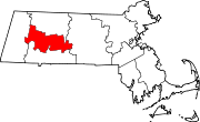
Towns Amherst | Belchertown | Chesterfield | Cummington | Goshen | Granby | Hadley | Hatfield | Huntington | Middlefield | Pelham | Plainfield | South Hadley | Southampton | Ware | Westhampton | Williamsburg | Worthington
CDPs Amherst Center | Bondsville‡ | Belchertown | Granby | Hatfield | North Amherst | South Amherst | Ware
Other
villagesFootnotes ‡This populated place also has portions in an adjacent county or counties
Categories:- Towns in Hampshire County, Massachusetts
- Springfield, Massachusetts metropolitan area


Wikimedia Foundation. 2010.