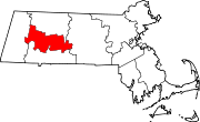
- North Amherst, Massachusetts
-
North Amherst, Massachusetts — CDP — North Amherst Library Coordinates: 42°24′22″N 72°31′16″W / 42.40611°N 72.52111°WCoordinates: 42°24′22″N 72°31′16″W / 42.40611°N 72.52111°W Country United States State Massachusetts County Hampshire Area – Total 2.1 sq mi (5.5 km2) – Land 2.1 sq mi (5.5 km2) – Water 0.0 sq mi (0.0 km2) Elevation 187 ft (57 m) Population (2000) – Total 6,019 – Density 2,856.1/sq mi (1,102.7/km2) Time zone Eastern (EST) (UTC-5) – Summer (DST) EDT (UTC-4) ZIP code 01059 Area code(s) 413 FIPS code 25-46295 GNIS feature ID 0608905 North Amherst is a census-designated place (CDP) in the town of Amherst in Hampshire County, Massachusetts, United States. The population was 6,019 at the 2000 census. It is part of the Springfield, Massachusetts Metropolitan Statistical Area.
There are several large apartment complexes in North Amherst, housing mostly students of the University of Massachusetts Amherst along with low-income families (Graduate Students). Apart from these housing developments, North Amherst also sports many beautiful old houses, and North Amherst Center Historic District is on the National Register of Historic Places. The Village is said[who?] to be an excellently-preserved example of a 19th-century farm community.
North Amherst is also home to a large majority of Amherst middle income families as the main street (East Pleasant Street) has many housing developments built off of it. This includes "Grantwood" which is the largest neighborhood/development in Amherst.[citation needed]
North Amherst is also home to two cohousing communities: Pioneer Valley and Pine Street Cohousing.
Cushman Village also resides in North Amherst. This small section of the area is unique as the roads turn back into each other unlike the square roads off East Pleasant Street. Cushman Village has many historical homes and is also located near the Cushman Common and the Cushman Store.
Contents
Geography
North Amherst is located at 42°24′22″N 72°31′16″W / 42.40611°N 72.52111°W (42.406192, -72.521217)[1].
According to the United States Census Bureau, the CDP has a total area of 5.5 km² (2.1 mi²), all land.
Demographics
As of the census[2] of 2000, there were 6,019 people, 1,915 households, and 813 families residing in the CDP. The population density was 1,101.4/km² (2,856.1/mi²). There were 1,947 housing units at an average density of 356.3/km² (923.9/mi²). The racial makeup of the CDP was 75.76% White, 4.44% African American, 0.25% Native American, 13.09% Asian, 0.22% Pacific Islander, 3.11% from other races, and 3.14% from two or more races. Hispanic or Latino of any race were 6.43% of the population.
There were 1,915 households out of which 25.4% had children under the age of 18 living with them, 30.9% were married couples living together, 9.3% had a female householder with no husband present, and 57.5% were non-families. 22.3% of all households were made up of individuals and 4.5% had someone living alone who was 65 years of age or older. The average household size was 2.60 and the average family size was 2.99.
In the CDP the population was spread out with 14.2% under the age of 18, 50.4% from 18 to 24, 19.7% from 25 to 44, 10.8% from 45 to 64, and 4.9% who were 65 years of age or older. The median age was 22 years. For every 100 females there were 105.6 males. For every 100 females age 18 and over, there were 103.3 males.
The median income for a household in the CDP was $28,063, and the median income for a family was $43,423. Males had a median income of $37,202 versus $29,079 for females. The per capita income for the CDP was $14,336. About 12.8% of families and 33.6% of the population were below the poverty line, including 19.5% of those under age 18 and 2.2% of those age 65 or over.
References
- ^ "US Gazetteer files: 2010, 2000, and 1990". United States Census Bureau. 2011-02-12. http://www.census.gov/geo/www/gazetteer/gazette.html. Retrieved 2011-04-23.
- ^ "American FactFinder". United States Census Bureau. http://factfinder.census.gov. Retrieved 2008-01-31.
External links
Municipalities and communities of Hampshire County, Massachusetts Cities Towns Amherst | Belchertown | Chesterfield | Cummington | Goshen | Granby | Hadley | Hatfield | Huntington | Middlefield | Pelham | Plainfield | South Hadley | Southampton | Ware | Westhampton | Williamsburg | Worthington
CDPs Amherst Center | Bondsville‡ | Belchertown | Granby | Hatfield | North Amherst | South Amherst | Ware
Other
villagesFootnotes ‡This populated place also has portions in an adjacent county or counties
Categories:- Census-designated places in Hampshire County, Massachusetts
- Amherst, Massachusetts
- Springfield, Massachusetts metropolitan area
Wikimedia Foundation. 2010.


