- Huntington, Massachusetts
-
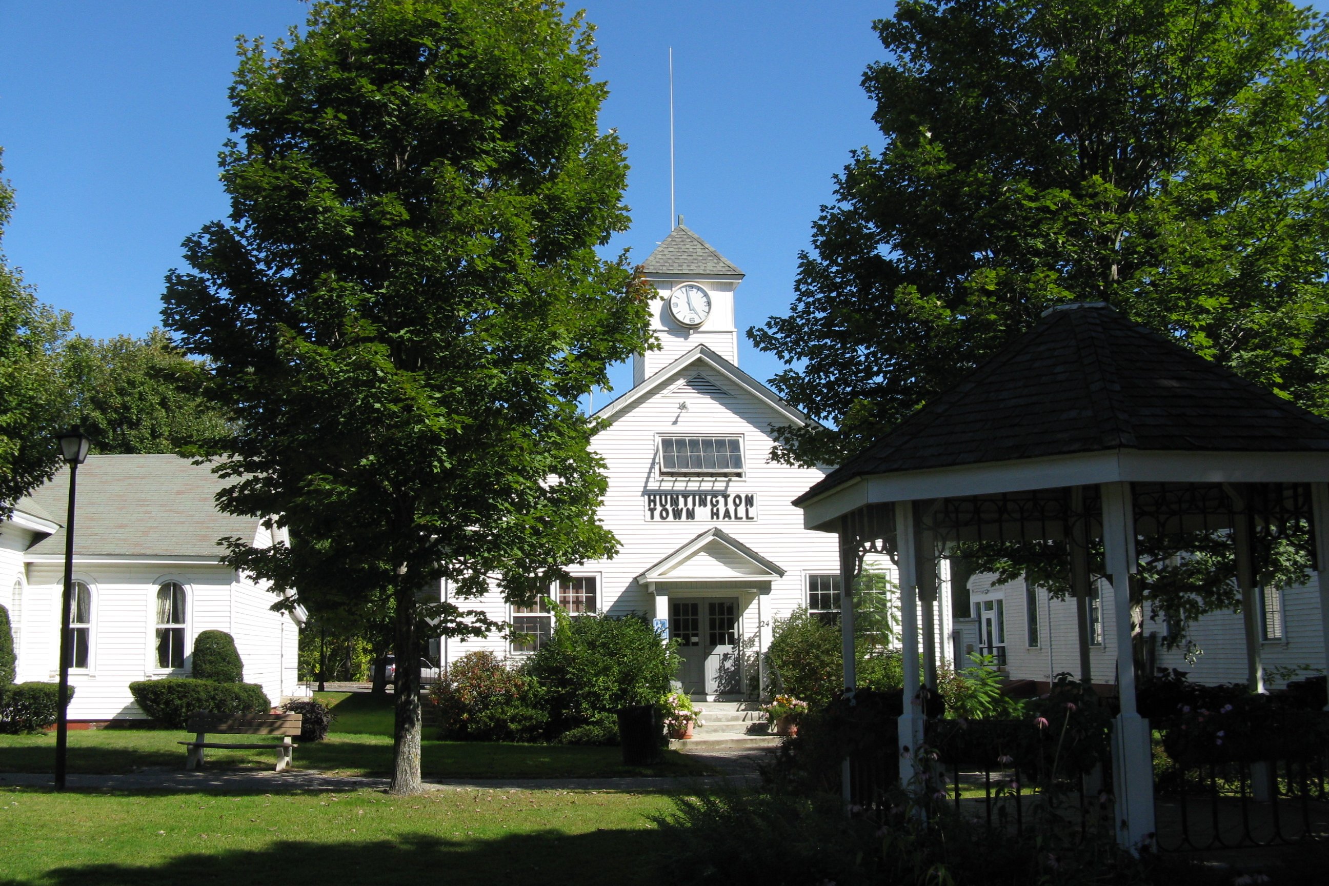
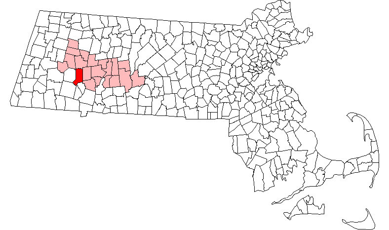
Huntington, Massachusetts — Town — Huntington Town Hall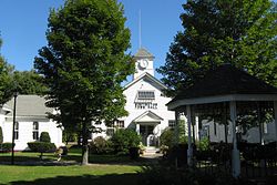 Location in Hampshire County in Massachusetts
Coordinates: 42°14′10″N 72°52′35″W / 42.23611°N 72.87639°WCoordinates: 42°14′10″N 72°52′35″W / 42.23611°N 72.87639°W Country United States State Massachusetts County Hampshire Settled 1769 Incorporated 1775 Government – Type Open town meeting Area – Total 26.9 sq mi (69.7 km2) – Land 26.6 sq mi (69.0 km2) – Water 0.3 sq mi (0.7 km2) Elevation 382 ft (116 m) Population (2000) – Total 2,174 – Density 81.6/sq mi (31.5/km2) Time zone Eastern (UTC-5) – Summer (DST) Eastern (UTC-4) ZIP code 01050 Area code(s) 413 FIPS code 25-31785 GNIS feature ID 0618203 Website http://huntingtonma.org/ Huntington is a town in Hampshire County, Massachusetts, United States. The population was 2,174 at the 2000 census. It is part of the Springfield, Massachusetts Metropolitan Statistical Area.
Contents
History
Huntington, originally named Norwich, was first settled in 1769 and was officially incorporated in 1775. As Norwich, it was incorporated in Hampshire County, Massachusetts in 1773. Norwich was created from Murrayfield in 1773, and re-named Huntington in 1855.
Geography
According to the United States Census Bureau, the town has a total area of 26.9 square miles (70 km2), of which, 26.6 square miles (69 km2) of it is land and 0.3 square miles (0.78 km2) of it (1.00%) is water.
Demographics
Historical populations Year Pop. ±% 1860 1,216 — 1870 1,156 −4.9% 1880 1,236 +6.9% 1890 1,385 +12.1% 1900 1,475 +6.5% 1910 1,473 −0.1% 1920 1,425 −3.3% 1930 1,242 −12.8% 1940 1,340 +7.9% 1950 1,257 −6.2% 1960 1,392 +10.7% 1970 1,593 +14.4% 1980 1,804 +13.2% 1990 1,987 +10.1% 2000 2,174 +9.4% 2001* 2,175 +0.0% 2002* 2,188 +0.6% 2003* 2,204 +0.7% 2004* 2,197 −0.3% 2005* 2,176 −1.0% 2006* 2,201 +1.1% 2007* 2,207 +0.3% 2008* 2,217 +0.5% 2009* 2,221 +0.2% 2010 2,180 −1.8% * = population estimate. Source: United States Census records and Population Estimates Program data.[1][2][3][4][5][6][7][8][9] As of the census[10] of 2000, there were 2,174 people, 809 households, and 597 families residing in the town. The population density was 81.6 people per square mile (31.5/km²). There were 935 housing units at an average density of 35.1 per square mile (13.6/km²). The racial makeup of the town was 97.56% White, 0.41% African American, 0.18% Native American, 0.41% Asian, 0.28% from other races, and 1.15% from two or more races. Hispanic or Latino of any race were 1.84% of the population.
There were 809 households out of which 35.0% had children under the age of 18 living with them, 60.4% were married couples living together, 8.9% had a female householder with no husband present, and 26.2% were non-families. 19.2% of all households were made up of individuals and 6.8% had someone living alone who was 65 years of age or older. The average household size was 2.69 and the average family size was 3.10.
In the town the population was spread out with 27.7% under the age of 18, 6.4% from 18 to 24, 30.0% from 25 to 44, 26.1% from 45 to 64, and 9.7% who were 65 years of age or older. The median age was 37 years. For every 100 females there were 98.5 males. For every 100 females age 18 and over, there were 98.2 males.
The median income for a household in the town was $48,958, and the median income for a family was $52,308. Males had a median income of $36,893 versus $27,414 for females. The per capita income for the town was $19,385. About 4.4% of families and 5.8% of the population were below the poverty line, including 6.2% of those under age 18 and 10.7% of those age 65 or over.
References
- ^ "TOTAL POPULATION (P1), 2010 Census Summary File 1, All County Subdivisions within Massachusetts". United States Census Bureau. http://factfinder2.census.gov/bkmk/table/1.0/en/DEC/10_SF1/P1/0400000US25.06000. Retrieved September 13, 2011.
- ^ "Massachusetts by Place and County Subdivision - GCT-T1. Population Estimates". United States Census Bureau. http://factfinder.census.gov/servlet/GCTTable?_bm=y&-geo_id=04000US25&-_box_head_nbr=GCT-T1&-ds_name=PEP_2009_EST&-_lang=en&-format=ST-9&-_sse=on. Retrieved July 12, 2011.
- ^ "1990 Census of Population, General Population Characteristics: Massachusetts". US Census Bureau. December 1990. Table 76: General Characteristics of Persons, Households, and Families: 1990. 1990 CP-1-23. http://www.census.gov/prod/cen1990/cp1/cp-1-23.pdf. Retrieved July 12, 2011.
- ^ "1980 Census of the Population, Number of Inhabitants: Massachusetts". US Census Bureau. December 1981. Table 4. Populations of County Subdivisions: 1960 to 1980. PC80-1-A23. http://www2.census.gov/prod2/decennial/documents/1980a_maABC-01.pdf. Retrieved July 12, 2011.
- ^ "1950 Census of Population". Bureau of the Census. 1952. Section 6, Pages 21-10 and 21-11, Massachusetts Table 6. Population of Counties by Minor Civil Divisions: 1930 to 1950. http://www2.census.gov/prod2/decennial/documents/23761117v1ch06.pdf. Retrieved July 12, 2011.
- ^ "1920 Census of Population". Bureau of the Census. Number of Inhabitants, by Counties and Minor Civil Divisions. Pages 21-5 through 21-7. Massachusetts Table 2. Population of Counties by Minor Civil Divisions: 1920, 1910, and 1920. http://www2.census.gov/prod2/decennial/documents/41084506no553ch2.pdf. Retrieved July 12, 2011.
- ^ "1890 Census of the Population". Department of the Interior, Census Office. Pages 179 through 182. Massachusetts Table 5. Population of States and Territories by Minor Civil Divisions: 1880 and 1890. http://www2.census.gov/prod2/decennial/documents/41084506no553ch2.pdf. Retrieved July 12, 2011.
- ^ "1870 Census of the Population". Department of the Interior, Census Office. 1872. Pages 217 through 220. Table IX. Population of Minor Civil Divisions, &c. Massachusetts. http://www2.census.gov/prod2/decennial/documents/1870e-05.pdf. Retrieved July 12, 2011.
- ^ "1860 Census". Department of the Interior, Census Office. 1864. Pages 220 through 226. State of Massachusetts Table No. 3. Populations of Cities, Towns, &c.. http://www2.census.gov/prod2/decennial/documents/1860a-08.pdf. Retrieved July 12, 2011.
- ^ "American FactFinder". United States Census Bureau. http://factfinder.census.gov. Retrieved 2008-01-31.
External links
- Huntington Police Department
- Huntington Town Site
- Huntington Public Library
- Huntington Public High School+
- Historical Program from Centennial Celebration in 1955 with history of the town
- MHC Survey Reconnaissance Town Report: Huntington' Massachusetts Historical Commission, 1982.
- Huntington Vision: Huntington Community Development Plan Pioneer Valley Planning Commission, 2003.
Municipalities and communities of Hampshire County, Massachusetts Cities 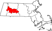
Towns Amherst | Belchertown | Chesterfield | Cummington | Goshen | Granby | Hadley | Hatfield | Huntington | Middlefield | Pelham | Plainfield | South Hadley | Southampton | Ware | Westhampton | Williamsburg | Worthington
CDPs Amherst Center | Bondsville‡ | Belchertown | Granby | Hatfield | North Amherst | South Amherst | Ware
Other
villagesFootnotes ‡This populated place also has portions in an adjacent county or counties
Categories:- Towns in Hampshire County, Massachusetts
- Springfield, Massachusetts metropolitan area

Wikimedia Foundation. 2010.