- West Newbury, Massachusetts
Infobox Settlement
official_name = West Newbury, Massachusetts
nickname =
motto =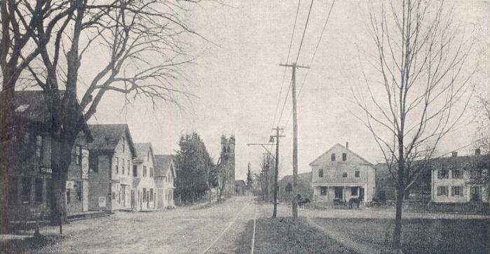
imagesize = 250px
image_caption = Post Office Square, c. 1905
image_
mapsize = 250px
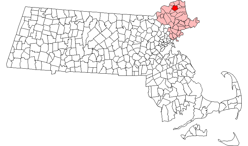
map_caption = Location in Essex County in Massachusetts
mapsize1 =
map_caption1 =
subdivision_type = Country
subdivision_name =United States
subdivision_type1 = State
subdivision_name1 =Massachusetts
subdivision_type2 = County
subdivision_name2 = Essex
established_title = Settled
established_date = 1635
established_title2 = Incorporated
established_date2 = 1817
established_title3 =
established_date3 =
government_type =Open town meeting
leader_title =
leader_name =
leader_title1 =
leader_name1 =
area_magnitude =
area_total_km2 = 37.8
area_total_sq_mi = 14.6
area_land_km2 = 35.0
area_land_sq_mi = 13.5
area_water_km2 = 2.8
area_water_sq_mi = 1.1
population_as_of = 2006
settlement_type = Town
population_total = 4,450
population_density_km2 = 118.5
population_density_sq_mi = 306.9
elevation_m = 28
elevation_ft = 92
timezone = EST
utc_offset = -5
timezone_DST = Eastern
utc_offset_DST = -4
latd = 42 |latm = 48 |lats = 05 |latNS = N
longd = 70 |longm = 59 |longs = 25 |longEW = W
website = http://www.town.west-newbury.ma.us
postal_code_type = ZIP code
postal_code = 01985
area_code = 351 / 978
blank_name = FIPS code
blank_info = 25-77150
blank1_name = GNIS feature ID
blank1_info = 0618313
footnotes =West Newbury is a town in Essex County,
Massachusetts ,United States . The population was 4,450 at the 2006 census. It is situated on the Merrimack River and is an old-fashioned, sleepy New England town with a deep history and exciting current events. Along with neighboring Merrimac and Groveland, it is part of thePentucket Regional School District .History
West Newbury was first settled in 1635 as part of neighboring Newbury. On
February 18 ,1819 , theGeneral Court of Massachusetts passed an act "to incorporate the town of Parsons." [Currier (1902), page 301.] The initial proposals had been made in the late 18th century, but determined resistance from the town of Newbury, which had already lost Newburyport, blocked the measure for decades. On June 14, 1820, the court passed another act to change the name to West Newbury.West Newbury is well known for it's many hills; Pipestave Hill, (Which includes coveted horseback riding trails and well-kept soccer fields), Break's Hill, Ilsey Hill, Long Hill, (Upon which Long Hill Farm is situated), and Meetinghouse Hill.
Geography
According to the
United States Census Bureau , the town has a total area of 14.6square mile s (37.8km² ), of which, 13.5 square miles (35.0 km²) of it is land and 1.1 square miles (2.8 km²) of it is water. The total area is 7.40% water. The town is 40 miles north of Boston.Demographics
As of the
census GR|2 of2006 , there were 4,450 people, 1,392 households, and 1,183 families residing in the town. Thepopulation density is 306.9 people per square mile (118.5/km²). There were 1,423 housing units at an average density of 105.3/sq mi (40.6/km²). The racial makeup of the town was 98.48% White, 0.19% African American, 0.02% Native American, 0.53% Asian, 0.00% Pacific Islander, 0.36% from other races, and 0.41% from two or more races. Hispanic or Latino of any race were 0.65% of the population.There were 1,392 households out of which 46.6% have children under the age of 18 living with them, 76.8% are married couples living together, 6.2% have a female householder with no husband present, and 15.0% are non-families. 11.9% of all households are made up of individuals and 5.2% have someone living alone who is 65 years of age or older. The average household size is 2.98 and the average family size is 3.25.
In the town the population was spread out with 30.0% under the age of 18, 4.3% from 18 to 24, 27.0% from 25 to 44, 29.9% from 45 to 64, and 8.8% who were 65 years of age or older. The median age was 40 years. For every 100 females there were 99.5 males. For every 100 females age 18 and over, there were 93.9 males.
The median income for a household in the town was $102,828, and the median income for a family was $120,050. Males had a median income of $100,670 versus $80,189 for females. The
per capita income for the town was $35,323. About 2.8% of families and 3.8% of the population were below thepoverty line , including 3.8% of those under the age of 18 and 9.8% of those 65 and older.Property values in West Newbury are among the highest in the state; particularly the Newbury-Newburyport-West Newbury area, which are towns in Essex County, one of the single most expensive counties in the state.
Notable residents
*
Bertrand R. Brinley - writer of short stories and children's tales, best known for his Mad Scientists' Club stories.
* Professional wrestlerJohn Cena ofWorld Wrestling Entertainment , 3 time WWE Champion
*Rawly Eastwick - Former professional baseball player.Trivia
* West Newbury provided the geographical inspiration for the "
Mad Scientists' Club " series of stories byBertrand R. Brinley .
*John Cena's music video, 'Right Now' was shot partly in West Newbury, Massachusetts. The remainder was filmed on Hampton Beach, NH.
* West Newbury was the feature of North Shore Magazine's Summer 2007 issue. Along with breathtaking photos of the rural town, the magazine featured the respected West Newbury School of Music, and a small personal account on the town by (then) Pentucket High School Junior and West Newbury Resident Ashley Adams.
* In the late Summer and Fall of 2008, various scenes from Mel Gibson's upcoming film "The Edge of Darkness" were shot on Church Street.
* Long Hill Farm is the town's largest privately-owned plot of land, (158 Acres), and home to Essex County's largest "landslide."References
External links
Wikimedia Foundation. 2010.