- Wenham, Massachusetts
Infobox Settlement
official_name = Wenham, Massachusetts
nickname =
motto =
imagesize = 250px
image_caption = The Wenham Town Hall on Route 1A
image_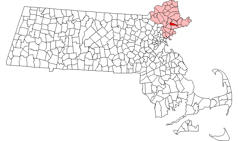
mapsize = 250px
map_caption = Location in Essex County in Massachusetts
mapsize1 =
map_caption1 =
subdivision_type = Country
subdivision_name =United States
subdivision_type1 = State
subdivision_name1 =Massachusetts
subdivision_type2 = County
subdivision_name2 = Essex
established_title = Settled
established_date = 1635
established_title2 = Incorporated
established_date2 = 1643
established_title3 =
established_date3 =
government_type =Open town meeting
leader_title =
leader_name =
leader_title1 =
leader_name1 =
area_magnitude =
area_total_km2 = 21.0
area_total_sq_mi = 8.1
area_land_km2 = 20.0
area_land_sq_mi = 7.7
area_water_km2 = 1.0
area_water_sq_mi = 0.4
population_as_of = 2000
settlement_type = Town
population_total = 4440
population_density_km2 = 222.1
population_density_sq_mi = 575.2
elevation_m = 32
elevation_ft = 105
timezone = Eastern
utc_offset = -5
timezone_DST = Eastern
utc_offset_DST = -4
latd = 42 |latm = 36 |lats = 15.15 |latNS = N
longd = 70 |longm = 53 |longs = 12.58 |longEW = W
website = http://www.wenhamma.gov/
postal_code_type = ZIP code
postal_code = 01984
area_code = 351 / 978
blank_name = FIPS code
blank_info = 25-74595
blank1_name = GNIS feature ID
blank1_info = 0619455
footnotes =Wenham is a town in Essex County,
Massachusetts ,United States . The population was 4,440 at the 2000 census. One of the inland communities part of the Metropolitan Area Planning Council's [http://www.mapc.org/metro_area/nstf.html North Shore Task Force] , but not often considered part of the North Shore in the strictest sense, as it does not border theAtlantic Ocean .History
Wenham was first settled in 1635 and officially incorporated in 1643.
Geography
According to the
United States Census Bureau , the town has a total area of 8.1square mile s (21.0km² ), of which, 7.7 square miles (20.0 km²) of it is land and 0.4 square miles (1.0 km²) of it (4.57%) is water.Wenham is bordered on the south by Beverly, on the east by Manchester, on the north by Hamilton, on the northwest by Topsfield, and on the west by Danvers.
Demographics
As of the
census GR|2 of 2000, there were 4,440 people, 1,285 households, and 957 families residing in the town. Thepopulation density was 575.2 people per square mile (222.1/km²). There were 1,320 housing units at an average density of 171.0/sq mi (66.0/km²). The racial makeup of the town was 97.84% White, 0.43% African American, 0.02% Native American, 1.35% Asian, 0.07% from other races, and 0.29% from two or more races. Hispanic or Latino of any race were 0.59% of the population.There were 1,285 households out of which 37.6% had children under the age of 18 living with them, 66.5% were married couples living together, 5.9% had a female householder with no husband present, and 25.5% were non-families. 22.5% of all households were made up of individuals and 15.6% had someone living alone who was 65 years of age or older. The average household size was 2.70 and the average family size was 3.19.
In the town the population was spread out with 22.0% under the age of 18, 23.6% from 18 to 24, 19.8% from 25 to 44, 20.5% from 45 to 64, and 14.1% who were 65 years of age or older. The median age was 34 years. For every 100 females there were 82.4 males. For every 100 females age 18 and over, there were 80.3 males.
The median income for a household in the town was $90,524, and the median income for a family was $98,004. Males had a median income of $76,639 versus $43,750 for females. The
per capita income for the town was $36,812. About 1.2% of families and 3.3% of the population were below thepoverty line , including 1.9% of those under age 18 and 5.1% of those age 65 or over.Education
Home to Gordon College, a private four year Christian college.Also home to
Buker Elementary School .Points of interest
*
Claflin-Richards House
*Grand Wenham Canal
*Wenham Lake
*Wenham Swamp
*West Wenham Notable residents
*
Bob Stanley , former Red Sox relief pitcherExternal links
* [http://www.wenhamma.gov/ Town of Wenham]
*Dodge, Richard. [http://www.salemdeeds.com/atlases_pages.asp?ImageName=WENHAM.jpg&atlastype=Atlases&atlastown=ESSEX+COUNTY&atlas=ESSEX+COUNTY+1795&atlas_desc=ESSEX+COUNTY+1795&pageprefix= 1795 Map of Wenham.] At the [http://www.salemdeeds.com Essex County Registry of Deeds] in
Salem .* Anderson, Philader. [http://www.salemdeeds.com/atlases_pages.asp?ImageName=WENHAM.jpg&atlastype=Atlases&atlastown=ESSEX+COUNTY&atlas=ESSEX+COUNTY+1830&atlas_desc=ESSEX+COUNTY+1830&pageprefix= 1831 Map of Wenham.]
* Beers, D.G. "1872 Atlas of Essex County". [http://www.salemdeeds.com/atlases_pages.asp?ImageName=PLATE_0095.jpg&atlastype=Atlases&atlastown=ESSEX+COUNTY&atlas=ESSEX+COUNTY+1872&atlas_desc=ESSEX+COUNTY+1872&pageprefix= Map of Wenham. plate 95.]
* Walker, George H. "1884 Atlas of Essex County". [http://www.salemdeeds.com/atlases_pages.asp?ImageName=PAGE_0087.jpg&atlastype=Atlases&atlastown=ESSEX+COUNTY&atlas=ESSEX+COUNTY+1884&atlas_desc=ESSEX+COUNTY+1884&pageprefix= Map of Wenham plate 87.]
* [http://docs.unh.edu/towns/WenhamMassachusettsMapList.htm Old USGS Maps of Wenham.]
* [http://video.google.com/videoplay?docid=6345657598676120676&q=Frederic+Tudor&hl=en "Frederic Tudor and the Massachusetts Ice Exchange"] , 10 minute video by Robby Griffin, Nick Hamlin, Eric Lundquist, created 2004. Mentions the high quality of the ice from Wenham.
Wikimedia Foundation. 2010.