- Boxford, Massachusetts
Infobox Settlement
official_name = Boxford, Massachusetts
nickname =
motto =
imagesize =
image_caption =
image_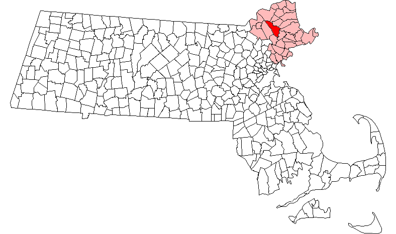
mapsize = 250px
map_caption = Location in Essex County in Massachusetts
mapsize1 =
map_caption1 =
subdivision_type = Country
subdivision_name =United States
subdivision_type1 = State
subdivision_name1 =Massachusetts
subdivision_type2 = County
subdivision_name2 = Essex
established_title = Settled
established_date = 1645
established_title2 = Incorporated
established_date2 = 1685
established_title3 =
established_date3 =
government_type =Open town meeting
leader_title =
leader_name =
leader_title1 =
leader_name1 =
area_magnitude =
area_total_km2 = 63.6
area_total_sq_mi = 24.6
area_land_km2 = 62.1
area_land_sq_mi = 24.0
area_water_km2 = 1.5
area_water_sq_mi = 0.6
population_as_of = 2000
settlement_type = Town
population_total = 7921
population_density_km2 = 127.6
population_density_sq_mi = 330.4
elevation_m = 29
elevation_ft = 95
timezone = Eastern
utc_offset = -5
timezone_DST = Eastern
utc_offset_DST = -4
latd = 42 |latm = 39 |lats = 40 |latNS = N
longd = 70 |longm = 59 |longs = 50 |longEW = W
website = http://www.town.boxford.ma.us/
postal_code_type = ZIP code
postal_code = 01921
area_code = 351 / 978
blank_name = FIPS code
blank_info = 25-07420
blank1_name = GNIS feature ID
blank1_info = 0618294
footnotes =Boxford is a town in Essex County,
Massachusetts ,United States . The population was 7,921 at the 2000 census.Part of the town comprises the
census-designated place of Boxford.History
Boxford was first settled in
1646 and was officially incorporated in1685 . The community takes its name from a town of the same name in theUnited Kingdom .Geography
According to the
United States Census Bureau , the town has a total area of 24.6square mile s (63.6km² ), of which, 24.0 square miles (62.1 km²) of it is land and 0.6 square miles (1.5 km²) of it (2.40%) is water.The highest natural point in Boxford is Bald Hill, at an elevation of 243 feet (74 meters). It sits in a corner of the Boxford State Forest, near the town's border with Middleton.
Boxford is a geographically large town with almost no commercial development. The town is traditionally divided into Boxford Village (commonly called East Boxford) and West Boxford Village, corresponding to the respective East and West Boxford centers. The "centers" of town each consist of a
Congregational church (First Congregational in Boxford and Second Congregational in West Boxford), ageneral store , alibrary , and afire department .The town is heavily forested, and criss-crossed by various brooks and streams. A number of ponds dot Boxford, among them Stiles Pond, Cedar Pond, Spofford Pond, Lowe Pond, Four Mile Pond and Baldpate Pond. Throughout town there are also a number of scenic hiking trails.
Demographics
As of the
census of 2000, there were 7,921 people, 2,568 households, and 2,254 families residing in the town. Thepopulation density was 330.4 people per square mile (127.6/km²). There were 2,610 housing units at an average density of 42.0 persons/km² (108.9 persons/sq mi). The racial makeup of the town was 97.37% White, 0.34%African American , 0.11% Native American, 1.21%Asia n, 0.03% Pacific Islander, 0.29% from other races, and 0.64% from two or more races. 0.85% of the population wereHispanic orLatino of any race.In 2008, approaching the 2010 census, the current population is slightly upwards of 9,000. Recent public Town budget discussions regarding the possibility of the need for future expansion of the elementary school facilities note that from all evidence, the Boxford Town populaton has leveled off enough for there to be no current need to address any need in the near future for expansion of either of the two Boxford Town elementary schools.
There were 2,568 households out of which 48.5% had children under the age of 18 living with them, 80.0% were married couples living together, 6.0% have a woman whose husband does not live with her, and 12.2% were non-families. 9.7% of all households were made up of individuals and 4.9% had someone living alone who was 65 years of age or older. The average household size was 3.08 and the average family size was 3.32.
In the town the population was spread out with 32.2% under the age of 18, 4.2% from 18 to 24, 25.8% from 25 to 44, 28.5% from 45 to 64, and 9.3% who were 65 years of age or older. The median age was 39 years. For every 100 females there were 98.9 males. For every 100 females age 18 and over, there were 94.8 males.
The median income for a household in the town was $113,212, and the median income for a family was $119,491. Males had a median income of $90,397 versus $48,042 for females. The
per capita income for the town was $48,846. 1.4% of the population and 0.8% of families were below the poverty line. Out of the total people living in poverty, 0.8% are under the age of 18 and 3.1% are 65 or olderEducation
Boxford has one high school,
Masconomet Regional High School . It is commonly believed to be in Topsfield because it has a TopsfieldPost Office box address. However, the school, which is located on Endicott Road, lies entirely within Boxford.There are also two elementary schools in Boxford. The Harry Lee Cole School, which serves Preschool through Grade 2, is located near East Boxford center. The Spofford Pond School, serving Grades 3 through 6, is located on the western side of the town's geographic center.
Points of interest
*Boxford State Forest, near Interstate 95 and the towns of Topsfield and Middleton, boasts numerous walking trails that weave through heavily forested areas.
*Commercial landmarks in and around town include Benson's Ice Cream, Paisley's Farm Stand and West Village Provisions in West Boxford center, Ingaldsby Farm, the Boxford Community store in East Boxford (also known as "Jack's" or "Wayne's", after its former and current owners), and the Boxford House of Pizza.
*"Witch Hollow Farm", formerly the home of one of those tried in the famous 1693 Salem Witch Trials, found at the intersection of Main Street and Ipswich Road in Boxford, is considered a nationally recognized "Haunted House"
*The Town has a retirement community called Four Mile Village, which sits adjacent to picturesque Four Mile Pond. The waiting list to get into this community is significant, and prospective applicants must either be former Boxford residents, or primary family members of current Boxford residents.
*Boxford's centrally located Stiles Pond is the site for the "Town Beach", where membership can be purchased by Boxford residents only, each season for a nominal fee through the Boxford Athletic Association (BAA). The adjacent ballpark and play area were recently designated by unanimous vote at Town Meeting as "Keith Koster Memorial Baseball Park" in memory of one of Boxford's beloved young people, a former Boxford beach lifeguard and baseball player, victim of a senseless act of crime in 2006.
*Camp Rotary is a popular summer co-ed boarding camp located on Stiles Pond off of Ipswich Road in Boxford.
*Danvers YMCA holds another popular summer day camp on Stiles Pond, next to the Town Beach.
*Camp Stepping Stone, a summer day camp for students with special needs, is also hosted just past the Danvers YMCA camp, also along the Stiles Pond Shoreline.
*Baldpate Pond is another popular swimming, fishing, boating, and hiking location.
*Boxford has two Town Libraries, in East Boxford and West Boxford. The East Boxford Library is housed in a previously private, renovated home, donated to the Town in the 1940s. The West Boxford Library branch is housed in what was previously an elementary school in West Boxford. Although longtime Boxford residents hold great affection for these buildings and libraries, in recent years it has been recognized that these buildings will outlive or have outlived their original functional purpose as libraries for the current population of Boxford. There is a current movement afoot, in the planning stages, to build a new, central Boxford Town Library.
Notable residents
*
Thomas Knowlton (1740–1776), American patriot who served as a Colonel in theContinental Army during theAmerican Revolution
*Rufus Porter (1792-1884), painter, designer of the Colt revolver, and founder ofScientific American
* Richard Smith (17th Century), Great grandfather of Joseph Smith, founder of Mormon church
*Sidney Perley (1858-1928), lawyer, writer, author, poet, historian.
* Norman Hassan (1958-) Drummer in the band UB40
*Debra Jo Rupp (1951-), Actress, best known for her role as Kitty Foreman in "That 70's Show "
*Mark Bavaro (1963-), former Pro BowlAmerican football player for the New York Giants [http://www.boston.com/sports/colleges/football/articles/2004/12/14/a_giant_among_us/]
*Carl Yastrzemski (1939-), former member of theBoston Red Sox and AmericanMajor League Baseball hall of famer. [http://www.gloucestertimes.com/pusports/etpsports_story_306145347.html]*
Johnny Bucyk (1935- ) Boston Bruins - Hall of Fame - Former team captain
*Raymond Bourque (1960- ) Boston Bruins - Hall of Fame - Former team captain
*Tim O'Brien (1946-) Author: "The Things They Carried" about the Vietnam WarReferences
*Perley, Sidney. [http://books.google.com/books?id=-7Jzk2EhcNgC&printsec=frontcover&dq=intitle:History+intitle:of+intitle:Essex+intitle:County&lr=&num=50&as_brr=0 History of Boxford, Essex County, Massachusetts.] Full images at books.google.Published 1880.
*Perley, Francis, Samuel Wood, Moses Carleton. [http://www.salemdeeds.com/atlases_pages.asp?ImageName=BOXFORD.jpg&atlastype=Atlases&atlastown=ESSEX+COUNTY&atlas=ESSEX+COUNTY+1795&atlas_desc=ESSEX+COUNTY+1795&pageprefix= 1795 Map of Boxford.]
*Dorman, Moses. [http://www.salemdeeds.com/atlases_pages.asp?ImageName=BOXFORD.jpg&atlastype=Atlases&atlastown=ESSEX+COUNTY&atlas=ESSEX+COUNTY+1830&atlas_desc=ESSEX+COUNTY+1830&pageprefix= 1830 Map of Boxford.]
*Beers, D.G. 1872 Atlas of Essex County [http://www.salemdeeds.com/atlases_pages.asp?ImageName=PLATE_0057.jpg&atlastype=Atlases&atlastown=ESSEX+COUNTY&atlas=ESSEX+COUNTY+1872&atlas_desc=ESSEX+COUNTY+1872&pageprefix= 1872 Map of Boxford. Plate 57.]
*Walker, George H. 1884 Atlas of Essex County [http://www.salemdeeds.com/atlases_pages.asp?ImageName=PAGE_0109.jpg&atlastype=Atlases&atlastown=ESSEX+COUNTY&atlas=ESSEX+COUNTY+1884&atlas_desc=ESSEX+COUNTY+1884&pageprefix= 1884 Map of Boxford. Plate 109.]
* [http://www.ma-vitalrecords.org/EssexCounty/Boxford/ Vital Records of Boxford to 1849.] Originally published by the Topsfield Historical Society in 1905. Transcribed and put online by John Slaughter and Jodi Salero 2007.
* [http://books.google.com/books?id=x62fbWH7bcQC&pg=PA41&dq=Sidney+Perley&lr= Boxford Town Records 1685-1706.] Transcribed by Sidney Perley in 1880. From page 41 of Volume 5 of "The Historical Collections of the Topsfield Historical Society". Published 1899. Full image and OCR at books.google.
*cite news |last=Burt |first=Bill |url=http://www.gloucestertimes.com/pusports/etpsports_story_306145347.html |title='67 Sox were there from start to finish |publisher=Gloucester Daily Times|date=2007-07-02 |accessdate=2007-07-11
*cite news |last=Goode |first=John |url=http://www.boston.com/sports/colleges/football/articles/2004/12/14/a_giant_among_us/ |title=A Giant Among Us |publisher=Boston.com|date=2004-12-14 |accessdate=2007-02-03External links
* [http://www.town.boxford.ma.us/ Town of Boxford]
Wikimedia Foundation. 2010.