- Nahant, Massachusetts
-
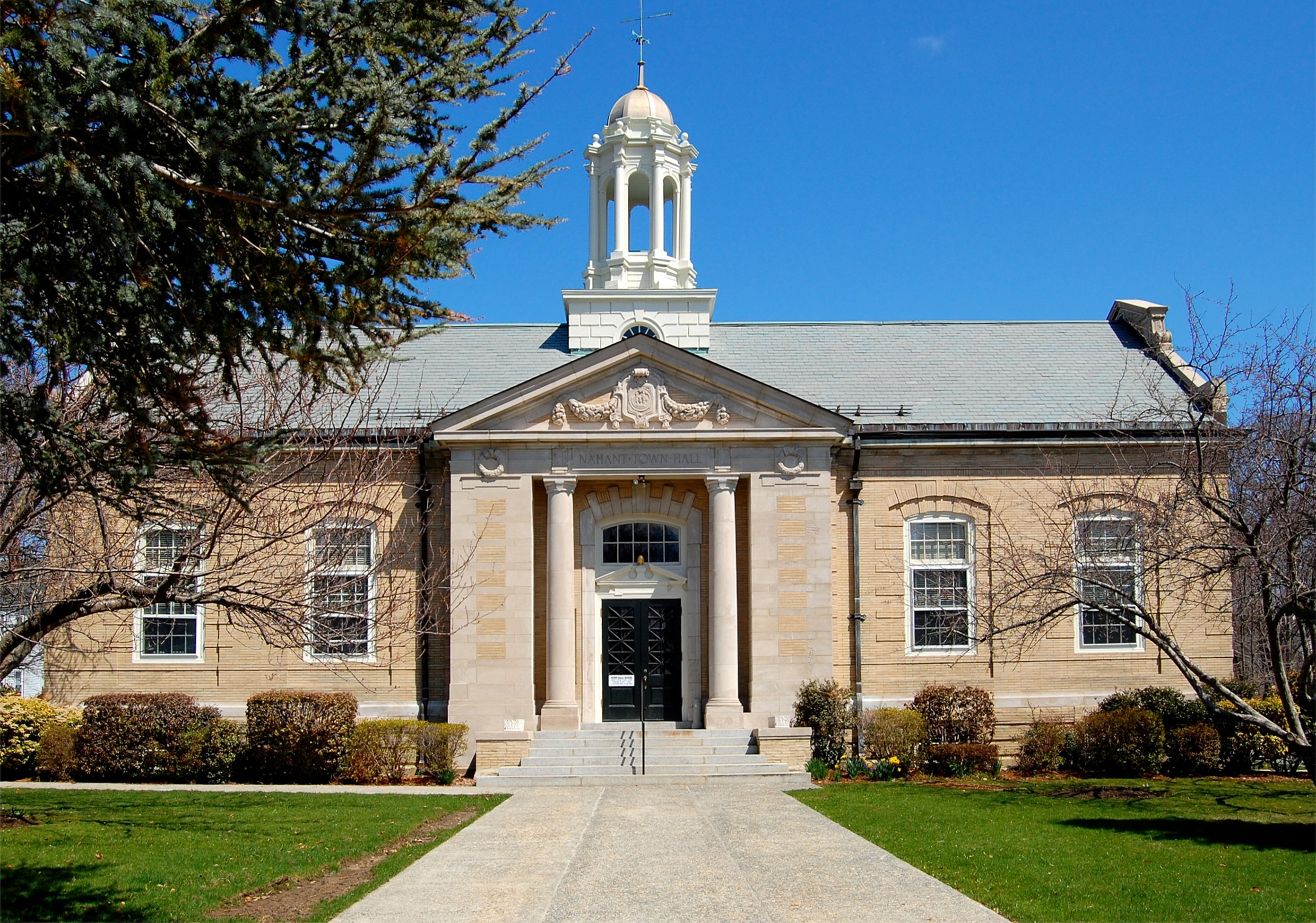
Nahant, Massachusetts — Town — Town Hall of Nahant

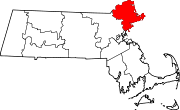
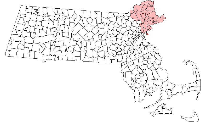
SealLocation in Essex County in Massachusetts
Coordinates: 42°25′35″N 70°55′10″W / 42.42639°N 70.91944°WCoordinates: 42°25′35″N 70°55′10″W / 42.42639°N 70.91944°W Country United States State Massachusetts County Essex Settled 1630 Incorporated 1853 Government – Type Open town meeting Area – Total 15.5 sq mi (40.1 km2) – Land 1.2 sq mi (3.2 km2) – Water 14.2 sq mi (36.9 km2) Elevation 50 ft (15 m) Population (2000) – Total 3,632 – Density 2,918.7/sq mi (1,126.9/km2) Time zone Eastern (UTC-5) – Summer (DST) Eastern (UTC-4) ZIP code 01908 Area code(s) 339 / 781 FIPS code 25-43580 GNIS feature ID 0618304 Website http://www.nahant.org/ Nahant (
 /nəˈhɑːnt/) is a town in Essex County, Massachusetts, United States. The population was 3,632 at the 2000 census. With just 1.2 square miles (3.1 km2) of land area, it is the smallest municipality by area in the state. It is primarily a residential community.
Contents
History
Native Americans called the area "Nahant," meaning "the point" or "almost an island." The original Indian name of the place, "Nahanten", signifies twins or two things united, referring to the two connected islands forming it.[1] Located on a rocky peninsula jutting into Massachusetts Bay, it was first settled in 1630, in the second year of the Puritan coming. The servants of Isaac Johnson grazed his cattle on the land, and it was also often used by citizens of Lynn for grazing cattle, sheep and goats. Before 1800 there were only three homes on the island those built by the Breeds and the Hoods, and the Johnson home built by Jeremiah Gray. The first hotel was built by one of the Johnsons 1802, and in 1817 a steamboat ran daily between Boston and Nahant. The town was originally part of Lynn; when the temperance movement threatened the summer resort trade in 1853, Nahant incorporated as a separate town. In the late 19th century, it was home to some of the country's first amusement parks, as well as a popular summer retreat for the wealthy, including the poet Henry Wadsworth Longfellow. During World War II, East Point was the site of a coastal artillery. It is now a town park, and location of the Marine Science Center for Northeastern University.
Development
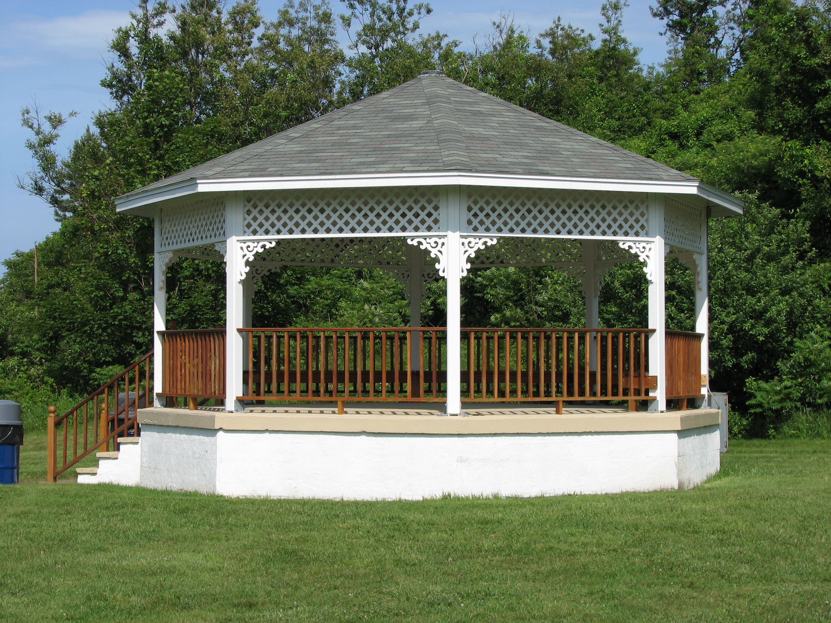
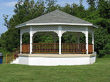 Calantha Sears' Gazebo
The old Nahant Life Saving Station (NLSS) on Nahant Road, and the new War Memorial erected across the street [from the NLSS] were renovated in 2004.
In 2003, the dilapidated Valley Road School was refurbished, and re-commissioned as the Nahant Community Center, which is now home to many local activities and banquets, including the local Boy Scout Troop 50.
On September 25, 2005, the Town of Nahant officially commemorated the completely rebuilt Bailey's Hill Gazebo, as the Calantha Sears Gazebo. The original was built for the bicentennial in 1976, and over the years had fallen into disrepair. With funding from the Woman's Club of Nahant, and collaboration with the town of Nahant, local residents contributed to its reconstruction. Close neighbor to Bailey's Hill, John Falat designed the architecture for the new structure. Local construction crew, J.P. Construction Company (based immediately adjacent to the park), rebuilt it during August and September 2005. Besides the cement base, the only remaining piece of the original is the wooden cylinder in the center of the roof, which still bears the "1976" emblem - repainted by Nahant local Octavia Randolph.
Geography and transportation
According to the United States Census Bureau, the town has a total area of 15.5 square miles (40 km2), of which, 1.2 square miles (3.1 km2) of it is land and 14.2 square miles (37 km2) of it (91.99%) is water. Originally connected to the mainland via a natural tombolo, Nahant is now a peninsula in Massachusetts Bay, connected to the city of Lynn by a causeway. The town is surrounded by Nahant Bay to the east, Nahant Harbor to the south, and Lynn Harbor to the west, all of which lead directly into Broad Sound and Massachusetts Bay. The town is essentially divided into the main portion and Little Nahant, just north of the main portion of town along the eastern side of the causeway. The area along the west side of town, between Black Rock Point and Bass Point, is the most densely settled part of town. There are ten beaches along the coastline, the largest being Nahant Beach and Long Beach, both of which line the eastern side of the causeway road north of Little Nahant. The town also has a few small parks and the Kelly Greens Golf Course.
Nahant is just one of four towns out of the 351 cities and towns in Massachusetts (along with Rockport, Provincetown and Aquinnah) that only touches one other town by land (Gosnold and Nantucket do not touch any). Only touching a 400-yard portion of Lynn by land, the water rights of the town also touch those of Revere, Winthrop and Boston, in Suffolk County. Both by land and by sea, Nahant is the southernmost town in Essex County. The town is centered fourteen miles by land northeast of Boston, nine miles south of Salem, and twenty-five miles southwest of Cape Ann.
The town has no state routes of any kind within town, one of fifteen in Massachusetts that share that distinction. The nearest state route is Route 129, within Lynn. The nearest highways are a highway portion of U.S. Route 1 in Saugus and Interstate 95 and Route 128 in Peabody. The only mass transit within town is Route 439 of the MBTA Bus system, which loops within town before passing back into Lynn, providing access to Central Square, home to a stop along the Newburyport/Rockport Line of the MBTA Commuter Rail, providing service between the North Shore and Boston's North Station. The nearest airport to town is Boston's Logan International Airport.
Demographics
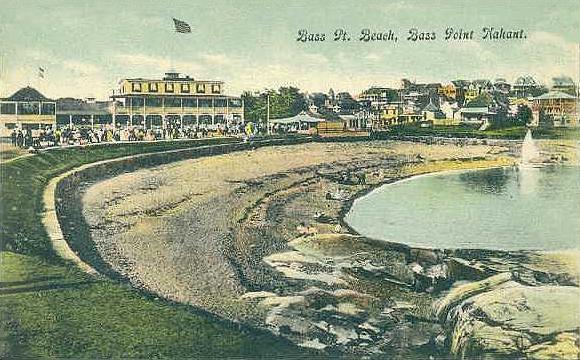
 Bass Point Beach in c. 1910
Historical populations Year Pop. ±% 1860 389 — 1870 475 +22.1% 1880 808 +70.1% 1890 880 +8.9% 1900 1,152 +30.9% 1910 1,184 +2.8% 1920 1,318 +11.3% 1930 1,654 +25.5% 1940 1,835 +10.9% 1950 2,679 +46.0% 1960 3,960 +47.8% 1970 4,119 +4.0% 1980 3,947 −4.2% 1990 3,828 −3.0% 2000 3,632 −5.1% 2001* 3,667 +1.0% 2002* 3,663 −0.1% 2003* 3,653 −0.3% 2004* 3,624 −0.8% 2005* 3,599 −0.7% 2006* 3,576 −0.6% 2007* 3,576 +0.0% 2008* 3,613 +1.0% 2009* 3,629 +0.4% 2010 3,410 −6.0% * = population estimate. Source: United States Census records and Population Estimates Program data.[2][3][4][5][6][7][8][9][10] As of the census[11] of 2000, there were 3,632 people, 1,629 households, and 970 families residing in the town. The population density was 2,918.7 people per square mile (1,130.9/km²). There were 1,704 housing units at an average density of 1,369.3 per square mile (530.6/km²). The racial makeup of the town was 97.11% White, 0.39% Black or African American, 0.08% Native American, 1.07% Asian, 0.06% Pacific Islander, 0.47% from other races, and 0.83% from two or more races. Hispanic or Latino of any race were 1.07% of the population.
There were 1,629 households out of which 22.5% had children under the age of 18 living with them, 49.4% were married couples living together, 7.8% had a female householder with no husband present, and 40.4% were non-families. 33.8% of all households were made up of individuals and 11.7% had someone living alone who was 65 years of age or older. The average household size was 2.20 and the average family size was 2.85.
In the town the population was spread out with 18.6% under the age of 18, 4.0% from 18 to 24, 28.0% from 25 to 44, 29.9% from 45 to 64, and 19.4% who were 65 years of age or older. The median age was 45 years. For every 100 females there were 91.2 males. For every 100 females age 18 and over, there were 86.7 males.
The median income for a household in the town was $64,052, and the median income for a family was $76,926. Males had a median income of $52,045 versus $46,522 for females. The per capita income for the town was $41,807. About 1.4% of families and 2.6% of the population were below the poverty line, including 2.7% of those under age 18 and 2.0% of those age 65 or over.
Education
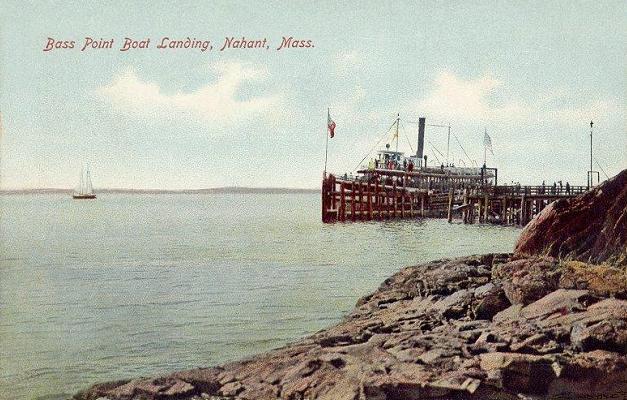
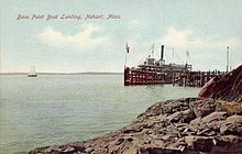 Bass Point Boat Landing in 1907
Nahant does not have a middle or high school. Students attend grades preschool through sixth at Johnson Elementary School in Nahant. For grades seven through twelve, students attend Swampscott Middle School (grades seven and eight) and Swampscott High School (grades nine through twelve).
Points of interest
- Nahant Historical Society Museum, located in the Nahant Community Center
- The beaches. Practically an island, Nahant has no shortage on beaches.
- Northeastern University, located at East Point, and home to Nahant's Observatory and Marine Science Center. Martin Scorsese filmed the lighthouse scenes for the movie Shutter Island starring Leonardo DiCaprio here in the summer of 2008.
- The World War II Bunkers. Located inside Trimountain, and East Point, they were initially designed to defend Boston Harbor and the surrounding waters from a possible attack during the war. During the cold war, the installation at East Point housed Nike missiles intended to stop a nuclear attack on Boston. The facility at Trimountain was for "aiming" the missiles.
- The site of the country's first lawn tennis game was played at East Point.
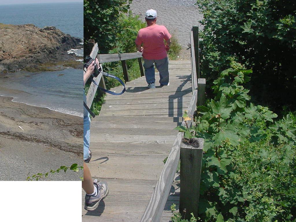
- Forty Steps - A wooden staircase, originally consisting of 40 steps, leading down to a pocket beach found heading towards East Point. This now has more than 40 steps due to beach erosion.
-

40 Steps
Annual events
- The annual Fourth of July fireworks, outside of Boston.[who?]
- Started in 1996, the annual Nahant Christmas Parade is one of the biggest celebrations the town of Nahant puts on.
- The Memorial Day Parade is a day of homecoming for former Nahant residents who gather each year to watch the festivities, which includes the playing of Taps at the cemetery, and cannon fire at Tudor Wharf.
- The Tudor Cocktail Ice Company sponsors the Annual Labor Day Weekend Block Party as a festive way for the townies to close out the Summer season and generously support community causes.
Image gallery
-

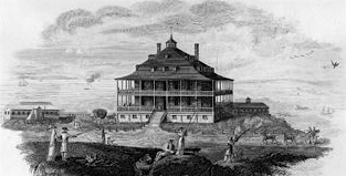
Nahant Hotel, from Boston Monthly Magazine, 1825. Engraving byJ.R. Penniman
-
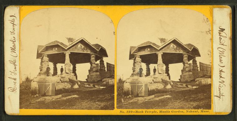
Maolis Garden, 19th c.
-
Maolis rock temple, 19th c.
-

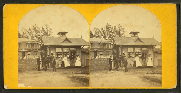
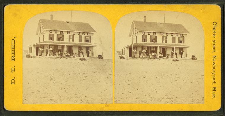
"Our House", 19th c.
-
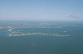
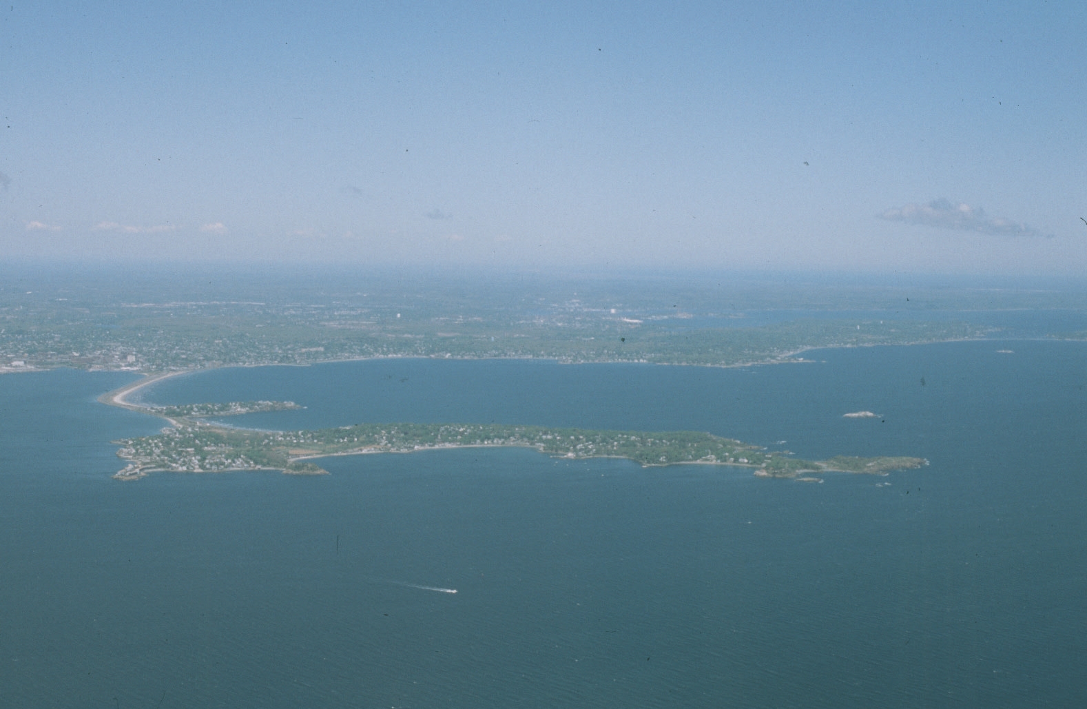
Nahant view from airplane
References
- ^ http://books.google.com/books?id=fuEXAQAAIAAJ&pg=PA87&lpg=PA87&dq=%22nahanten%22&source=bl&ots=0EvzXAKj4m&sig=PtY9yI4LQWmeobvsiuBY6E-3sBI&hl=en&ei=_f4YTKKIEIP-8Aap9bn9AQ&sa=X&oi=book_result&ct=result&resnum=5&ved=0CB8Q6AEwBA#v=onepage&q=%22nahanten%22&f=false
- ^ "TOTAL POPULATION (P1), 2010 Census Summary File 1, All County Subdivisions within Massachusetts". United States Census Bureau. http://factfinder2.census.gov/bkmk/table/1.0/en/DEC/10_SF1/P1/0400000US25.06000. Retrieved September 13, 2011.
- ^ "Massachusetts by Place and County Subdivision - GCT-T1. Population Estimates". United States Census Bureau. http://factfinder.census.gov/servlet/GCTTable?_bm=y&-geo_id=04000US25&-_box_head_nbr=GCT-T1&-ds_name=PEP_2009_EST&-_lang=en&-format=ST-9&-_sse=on. Retrieved July 12, 2011.
- ^ "1990 Census of Population, General Population Characteristics: Massachusetts". US Census Bureau. December 1990. Table 76: General Characteristics of Persons, Households, and Families: 1990. 1990 CP-1-23. http://www.census.gov/prod/cen1990/cp1/cp-1-23.pdf. Retrieved July 12, 2011.
- ^ "1980 Census of the Population, Number of Inhabitants: Massachusetts". US Census Bureau. December 1981. Table 4. Populations of County Subdivisions: 1960 to 1980. PC80-1-A23. http://www2.census.gov/prod2/decennial/documents/1980a_maABC-01.pdf. Retrieved July 12, 2011.
- ^ "1950 Census of Population". Bureau of the Census. 1952. Section 6, Pages 21-10 and 21-11, Massachusetts Table 6. Population of Counties by Minor Civil Divisions: 1930 to 1950. http://www2.census.gov/prod2/decennial/documents/23761117v1ch06.pdf. Retrieved July 12, 2011.
- ^ "1920 Census of Population". Bureau of the Census. Number of Inhabitants, by Counties and Minor Civil Divisions. Pages 21-5 through 21-7. Massachusetts Table 2. Population of Counties by Minor Civil Divisions: 1920, 1910, and 1920. http://www2.census.gov/prod2/decennial/documents/41084506no553ch2.pdf. Retrieved July 12, 2011.
- ^ "1890 Census of the Population". Department of the Interior, Census Office. Pages 179 through 182. Massachusetts Table 5. Population of States and Territories by Minor Civil Divisions: 1880 and 1890. http://www2.census.gov/prod2/decennial/documents/41084506no553ch2.pdf. Retrieved July 12, 2011.
- ^ "1870 Census of the Population". Department of the Interior, Census Office. 1872. Pages 217 through 220. Table IX. Population of Minor Civil Divisions, &c. Massachusetts. http://www2.census.gov/prod2/decennial/documents/1870e-05.pdf. Retrieved July 12, 2011.
- ^ "1860 Census". Department of the Interior, Census Office. 1864. Pages 220 through 226. State of Massachusetts Table No. 3. Populations of Cities, Towns, &c.. http://www2.census.gov/prod2/decennial/documents/1860a-08.pdf. Retrieved July 12, 2011.
- ^ "American FactFinder". United States Census Bureau. http://factfinder.census.gov. Retrieved 2008-01-31.
External links
- Town of Nahant
- Marine Science Center for Northeastern University
- Nahant Historical Society
- Frederic Tudor and the Massachusetts Ice Exchange, 10 minute video by Robby Griffin, Nick Hamlin, Eric Lundquist, created 2004.
Municipalities and communities of Essex County, Massachusetts Cities Amesbury | Beverly | Gloucester | Haverhill | Lawrence | Lynn | Methuen | Newburyport | Peabody | Salem
Towns Andover | Boxford | Danvers | Essex | Georgetown | Groveland | Hamilton | Ipswich | Lynnfield | Manchester-by-the-Sea | Marblehead | Merrimac | Middleton | Nahant | Newbury | North Andover | Rockport | Rowley | Salisbury | Saugus | Swampscott | Topsfield | Wenham | West Newbury
CDPs Other
villagesAnnisquam | Ballardvale | Beverly Farms | Bradford | Byfield | Clifton | Plum Island
Categories:- Populated coastal places in Massachusetts
- Nahant, Massachusetts
- Populated places established in 1630

Wikimedia Foundation. 2010.