- Marblehead, Massachusetts
-
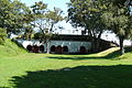
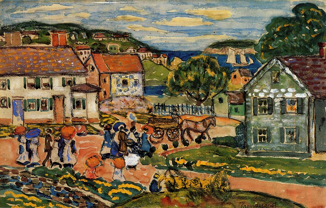
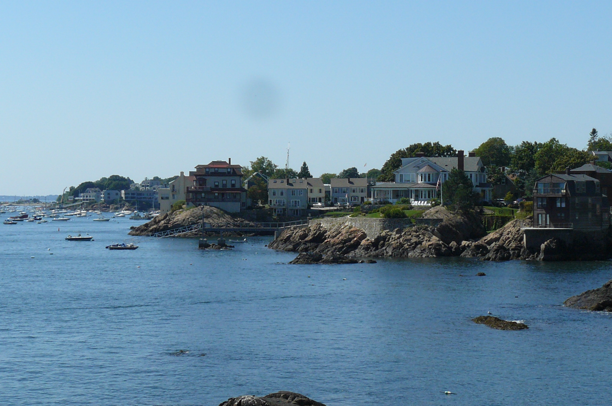
Marblehead, Massachusetts — Town — Marblehead Neck as viewed from the Landing on State Street.

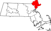
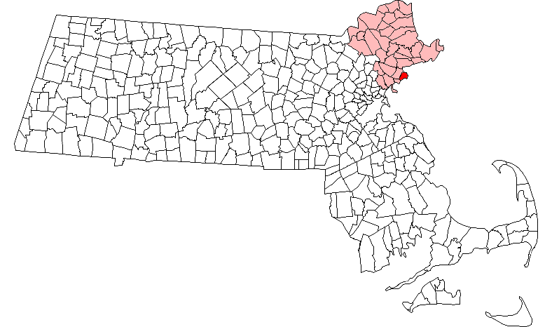
SealLocation in Essex County in Massachusetts
Coordinates: 42°30′00″N 70°51′30″W / 42.5°N 70.85833°WCoordinates: 42°30′00″N 70°51′30″W / 42.5°N 70.85833°W Country United States State Massachusetts County Essex Settled 1629 Incorporated 1639 Government – Type Open town meeting Area – Total 19.6 sq mi (50.8 km2) – Land 4.5 sq mi (11.7 km2) – Water 15.1 sq mi (39.1 km2) Elevation 65 ft (20 m) Population (2010) – Total 19,808 – Density 4,401.7/sq mi (1,693.0/km2) Time zone Eastern (UTC-5) – Summer (DST) Eastern (UTC-4) ZIP code 01945 Area code(s) 339 / 781 FIPS code 25-38400 GNIS feature ID 0618300 Website http://www.marblehead.org Town Website Marblehead is a town in Essex County, Massachusetts, United States. The population was 19,808 at the 2010 census. It is home to the Marblehead Neck Wildlife Sanctuary and Devereux Beach. A town with roots in both commercial fishing and yachting, locals allege that Marblehead is the birthplace of the American Navy, Marine Corps Aviation, and a yachting capital of the United States.
Contents
History
Marblehead was first settled as a plantation of Salem in 1629 by John Peach Sr., then set off and incorporated in 1649. Originally called Massebequash after the river which ran between it and Salem, the land was inhabited by the Naumkeag tribe of Indians under the sachem, Nanepashemet. But epidemics in 1615–1619 and 1633, believed to be smallpox, devastated the tribe. Heirs of Nanepashemet would sell their 3,700 acres (15 km2) on September 16, 1684, the deed preserved today at the town hall.
At times called Marvell Head, Marble Harbour (by Captain John Smith) and Foy (by immigrants from Fowey, Cornwall), the town would be named Marblehead by settlers who mistook its granite ledges for marble. It began as a fishing village with narrow, crooked streets, and grew inland from the harbor. The shoreline smelled of drying fish, typically cod, which were exported abroad and to Salem. The town peaked economically just prior to the Revolution, as locally financed privateering vessels pirated the seas for bounty from large European ships. Much early architecture survives from the era, including the Jeremiah Lee Mansion.
A large percentage of residents became involved early in the fight for American freedom, and the sailors of Marblehead are generally recognized by scholars as forerunners of the American Navy. The first vessel commissioned for the navy, the Hannah, was equipped with cannons, rope, provision (including the indigenous "Joe Frogger" molasses/sea water cookie)—and a crew from Marblehead. With their nautical backgrounds, soldiers from Marblehead, under General John Glover were instrumental in the escape of the Continental army after the Battle of Long Island, and Marblehead men ferried George Washington across the Delaware River for his attack on Trenton. Many who set out for war, however, did not return. Indeed, the community lost a substantial portion of its population and economy, although it was still the tenth largest inhabited location in the United States at the first census, in 1790.[1] After the conflict, fishing would remain important, with 98 vessels (95 of which exceeded 50 tons) putting to sea in 1837. But a gale or hurricane at the Grand Banks of Newfoundland on September 19, 1846 sank 11 vessels and damaged others. With 65 men and boys lost in the storm, the town's fishing industry began a decline.
During the late 19th century, Marblehead experienced a short-term boom from shoe-making factories. At the same time, the exceptional harbor attracted yachting and yacht clubs. It would become home to the Boston Yacht Club, Corinthian Yacht Club, Eastern Yacht Club, Marblehead Yacht Club, Dolphin Yacht Club, and the oldest junior yacht club in America, the Pleon Yacht Club.
After World War II, the town enjoyed a population boom, as a bedroom community for Boston, Lynn and Salem. This boom ended around 1970 when the town became built out.
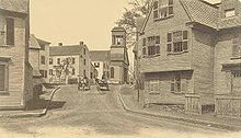
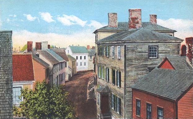
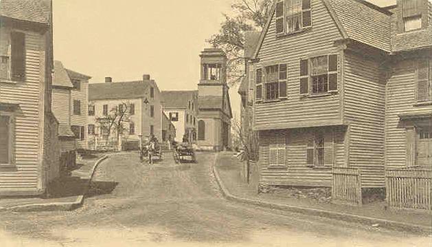
-

Front Street in 1914
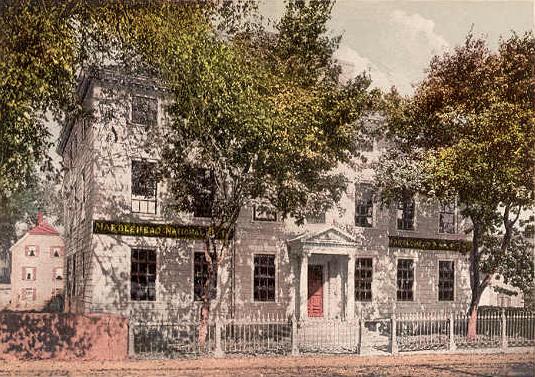
-
Lee Mansion in c. 1905
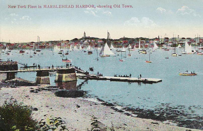
-
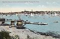
The Harbor in 1908
-
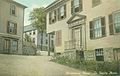
Lafayette House, c. 1908
Geography and transportation
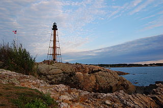 Marblehead Light, at the northern tip of Marblehead Neck
Marblehead is located at 42°29′49″N 70°51′47″W / 42.49694°N 70.86306°W (42.497146, -70.863236).[2] According to the United States Census Bureau, the town has a total area of 19.6 square miles (50.8 km²), of which, 4.5 square miles (11.7 km²) of it is land and 15.1 square miles (39.1 km²) of it (76.92%) is water. Marblehead is situated on the North Shore of Massachusetts along Massachusetts Bay and Salem Harbor. The town consists of rocky peninsula that extends into the bay, with a neck connected by a long sandbar. This ring of land defines Marblehead's deep, sheltered harbor. Marblehead Neck is home to a bird sanctuary, as well as Castle Rock and Chandler Hovey Park at its northern tip, where Marblehead Light is located. The town was once home to two forts, Fort Miller at Naugus Head along Salem Harbor, and Fort Sewall, at the western edge of the mouth of Marblehead Harbor. The town land also includes several small islands in Massachusetts Bay and Dolliber Cove, the area between Peaches Point and Fort Sewall. The town is partially divided from Salem by the Forest River, and is also home to several small ponds. Keeping with the town's location, there are four beaches (one in Dolliber Cove, one in Marblehead Harbor, and two along the southern shore of town), as well as six yacht clubs and several boat ramps.
Besides Marblehead Neck, there are also two other villages within town, Devereux to the southeast and Clifton to the southwest. Given its small area, most of the residential land in town is closely packed. Marblehead's town center is located approximately four miles from the center of Salem, sixteen miles northeast of Boston and twelve miles (19 km) southwest of Cape Ann. It is bordered by Swampscott to the south, and Salem to the northwest. (Because Salem's water rights extend into Massachusetts Bay, there is no connection between Marblehead and the city of Beverly across Beverly Harbor.)
Marblehead is home to the eastern termini of Route 114 and Route 129, which both terminate at the intersection of Atlantic and Ocean Avenues. Route 114 heads west into Salem, while Route 129 heads south along Atlantic Avenue into Swampscott towards Lynn. There are no highways within town, with the nearest access being to Route 128 in Peabody and Beverly. Two routes of MBTA Bus service pass through town regularly, with weekend service extending to Wonderland in Revere. The Newburyport/Rockport Line of the MBTA Commuter Rail passes through neighboring Salem, with service between the North Shore and Boston's North Station. The nearest air service is located at Beverly Municipal Airport, with the nearest national and international service at Boston's Logan International Airport. Seasonal ferry service to Boston can also be found in Salem.
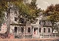
Demographics
 Old Bowen House in c. 1905
Historical populations Year Pop. ±% 1850 6,167 — 1860 7,646 +24.0% 1870 7,703 +0.7% 1880 7,467 −3.1% 1890 8,202 +9.8% 1900 7,582 −7.6% 1910 7,338 −3.2% 1920 7,324 −0.2% 1930 8,668 +18.4% 1940 10,856 +25.2% 1950 13,765 +26.8% 1960 18,521 +34.6% 1970 21,295 +15.0% 1980 20,126 −5.5% 1990 19,971 −0.8% 2000 20,377 +2.0% 2001* 20,480 +0.5% 2002* 20,424 −0.3% 2003* 20,317 −0.5% 2004* 20,084 −1.1% 2005* 19,959 −0.6% 2006* 19,804 −0.8% 2007* 19,784 −0.1% 2008* 19,872 +0.4% 2009* 19,959 +0.4% 2010 19,808 −0.8% * = population estimate.
Source: United States Census records and Population Estimates Program data.[3][4][5][6][7][8][9][10][11][12]As of the census[13] of 2000, there were 20,377 people, 8,541 households, and 5,679 families residing in the town. The population density was 4,498.9 people per square mile (1,736.8/km²). There were 8,906 housing units at an average density of 1,966.3 per square mile (759.1/km²). The racial makeup of the town was 97.56% White, 0.44% Black or African American, 0.08% Native American, 0.98% Asian, 0.03% Pacific Islander, 0.19% from other races, and 0.73% from two or more races. Hispanic or Latino of any race were 0.88% of the population.
There were 8,541 households out of which 31.2% had children under the age of 18 living with them, 56.5% were married couples living together, 8.0% had a female householder with no husband present, and 33.5% were non-families. 28.7% of all households were made up of individuals and 10.7% had someone living alone who was 65 years of age or older. The average household size was 2.37 and the average family size was 2.94.
In the town the population was spread out with 23.9% under the age of 18, 3.5% from 18 to 24, 28.0% from 25 to 44, 29.0% from 45 to 64, and 15.6% who were 65 years of age or older. The median age was 42 years. For every 100 females there were 89.3 males. For every 100 females age 18 and over, there were 84.3 males.
According to a 2009 estimate,[14] the median income for a household in the town was $97,441, and the median income for a family was $129,968. Males had a median income of $70,470 versus $44,988 for females. The per capita income for the town was $46,738. About 3.2% of families and 4.3% of the population were below the poverty line, including 5.7% of those under age 18 and 4.6% of those age 65 or over.
Education
Marblehead Public Schools oversees eight schools: Bell School, Coffin School, Eveleth School, Gerry School, Glover School, Village School, Marblehead Veterans Middle School, and Marblehead High School.[15] The town is also home to the Marblehead Community Charter Public School, the first Commonwealth charter school to open in Massachusetts.
Points of interest
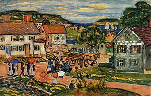
 View from Rockmere Point, ca. 1905
- Crocker Park, the gift of Uriel Crocker
- Crowninshield (Brown's) Island
- Devereux Beach
- Herreshoff Castle
- Marblehead Neck Wildlife Sanctuary [1]
- The Driftwood
- Old Burial Hill
- The Lighthouse
- Pleon Yacht Club, the oldest junior yacht club in the United States. [2]
- Castle Rock Park [3]
Historical Sites and Museums
- Abbot Hall (1877), containing The Spirit of '76 by Archibald MacNeal Willard
- Fort Sewall (1644)
- Frost Folk Art Museum
- G.A.R. & Civil War Museum
- King Hooper Mansion (1768)
- Jeremiah Lee Mansion (1768)
- Pride Rock (Conservation Land)
- St. Michael's Church (1714)
- William L. Hammond Park (formally recognized as the birthplace of Marine Corps Aviation, 1977)
Notable residents
- Keith Ablow, psychiatrist, writer and was host/executive producer of the The Dr. Keith Ablow Show
- Frank Black, contemporary musician and former member of the Pixies
- Sheldon Brown, bicycle mechanic and author of books on cycling
- W. Starling Burgess, yacht designer & aircraft manufacturer
- Uriel Crocker, publisher, businessman
- Susan Estrich, lawyer, professor, author, political operative
- Shalane Flanagan, American-record holding distance runner and bronze medalist at the 2008 olympic games in Beijing
- Elbridge Gerry, 5th Vice President of the United States
- Julia Glass, novelist
- John Glover, Revolutionary War general
- Tyler Hamilton, cyclist
- Ted Hood, yachtsman, America's Cup winner
- Katherine Howe, novelist
- Ada Louise Huxtable, architecture critic
- Ruth Edna Kelley, author
- Harry Kemelman, novelist
- Peter Lynch, investor, author
- John Nestor, blog author, boatbuilder
- Rhod Sharp, BBC Radio presenter of Up All Night
- Joseph Story, Supreme Court justice
- Cory Schneider, Vancouver Canucks goaltender
- Dave Silverman, Atheist activist
Arts
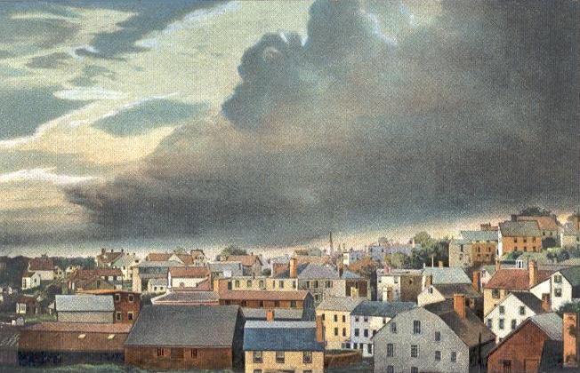
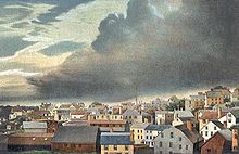 Thunderstorm in c. 1910
Movies filmed in Marblehead include:
- Home Before Dark (1958)
- Coma (1974)
- The Witches of Eastwick (1986)
- The Good Son (1993)
- Hocus Pocus (1993)
- Autumn Heart (2000)
- Treading Water (2001)
- Moonlight Mile (2002)
- What's the Worst That Could Happen? (although filmed in Manchester-by-the-Sea, scenes are said to be set in town)
- The Company Men (2010)
- Grown Ups (2010)
H. P. Lovecraft based his fictional Massachusetts town Kingsport on Marblehead. The real Marblehead, as well as Lovecraft himself, appears in the 1985 Richard A. Lupoff novel Lovecraft's Book. It also features in the eponymous 1978 Marblehead by Joan Thompson.
Lovecraft once visited Marblehead in December 1922 and described his voyage as:
- "…the most powerful single emotional climax experienced during my nearly forty years of existence. In a flash all the past of New England--all the past of Old England—all the past of Anglo-Saxondom and the Western World—swept over me and identified me with the stupendous totality of all things in such a way as it never did before and never did again. That was the high tide of my life.".[16]
Author Ben Sherwood set his novel The Death and Life of Charlie St. Cloud in Marblehead, featuring the Waterside Cemetery. For the 2010 film adaptation starring Zac Efron and Charlie Tahan, Vancouver was used as a stand-in due to a large cost of shooting.
Harry Kemelman wrote a series of mystery novels around a character, "Rabbi Small", who solves various murder cases in a town very similar to Marblehead, nicknamed "Barnard's Crossing". Kemelman lived in Marblehead for 50 years.
Robert B. Parker supposedly based the fictional town of Paradise on Marblehead in his Jesse Stone book series, going so far as to include the annual Race Week yachting event.
Contemporary photographs of Marblehead
-

Seaside view from Fort Sewall
-
Inside Fort Sewall
-

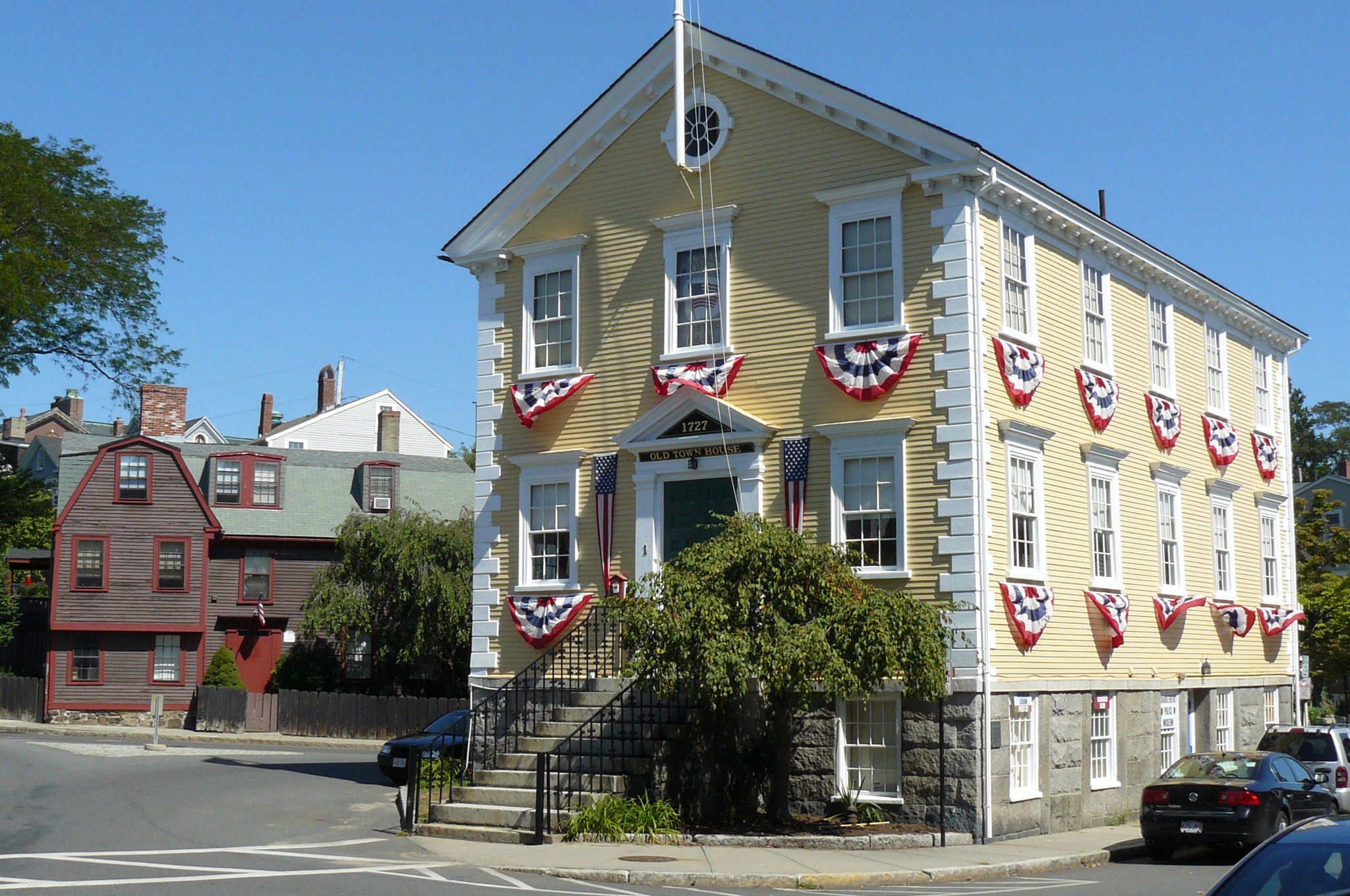
Old Town House
-

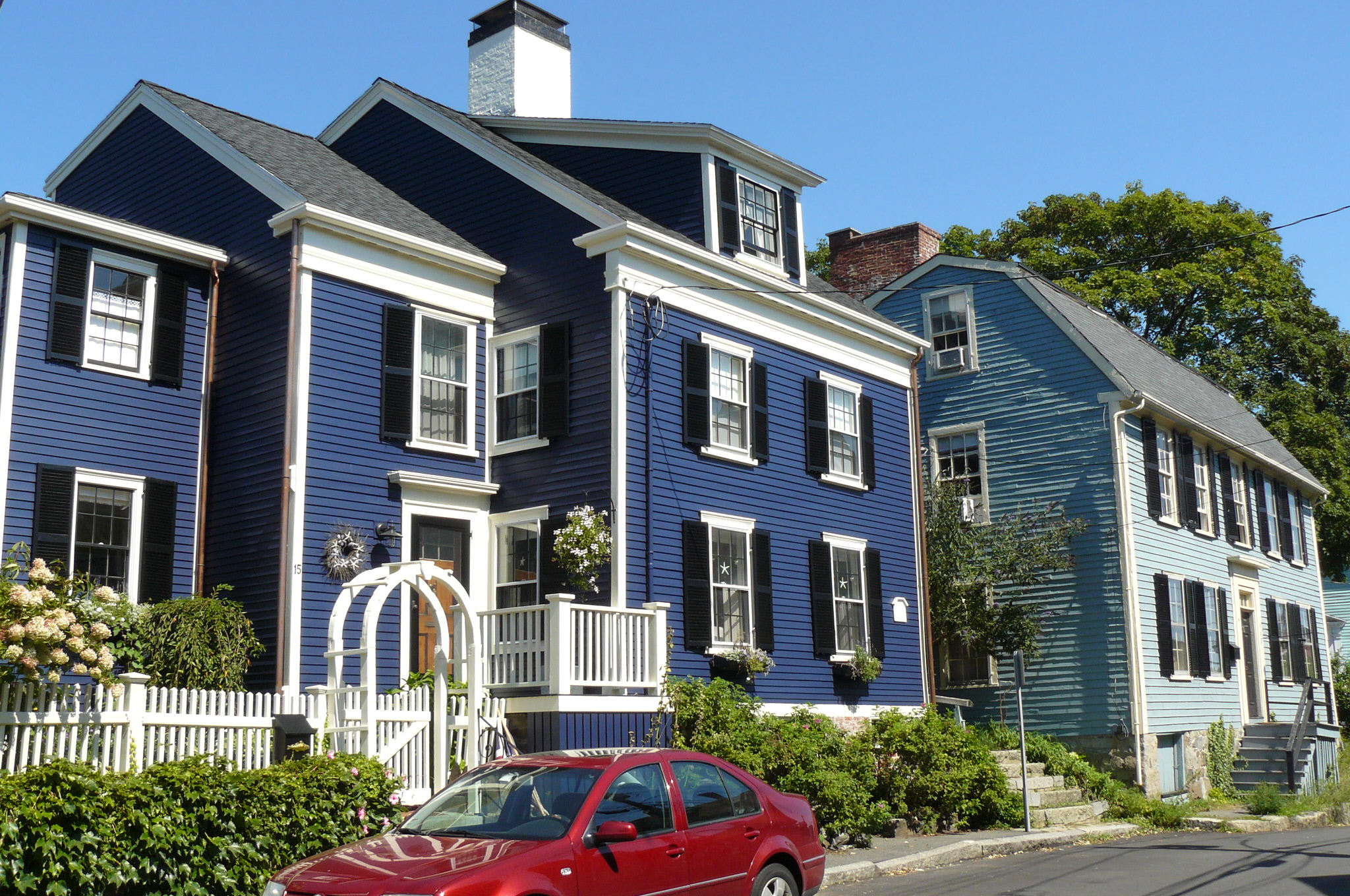
Homes on Washington Street
References
- ^ "Population of the 24 Urban Places: 1790". United States Bureau of the Census. June 15, 1998. http://www.census.gov/population/www/documentation/twps0027/tab02.txt. Retrieved September 8, 2011.
- ^ "US Gazetteer files: 2010, 2000, and 1990". United States Census Bureau. 2011-02-12. http://www.census.gov/geo/www/gazetteer/gazette.html. Retrieved 2011-04-23.
- ^ "TOTAL POPULATION (P1), 2010 Census Summary File 1, All County Subdivisions within Massachusetts". United States Census Bureau. http://factfinder2.census.gov/bkmk/table/1.0/en/DEC/10_SF1/P1/0400000US25.06000. Retrieved September 13, 2011.
- ^ "Massachusetts by Place and County Subdivision - GCT-T1. Population Estimates". United States Census Bureau. http://factfinder.census.gov/servlet/GCTTable?_bm=y&-geo_id=04000US25&-_box_head_nbr=GCT-T1&-ds_name=PEP_2009_EST&-_lang=en&-format=ST-9&-_sse=on. Retrieved July 12, 2011.
- ^ "1990 Census of Population, General Population Characteristics: Massachusetts". US Census Bureau. December 1990. Table 76: General Characteristics of Persons, Households, and Families: 1990. 1990 CP-1-23. http://www.census.gov/prod/cen1990/cp1/cp-1-23.pdf. Retrieved July 12, 2011.
- ^ "1980 Census of the Population, Number of Inhabitants: Massachusetts". US Census Bureau. December 1981. Table 4. Populations of County Subdivisions: 1960 to 1980. PC80-1-A23. http://www2.census.gov/prod2/decennial/documents/1980a_maABC-01.pdf. Retrieved July 12, 2011.
- ^ "1950 Census of Population". Bureau of the Census. 1952. Section 6, Pages 21-10 and 21-11, Massachusetts Table 6. Population of Counties by Minor Civil Divisions: 1930 to 1950. http://www2.census.gov/prod2/decennial/documents/23761117v1ch06.pdf. Retrieved July 12, 2011.
- ^ "1920 Census of Population". Bureau of the Census. Number of Inhabitants, by Counties and Minor Civil Divisions. Pages 21-5 through 21-7. Massachusetts Table 2. Population of Counties by Minor Civil Divisions: 1920, 1910, and 1920. http://www2.census.gov/prod2/decennial/documents/41084506no553ch2.pdf. Retrieved July 12, 2011.
- ^ "1890 Census of the Population". Department of the Interior, Census Office. Pages 179 through 182. Massachusetts Table 5. Population of States and Territories by Minor Civil Divisions: 1880 and 1890. http://www2.census.gov/prod2/decennial/documents/41084506no553ch2.pdf. Retrieved July 12, 2011.
- ^ "1870 Census of the Population". Department of the Interior, Census Office. 1872. Pages 217 through 220. Table IX. Population of Minor Civil Divisions, &c. Massachusetts. http://www2.census.gov/prod2/decennial/documents/1870e-05.pdf. Retrieved July 12, 2011.
- ^ "1860 Census". Department of the Interior, Census Office. 1864. Pages 220 through 226. State of Massachusetts Table No. 3. Populations of Cities, Towns, &c.. http://www2.census.gov/prod2/decennial/documents/1860a-08.pdf. Retrieved July 12, 2011.
- ^ "1850 Census". Department of the Interior, Census Office. 1854. Pages 338 through 393. Populations of Cities, Towns, &c.. http://www2.census.gov/prod2/decennial/documents/1850c-11.pdf. Retrieved July 12, 2011.
- ^ "American FactFinder". United States Census Bureau. http://factfinder.census.gov. Retrieved 2008-01-31.
- ^ "factfinder.census.gov". http://factfinder.census.gov/servlet/ACSSAFFFacts?_event=ChangeGeoContext&geo_id=06000US2500938400&_geoContext=01000US%7C04000US25%7C05000US25017%7C06000US2501735215&_street=&_county=marblehead&_cityTown=marblehead&_state=04000US25&_zip=&_lang=en&_sse=on&ActiveGeoDiv=geoSelect&_useEV=&pctxt=fph&pgsl=010&_submenuId=factsheet_1&ds_name=ACS_2007_3YR_SAFF&_ci_nbr=null&qr_name=null®=null%3Anull&_keyword=&_industry=.
- ^ "Marblehead Public Schools". Marblehead Public Schools. http://www.marblehead.com/schools/. Retrieved 2007-12-03.
- ^ H. P. Lovecraft, Selected Letters Vol. 3, pp. 126-127; cited in Joshi and Schultz, An H. P. Lovecraft Encyclopedia, p. 92.
- History and Traditions of Marblehead by Samuel Roads, Published 1880, 390 pages.
External links
- Town of Marblehead
- Historic Marblehead - Audio walking tour
- 1912 Marblehead Atlas.
- 1881 Atlas of Marblehead published by Hopkins.
- 1897 Atlas of Salem, Danvers, Peabody, and Marblehead.
Municipalities and communities of Essex County, Massachusetts Cities Amesbury | Beverly | Gloucester | Haverhill | Lawrence | Lynn | Methuen | Newburyport | Peabody | Salem
Towns Andover | Boxford | Danvers | Essex | Georgetown | Groveland | Hamilton | Ipswich | Lynnfield | Manchester-by-the-Sea | Marblehead | Merrimac | Middleton | Nahant | Newbury | North Andover | Rockport | Rowley | Salisbury | Saugus | Swampscott | Topsfield | Wenham | West Newbury
CDPs Other
villagesAnnisquam | Ballardvale | Beverly Farms | Bradford | Byfield | Clifton | Plum Island
Categories:- Marblehead, Massachusetts
- Populated coastal places in Massachusetts
- Towns in Essex County, Massachusetts
- Populated places established in 1629
- Port settlements in the United States
-


Wikimedia Foundation. 2010.