- Baltimore
-
This article is about the city in Maryland. For the surrounding county, see Baltimore County, Maryland. For other uses, see Baltimore (disambiguation).
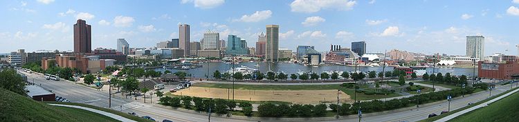
City of Baltimore — Independent city — Baltimore skyline from the Inner Harbor

Flag
SealNickname(s): Charm City,[1] Mobtown,[2] B'more,[3] The City of Firsts,[4][5] Monument City,[6] Ravenstown[7] Motto: "The Greatest City in America",[1]
"Get in on it."[1]
"The city that reads."[8]Location of Baltimore in Maryland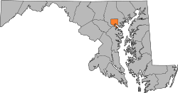 Location of Baltimore in the United States
 City of Baltimore
Coordinates: 39°17′N 76°37′W / 39.283°N 76.617°WCoordinates: 39°17′N 76°37′W / 39.283°N 76.617°W Country United States State Maryland Founded 1729 Incorporation 1797 Named for Cecilius Calvert, 2nd Baron Baltimore Government – Type Independent city – Mayor Stephanie C. Rawlings-Blake (D) – Baltimore City Council Council members– Houses of Delegates Delegates– State Senate State senators– U.S. House RepresentativesArea[9] – Independent city 92.052 sq mi (238.4 km2) – Land 80.944 sq mi (209.6 km2) – Water 11.108 sq mi (28.8 km2) 12.07% Elevation[10] 33 ft (10 m) Population (2010)[11][12] – Independent city 620,961 – Density 7,671.5/sq mi (2,962.6/km2) – Metro 2,690,886 (20th) – Demonym Baltimorean Time zone EST (UTC-5) – Summer (DST) EDT (UTC-4) ZIP Code 21201–21231, 21233–21237, 21239–21241, 21244, 21250–21252, 21263–21265, 21268, 21270, 21273–21275, 21278–21290, 21297–21298 FIPS code 24-04000 GNIS feature ID 0597040 Website www.BaltimoreCity.gov Baltimore (
 /ˈbɒltɨmɔr/, colloquially /ˈbɔl.mɔr/) is the largest independent city in the United States and the largest city and cultural center of the US state of Maryland. The city is located in central Maryland along the tidal portion of the Patapsco River,[13] an arm of the Chesapeake Bay. Baltimore is sometimes referred to as Baltimore City in order to distinguish it from surrounding Baltimore County. Founded in 1729, Baltimore is the largest U.S. seaport in the Mid-Atlantic and is situated closer to major Midwestern markets than any other major seaport on the East Coast.[14] Baltimore's Inner Harbor was once the second leading port of entry for immigrants to the United States and a major manufacturing center. After a decline in manufacturing, like most other major American coastal cities, Baltimore shifted to a service-oriented economy. The city is home to the National Aquarium, the Maryland Science Center, Harborplace, the Baltimore Orioles and the Baltimore Ravens.
At 620,961 in 2010,[12] Baltimore city's population has been decreasing considerably since the 1970s. The Baltimore Metropolitan Area has approximately 2.7 million residents; the 21st largest in the country. Baltimore is also the largest city in the surrounding associated combined statistical area of approximately 8.4 million residents.[15]
The city is named after Lord Baltimore, a member of the Irish House of Lords and the founding proprietor of the Maryland Colony. Baltimore himself took his title from a place in Bornacoola parish, County Leitrim and County Longford, Ireland.[16] Baltimore is an anglicized form of the Irish Baile an Tí Mhóir, meaning "Town of the Big House",[17] not to be confused with Baltimore, County Cork, the Irish name of which is Dún na Séad.[18]
Contents
History
Main article: History of BaltimoreThe Maryland colonial General Assembly created the Port of Baltimore at Locust Point in 1706 for the tobacco trade. The Town of Baltimore was founded on July 30, 1729, and is named after Lord Baltimore (Cecilius Calvert), who was the first Proprietary Governor of the Province of Maryland. Cecilius Calvert was a son of George Calvert, who became the First Lord Baltimore of County Cork, Ireland in 1625.[19] Baltimore grew swiftly in the 18th century as a granary for sugar-producing colonies in the Caribbean. The profit from sugar encouraged the cultivation of cane and the importation of food.

Baltimore played a key part in events leading to and including the American Revolution. City leaders such as Jonathan Plowman Jr. moved the city to join the resistance to British taxes and merchants signed agreements to not trade with Britain.[20] The Second Continental Congress met in the Henry Fite House from December 1776 to February 1777, effectively making the city the capitol of the United States during this period.[21] After the war, the Town of Baltimore, nearby Jonestown, and an area known as Fells Point were incorporated as the City of Baltimore in 1796. The city remained a part of Baltimore County until 1851 when it was made an independent city.[22]
The city was the site of the Battle of Baltimore during the War of 1812. After burning Washington, D.C., the British attacked Baltimore on the night of September 13, 1814. United States forces from Fort McHenry successfully defended the city's harbor from the British. Francis Scott Key, a Maryland lawyer, was aboard a British ship where he had been negotiating for the release of an American prisoner, Dr. William Beanes. Key witnessed the bombardment from this ship and later wrote "The Star-Spangled Banner", a poem recounting the attack. Key's poem was set to a 1780 tune by British composer John Stafford Smith, and the Star-Spangled Banner became the official National Anthem of the United States in 1931.
 Sixth Regiment fighting railroad strikers, July 20, 1877[23]
Following the Battle of Baltimore, the city's population grew rapidly. The construction of the Federally funded National Road (presently U.S. Route 40) and the private Baltimore and Ohio Railroad (B&O) made Baltimore a major shipping and manufacturing center by linking the city with major markets in the Midwest. A distinctive local culture started to take shape, and a unique skyline peppered with churches and monuments developed. Baltimore acquired its moniker, "The Monumental City" after an 1827 visit to Baltimore by President John Quincy Adams. At an evening function Adams gave the following toast: "Baltimore: the Monumental City- May the days of her safety be as prosperous and happy, as the days of her dangers have been trying and triumphant."[24] Baltimore suffered one of the worst riots of the antebellum south in 1835, when bad investments led to the Baltimore bank riot.[25]
Maryland did not secede from the Union during the American Civil War; however, when Union soldiers marched through the city at the start of the war, Confederate sympathizers attacked the troops, which led to the Baltimore riot of 1861. Four soldiers and 12 civilians were killed during the riot, which caused Union troops to occupy Baltimore. Maryland came under direct federal administration—in part, to prevent the state from seceding—until the end of the war in April 1865.
Following an economic depression known as the Panic of 1873, the Baltimore & Ohio Railroad company attempted to lower its workers' wages, leading to the Great Railroad Strike of 1877. On July 20, 1877, Maryland Governor John Lee Carroll called up the 5th and 6th Regiments of the National Guard to end the strikes, which had disrupted train service at Cumberland in western Maryland. Citizens sympathetic to the railroad workers attacked the national guard troops as they marched from their armories in Baltimore to Camden Station. Soldiers from the 6th Regiment fired on the crowd, killing 10 and wounding 25. Rioters then damaged B&O trains and burned portions of the rail station. Order was restored in the city on July 21–22 when federal troops arrived to protect railroad property and end the strike.[26]
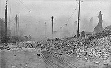
On February 7, 1904, the Great Baltimore Fire destroyed over 1,500 buildings in 30 hours, leaving more than 70 blocks of the downtown area burned to the ground. Damages were estimated at $150 million—in 1904 dollars.[27] As the city rebuilt during the next two years, lessons learned from the fire led to improvements in firefighting equipment standards.[28]
The city grew in area by annexing new suburbs from the surrounding counties, the last being in 1918, when the city acquired portions of Baltimore County and Anne Arundel County.[29] A state constitutional amendment approved in 1948, required a special vote of the citizens in any proposed annexation area, effectively preventing any future expansion of the city's boundaries.[30]
The relative size of the city's black population grew from 23.8% in 1950 to 46.4% in 1970.[31] The Baltimore riot of 1968 occurred following the assassination of Martin Luther King, Jr. in Memphis, Tennessee on April 4, 1968. Coinciding with riots in other cities, public order was not restored until April 12, 1968. The Baltimore riot cost the city of Baltimore an estimated $10 million (US$ 63 million in 2011). A total of 11,000 Maryland National Guard and federal troops were ordered into the city.[32] Lasting effects of the riot can be seen on the streets of North Avenue, Howard Street, Gay Street, and Pennsylvania Avenue where long stretches of the streets remain barren.[33]
During the 1970s, Baltimore's downtown area known as the Inner Harbor, had been neglected and was only occupied by a collection of abandoned warehouses. Efforts to redevelop the downtown area started with the construction of the Baltimore Convention Center, which opened 1979. Harborplace, an urban retail and restaurant complex opened on the waterfront in 1980, followed by the National Aquarium in Baltimore, Maryland's largest tourist destination, and the Baltimore Museum of Industry in 1981. In 1992, the Baltimore Orioles baseball team moved from Memorial Stadium to Oriole Park at Camden Yards, located downtown near the harbor. Six years later the Baltimore Ravens football team moved into M&T Bank Stadium next to Camden Yards.[34]
The city has 280 properties identified as historical in the National Register of Historic Places.
Further information: National Register of Historic Places listings in Baltimore, MarylandGeography
 Eastward view along Baltimore harbor
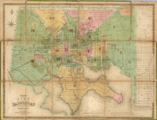 City plan of Baltimore (1852) by Fielding Lucas, Jr. of Baltimore.
Baltimore is in north-central Maryland on the Patapsco River close to where it empties into the Chesapeake Bay. The city is also located on the fall line between the Piedmont Plateau and the Atlantic Coastal Plain, which divides Baltimore into "lower city" and "upper city". The city's elevation ranges from sea level at the harbor to 480 feet (150 m) in the northwest corner near Pimlico.[35]
According to the 2010 Census, the city has a total area of 92.052 square miles (238.41 km2), of which 80.944 square miles (209.64 km2) is land and 11.108 square miles (28.77 km2) is water.[9] The total area is 12.07 percent water.
Climate
Baltimore lies within the humid subtropical climate zone (Cfa), according to the Köppen classification.
July is typically the hottest month of the year, with an average temperature of 81.7 °F (27.6 °C). Summer is also a season of high (generally, not consistently) humidity in the Baltimore area. The record high for Baltimore is 107 °F (42 °C), set in 1936.[36] January is the coldest month, with an average temperature of 36.8 °F (2.7 °C). However, subtropical air masses can bring periods of springlike weather, and Arctic fronts push nighttime low temperatures into the teens (< −7 °C) and more rarely, single digits (< −12 °C). The record low temperature for Baltimore is −7 °F (−22 °C) in 1934 and 1984.[36] Due to an urban heat island effect in the city proper and a moderating effect of the Chesapeake Bay, the outlying and inland parts of the Baltimore metro area are usually cooler than the city proper and the coastal towns.
As is typical in most East Coast cities, precipitation is generous and very evenly spread throughout the year. Every month typically brings 3–4 inches of precipitation, averaging around 42 inches (1,100 mm) annually. Spring, summer and fall bring frequent showers and thunderstorms, with an average of 105 sunny days a year. Winter often brings lighter rain showers of longer duration, and generally less sunshine and more clouds. Snowfall occurs occasionally in the winter, with an annual average of 20.8 inches (53 cm).[37] In the northern and western suburbs, temperatures tend to be cooler, and winter snowfall is more significant, where some areas average more than 30 inches (76 cm) of snow per year.[38] Freezing rain and sleet occurs a few times each winter in Baltimore, as warm air overrides cold air at the low-mid levels of the atmosphere. When the wind blows from the east, the cold air gets dammed against the mountains to the west and the result is freezing rain or sleet.
The average date of first frost in Baltimore is October 29, and the average last frost is April 11, allowing a growing season of 200 days.[39]
NOTE: The temperature data presented below was recorded at Inner Harbor; all other data recorded at BWI Airport.
Climate data for Baltimore (Inner Harbor) Month Jan Feb Mar Apr May Jun Jul Aug Sep Oct Nov Dec Year Record high °F (°C) 79
(26)83
(28)90
(32)94
(34)98
(37)105
(41)107
(42)105
(41)101
(38)97
(36)86
(30)77
(25)107
(42)Average high °F (°C) 44.1
(6.7)47.3
(8.5)56.8
(13.8)67.8
(19.9)77.2
(25.1)86.0
(30.0)90.6
(32.6)88.2
(31.2)80.9
(27.2)69.7
(20.9)58.7
(14.8)48.5
(9.2)67.98
(19.99)Average low °F (°C) 29.4
(−1.4)31.3
(−0.4)39.0
(3.9)48.2
(9.0)58.2
(14.6)67.7
(19.8)72.7
(22.6)70.8
(21.6)63.7
(17.6)51.6
(10.9)42.1
(5.6)33.5
(0.8)50.68
(10.38)Record low °F (°C) −7
(−22)−7
(−22)5
(−15)15
(−9)32
(0)40
(4)50
(10)45
(7)35
(2)25
(−4)12
(−11)−3
(−19)−7
(−22)Precipitation inches (mm) 3.05
(77.5)2.90
(73.7)3.90
(99.1)3.19
(81)3.99
(101.3)3.46
(87.9)4.07
(103.4)3.29
(83.6)4.03
(102.4)3.33
(84.6)3.30
(83.8)3.37
(85.6)41.88
(1,063.8)Snowfall inches (cm) 6.8
(17.3)8.0
(20.3)1.9
(4.8)0
(0)0
(0)0
(0)0
(0)0
(0)0
(0)0
(0)0.4
(1)3.1
(7.9)20.2
(51.3)Avg. precipitation days (≥ 0.01 in) 10.8 9.3 10.4 10.2 11.5 10.0 10.0 9.1 8.4 8.2 8.9 9.7 116.5 Avg. snowy days (≥ 0.1 in) 3.7 2.7 1.3 0 0 0 0 0 0 0 .5 1.5 9.7 Sunshine hours 155.0 166.7 213.9 231.0 254.2 276.0 291.4 263.5 222.0 204.6 159.0 145.7 2,583.0 Source: NOAA,[40] HKO[41] idcide,[42] intellicast,[43] The Weather Channel[44] Cityscape
A day time panorama of Baltimore's Inner Harbor, seen from Federal Hill. 
A night time panorama of Baltimore's Inner Harbor. Architecture
 Baltimore is the home of the National Aquarium, one of the world's largest
 Washington Monument, in the Mt. Vernon neighborhood of Baltimore
Baltimore exhibits examples from each period of architecture over more than two centuries, and work from many famous architects such as Benjamin Latrobe, George A. Frederick, John Russell Pope, Mies Van Der Rohe and I. M. Pei.
The city has architecturally important buildings in a variety of styles. The Baltimore Basilica (1806–1821) is a neoclassical design by Benjamin Latrobe, and also the oldest Catholic Cathedral in the United States. In 1813 Robert Cary Long, Sr. built for Rembrandt Peale the first substantial structure in the United States designed expressly as a museum. Restored, it is now the Municipal Museum of Baltimore, or popularly the “Peale Museum”. The McKim Free School was founded and endowed by John McKim, although the building was erected by his son Isaac in 1822 after a design by William Howard and William Small. It reflects the popular interest in Greece when the nation was securing its independence, as well as a scholarly interest in recently published drawings of Athenian antiquities.
The Phoenix Shot Tower (1828), at 234.25 feet (71.40 m) tall, was the tallest building in the United States until the time of the Civil war. It was constructed without the use of exterior scaffolding. The Sun Iron Building designed by R.C. Hatfield in 1851, was city’s first iron-front building and it was a model for a whole generation of downtown buildings. Brown Memorial Presbyterian Church, built in 1870 in memory of financier George Brown, has stained glass windows by Louis Comfort Tiffany and has been called "one of the most significant buildings in this city, a treasure of art and architecture" by Baltimore Magazine.[45][46] The 1845 Greek Revival style Lloyd Street Synagogue is one of the oldest synagogues in the United States. The Johns Hopkins Hospital, designed by Lt. Col. John S. Billings in 1876 was a considerable achievement for its day in functional arrangement and fireproofing.
I.M.Pei's World Trade Center (1977) is the tallest equilateral pentagonal building in the world at 405 feet (123.4 m) tall.
Future contributions to Baltimore's skyline include plans for a 717 foot (218.5 m) tall structure known as "10 Inner Harbor". The building was recently approved by Baltimore's design panel, but as of January 10, 2010, ARC Wheeler had yet to break ground on the project. It will include luxury condominiums, a hotel, restaurants, and shopping centers. The Naing Corporation has approved a tower of 50–60 floors for the lot at 300 Pratt street, with the design currently being finalized. The Inner Harbor East area will see the addition of two new towers which have started construction: a 24-floor tower that will be the new world headquarters of Legg Mason (now complete), and a 21 floor Four Seasons Hotel complex.
The streets of Baltimore are organized in a grid pattern, lined with tens of thousands of brick and formstone faced rowhouses. In The Baltimore Rowhouse, Mary Ellen Hayward and Charles Belfoure considered the rowhouse as the architectural form defining Baltimore as "perhaps no other American city."[47] In the mid 1790s, developers began building entire neighborhoods of the British-style rowhouses, which became the dominant house type of the city early in the 19th century.[48]
Formstone facings, now a common feature on Baltimore rowhousess, were an addition patented in 1937 by Albert Knight. John Waters characterized formstone as "the polyester of brick" in his 30 minute documentary film, Little Castles: A Formstone Phenomenon.[49]
Oriole Park at Camden Yards is considered by many to be the most beautiful baseball park in Major League Baseball, and has inspired many other cities to build their own versions of this retro style ballpark. Camden Yards along with the National Aquarium have helped revive the Inner Harbor from what once was an industrial district full of dilapidated warehouses, into a bustling commercial district full of bars, restaurants and retail establishments.
Tallest buildings
Main article: List of tallest buildings in Baltimore The Transamerica Tower (formerly the Legg Mason Building), Baltimore's tallest
Rank Building Height Floors Built 1 Transamerica Tower (formerly the Legg Mason Building)[50] 529 feet (161 m) 40 1973 [51] 2 Bank of America Building 509 feet (155 m) 37 1924 [52] 3 William Donald Schaefer Building 493 feet (150 m) 37 1992 [53] 4 Commerce Place 454 feet (138 m) 31 1992 [54] 5 100 East Pratt Street 418 feet (127 m) 28 1992 [55] 6 Baltimore World Trade Center 405 feet (123 m) 28 1977 [56] 7 Tremont Plaza Hotel 395 feet (120 m) 37 1967 [57] 8 Charles Towers South Apartments 385 feet (117 m) 30 1969 [58] 9 Blaustein Building 360 feet (110 m) 30 1962 [59] 10 250 West Pratt Street 360 feet (110 m) 24 1986 [60] Neighborhoods
See also: List of Baltimore neighborhoodsBaltimore is divided officially into nine geographical regions: Northern, Northwestern, Northeastern, Western, Central, Eastern, Southern, Southwestern, and Southeastern, with each patrolled by a respective Baltimore Police Department district. However, it is common for locals to divide the city simply by East or West Baltimore, using Charles Street as a dividing line, and/or into North and South using Baltimore Street as a dividing line.
The Central district includes Downtown Baltimore, the city's main commercial area. Home to Harborplace, The Camden Yards Sports Complex (Oriole Park at Camden Yards and M&T Bank Stadium), the Convention Center, and the National Aquarium in Baltimore, the area also includes many nightclubs, bars and restaurants, shopping centers and various other attractions. Many of Baltimore's key businesses, such as Legg Mason and Constellation Energy are based here. In addition, the University of Maryland, Baltimore campus is housed in this area, with the long-associated University of Maryland Medical System adjacent to the school. The downtown core has mainly served as a commercial district with limited residential opportunities. However, since 2002 the downtown population has doubled to 12,000 residents, with a projection of 7,400 additional housing units becoming available by 2012.[61] Central district stretches north of the downtown core up to the edge of Druid Hill Park. This northern portion of Central, between downtown and the park, is home to many of the city's cultural opportunities. Maryland Institute College of Art, the Peabody Institute of music, the Lyric Opera House, The Walters Art Museum, The Joseph Meyerhoff Symphony Hall, as well as several galleries are located in this region.
Crime in the Inner Harbor and Mount Vernon neighborhoods of the Central district became of greater concern in 2009, as an increasing number of random assaults on tourists were reported.[62][63]
The Northern District lies directly north of the Central district and is bounded on the east by The Alameda and on the west by Pimlico Road. Loyola University Maryland, The Johns Hopkins University and College of Notre Dame of Maryland are located in this district.
The Southern District, a mixed industrial and residential area, consists of the area of the city below the Inner Harbor, east of the B&O railroad tracks. It is a mixed socio-economic region consisting of working class, culturally and ethnically diverse neighborhoods such as Locust Point;[64] the historic Federal Hill area, home to many working professionals, pubs and restaurants;[65] and low-income residential areas such as Cherry Hill.[66] The Port of Baltimore operates two terminals in this district and the old Domino Sugar plant is located here.[64] Westport is another lower-income neighborhood that has been approved for tremendous waterfront development in the years to come. (See Westport Waterfront[67])
East Baltimore consists of the Northeastern, Eastern, and Southeastern districts.
The Northeastern district is primarily a residential neighborhood, home to Morgan State University, bounded by the city line on its northern and eastern boundaries, Sinclair Lane, Erdman Avenue, and Pulaski Highway on its southern boundaries and The Alameda on its western boundaries. It has undergone demographic shifts over many years and remains a diverse but predominantly African American region of the city.[68][69][70]
The Eastern district is the heart of what is considered East Baltimore and is home to Johns Hopkins Hospital and Johns Hopkins University School of Medicine. Located below Erdman Avenue and Sinclair Lane, above Orleans Street, it is an almost exclusively African American area, made up of low-income residential neighborhoods. Entire blocks of abandoned buildings and its chronic problem with drug trafficing made this area a frequent on-site film location for The Wire, a television drama produced from 2002 to 2008.[71]
The Southeastern district, located below Orleans Street, bordering the Inner Harbor on its western boundary, the city line on its eastern boundaries and the Baltimore harbor on its southern boundaries, is a mixed industrial and residential area. The demography of individual neighborhoods varies widely, from predominantly black O'Donnell Heights, where 66 percent of the population was measured below the poverty line in 2000, to predominantly white Fells Point, with less than 17 percent below the poverty line. Yet, even these two neighborhoods have a significant mix of other races and cultures, a common characteristic of Southeastern neighborhoods.[72][73][74][75]
West Baltimore consists of the Northwestern, Western, and Southwestern districts.
The Northwestern district, bounded by the county line on its northern and western boundaries, Gwynns Falls Parkway on the south and Pimlico Road on the East, is home to Pimlico Race Course, Sinai Hospital. Its neighborhoods are mostly residential. Formerly the center of Baltimore's Jewish community, the district's Park Heights neighborhood, has undergone white flight since the 1960s, becoming an almost exclusively black.[76][77]
Northern Parkway divides the Northwestern district into two distinctly different demographic areas. Neighborhoods to the north of the parkway, such as Mount Washington and Cheswolde are predominantly white, with low-density suburban housing. South of the parkway, the neighborhoods are mostly black. Some of the neighborhoods south of the parkway also have suburban housing,[76] but several are high density urban communities, with greater percentage of residents reported below the poverty level in the 2000 census.[78]
The Western district, located west of downtown, is the heart of West Baltimore, bounded by Gwynns Falls Parkway, Fremont Avenue, and Baltimore Street. Coppin State University, Mondawmin Mall, and Edmondson Village, located in this district, have been historic cultural and economic centers of the city's African American community. Once home to many middle to upper class African Americans, over the years the more affluent residents have migrated to other sections of the city or beyond the city line into Baltimore County and Howard County.[79]
Income levels below the poverty line were reported by the 2000 census for more than 45 percent of residents in some of the district's neighborhoods, which are almost exclusively black.[80][81] Like East Baltimore, the area's crime problems have provided subject material for television series, such as The Wire.
Local organizations, such as the Sandtown Habitat for Humanity and the Upton Planning Committee, have been steadily transforming formerly blighted areas of the Western district into clean, safe and well-kept communities.[82][83]
The Southwestern district is bounded by Baltimore County to the west, Baltimore Street to the north, and the downtown area to the east. St. Agnes Hospital is located in this district, amid a mix of industrial parks and residential areas. Economic and demographic characteristics of Southwestern district vary greatly. Almost exclusively black, the Uplands neighborhood, near the Central district, had 39.9 percent of its residents measured below the poverty line by the 2000 census.[84] Predominantly white Violetville, at the city's southwest edge, had only 6.4 percent of its residents reported below the poverty line.[85]
-

Fells Point
Adjacent communities
The City of Baltimore is bordered by the following communities, all unincorporated census-designated places.
Culture
Main article: Culture of BaltimoreSee also: Music of Baltimore and List of museums in Baltimore The Washington Monument
Historically a working-class port town, Baltimore has sometimes been dubbed a "city of neighborhoods," with 72 designated historic districts[86] traditionally occupied by distinct ethnic groups. Most notable today are three downtown areas along the port: the Inner Harbor, frequented by tourists due to its hotels, shops, and museums; Fells Point, once a favorite entertainment spot for sailors but now refurbished and gentrified (and featured in the movie Sleepless in Seattle); and Little Italy, located between the other two, where Baltimore's Italian-American community is based – and where former U.S. House Speaker Nancy Pelosi grew up. Further inland, Mt. Vernon is the traditional center of cultural and artistic life of the city; it is home to a distinctive Washington Monument, set atop a hill in a 19th century urban square, that predates the more well-known monument in Washington, D.C. by several decades.
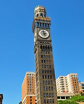 Emerson Bromo-Seltzer Tower, built in 1911
Each year the Artscape takes place in the city in the Bolton Hill neighborhood, due to its proximity to Maryland Institute College of Art. Artscape styles itself as the 'largest free arts festival in America'.[87]
Local dialect
Main article: Baltimore dialectOne thing visitors quickly notice is that some locals refer to their city as "Balamer," dropping the "t". The traditional local accent, peculiar to some working-class areas of the city, has long been noted and celebrated as "Baltimorese" or "Bawlmorese." As a member of the Mid-Atlantic English dialect group, Baltimore's dialect shares many characteristics with Philadelphia's, such as the addition of an "eh" sound before a long "o". Its influence distinguishes Baltimore, especially with words containing "oi" flattened into an "aw" sound. Baltimore is also known for its use of Hun or Hon.[88]
Baltimore native John Waters parodies the city and its dialect extensively in his films, including the 1972 cult classic Pink Flamingos. His film Hairspray and its Broadway musical remake are also set in Baltimore.
See also: List of films shot in BaltimorePerforming arts
The Baltimore Symphony Orchestra is an internationally renowned orchestra, founded in 1916 as a publicly funded municipal organization. The current Music Director is Marin Alsop, a protégé of Leonard Bernstein. Center Stage is the premier theater company in the city and a regionally well-respected group. The Baltimore Opera was an important regional opera company, though it filed for bankruptcy in 2008 and is not currently performing.[89] The Baltimore Consort has been a leading early music ensemble for over twenty-five years. The France-Merrick Performing Arts Center, home of the restored Thomas W. Lamb-designed Hippodrome Theatre, has afforded Baltimore the opportunity to become a major regional player in the area of touring Broadway and other performing arts presentations.
Baltimore also boasts a wide array of professional (non-touring) and community theater groups. Aside from Center Stage, resident troupes in the city include Everyman Theatre, Single Carrot Theatre, and Baltimore Theatre Festival. Community theaters in the city include Fells Point Community Theatre and the Arena Players Inc., which is the nation's oldest continuously operating African American community theater.[90]
Baltimore is home to the Pride of Baltimore Chorus, a 3-time International silver medalist women's chorus, affiliated with Sweet Adelines International.
The city is also home to the Baltimore School for the Arts, a public high school in the Mount Vernon neighborhood of Baltimore. The institution is nationally recognized for its success in preparation for students entering visual art, music, theatre, dance, and stage production.
Notable persons
See also: List of people from BaltimoreEconomy
Once a major industrial town, with an economic base focused on steel processing, shipping, auto manufacturing, and transportation, the city suffered a deindustrialization which cost residents tens of thousands of low-skill, high-wage jobs.[citation needed] While it retains some industry, Baltimore now has a modern service economy providing a growing financial, business, and health service base for the southern Mid-Atlantic region.
Greater Baltimore (the city and surrounding suburbs in Baltimore County) is home to five Fortune 1000 companies: Constellation Energy, Grace Chemicals (in Columbia), Legg Mason, T. Rowe Price, and McCormick & Company (in Hunt Valley). Other companies that call Greater Baltimore home include AAI Corporation (in Hunt Valley), Adams Express Company, Brown Advisory, Deutsche Bank Alex. Brown (the oldest continuously running investment bank in the United States),[91] FTI Consulting, Petroleum & Resources Corporation, Vertis, Prometric, Sylvan Learning, Laureate Education, Under Armour, DAP, 180s, DeBaufre Bakeries, Wm. T. Burnett & Co, Old Mutual Financial Network, Firaxis Games (in Sparks), Sinclair Broadcast Group (in Hunt Valley), Fila USA (in Sparks) and JoS. A. Bank Clothiers (in Hampstead).
The city is also home to the Johns Hopkins Hospital, which will serve as the center of a new biotechnology park, one of two such projects currently under construction in the city.
A sugar refinery owned by American Sugar Refining is also located in Baltimore.
Demographics
Historical populations Census Pop. %± 1790 13,503 — 1800 26,514 96.4% 1810 46,555 75.6% 1820 62,738 34.8% 1830 80,620 28.5% 1840 102,313 26.9% 1850 169,054 65.2% 1860 212,418 25.7% 1870 267,354 25.9% 1880 332,313 24.3% 1890 434,439 30.7% 1900 508,957 17.2% 1910 558,485 9.7% 1920 733,826 31.4% 1930 804,874 9.7% 1940 859,100 6.7% 1950 949,708 10.5% 1960 939,024 −1.1% 1970 905,759 −3.5% 1980 786,775 −13.1% 1990 736,014 −6.5% 2000 651,154 −11.5% 2010 620,961 −4.6% At the 2010 Census, there were 620,961 people residing in Baltimore, a decrease of −4.6% since 2000. According to the 2010 Census, 29.6% of the population was White, 63.7% Black , 0.4% American Indian and Alaska Native, 2.3% Asian, 0.2% from some other race (non-Hispanic) and 2.1% of two or more races. 4.2% of Baltimore's population was of Hispanic, Latino, or Spanish origin (they may be of any race). After New York City, Baltimore was the second city in the United States to reach a population of 100,000.[92][93] In the 1830, 1840, and 1850 US censuses, Baltimore was the second-largest city in population,[93][94] surpassed by Philadelphia in 1860.[95] It was among the top 10 cities in population in the United States in every census up to the 1980 census,[96] and after World War II had a population of nearly a million.
In the 1990s, the US Census reported that Baltimore ranked as one of the largest population losers alongside Detroit and Washington D.C., losing over 84,000 residents between 1990 and 2000.[97]
In a People QuickFacts report, the U.S. Census Bureau estimated the racial composition of Baltimore in 2009 as follows:
- Black or African American: 63.2%
- White: 33.1% (Non-Hispanic Whites: 30.9%)
- Native American: 0.4%
- Asian: 2.0%
- Native Hawaiian and Other Pacific Islander: 0.1%
- Two or more races: 1.3%
- Hispanic or Latino (of any race): 3.0%
The same report also estimated these people lived in a total of 294,579 housing units. Age ranges were 22.4% under 18 years old, 11.8% at age 65 or older, and 65.8% from 18 to 64 years old. The city's estimated 2009 population of 637,418 was 53.4% female.[98]
A statistical abstract prepared by the U.S. Census Bureau estimated the median income for a household in the city during 2008 at $30,078, and the median income for a family at $48,216. The same abstract also listed a per capita income of $22,885 for the city in 2008, with 15.4% of families and 19.3% of the population below the poverty line.[99]
Despite the housing collapse, and along with the national trends, Baltimore residents still face slowly increasing rent (up 3% in the summer of 2010).[100]
Crime
See also: Baltimore Police DepartmentBaltimore reported 223 homicides in 2010, the lowest count since a peak of 353 in 1993. This has been part of a general trend in all violent crimes for the city, which have declined from 21,799 in 1993 to 9,316 in 2010. Even with stark population decline taken into account -- Baltimore went from from 732,968 residents in 1993 to just 620,961 in 2010 -- the drop in violent crime was significant, falling from 3.0 incidents per 100 residents to 1.6 incidents per 100 residents.[101] Baltimore's level of violent crime is still much higher than the national average, however. In 2009, a total of 1,318,398 violent crimes were reported nationwide across the United States, equivalent to a rate of just 0.4 incidents per 100 people.[102]
City officials came under scrutiny from Maryland legislators in 2006 regarding the veracity of crime statistics reported by the Baltimore Police Department.[103] In 2003, the FBI identified irregularities in the number of rapes reported, which was confirmed by then-Mayor Martin O'Malley. The number of homicides in 2005 appeared to exhibit discrepancies as well.[104] Former police commissioner Kevin P. Clark stated upon interview that the administration suppressed corrections to its crime reports;[105] however, many of the charges made by the police commissioner now appear to have been politically motivated.[106]
Government
Baltimore is an independent city, and not part of any county. For most governmental purposes under Maryland law, Baltimore City is treated as a county-level entity. The United States Census Bureau uses counties as the basic unit for presentation of statistical information in the United States, and treats Baltimore as a county equivalent for those purposes.
Baltimore has been a Democratic stronghold for over 150 years, with Democrats dominating every level of government.[107]
Mayor
 Baltimore Mayor Stephanie Rawlings-Blake (D)
- For a full list of mayors, see List of Baltimore Mayors.
Sheila Dixon became the first female mayor of Baltimore on January 17, 2007. As the former City Council President, she assumed the office of Mayor when former Mayor Martin O'Malley took office as Governor of Maryland.[108] On November 6, 2007, Dixon won the Baltimore mayoral election.
Mayor Dixon's administration ended less than three years after her election, the result of a criminal investigation that began in 2006 while she was still City Council President. She was convicted on a single misdemeanor charge of embezzlement on December 1, 2009. A month later, Dixon made an Alford plea to a perjury charge and agreed to resign from office.[109][110] Stephanie Rawlings-Blake, who was City Council President at that time, assumed the office of Mayor on February 4, 2010, when Dixon's resignation became effective.[111]
Baltimore City Council
 Baltimore City Hall
Grassroots pressure for reform, voiced as Question P, restructured the city council in November 2002, against the will of the mayor, the council president, and the majority of the council. A coalition of union and community groups, organized by the Association of Community Organizations for Reform Now (ACORN), backed the effort.[112]
The Baltimore City Council is now made up of 14 single-member districts and one elected at-large council president. Bernard C. "Jack" Young has been the council president since February 2010, when he was unanimously elected by the other council members to replace Stephanie Rawlings-Blake, who had become mayor.[113] Edward Reisinger, the 10th district representative, is the council's current vice president.[114]
State government
See also: Baltimore City DelegationSince the legislative redistricting in 2002, Baltimore has had six legislative districts located entirely within its boundaries, giving the city six seats in the 47-member Maryland State Senate and 18 in the 141-member Maryland House of Delegates.[115][116] During the previous 10 year period, Baltimore had four legislative districts within the city limits, but four others overlapped the Baltimore County line.[117] As of January 2011, all of Baltimore's state senators and delegates were Democrats.[115] Approval of the next redistricting plan is expected to become effective in time for Maryland's 2012 Congressional primary election on February 14, 2012. [118]
State agencies
See also: List of state agencies headquartered in BaltimoreFederal government
Further information: Maryland's 2nd congressional district, Maryland's 3rd congressional district, and Maryland's 7th congressional districtThree of the state's eight congressional districts include portions of Baltimore: the 2nd, represented by Dutch Ruppersberger; the 3rd, represented by John Sarbanes; and the 7th, represented by Elijah Cummings. All three are Democrats; a Republican has not represented a significant portion of Baltimore in Congress since John Boynton Philip Clayton Hill represented the 3rd District in 1927, and has not represented any of Baltimore since the Eastern Shore-based 1st District lost its share of Baltimore after the 2000 census; it was represented by Republican Wayne Gilchrest at the time.
Both of Maryland's Senators, Ben Cardin and Barbara Mikulski, are from Baltimore, and both represented the 3rd District before being elected to the Senate. Mikulski represented the 3rd from 1977 to 1987, and was succeeded by Cardin, who held the seat until his election and inauguration to the Senate in 2007.[119]
The Postal Service's Baltimore Main Post Office is located at 900 East Fayette Street in the Jonestown area.[120]
Law enforcement
The Baltimore City Police Department is the primary law enforcement agency serving the citizens of Baltimore. Campus security for the city's public schools is provided by the Baltimore City Public Schools Police.
The Maryland Transportation Authority Police is the primary law enforcement agency on the Fort McHenry Tunnel Thruway (I-95), the Baltimore Harbor Tunnel Thruway (I-895) and I-395, which are under MdTA jurisdiction and have limited concurrent jurisdiction with the Baltimore Police under a memorandum of understanding.
Law enforcement on the fleet of transit buses and transit rail systems serving Baltimore is the responsibility of the Maryland Transit Administration Police, which is part of the Maryland Transit Administration. The MTA Police also share jurisdiction authority with the Baltimore Police, governed by a memorandum of understanding.[121]
As the enforcement arm of the Baltimore court system, the Baltimore City Sheriff's Office is responsible for the security of city courthouses and property, service of court-ordered writs, protective and peace orders, warrants, tax levies, prisoner transportation and traffic enforcement. Deputy Sheriffs are sworn law enforcement officials, with full arrest authority granted by the constitution of Maryland, the MPCTC and the Sheriff of the City of Baltimore.[122]
Baltimore City Fire Department
Main article: Baltimore City Fire DepartmentThe city of Baltimore is protected by the over 1,800 professional firefighters of the Baltimore City Fire Department (BCFD), founded in December 1858. The BCFD operates out of 37 Fire Stations, located throughout the city.
Transportation
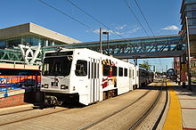 The Baltimore Light Rail provides service to Baltimore-Washington International Thurgood Marshall Airport and the Baltimore area.
The Interstate Highways serving Baltimore are I-70, I-83 (the Jones Falls Expressway), I-95 (the John F. Kennedy Memorial Highway), I-395, I-695 (the Baltimore Beltway), I-795 (the Northwest Expressway), I-895 (the Harbor Tunnel Thruway), and I-97. Several of the city's Interstate Highways, e.g. I-95, I-83, and I-70 are not directly connected to each other, and in the case of I-70 end at a park and ride lot just inside the city limits, because of freeway revolts in the City of Baltimore. These revolts were led primarily by Barbara Mikulski, now a United States Senator, which resulted in the abandonment of the original plan. U.S. highways and state routes that run to and through downtown Baltimore include US 1, US 40 National Road, and the Baltimore-Washington Parkway. There are two tunnels traversing the Baltimore harbor within the city limits: the four-bore Fort McHenry Tunnel (served by I-95) and the two-bore Harbor Tunnel (served by I-895). The Baltimore Beltway crosses south of Baltimore harbor over the Francis Scott Key Bridge.
Baltimore is a top destination for Amtrak along the Northeast Corridor. Baltimore's Penn Station is one of the busiest in the country. In FY 2008, it ranked 8th in the United States with a total ridership of 1,020,304.[123] Just outside the city, Baltimore/Washington International (BWI) Thurgood Marshall Airport Rail Station is another popular stop. Amtrak's Acela Express, Palmetto, Carolinian, Silver Star, Silver Meteor, Vermonter, Crescent, and Northeast Regional trains are the scheduled passenger train services that stop in the city. Additionally, MARC commuter rail service connects the city's two main intercity rail stations, Camden Station and Penn Station, with Washington, D.C.'s Union Station as well as stops in between.
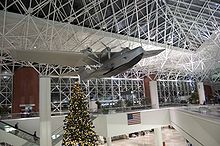 Interior of Baltimore-Washington International Thurgood Marshall Airport, Baltimore's major commercial airport
Baltimore is served by Baltimore-Washington International Thurgood Marshall Airport, generally known as "BWI," which lies about 10 miles (16 km) to the south in neighboring Anne Arundel County, and by Martin State Airport, a general aviation facility, to the north in Baltimore County. BWI and Martin State airports are operated by the Maryland Aviation Administration, which is part of the Maryland Department of Transportation.[124] In terms of passenger traffic, BWI is the 24th busiest airport in the United States.[125] Downtown Baltimore is connected to BWI by two major highways (I-95 and the Baltimore-Washington Parkway via Interstate 195), the Baltimore Light Rail, and Amtrak and MARC commuter rail service between Baltimore's Penn Station and BWI Rail Station. Martin State Airport is linked to downtown Baltimore by two major highways, I-95 and U.S. Route 40, and MARC commuter rail service between Baltimore's Penn Station and its nearby Martin State Airport MARC Train stop.
Public transit
Public transit in Baltimore is provided by the Maryland Transit Administration and Charm City Circulator. The city has a comprehensive bus network, a small light rail network connecting Hunt Valley in the north to BWI airport and Cromwell in the south, and a subway line between Owings Mills and Johns Hopkins Hospital.[126] A proposed rail line, known as the Red Line, which would link the Social Security Administration to Johns Hopkins Bayview and perhaps the Canton and Dundalk communities, is under study as of 2007; a proposal to extend Baltimore's existing subway line to Morgan State University, known as the Green Line, is in the planning stages.[127]
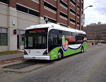 Charm City Circulator Vanhool A330 #1101 on the Orange Line.
The Charm City Circulator a.k.a. CCC, a shuttlebus service operated by Veolia Transportation for the Baltimore Department of Transportation, began operating in the downtown area in January 2010. Funded partly by a 16 percent increase in the city's parking fees, the circulator provides free bus service seven days a week, picking up passengers every 15 minutes at designated stops during service hours.[128][129]
The CCC's first bus line, the Orange route, travels between Hollins Market and Harbor East. Its Purple route, launched June 7, 2010, operates between Penn Station and Federal Hill. The Green route, the next bus line due for the circulator, will run between Johns Hopkins and City Hall.[129][130] The Charm City Circulator operates a fleet of Diesel and Hybrid vehicles built by DesignLine, Orion, and Vanhool.[128]
Walkability
A 2011 study by Walk Score ranked Baltimore the 14th most walkable of fifty largest U.S. cities.[131]
Port of Baltimore
Main article: Helen Delich Bentley Port of Baltimore Baltimore harbor in 1849 with the prominent Washington monument in the background North of the city
The port was founded in 1706, preceding the founding of Baltimore. The Maryland colonial legislature made the area near Locust Point as the port of entry for the tobacco trade with England. Fells Point, the deepest point in the natural harbor, soon became the colony's main ship building center, later on becoming leader in the construction of clipper ships.[132] After the founding of Baltimore, mills were built behind the wharves. The California Gold Rush led to many orders for fast vessels; many overland pioneers also relied upon canned goods from Baltimore. After the civil war, a coffee ship was designed here for trade with Brazil. At the end of the nineteenth century, European ship lines had terminals for immigrants. The Baltimore and Ohio Railroad made the port a major transshipment point.[133]:17,75
Currently the port has major roll-on roll-off facilities, as well as bulk facilities, especially steel handling.[134] Water taxis also operate in the Inner Harbor. Governor Ehrlich participated in naming the port after Helen Delich Bentley during the 300th anniversary of the port.[135]
In 2007, Duke Realty Corporation began a new development near the Port of Baltimore, named the Chesapeake Commerce Center. This new industrial park is located on the site of a former General Motors plant. The total project comprises 184 acres (0.74 km2) in eastern Baltimore City and the site will yield 2,800,000 square feet (260,000 m2) of warehouse/distribution and office space. Chesapeake Commerce Center has direct access to two major Interstate Highways (I-95 and I-895) and is located adjacent to two of the major Port of Baltimore Terminals. The Port of Baltimore is one of two seaports on the U.S. east coast with a 50-foot (15 m) dredge to accommodate the largest shipping vessels.[136]
Education
See also: List of high schools in MarylandColleges and universities
Baltimore is the home of numerous places of higher learning, both public and private. Among them are:
Private
 Keyser Quadrangle in Spring at the Johns Hopkins University
- Baltimore International College (BIC)
- College of Notre Dame of Maryland (CND or NDM)
- The Johns Hopkins University (JHU)
- Loyola University Maryland (LUM)
- Maryland Institute College of Art (MICA)
- Peabody Institute of the Johns Hopkins University
- Sojourner-Douglass College
Public
- Baltimore City Community College (BCCC)
- Coppin State University
- Morgan State University (MSU)
- University of Baltimore (UB)
- University of Maryland, Baltimore (UMB, formerly UMAB)
Primary and secondary schools
The city's public schools are operated by the Baltimore City Public School System and include the historic Frederick Douglass High School, which is the second oldest African American high school in the United States,[137] Baltimore City College, the third oldest public high school in the country,[138] and Western High School, the oldest public all girls school in the nation.[139] Baltimore City College (also known as "City") and Baltimore Polytechnic Institute (also known as "Poly") share the nation's second-oldest high school football rivalry.[140]
See also: List of private and parochial schools in BaltimoreMedia
Main article: Media in BaltimoreBaltimore's main newspaper is The Baltimore Sun. It was sold by its Baltimore owners in 1986 to the Times Mirror Company,[141] which was bought by the Tribune Company in 2000.[142]
Like many cities well into the 20th Century, Baltimore was a two-newspaper town until the Baltimore News-American ceased publication in 1986.[143]
In 2006, The Baltimore Examiner was launched to compete with The Sun. It was part of a national chain that includes The San Francisco Examiner and The Washington Examiner. In contrast to the paid subscription Sun, The Examiner was a free newspaper funded solely by advertisements. Unable to turn a profit and facing a deep recession, The Baltimore Examiner ceased publication on February 15, 2009.
Nielsen ranked Baltimore as the 26th-largest television market for the 2008–2009 viewing season and the 27th-largest for 2009–2010.[144] Arbitron's Fall 2010 rankings identified Baltimore as the 22nd largest radio market.[145]
Sports teams
Main article: Sports in BaltimoreBaseball
Baltimore has a long and storied baseball history, including the birth of Babe Ruth in 1895. The original 19th century Baltimore Orioles were one of the most successful early franchises, featuring numerous hall of famers during its years of 1882–1899. Ruth played for the minor league Baltimore Orioles team, which was active from 1903–1914. After playing one season in 1915 as the Richmond Climbers, the team returned the following year to Baltimore, where it played as the Orioles until 1953.[146]
The team currently known as the Baltimore Orioles has represented Major League Baseball locally since 1954 when the St. Louis Browns moved to the city of Baltimore. The Orioles advanced to the World Series in 1966, 1969, 1970, 1971, 1979 and 1983, winning three times (1966, 1970 and 1983), while making the playoffs all but one year (1972) from 1969 through 1974.
Further information: List of World Series champions and American League Championship SeriesIn 1995, local player (and later Hall of Famer) Cal Ripken, Jr. broke Lou Gehrig's "unbreakable" streak of 2,130 consecutive games played, for which Ripken was named Sportsman of the Year by Sports Illustrated magazine. Six former Orioles players, including Ripken (2007), and two of the team's managers have been inducted into the Baseball Hall of Fame.
Further information: List of members of the Baseball Hall of FameArea fans, such as Wild Bill Hagy, are known for their enthusiasm. Hagy, a cab driver from Dundalk, gained notoriety leading chants from the upper deck of the Memorial Stadium during the 1970s and 1980s.
Football
After moving to Baltimore in 1953, the former Dallas Texans (NFL) played as the Baltimore Colts until 1984. During this period, NFL Hall of Fame quarterback Johnny Unitas set his unmatched record of 47 consecutive games with a touchdown pass. The Colts advanced to the NFL Championship twice (1958 & 1959) and Super Bowl twice (1969 & 1971), winning all except Super Bowl III in 1969. The team name previously belonged to an All American Football Conference which played in Baltimore 1947–1950, then folded after becoming an NFL franchise team in 1950. The team which took the name in 1953 left Baltimore for Indianapolis in 1984, where it became the Indianapolis Colts.
Further information: History of the Indianapolis ColtsThe Baltimore Stallions was an expansion professional football team that joined the Canadian Football League in 1994. It remained in Baltimore for two seasons before relocating to Montreal after the 1995 season to become the Montreal Alouettes. While playing for Baltimore, the team posted the best two season starts of any CFL expansion team ever, advancing to the Grey Cup in both seasons. In its final season in Baltimore, the Stallions became the only U.S. based CFL team to win the Grey Cup, upsetting the heavily favored Calgary Stampeders.
Further information: List of Grey Cup championsThe NFL returned to Baltimore a year after the Stallions left, when the former Cleveland Browns moved to Baltimore to become the Baltimore Ravens in 1996. Since then, the Ravens won a Super Bowl championship in 2000, two division championships (2003 and 2006), and appeared in two AFC Championships (2000 & 2009).
Baltimore has two women's American football teams: the Baltimore Burn (founded 2001) and the Baltimore Nighthawks (founded 2007). Both teams play at Art Modell Field.
The Baltimore Mariners, a franchise of the American Indoor Football Association, played at the 1st Mariner Arena from 2008 to 2010. After winning the AIFA championship to cap an undefeated season in 2010, the team folded over charges that owner Dwayne Wells purchased the franchise with embezzled funds.[147]
Other teams and events
Baltimore Blast, a franchise of the Major Indoor Soccer League, has been playing at the 1st Mariner Arena since 1992. Originally known as Baltimore Spirit, the team changed its name in 1998. The current name was previously used by another indoor soccer team that played in Baltimore from 1980 to 1992. Since joining the MISL in 2001, Baltimore Blast has won 5 league championships: 2002, 2003, 2005, 2007 and 2008.
See also: Baltimore Blast (1980-1992)Other professional or semi-professional Baltimore teams include Crystal Palace Baltimore, an outdoor soccer franchise of USL Second Division since 2006; and the Charm City Roller Girls, a franchise of the Women's Flat Track Derby Association since 2005.
Preakness Stakes, the second jewel in the United States Triple Crown of Thoroughbred Racing, is held every May at Pimlico Race Course in Baltimore.
The Baltimore Grand Prix debuted along the streets of the Inner Harbor section of the city's downtown on September 2–4, 2011. The event played host to the American Le Mans Series on Saturday and the IndyCar Series on Sunday. Support races from smaller series were also held, including Indy Lights.
Sister cities
Baltimore has eleven sister cities, as designated by Sister Cities International: [148][149]
See also
- Arabbers
- Baltimore Development Corporation
- Baltimore in fiction
- Baltimore Steam Packet Company
- Cemeteries in Baltimore
- Enoch Pratt Free Library
- List of parks in the Baltimore-Washington metropolitan area
- Royal Blue (train)
- Screen painting
References
- ^ a b c Donovan, Doug (May 20, 2006). "Baltimore's New Bait: The City is About to Unveil a New Slogan, 'Get In On It,' Meant to Intrigue Visitors". The Baltimore Sun. http://www.redorbit.com/news/business/511672/baltimores_new_bait_the_city_is_about_to_unveil_a/index.html. Retrieved November 28, 2008.
- ^ Smith, Van (October 6, 2004). "Mob Rules". Baltimore City Paper. http://www.citypaper.com/arts/story.asp?id=9176. Retrieved January 24, 2009.
- ^ Kane, Gregory (June 15, 2009). "Dispatch from Bodymore, Murderland". Washington Examiner. http://www.washingtonexaminer.com/opinion/columns/gregory-kane/Dispatch-from-Bodymore-Murderland-48061142.html.
- ^ "Baltimore Heritage Area". Maryland Historical Trust. February 11, 2011. http://mht.maryland.gov/heritageareas_baltimore.html. Retrieved March 30, 2011.
- ^ "Baltimore: A City of Firsts". Visit Baltimore. http://baltimore.org/about-baltimore/baltimore-firsts/. Retrieved March 30, 2011.
- ^ "Best Monument". 2005 Baltimore Living Winners. Baltimore City Paper. September 21, 2005. http://www.citypaper.com/bob/story.asp?id=10574. Retrieved September 19, 2007.
- ^ "Ravenstown". Baltimore Ravens. http://preview.baltimoreravens.com/Ravenstown/Ravenstown.aspx. Retrieved June 7, 2008.
- ^ "More Literate than Akron". Baltimore City Paper. August 18, 2004. http://www.citypaper.com/news/story.asp?id=8702. Retrieved February 10, 2010.
- ^ a b 2010 Census U.S. Gazetteer Files: Counties. U.S. Census Bureau, Geography Division (March 2, 2011). Retrieved March 18, 2011.
- ^ "USGS detail on Baltimore". http://geonames.usgs.gov/pls/gnispublic/f?p=gnispq:3:::NO::P3_FID:0597040. Retrieved October 23, 2008.
- ^ "Annual Estimates of the Population of Metropolitan and Micropolitan Statistical Areas: April 1, 2000 to July 1, 2009". US Census Bureau. October 20, 2003. http://www.census.gov/popest/metro/tables/2009/CBSA-EST2009-01.csv. Retrieved March 31, 2010.
- ^ a b "U.S. Census Bureau Delivers Maryland's 2010 Census Population Totals". U.S. Census 2010 press release. February 9, 2011. http://2010.census.gov/news/releases/operations/cb11-cn20.html. Retrieved March 18, 2011.
- ^ "no title". Maryland Department of Natural Resources. http://www.dnr.state.md.us/fisheries/regulations/tidal_nontidal/central/patapsco1a.jpg. Retrieved February 9, 2009. Map shows the demarcation point between tidal and non-tidal portions of the Patapsco River.
- ^ Hughes, Joseph R.. "Inland port gives Baltimore strategic shipping advantages". Washington Examiner. http://washingtonexaminer.com/inland-port-gives-baltimore-strategic-shipping-advantages. Retrieved June 23, 2011.
- ^ "Annual Estimates of the Population of Combined Statistical Areas: April 1, 2000 to July 1, 2009" (CSV). 2009 Population Estimates. United States Census Bureau, Population Division. March 2010. http://www.census.gov/popest/metro/tables/2009/CBSA-EST2009-02.csv. Retrieved March 31, 2010.
- ^ As a goodwill gesture, and based on this historic link, a statue of Lady Baltimore was sent back to Ireland in 1974 and erected there some years later. See Jensen, Brennen (June 28, 2000). "Ms. Mobtown". Baltimore City Paper. http://www.citypaper.com/printStory.asp?id=2478. Retrieved January 24, 2009.
- ^ "Placenames". n-ireland.co.uk. http://www.n-ireland.co.uk/genealogy/placenames/placenamesb2.htm. Retrieved March 29, 2007.
- ^ "Placenames Database of Ireland". http://www.logainm.ie/?text=baltimore&uiLang=en&placeID=13321. Retrieved April 4, 2009.
- ^ Krugler, John D (2004). English and Catholic: the Lords Baltimore in the Seventeenth Century. Baltimore: Johns Hopkins University Press. p. 74. ISBN 0801879639. http://books.google.com/books?id=Lo5Bbf1AqYAC&printsec=frontcover&source=gbs_navlinks_s#v=onepage&q=&f=false.
- ^ Hezekiah Niles (1876). Principles and Acts of the Revolution in America. New York: A. S. Barnes & Co.. pp. 257–258. http://books.google.com/books?id=3VwsAAAAMAAJ&pg=PA257&lpg=PA257&dq=baltimore+non-importation+agreement&source=bl&ots=6nmmmIpYJt&sig=8l1oiPSZdX0sZEaaW7akacYLsf0&hl=en#.
- ^ "Henry Fite's House, Baltimore". U.S. Department of State, Office of the Historian. http://history.state.gov/departmenthistory/buildings/section4. Retrieved March 23, 2011.
- ^ "Baltimore, Maryland—Government". Maryland Manual On-Line: A Guide to Maryland Government. Maryland State Archives. October 23, 2008. http://www.msa.md.gov/msa/mdmanual/36loc/bcity/html/bcity.html. Retrieved October 27, 2008.
- ^ "The Great Strike". Catskill Archive. Timothy J. Mallery. http://www.catskillarchive.com/rrextra/sk7711.Html. Retrieved October 26, 2008.
- ^ "Baltimore, October 17". Salem Gazette (Salem, Massachusetts): p. 2. October 23, 1827. http://docs.newsbank.com/openurl?ctx_ver=z39.88-2004&rft_id=info:sid/iw.newsbank.com:EANX&rft_val_format=info:ofi/fmt:kev:mtx:ctx&rft_dat=10C5DE501F137990&svc_dat=HistArchive:ahnpdoc&req_dat=0F418C809CE5EA70. Retrieved October 27, 2008.
- ^ "The Baltimore Bank Riot". University of Illinois Press. http://www.press.uillinois.edu/books/catalog/34gcw3dk9780252034800.html. Retrieved Jan 5, 2010.
- ^ Scharf, J. Thomas (1967). History of Maryland From the Earliest Period to the Present Day. 3 (2nd ed.). Hatboro, PA: Tradition Press. pp. 733–42.
- ^ "A Howling Inferno: The Great Baltimore Fire". Virtually Live@Hopkins (Johns Hopkins University). January 12, 2004. http://www.jhu.edu/news/audio-video/fire.html. Retrieved March 17, 2011.
- ^ Peter B. Petersen (2009). "Legacy of the Fire". Fire Museum of Maryland. http://www.firemuseummd.org/thegreatbaltimorefireof1904.htm. Retrieved March 18, 2011.
- ^ George P. Bagby, editor (1918). The annotated code of the public civil laws of Maryland, Volume 4. King Bros., Printers and Publishers. p. 769. http://books.google.com/books?id=4nVKAAAAYAAJ&pg=PA769&lpg=PA769&dq=Baltimore+City+line+1918&source=bl&ots=wBtqWNI1kf&sig=qM56YBHhPt3zxF4QKj-n3otbnuE&hl=en&ei=cOiJTfn-NMe2twfxkuX1DQ&sa=X&oi=book_result&ct=result&resnum=1&sqi=2&ved=0CBwQ6AEwAA#v=onepage&q=Baltimore%20City%20line%201918&f=false.
- ^ Duffy, James (December 2007). "Baltimore seals its borders". Baltimore Magazine: pp. 124–27.
- ^ "Alabaster cities: urban U.S. since 1950". John R. Short (2006). Syracuse University Press. p.142. ISBN 0-8156-3105-7
- ^ "Baltimore '68 Events Timeline". Baltimore 68: riots and Rebirth. University of Baltimore Archives. http://archives.ubalt.edu/bsr/timeline.htm. Retrieved January 19, 2011.
- ^ "Recalling Baltimore's 1968 riots". The Baltimore Sun. April 3, 1998. http://articles.baltimoresun.com/1998-04-03/news/1998093147_1_baltimore-riot-gay-street-east-baltimore. Retrieved January 19, 2011.
- ^ "Who We Are". Maryland Stadium Authority. http://www.mdstad.com/index.php?option=com_content&task=view&id=12&Itemid=26. Retrieved October 26, 2008.
- ^ "Highest and Lowest Elevations in Maryland's Counties". Maryland Geological Survey. http://www.mgs.md.gov/esic/fs/fs1.html. Retrieved November 14, 2007.
- ^ a b "Monthly Averages for Baltimore, MD". The Weather Channel. http://www.weather.com/outlook/travel/businesstraveler/wxclimatology/monthly/USMD0018. Retrieved November 10, 2011.
- ^ NOAA, "1981–2010 Climate averages". http://www.erh.noaa.gov/er/lwx/climate/LWX_1981-2010_Normals_Website_pdf_version.pdf.
- ^ NOAA, "Maryland Average Annual Snowfall Map". http://www.erh.noaa.gov/er/lwx/Historic_Events/md-snow-avg.gif.
- ^ "Frost Chart for United States". The Old Farmer's Almanac. http://www.almanac.com/content/frost-chart-united-states. Retrieved March 29, 2011.
- ^ "The New 1981–2010 Climate Normals" (PDF). National Oceanic and Atmospheric Administration. August 2011. http://www.erh.noaa.gov/er/lwx/climate/LWX_1981-2010_Normals_Website_pdf_version.pdf. Retrieved August 8, 2011.
- ^ "Climatological Normals of Baltimore". Hong Kong Observatory. http://www.weather.gov.hk/wxinfo/climat/world/eng/n_america/us/Baltimore_e.htm. Retrieved June 14, 2010.
- ^ "Average Temperatures for Baltimore, MD (Inner Harbor)". NOAA. http://www.idcide.com/weather/md/baltimore.htm. Retrieved November 22, 2010.
- ^ "Climatological Data for Baltimore, MD (Inner Harbor)". NOAA. http://www.intellicast.com/Local/History.aspx#chart. Retrieved November 22, 2010.
- ^ "Monthly Averages for Baltimore/Inner Harbor, MD". The Weather Channel. http://www.weather.com/outlook/health/fitness/wxclimatology/monthly/USMD0020. Retrieved November 10, 2011.
- ^ Evitts, Elizabeth (April 2003). "Window to the Future" (PDF). Baltimore Magazine. http://www.browndowntown.org/files/april_balt_magazine.pdf. Retrieved May 6, 2009.
- ^ Bishop, Tricia (April 7, 2003). "Illuminated by a jewel". The Baltimore Sun. http://pqasb.pqarchiver.com/baltsun/access/321974201.html?dids=321974201:321974201&FMT=ABS&FMTS. Retrieved May 6, 2009.
- ^ Mary Ellen Hayward and Charles Belfoure (1999). The Baltimore Rowhouse. Princeton Architectural Press. p. back cover. ISBN ISBN 1-56898-283-6. http://books.google.com/books?id=6pGARnkq3eUC&printsec=frontcover&dq=baltimore+rowhouse&source=bl&ots=j8rzRxs0ks&sig=BgaU-fjKdrtxP3UQMZ-Rdw6drK8&hl=en&ei=_kuHTZzEG8yCtgeKiK2xBA&sa=X&oi=book_result&ct=result&resnum=10&ved=0CEwQ6AEwCQ#v=onepage&q&f=false. Retrieved March 21, 2011.
- ^ Hayward and Belfoure, pp 17–18, 22.
- ^ Paul K. Williams (September 23, 2009). "The Story of Formstone". Welcome to Baltimore, Hon!. http://welcometobaltimorehon.com/the-story-behind-formstone. Retrieved March 21, 2011.
- ^ Hopkins, Jamie Smith (October 31, 2011). "Transamerica workers begin move to downtown skyscraper". The Baltimore Sun. http://articles.baltimoresun.com/2011-10-31/business/bs-bz-transamerica-move-20111031_1_lexington-realty-trust-legg-mason-tower-ober-kaler. Retrieved November 16, 2011.
- ^ "Legg Mason Building". Emporis Corporation. http://www.emporis.com/en/wm/bu/?id=leggmasonbuilding-baltimore-md-usa. Retrieved November 1, 2007.
- ^ "Bank of America Building". Emporis Corporation. http://www.emporis.com/en/wm/bu/?id=bankofamericabuilding-baltimore-md-usa. Retrieved November 1, 2007.
- ^ "William Donald Schaefer Tower". Emporis Corporation. http://www.emporis.com/en/wm/bu/?id=williamdonaldschaefertower-baltimore-md-usa. Retrieved November 1, 2007.
- ^ "Commerce Place". Emporis Corporation. http://www.emporis.com/en/wm/bu/?id=commerceplace-baltimore-md-usa. Retrieved November 1, 2007.
- ^ "100 East Pratt Street". Emporis Corporation. http://www.emporis.com/en/wm/bu/?id=100eastprattstreet-baltimore-md-usa. Retrieved November 1, 2007.
- ^ "Trade Center". Emporis Corporation. http://www.emporis.com/en/wm/bu/?id=worldtradecenter-baltimore-md-usa. Retrieved November 1, 2007.
- ^ "Tremont Plaza Hotel". Emporis Corporation. http://www.emporis.com/en/wm/bu/?id=tremontplazahotel-baltimore-md-usa. Retrieved November 1, 2007.
- ^ "Charles Towers South Apartments". Emporis Corporation. http://www.emporis.com/en/wm/bu/?id=charlestowerssouthapartments-baltimore-md-usa. Retrieved November 1, 2007.
- ^ "Blaustein Building". Emporis Corporation. http://www.emporis.com/en/wm/bu/?id=blausteinbuilding-baltimore-md-usa. Retrieved November 1, 2007.
- ^ "250 West Pratt Street". Emporis Corporation. http://www.emporis.com/en/wm/bu/?id=250westprattstreet-baltimore-md-usa. Retrieved November 1, 2007.
- ^ Mirabella, Lorraine. "Downtown jobs, housing boom". The Baltimore Sun. Archived from the original on January 27, 2008. http://web.archive.org/web/20080127050520/http://www.ubalt.edu/jfi/jfi/Media/Balto_Sun/sun013007.htm. Retrieved January 30, 2007.
- ^ Fenton, Justin (May 31, 2009). "Violence in tourist areas leads to more patrols". The Baltimore Sun. http://articles.baltimoresun.com/2009-05-31/news/bal-cityattacks0531_1_police-beef-downtown-area-patrols. Retrieved March 30, 2011.
- ^ Hermann, Peter (May 31, 2009). "Downtown gets riskier after dark". The Baltimore Sun. http://www.perfectpeople.net/article/14190/3619162/peter-hermann/downtown-gets-riskier-after-dark-baltimore-sun.htm. Retrieved March 30, 2011.
- ^ a b Scott Sheads. "Locust Point – Celebrating 300 Years of a Historic Community". Locust point Civic Association. http://www.mylocustpoint.com/LocustPointHistory/tabid/54/Default.aspx. Retrieved April 1, 2011.
- ^ "Discover Federal Hill". Historic Federal Hill. http://www.historicfederalhill.org/www/docs/3. Retrieved April 1, 2011.
- ^ "History of Cherry Hill". Cherry Hill Master Plan. Baltimore City Department of Planning. July 10, 2008. p. 10. http://www.cherryhillnet.org/documents/071008CherryHillMasterPlan.pdf. Retrieved April 1, 2011.
- ^ www.westportwaterfront.com
- ^ "New Northwood neighborhood in Baltimore". City-Data.com. http://www.city-data.com/neighborhood/New-Northwood-Baltimore-MD.html. Retrieved March 29, 2011.
- ^ "Profile of General Demographic Charaterics (2000): Hillen". Baltimore City Planning Department. http://bniajfi.org/uploaded_files/0000/0169/hillen_demographic_profile.pdf. Retrieved March 29, 2011.
- ^ "Profile of General Demographic Characteristics (2000): Stonewood-Pentwood-Winston" (PDF). Baltimore City Planning Department. http://bniajfi.org/uploaded_files/0000/0262/stonewood-pentwood-winston_demographic_profile.pdf. Retrieved March 29, 2011.
- ^ Gadi Dechter (May 24, 2006). "A Guided Tour Of The Wire's East Baltimore". Baltimore City Paper. http://www2.citypaper.com/special/story.asp?id=11846. Retrieved April 1, 2011.
- ^ "O'Donnell Heights neighborhood in Baltimore". City-Data.com. http://www.city-data.com/neighborhood/O-Donnell-Heights-Baltimore-MD.html. Retrieved April 4, 2011.
- ^ "Fells Point neighborhood in Baltimore, Maryland". City-Data.com. http://www.city-data.com/neighborhood/Fells-Point-Baltimore-MD.html. Retrieved April 4, 2011.
- ^ "Hopkins Bayview neighborhood in Baltimore". City-Data.com. http://www.city-data.com/neighborhood/Hopkins-Bayview-Baltimore-MD.html. Retrieved April 4, 2011.
- ^ "Greektown neighborhood in Baltimore, Maryland". City-Data.com. http://www.city-data.com/neighborhood/Greektown-Baltimore-MD.html. Retrieved April 4, 2011.
- ^ a b "Park Heights". Live in Baltimore. http://www.livebaltimore.com/neighborhoods/list/parkheights/. Retrieved April 4, 2011.
- ^ "Park Heights neighborhood in Baltimore, Maryland". City-Data.com. http://www.city-data.com/neighborhood/Central-Park-Heights-Baltimore-MD.html. Retrieved April 4, 2011.
- ^ "West Arlington neighborhood in Baltimore, Maryland". City-Data.com. http://www.city-data.com/neighborhood/West-Arlington-Baltimore-MD.html. Retrieved April 4, 2011.
- ^ Theo Lippman, Jr. (September 19, 1990). "Remember When: The shorthand way to describe what was...". The Baltimore Sun.
- ^ "Upton neighborhood in Baltimore, Maryland". City-Data.com. http://www.city-data.com/neighborhood/Upton-Baltimore-MD.html. Retrieved April 5, 2011.
- ^ "Poppleton neighborhood in Baltimore, Maryland". City-Data.com. http://www.city-data.com/neighborhood/Poppleton-Baltimore-MD.html. Retrieved April 5, 2011.
- ^ "About Us". Sandtown Habitat for Humanity. http://www.sandtownhabitat.org/about_us.htm. Retrieved April 5, 2011.
- ^ "Upton". Live in Baltimore. http://www.livebaltimore.com/neighborhoods/list/upton/. Retrieved April 5, 2011.
- ^ "Uplands neighborhood in Baltimore". City-Data.com. http://www.city-data.com/neighborhood/Uplands-Baltimore-MD.html. Retrieved April 5, 2011.
- ^ "Violetville neighborhood in Baltimore". City-Data.com. http://www.city-data.com/neighborhood/Violetville-Baltimore-MD.html. Retrieved April 5, 2011.
- ^ "Baltimore City Residents". City of Baltimore, Maryland. http://www.ci.baltimore.md.us/residents/. Retrieved June 5, 2009.
- ^ Mike Unger. "Artscape 2010 in Baltimore". About.com Baltimore. http://baltimore.about.com/od/eventsfestivals/a/Artscape.htm. Retrieved March 15, 2011.
- ^ "The Mid-Atlantic Dialects". Evolution Publishing. http://www.evolpub.com/Americandialects/MidAtldialects.html. Retrieved March 29, 2011.
- ^ Smith, Tim (December 9, 2008). "Baltimore Opera seeks Chapter 11 protection". The Baltimore Sun. http://www.baltimoresun.com/entertainment/bal-te.to.opera09dec09,0,685458.story. Retrieved February 21, 2009.
- ^ "Baltimore's African American Heritage and Attractions Guide:: Visual and Performing Arts". Visit Baltimore (affiliated with the Baltimore Convention & Tourism Board). http://www.baltimore.org/africanamerican/visual_performingarts.htm. Retrieved Jan 5, 2010.
- ^ "Deutsche Bank Overview". Deutsche Bank. 2009. http://www.deutsche-bank.de/pwm/en/contact-us-alex_brown.html. Retrieved January 18, 2011.
- ^ "1840 Fast Facts: 10 Largest Urban Places". U.S. Census Bureau. http://www.census.gov/history/www/through_the_decades/fast_facts/1840_fast_facts.html. Retrieved March 29, 2011.
- ^ a b "1850 Fast Facts: 10 Largest Urban Places". U.S. Census Bureau. http://www.census.gov/history/www/through_the_decades/fast_facts/1850_fast_facts.html. Retrieved March 29, 2011.
- ^ "1830 Fast Facts: 10 Largest Urban Places". U.S. Census Bureau. http://www.census.gov/history/www/through_the_decades/fast_facts/1830_fast_facts.html. Retrieved March 29, 2011.
- ^ "1860 Fast Facts: 10 Largest Urban Places". U.S. Census Bureau. http://www.census.gov/history/www/through_the_decades/fast_facts/1860_fast_facts.html. Retrieved March 29, 2011.
- ^ "1980 Fast Facts: 10 Largest Urban Places". U.S. Census Bureau. http://www.census.gov/history/www/through_the_decades/fast_facts/1980_new.html. Retrieved March 29, 2011.
- ^ "Top 50 Cities in the U.S. by Population and Rank (2005 Census)". Information Please (a division of Pearson Education, Inc.). http://www.infoplease.com/ipa/A0763098.html. Retrieved August 1, 2006.
- ^ Baltimore city, Maryland: People QuickFacts. U.S. Census Bureau. Retrieved March 18, 2011
- ^ Statistical Abstract of the United States: Income, Expenditures, Poverty, and Wealth. U.S. Census Bureau (2011). Retrieved March 22, 2011.
- ^ Jamie Smith Hopkins (October 27, 2010). "A smaller rent increase for a wider swath of Baltimore apartments". The Baltimore Sun-news. http://weblogs.baltimoresun.com/business/realestate/blog/2010/10/a_smaller_rent_increase_for_a_wider_swath_of_baltimore_apart.html. Retrieved March 18, 2011.
- ^ "FBI — Table 4 Illinois - Missouri". Fbi.gov. http://www.fbi.gov/about-us/cjis/ucr/crime-in-the-u.s/2010/preliminary-annual-ucr-jan-dec-2010/data-tables/table-4/table-4-illinois-missouri. Retrieved 2011-09-10.
- ^ "Estimated crime in 2009". FBI Uniform Crime Reporting. http://www.ucrdatatool.gov/Search/Crime/State/RunCrimeOneYearofData.cfm. Retrieved March 20, 2011.
- ^ "State Lawmaker Calls For Investigation Into Police". http://www.thewbalchannel.com/news/7057074/detail.html., WBAL-TV (February 14, 2006)
- ^ "Homicide Rate, Police Procedures Questioned". http://www.thewbalchannel.com/news/7056945/detail.html., WBAL-TV (February 14, 2006)
- ^ "Ex-Commish Raised Questions During Tenure". http://www.thewbalchannel.com/news/7341879/detail.html., WBAL-TV (February 22, 2006)
- ^ John Wagner and Tim Craig, Wagner, John; Craig, Tim (February 14, 2006). "Duncan Rebukes O'Malley Over Crime". The Washington Post. http://www.washingtonpost.com/wp-dyn/content/article/2006/02/13/AR2006021301857.html. Retrieved April 26, 2010., Washington Post (February 14, 2006)
- ^ Clayton Coleman Hall, editor (1912). Baltimore: its history and its people, Volume 1—History. Lewis Historical Publishing Co., New York. pp. 372-273. http://books.google.com/books?id=vCy9GAlzntAC&pg=PA372&lpg=PA372&dq=baltimore+democratic+stronghold&source=bl&ots=jbwH62TYdj&sig=qSjGxt_XyILut0vu8qa_33tzz6Y&hl=en&ei=AsiUTabMMcrcgQfw38i7CA&sa=X&oi=book_result&ct=result&resnum=7&sqi=2&ved=0CEMQ6AEwBg#v=onepage&q=baltimore%20democratic%20stronghold&f=false. Retrieved March 31, 2011.
- ^ Fritze, John (January 19, 2007). "Dixon Takes Oath". The Baltimore Sun.
- ^ Bykowicz, Julie (January 7, 2010). "Dixon Resigns". The Baltimore Sun. http://www.baltimoresun.com/news/maryland/baltimore-city/bal-md.plea07jan07,0,5485782.story. Retrieved December 21, 2010.
- ^ Bykowicz, Julie; Annie Linskey (December 1, 2009). "Dixon convicted of embezzlement". Baltimore Sun. http://www.baltimoresun.com/news/maryland/baltimore-city/bal-dixon-trial1201,0,2096336.story.
- ^ Nuckols, Ben (February 4, 2010). "Rawlings-Blake sworn in as mayor". Baltimore Sun. http://www.baltimoresun.com/news/maryland/baltimore-city/bal-rawlings-blake-mayor0204,0,4678610.story.
- ^ Laura Vozzella (November 6, 2002). "Voters OK reshaping of City Council". The Baltimore Sun. Archived from the original on September 27, 2007. http://web.archive.org/web/20070927193012/http://www.baltimoresun.com/news/local/bal-md.city06nov06,0,1845299.story?coll=bal-local-headlines. Retrieved March 31, 2011.
- ^ Sharper, Julie (February 9, 2010). "Young unanimously elected Baltimore City Council president". http://www.baltimoresun.com/news/maryland/baltimore-city/bal-md.young09feb09,0,1524917.story. Retrieved February 10, 2010.
- ^ "District 10: Edward Reisinger, Council Vice-President". Baltimore City Council. http://www.baltimorecitycouncil.com/District10/default.htm. Retrieved March 31, 2011.
- ^ a b "General Assembly Members by County: Baltimore City". Maryland Manual On-Line. Maryland State Archives. January 27, 2011. http://www.msa.md.gov/msa/mdmanual/07leg/html/gacobcit.html. Retrieved March 30, 2011.
- ^ "2002 Legislative District Plan". Maryland Department of Planning. http://planning.maryland.gov/PDF/OurProducts/Redistrict/2002ld_courtappeals_62102_MD_map_web.pdf. Retrieved March 30, 2011.
- ^ "Legislative Election Districts 1992–2000". Maryland Manual On-Line. Maryland State Archives. June 17, 2004. http://www.msa.md.gov/msa/mdmanual/07leg/map/html/bcm.html. Retrieved March 31, 2011.
- ^ "Congressional and Legislative Redistricting". Maryland Department of Planning. http://planning.maryland.gov/OurProducts/redistrictingFAQ.shtml. Retrieved March 31, 2011.
- ^ "Official 2006 Gubernatorial General Election results for U.S. Senator". Maryland State Board of Elections. http://www.elections.state.md.us/elections/2006/results/general/office_US_Senator.html. Retrieved Jan 5, 2010.
- ^ "Post Office Location—BALTIMORE". United States Postal Service / WhitePages Inc. http://usps.whitepages.com/service/post_office/33287?p=1&s=MD&service_name=post_office&z=bALTIMORE. Retrieved May 5, 2009.
- ^ "MTA Police Force". Maryland Transit Administration. http://mta.maryland.gov/about/mtapoliceforce/. Retrieved April 5, 2011.
- ^ "Baltimore CIty Sheriff's Office". City of Baltimore. http://www.baltimorecity.gov/government/sheriff/. Retrieved Jan 5, 2010.
- ^ "Amtrak Fact Sheet, Fiscal Year 2008: State of Maryland". Amtrak. November 2008. http://www.amtrak.com/pdf/factsheets/MARYLAND08.pdf. Retrieved December 6, 2009.
- ^ "Maryland Aviation Administration". Maryland Aviation Administration. http://www.marylandaviation.com/. Retrieved April 5, 2007.
- ^ "Facts and Figures". Baltimore/Washington International Airport. Archived from the original on August 22, 2008. http://web.archive.org/web/20080822141803/http://www.bwiairport.com/about_bwi/facts_figures/. Retrieved January 18, 2009.
- ^ "Maryland Transit Administration". Maryland Transit Administration. http://www.mtamaryland.com/. Retrieved April 5, 2007.
- ^ "Baltimore Region Rail System Plan". Maryland Transit Administration. http://www.baltimoreregiontransitplan.com/. Retrieved April 5, 2007.
- ^ a b "What is the Charm City Circulator All About?". http://www.charmcitycirculator.com/content/about. Retrieved March 31, 2011.
- ^ a b John Barry (July 7, 2010). "The Charm City Circulator is more than a cool free bus". Baltimore City Paper. http://www2.citypaper.com/arts/story.asp?id=20397. Retrieved March 31, 2011.
- ^ Daniel J. Sernovitz (August 26, 2010). "For the Charm City Circulator, 'growing pains are inevitable'". Baltimore Business Journal. http://www.bizjournals.com/baltimore/stories/2010/08/23/daily30.html. Retrieved March 31, 2011.
- ^ "2011 City and Neighborhood Rankings". Walk Score. 2011. http://www.walkscore.com/rankings/cities/. Retrieved Aug 28, 2011.
- ^ Christopher T. George. "Fells Point: The Port of Early Baltimore". Baltimore A Link To The City. http://www.baltimoremd.com/monuments/sea01.html. Retrieved March 16, 2011.
- ^ Stover, John F. (1987). History of the Baltimore and Ohio Railroad. West Lafayette, IN: Purdue University Press. ISBN 0-911198-81-4. http://books.google.com/?id=IEPCqQErPHAC&pg=PP1&dq=History+of+the+Baltimore+and+Ohio+Railroad#v=onepage&q=.
- ^ "Types of Cargo". Maryland Port Administration. http://www.mpa.maryland.gov/content/types-of-cargo.php. Retrieved January 19, 2011.
- ^ "Governor Ehrlich Names Port Of Baltimore After Helen Delich Bentley". Tesla Memorial Society of New York. http://www.teslasociety.com/bentley.htm. Retrieved Jan 5, 2010.
- ^ "Safe Passage". Maryland Port Administration. http://www.mpasafepassage.org/safe.html. Retrieved January 19, 2011.
- ^ "Film shows Baltimore school struggling despite No Child Left Behind law". Associated Press. June 21, 2008. http://www.globegazette.com/articles/2008/06/21/entertainment/tv/doc485dd0f84f4ed169476907.txt. Retrieved January 24, 2009.
- ^ Katz-Stone, Adam (January 28, 2000). "School boundaries". Baltimore Business Journal. http://baltimore.bizjournals.com/baltimore/stories/2000/01/31/focus2.html. Retrieved January 24, 2009.
- ^ "WHS Flyer". Western High School. http://www.westernhighschool.org/academics/WHS_flyer.pdf. Retrieved January 24, 2009.
- ^ Patterson, Ted (2000). Football in Baltimore: History and Memorabilia. Baltimore: Johns Hopkins University Press. p. 7. ISBN 978-0801864247. http://books.google.com/books?id=cZeye8iTWyMC&printsec=frontcover&source=gbs_navlinks_s#v=onepage&q=&f=false.
- ^ "The Times Mirror Company—Company History". fundinguniverse.com. Funding Universe. http://www.fundinguniverse.com/company-histories/The-Times-Mirror-Company-Company-History.html. Retrieved September 25, 2008.
- ^ Smith, Terence (March 21, 2000). "Tribune Buys Times Mirror". pbs.org (MacNeil/Lehrer Productions). http://www.pbs.org/newshour/bb/media/jan-june00/tribune_3-21.html. Retrieved September 25, 2008.
- ^ "The Baltimore News American Photograph Collection". University of Maryland: Libraries. December 18, 2009. http://www.lib.umd.edu/RARE/MarylandCollection/NewsAmerican/Index.html. Retrieved December 31, 2009.
- ^ "Local Television Market Universe Estimates". nielsen. http://blog.nielsen.com/nielsenwire/wp-content/uploads/2009/08/2009-2010-dma-ranks.pdf. Retrieved March 16, 2011.
- ^ "Arbitron Radio Market Rankings: Fall 2010". Arbitron. http://www.arbitron.com/home/mm001050.asp. Retrieved March 16, 2011.
- ^ "Baltimore Orioles (minors)". Baseball-Reference.com. Sports Reference, LLC. http://www.baseball-reference.com/bullpen/Baltimore_Orioles_(IL). Retrieved April 5, 2011.
- ^ Sarah Beth Hensley (January 3, 2011). "Potomac Man Sentenced to 15 Months in Prison for Embezzling $1.7 million". Potomac Patch. http://potomac.patch.com/articles/potomac-man-sentenced-to-15-years-in-prison-for-embezzling-17-million. Retrieved April 6, 2011.
- ^ "Sister Cities". Visit Baltimore. http://baltimore.org/visitors/international/sister-cities. Retrieved March 30, 2011.
- ^ "Sister City Committee". Baltimore-Luxor-Alexandria Sister City Committee. http://www.baltimoreegypt.org/. Retrieved March 30, 2011.
External links
- City of Baltimore official website
- Visit Baltimore – official Destination Marketing Organization
- Baltimore City Maps, historic maps at the Sheridan Libraries.
Preceded by
PhiladelphiaCapitol of the United States of America
1776–1777Succeeded by
PhiladelphiaCategories:- Baltimore, Maryland
- Chesapeake Bay
- Cities in Maryland
- Early American industrial centers
- Former capitals of the United States
- Independent cities in the United States
- Port settlements in the United States
- Populated places established in 1729
- Populated places in Maryland with African American majority populations
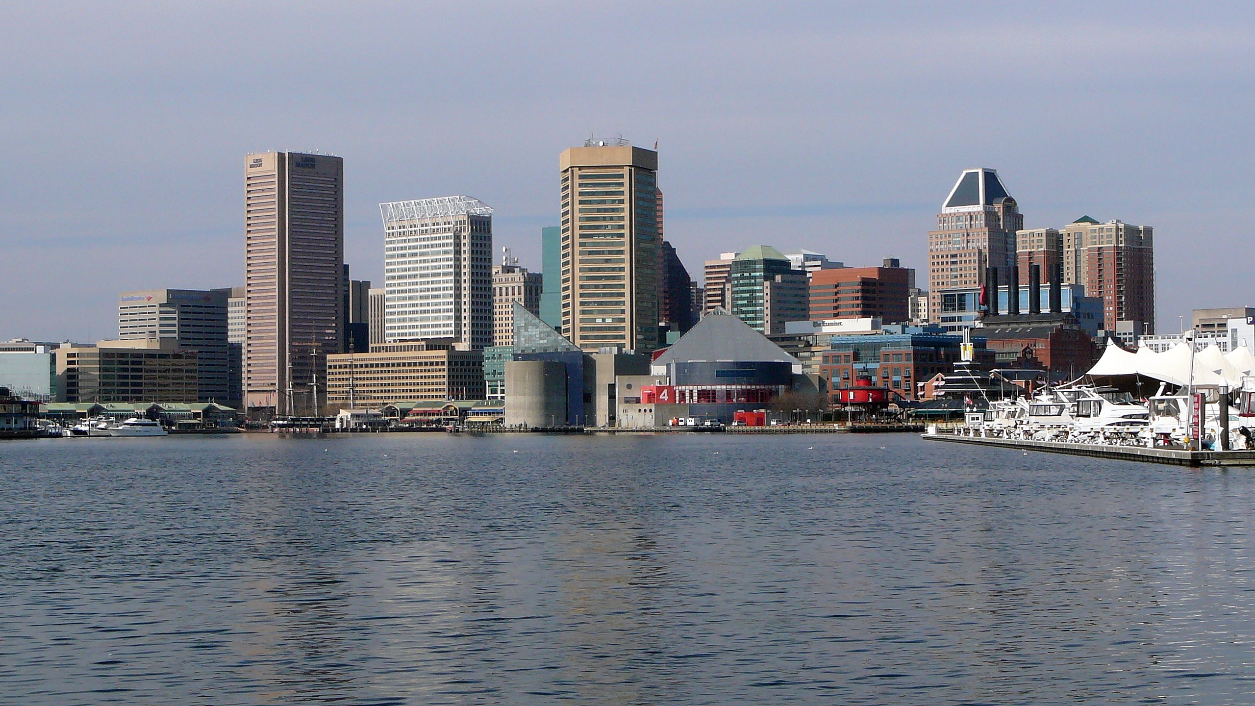


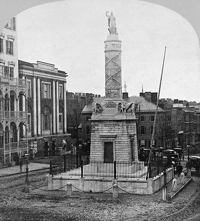
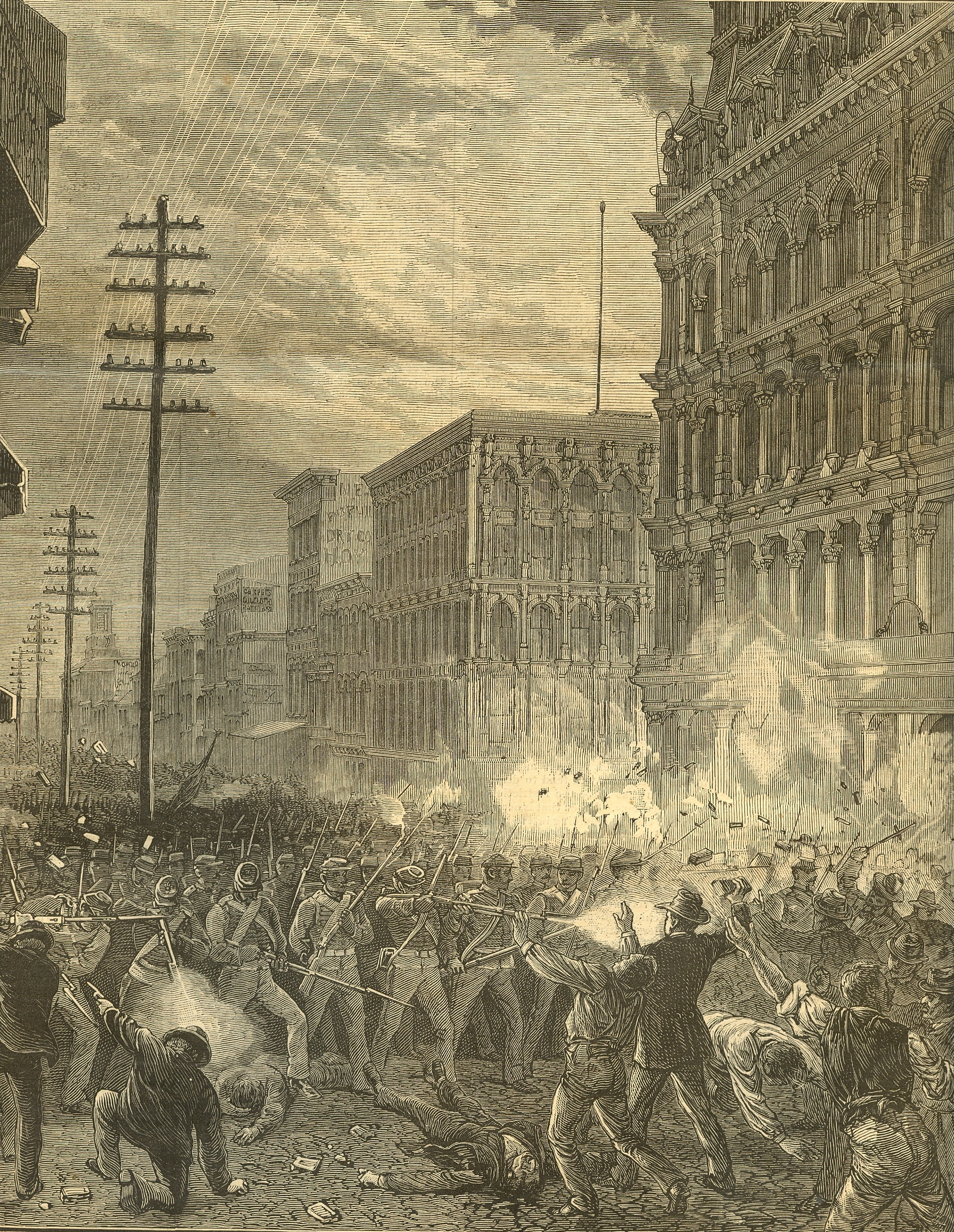
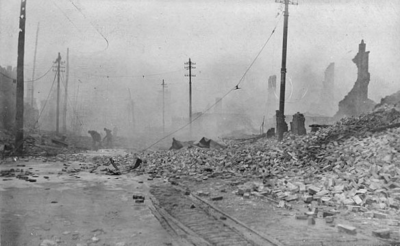
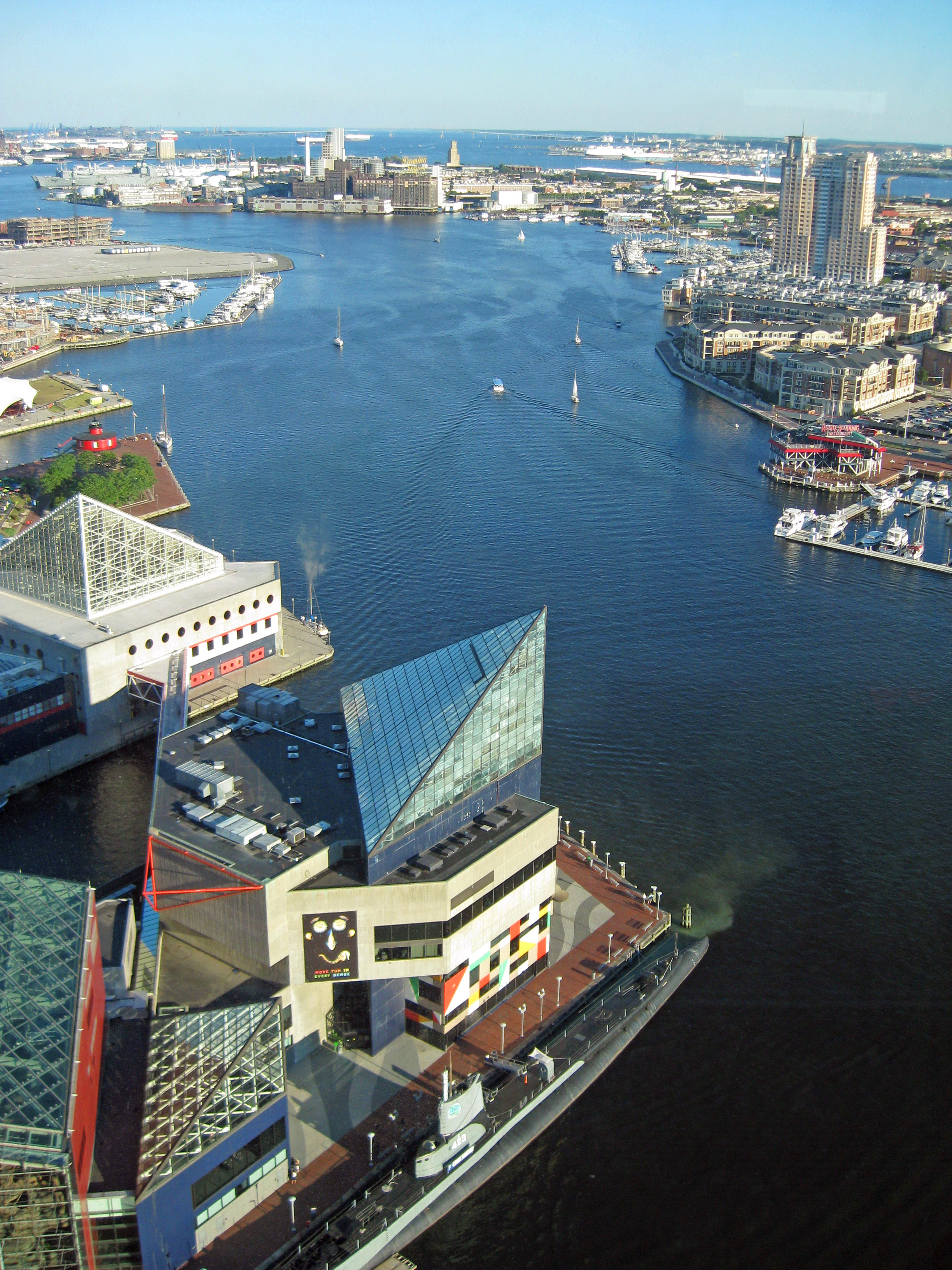
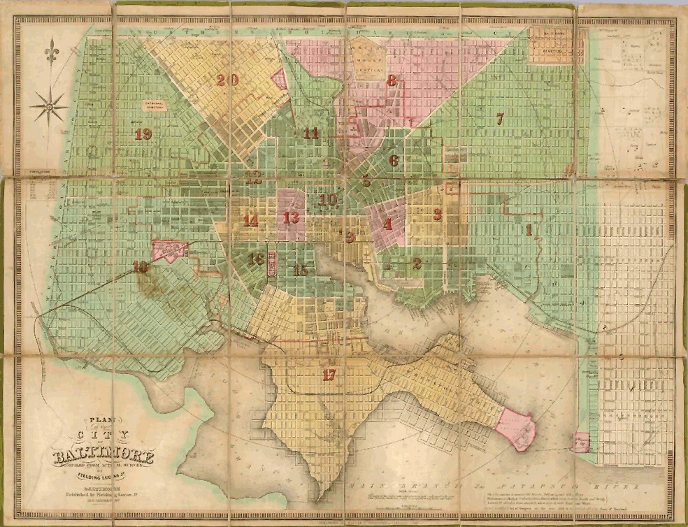

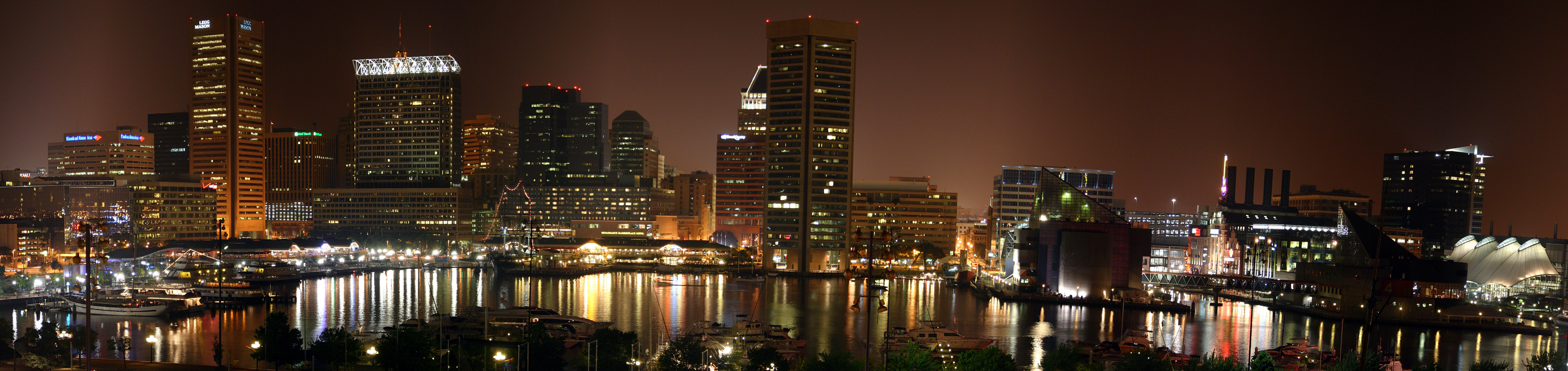
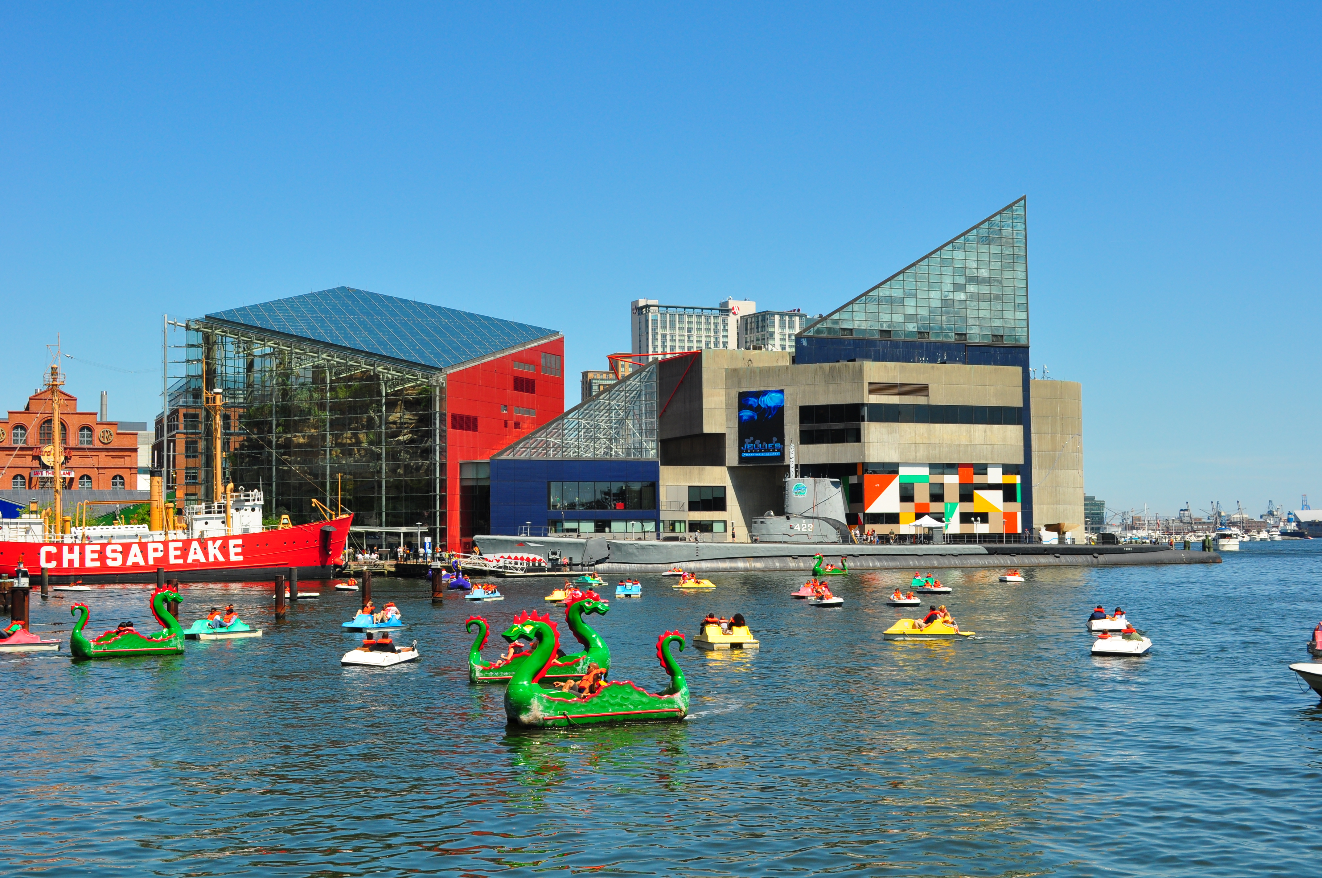
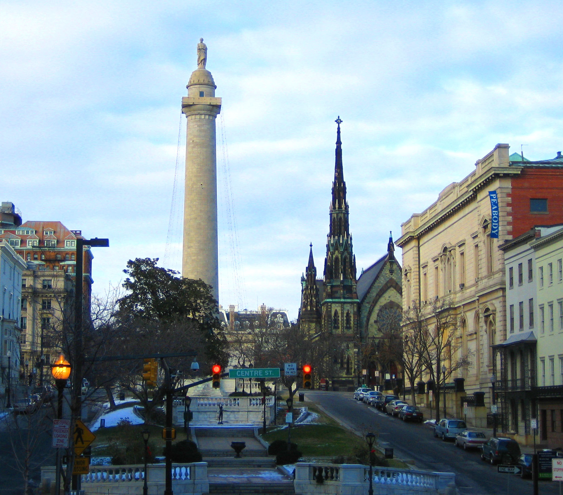
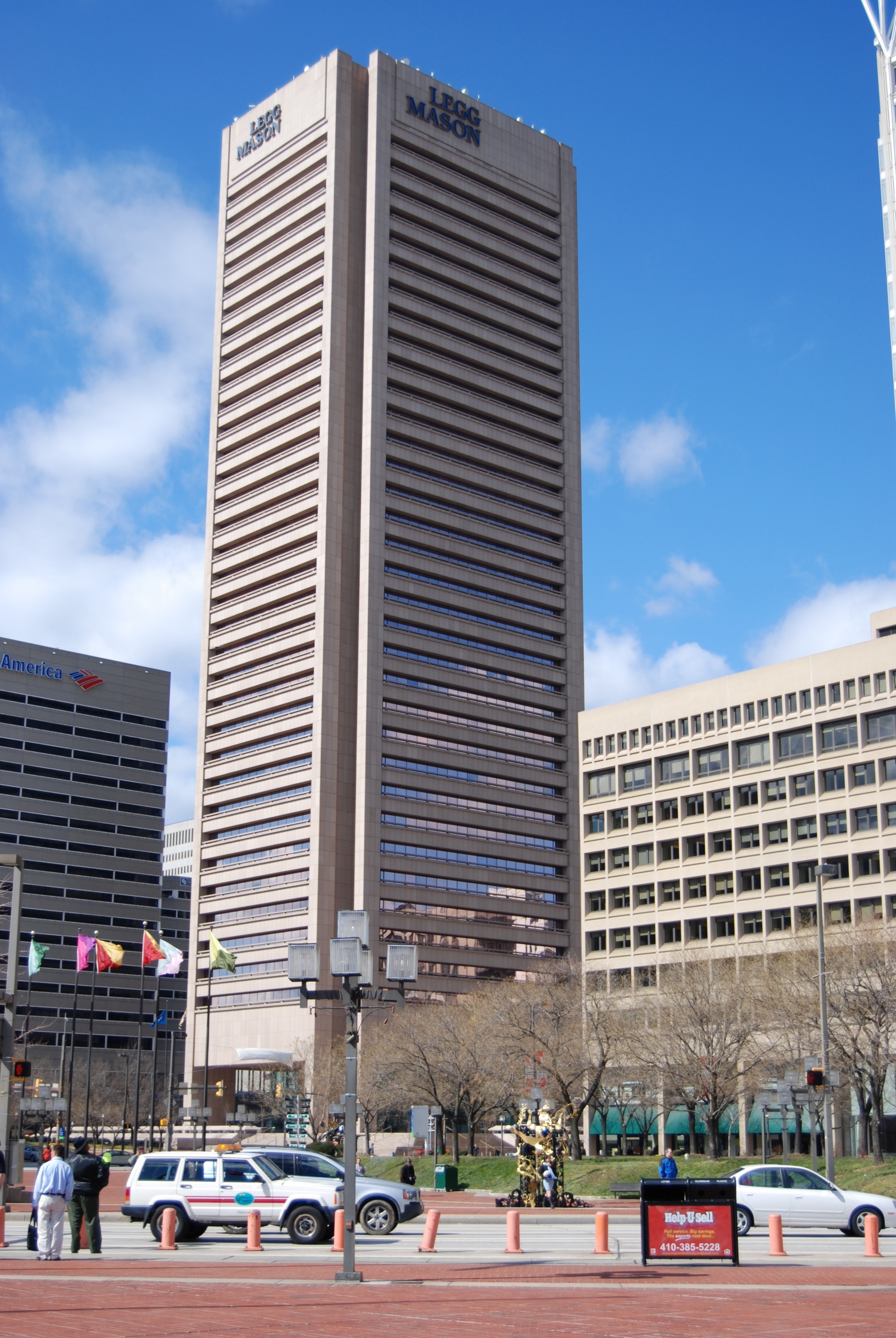

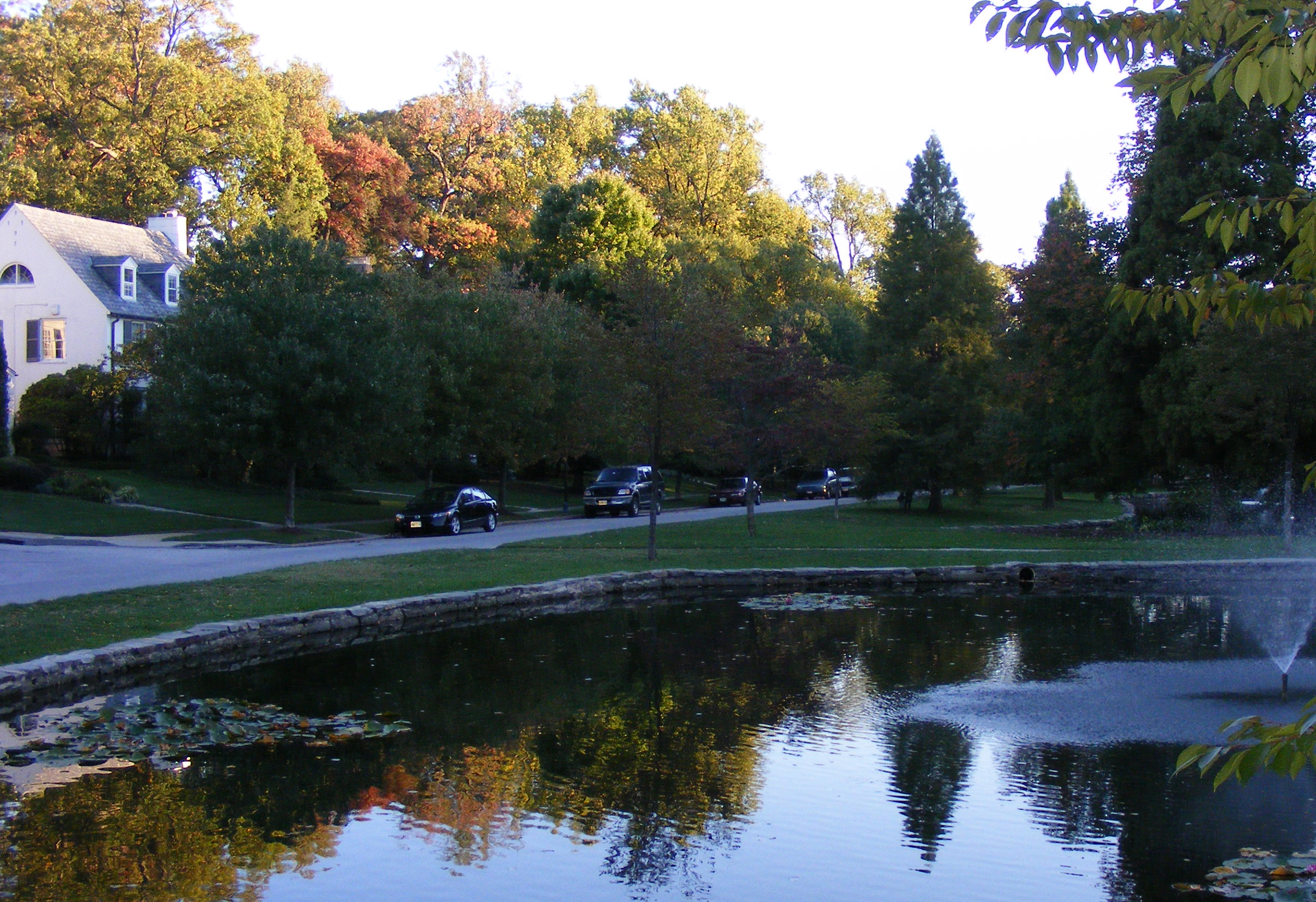


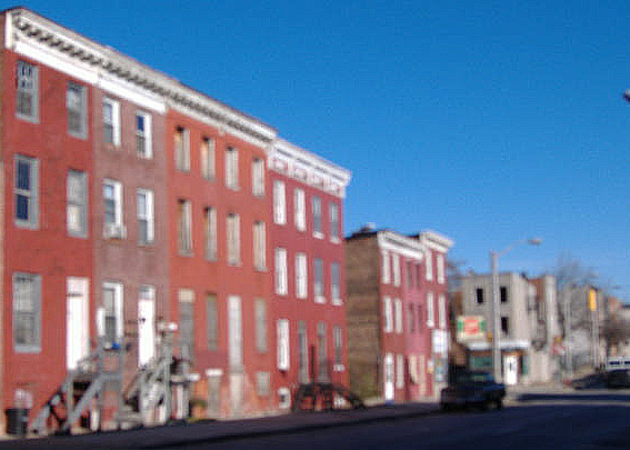
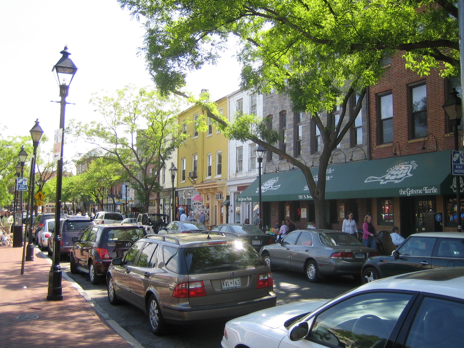
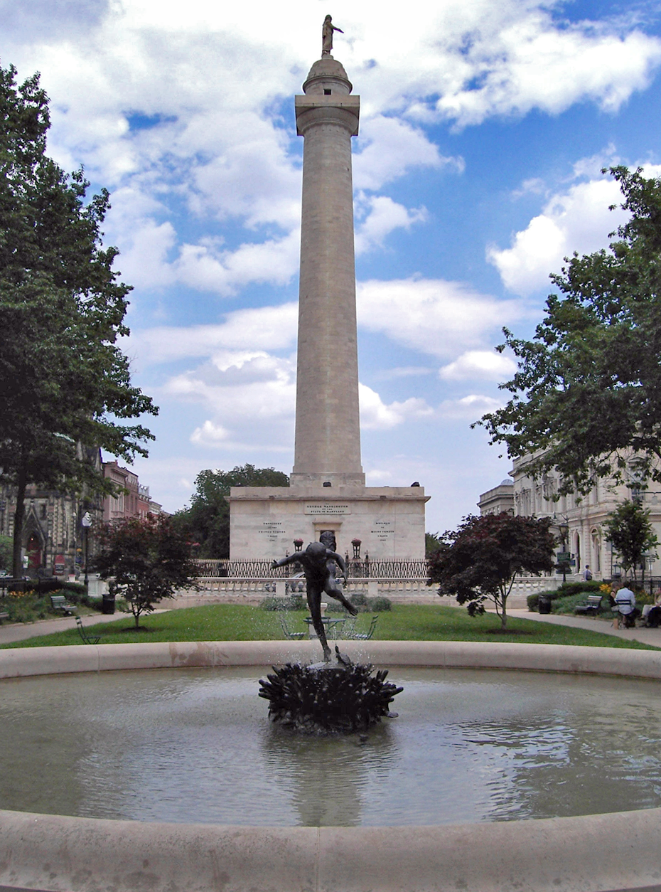
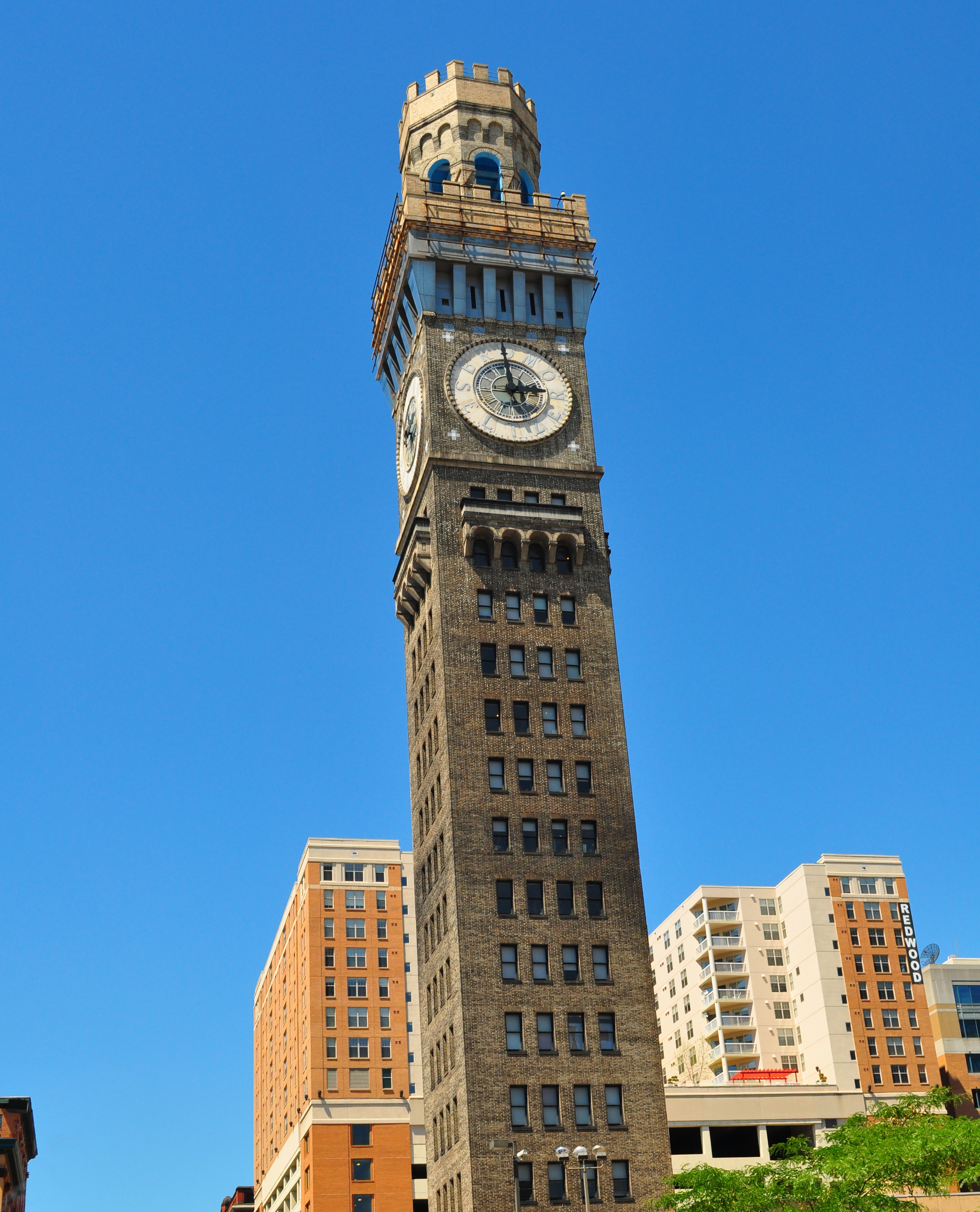
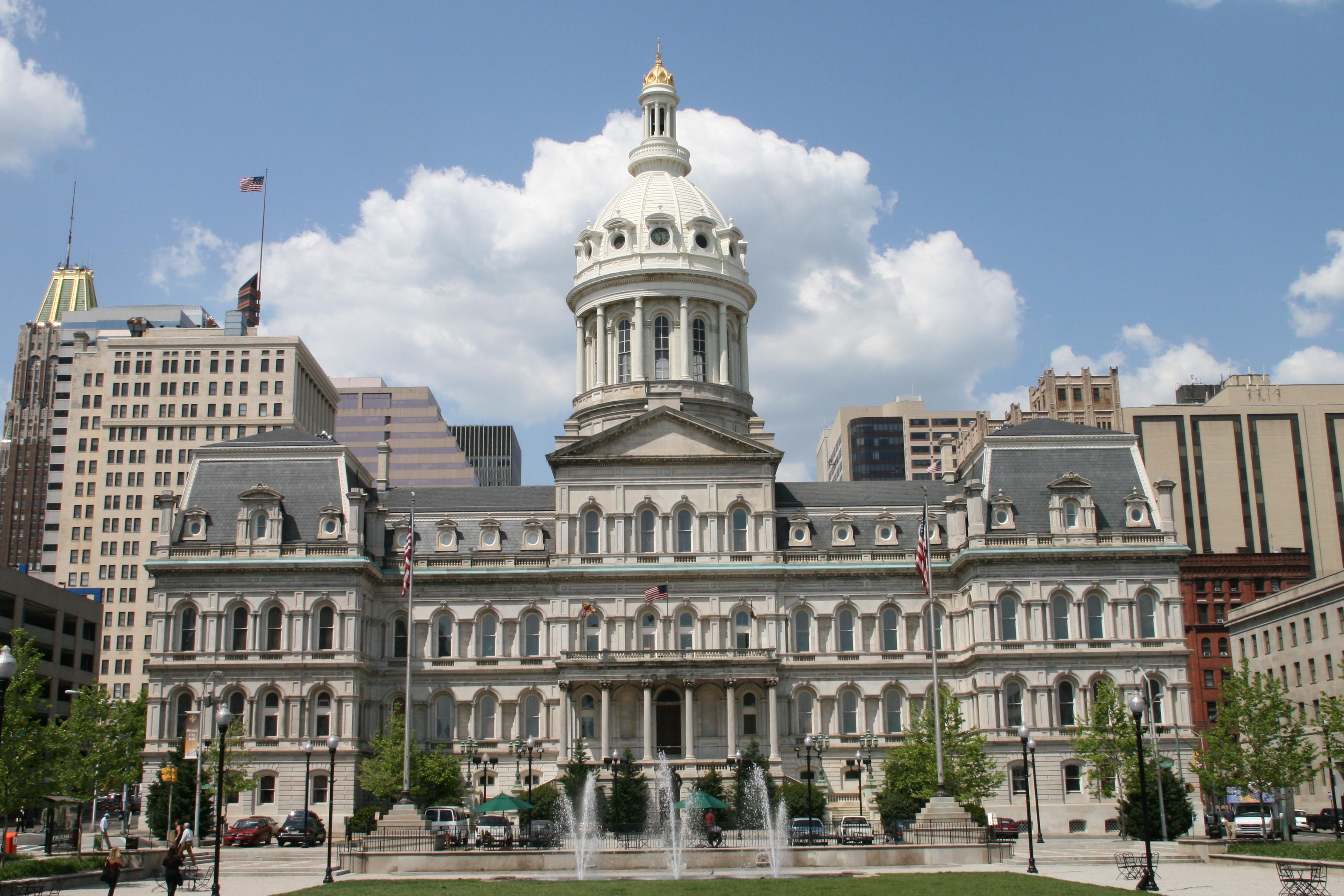
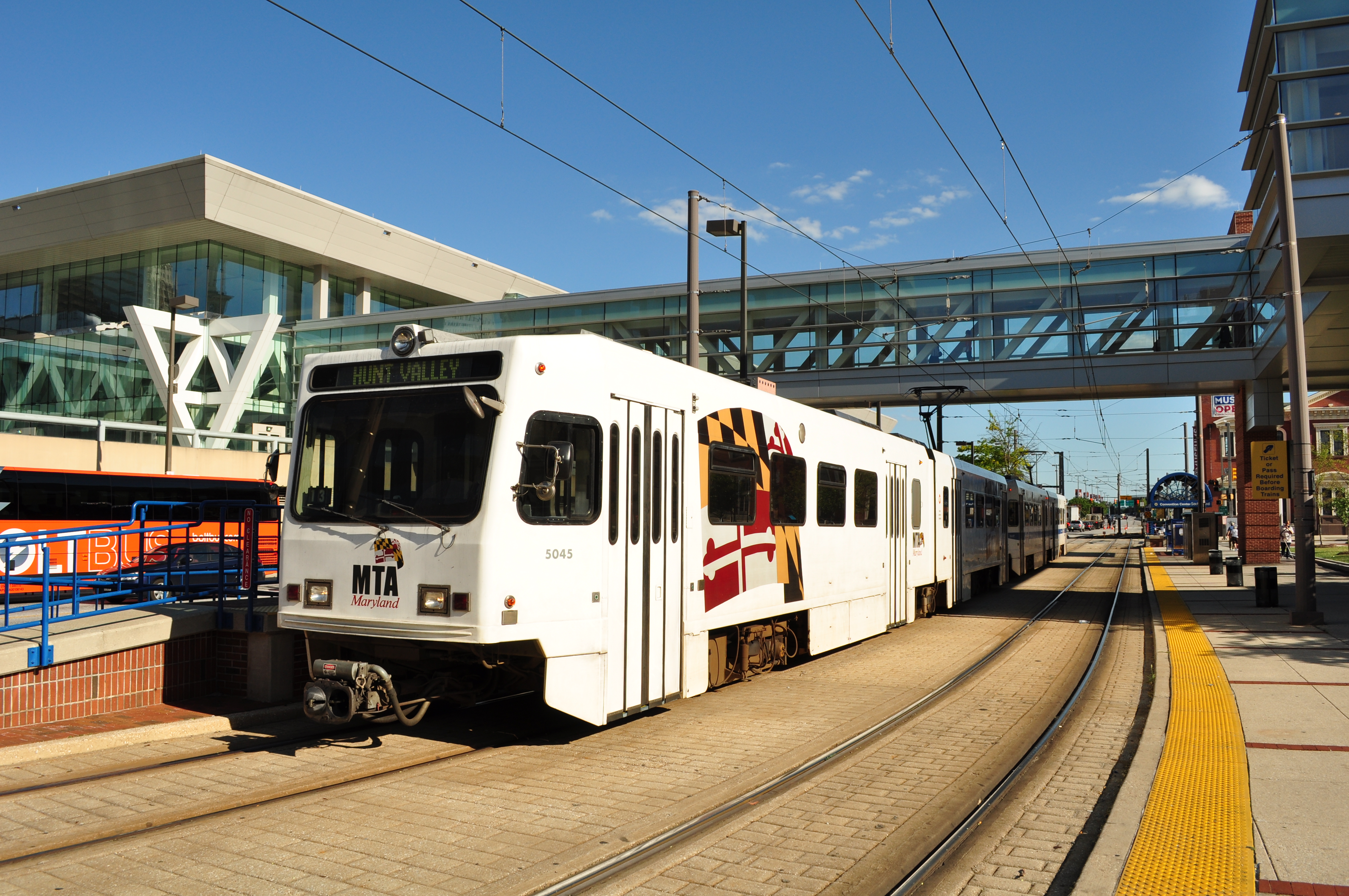
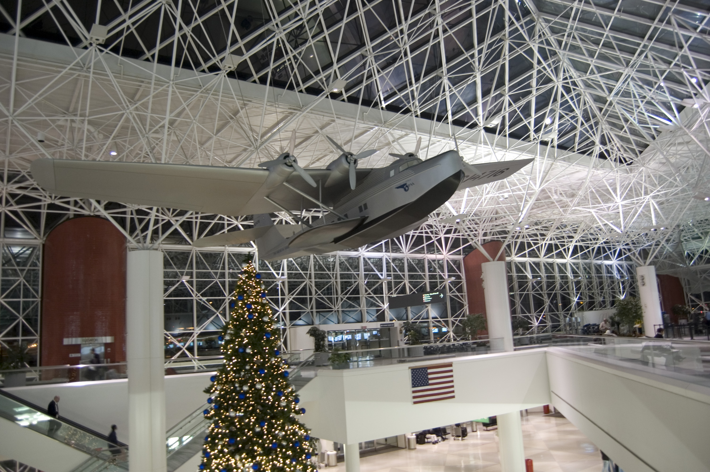

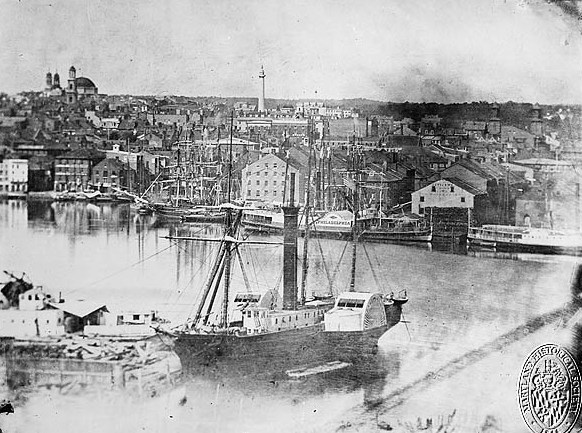

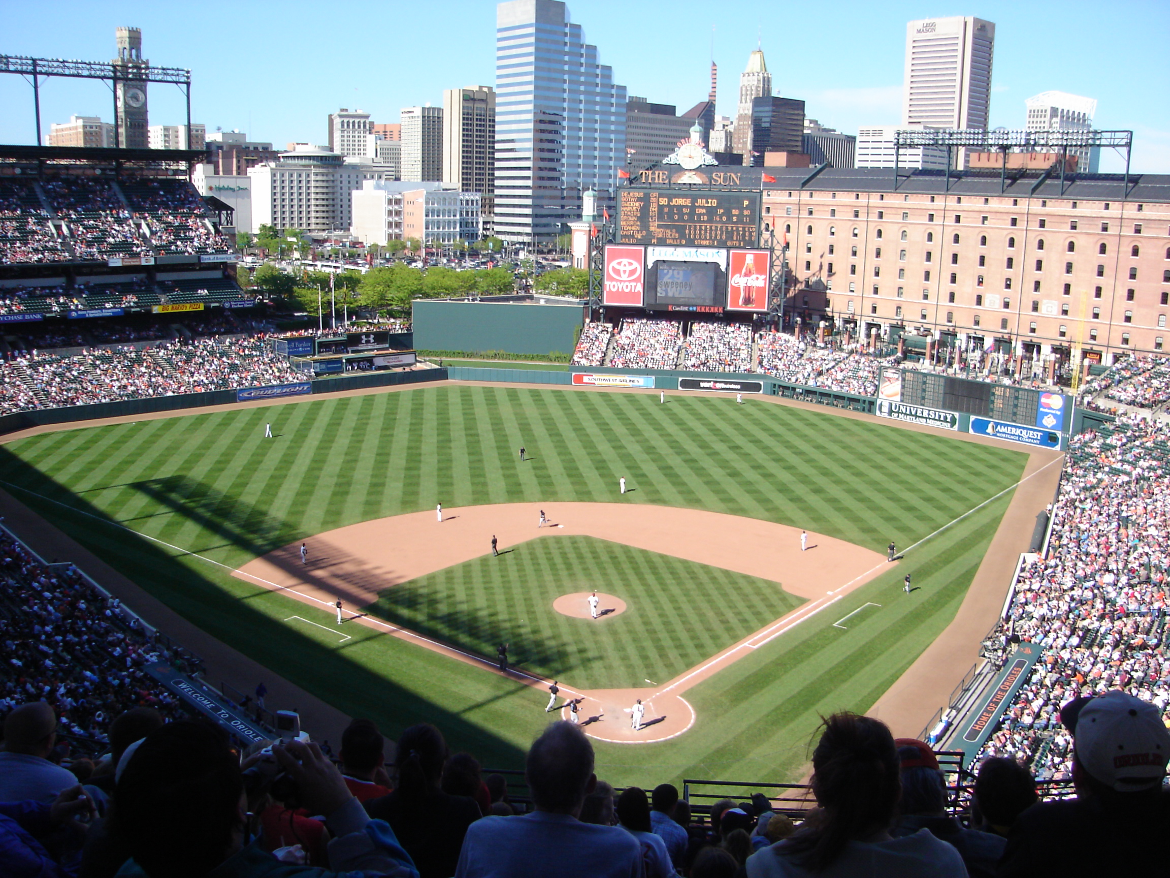
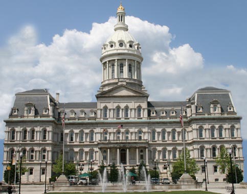
Wikimedia Foundation. 2010.