- Patapsco River
-
Patapsco River 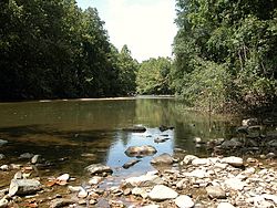 Patapsco Valley State Park at Catonsville
Country United States State Maryland Tributaries - left North Branch - right South Branch Cities Baltimore, Elkridge, Ellicott City Source - location Marriottsville - elevation 260 ft (79 m) - coordinates 39°20′59″N 76°52′56″W / 39.3498272°N 76.8821987°W Mouth Chesapeake Bay - location Baltimore - elevation 0 ft (0 m) - coordinates 39°10′25″N 76°26′36″W / 39.1737202°N 76.4432935°W Basin 632 sq mi (1,637 km2) 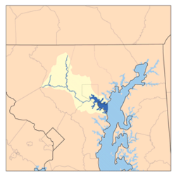 Patapsco River Watershed
The Patapsco River is a 39-mile-long (63 km)[1] river in central Maryland which flows into Chesapeake Bay. The river's tidal portion forms the harbor for the city of Baltimore. With its South Branch, the Patapsco forms the northern border of Howard County, Maryland.
Contents
Geography
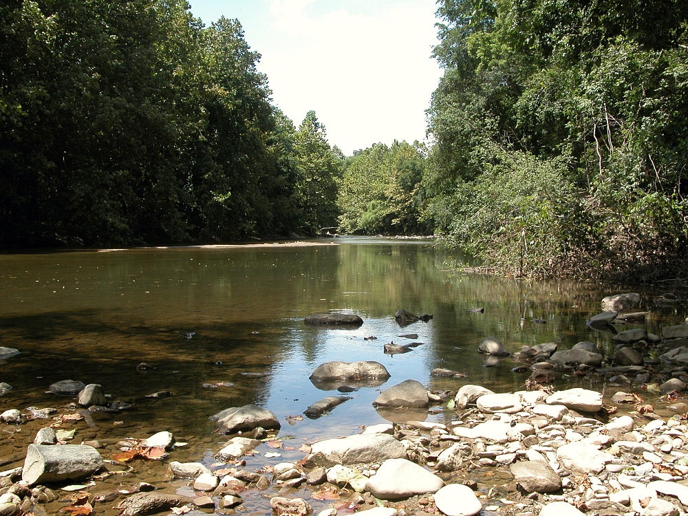
The Patapsco proper begins at the confluence of the North and South Branches, near Marriottsville, approximately 15 miles (24 km) west of downtown Baltimore. The 19.4-mile-long (31.2 km)[1] South Branch rises further west at Parrs Spring, where Howard County, Carroll, Frederick, and Montgomery counties meet. The North Branch flows 20.9 miles (33.6 km)[1] southward from its origins in Carroll County. Through most of its length, the Patapsco is a minor river, flowing for the most part through a narrow valley. The last 10 miles (16 km), however, form a large tidal estuary inlet of Chesapeake Bay. The inner part of this estuary provides the harbor of Baltimore, composed of the Northwest Harbor and the Middle Branch. (See Baltimore Inner Harbor.) The Patapsco estuary is south of the Back River and north of the Magothy River.
The Patapsco has a watershed area (including the water surface) of 680 square miles (1,760 km2), or 632 square miles (1,637 km2) of land. Thus, its total watershed area is 7% water.[citation needed]
Patapsco Valley State Park is adjacent to 32 miles (51 km) of the Patapsco and its branches, encompassing a total of 14,000 acres (5,700 ha) in five different areas. Liberty Dam and its reservoir, located on the North Branch, is a major component of the Baltimore city water system.[2] Besides Baltimore, the river also flows through Ellicott City (the county seat of Howard County) and Elkridge.
History
On the 1612 John Smith map, it was called the Bolus River. It has never been a major path of commerce since it is not navigable further upstream than Elkridge. However, the Patapsco valley was used as the route of the Baltimore and Ohio Railroad's original main line west constructed from 1829 onwards, and this route remains, though much altered. Many old railroad bridges lie along the valley, most notably the Thomas Viaduct and the ruins of the Patterson Viaduct. Flour mills and a hydropower dam were formerly powered by the river.
The valley is prone to flooding, though at long intervals. The most recent severe flood occurred in 1972 as a result of rainfall from the remnants of Hurricane Agnes, in which Ellicott City and the Old Main Line sustained serious damage.
The Patapsco River featured prominently in the Battle of Baltimore during the War of 1812. This is where Francis Scott Key, while aboard a British ship, wrote a poem which would later become the national anthem of the United States, "The Star-Spangled Banner". Today, a red, white, and blue buoy marks the spot where the HMS Tonnant was anchored.
Water quality
The eastern portion of the Patapsco River is in a highly urbanized area and is subject to extensive urban runoff and other forms of water pollution. The Maryland Department of the Environment has identified the Lower North Branch as containing high levels of heavy metals (chromium, arsenic, cadmium, copper, mercury, nickel, lead, selenium, and zinc), as well as phosphorus, fecal coliform bacteria, and PCBs.[3]
See also
- List of Maryland rivers
References
- ^ a b c U.S. Geological Survey. National Hydrography Dataset high-resolution flowline data. The National Map, accessed April 1, 2011
- ^ Baltimore County Department of Environmental Protection and Resource Management. Towson, MD. "Patapsco River Watershed." 2009-07-13.
- ^ Maryland Department of the Environment. Baltimore, MD (2009). "Notice of Intent to Establish Total Maximum Daily Load (TMDL) of Sediment: Patapsco River Lower North Branch Watershed."
External links
- Maryland DNR's Surf Your Watershed: Patapsco/Back River
- Maryland Port Administration
- Blue Water Baltimore, formed in 2010 from a merger of the Gwynns Falls, Jones Falls, Herring Run, and Baltimore Harbor Watershed Associations, and the Baltimore Harbor Waterkeeper
- Friends of Patapsco Valley and Heritage Greenway
Waters of Maryland Bays/Estuaries Assawoman • Chesapeake • Chincoteague • Eastern • Fishing • Herring • Isle of Wight • Mallows • Newport • Pocomoke • Sinepuxent • TangierRivers Anacostia • Annemessex (Big) • Annemessex (Little) • Back • Bird • Blackwater • Blackwater (Little) • Bohemia • Bush • Casselman • Chester • Chicamacomico • Choptank • Choptank (Little) • Christina River • Corsica • Elk • Front • Gunpowder • Hawlings • Jones Falls • Magothy • Magothy (Little) • Manokin • Middle • Miles • Monocacy • Monocacy (Little) • Nanticoke • North East • Patapsco • Patuxent • Pocomoke • Port Tobacco • Potomac • Rhode • St. Martin • St. Marys • Sassafras • Savage • Severn • South • Susquehanna • Transquaking • Tred Avon • Warwick • West • Wicomico (Potomac) • Wicomico • Wye • Wye East • YoughioghenyCreeks/Runs/Streams Antietam • Alloway • Ballenger • Bear (Patapsco) • Bear (Sideling Hill) • Bear (Youghiogheny) • Bennett • Big Pipe • Bodkin • Bread and Cheese • Broad (Choptank) • Broad (Potomac) • Broad (Susquehanna) • Broad Run • Budds • Cabin John • Carroll • Catoctin • Catoctin (Little) • Chicamuxen • Conococheague • Conococheague (Little) • Conowingo • Cuckold • Curtis • Deep Run • Deer • Dividing • Double Pipe • Dry Seneca • Dueling • Dundee • Evitts • Fifteenmile • Fishing • Flintstone • Frog Mortar • Furnace • Georges • Great Seneca • Greys • Gwynns Falls • Harris • Henson • Herring Run • Honga • Indian (Anacostia) • Indian (Patuxent) • Israel • Laurel Run • Licking • Linganore • Little Falls Branch • Little Pipe • Little Seneca • Lyons • Main • Marley • Marsh • Marshyhope • Mattawoman • Meekins • Middle • Minnehaha Branch • Moores Run • Muddy Branch • Nanjemoy • Nassawango • Northeast Branch Anacostia River • Northwest Branch Anacostia River • Octoraro • Owens • Oxon • Paint Branch • Parsons • Piney • Piscataway • Pomonkey • Rock (Potomac) • Rock Run • Rockburn Branch • Romney • St. Leonard • Saltpeter • Sams Creek • Sellman • Seneca (Middle) • Seneca (Potomac) • Sideling Hill • Slaughter • Sligo • Stony • Swanson • Toms • Tonoloway • Town (Patuxent) • Town (Potomac) • Town (Tred Avon) • Trappe • Tuckahoe • Turville • Tuscarora (Monocacy) • Tuscarora (Potomac) • Tuscarora (Little) • Watts Branch • Wills • Winters RunLakes Artemesia • Centennial • Deep Creek • Elkhorn • Bernard Frank • Jennings Randolph • Kittamaqundi • Little Seneca • Needwood • Roland • YoughioghenyReservoirs Categories:- Geography of Baltimore, Maryland
- Chesapeake Bay Watershed
- Rivers of Maryland

Wikimedia Foundation. 2010.