- Elkridge, Maryland
Infobox Settlement
official_name = Elkridge, Maryland
settlement_type = CDP
nickname =
motto =
imagesize =
image_caption =
image_
imagesize =
image_caption =
image_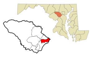
mapsize = 250x200px
map_caption = Location of Elkrdige, Maryland
mapsize1 =
map_caption1 =subdivision_type = Country
subdivision_name =United States
subdivision_type1 = State
subdivision_name1 =Maryland
subdivision_type2 = County
subdivision_name2 = Howard
government_footnotes =
government_type =
leader_title =
leader_name =
leader_title1 =
leader_name1 =
established_title =
established_date =unit_pref = Imperial
area_footnotes =
area_magnitude =
area_total_km2 = 20.4
area_land_km2 = 20.4
area_water_km2 = 0.0
area_total_sq_mi = 7.9
area_land_sq_mi = 7.9
area_water_sq_mi = 0.0population_as_of = 2000
population_footnotes =
population_total = 22042
population_density_km2 = 1081.1
population_density_sq_mi = 2799.9timezone = Eastern (EST)
utc_offset = -5
timezone_DST = EDT
utc_offset_DST = -4
elevation_footnotes =
elevation_m = 28
elevation_ft = 92
latd = 39 |latm = 12 |lats = 7 |latNS = N
longd = 76 |longm = 45 |longs = 1 |longEW = Wpostal_code_type =
ZIP code
postal_code = 21075
area_code = 410 443
blank_name = FIPS code
blank_info = 24-25750
blank1_name = GNIS feature ID
blank1_info = 0590149
website =
footnotes =Elkridge is a
census-designated place (CDP) in Howard County,Maryland ,United States . The population was 22,042 at the 2000 census. Founded early in the 18th century, Elkridge is located at the confluence of three counties, the other two being Anne Arundel and Baltimore counties. It is bordered on the north by Catonsville, on the east by Linthicum andBaltimore-Washington International Airport , on the south by Dorsey, and on the west by various small communities between it and Columbia.History
Elkridge qualifies as the oldest settlement in its present county, when Howard was a part of
Anne Arundel County . Its location on thePatapsco River was a key element in its growth. The settlement existed even before theMaryland General Assembly elected a law to erect a thirty acre, forty-lot town at Elkridge Landing to be called "Jansen Town" in 1733. Initially, the settlement was developed as a place where planters, who each had a wharf along the River, could bring their tobacco crop to be loaded on English trading ships. Later, Elkridge Landing was built as the seaport dock for the community. In 1825, Jansen Town burned, taking out all of the oldest buildings at the Landing and 9 out of 10 houses in the village.Elkridge also has historic churches, including Melville Church on Furnace Ave. Its original building was the first Methodist church built (1772) and was visited on the circuit rides of
Francis Asbury . Saint Augustine Church, on Old Washington Blvd., was originally built in 1845.Elkridge had a rich history of industries including pig-iron forging, basket weaving, paper, cotton and grist milling, as well as employment from the B&O Railroad. The
Thomas Viaduct , located over Levering Avenue at the entrance to thePatapsco Valley State Park , is the oldest stone curved bridge in the world. Built in 1833, its architect wasBenjamin Latrobe, Jr. The B&O first used horse-drawn coaches in relays, hence Relay Station was added. The Viaduct also carried the Tom Thumb and the first telegraph message fromWashington, D.C. , stating: "what has God wrought?" was wired across.Elkridge did not escape the Civil War. Union troops guarded the Viaduct and the thoroughfare to Baltimore City by camping on Lawyers Hill, a community of summer estates built over the years by residents such as Caleb Dorsey ("Belmont"), Baltimore City Supreme Bench Judge George Washington Dobbin (the "Lawn"), Thomas Donaldson ("Edgewood"), John Latrobe ("Fairy-Knowe"), and the Penniman family home ("Wayside"). Some of these families had slaves. Their estate cottages were built along the very top of the Lawyers Hill, including along Old Lawyers Hill Road, which at one corner stands the Elkridge Assembly Rooms. This community hall, built in 1871, was a neutral meeting place for entertainments for Northern and Southern sympathizers of the neighborhood and owned by them as stockholders. Neighbors did not betray neighbors and each protected others property from advancing troops. The historic Lawyers Hill homes remain in the National Historic Trust.
Geography
Elkridge is located at coor dms|39|12|7|N|76|45|1|W|city (39.202057, -76.750157)GR|1.
Elkridge was named for a geographic ridge line, the area and length extending as far west as
Doughoregan Manor and as far south as Oakland Mills. According to theUnited States Census Bureau , the CDP has a total area of 7.9 square miles (20.4 km²), all of it land. except the Patapsco River, tributaries and streams.Demographics
As of the
census GR|2 of 2000, there were 22,042 people, 8,324 households, and 5,793 families residing in the CDP. Thepopulation density was 2,799.9 people per square mile (1,081.4/km²). There were 8,719 housing units at an average density of 1,107.5/sq mi (427.8/km²). The racial makeup of the CDP was 80.58% White, 9.59% African American, 0.21% Native American, 6.47% Asian, 0.03% Pacific Islander, 0.95% from other races, and 2.16% from two or more races. Hispanic or Latino of any race were 2.22% of the population.There were 8,324 households out of which 42.0% had children under the age of 18 living with them, 55.6% were married couples living together, 10.5% had a female householder with no husband present, and 30.4% were non-families. 22.5% of all households were made up of individuals and 4.1% had someone living alone who was 65 years of age or older. The average household size was 2.64 and the average family size was 3.16.
In the CDP the population was spread out with 29.2% under the age of 18, 6.0% from 18 to 24, 44.4% from 25 to 44, 15.3% from 45 to 64, and 5.2% who were 65 years of age or older. The median age was 32 years. For every 100 females there were 95.5 males. For every 100 females age 18 and over, there were 91.9 males.
The median income for a household in the CDP was $65,835, and the median income for a family was $71,923. Males had a median income of $47,329 versus $35,802 for females. The
per capita income for the CDP was $27,629. About 2.0% of families and 2.7% of the population were below thepoverty line , including 2.9% of those under age 18 and 5.5% of those age 65 or over.Notable Residents - Past and Present
*
Arvydas Sabonis
*Dr. Douglas M. "Fresh" Roland III, Founder - Center for MP Research
*Leonard Marion Bahr, portrait painter
*Florence Riefle Bahr , artist and activist, State of MD 1999 "Woman of the Year."
*George Washington Dobbin , Supreme Bench Judge of Baltimore City.
*Caleb andPriscilla Dorsey , original builders of "Belmont."
*Dr. George Dobbin Brown, grandson of G.W. Dobbin.
*John H.B. Latrobe, attorney for the B&O, writer, artist, and builder of "Fairy-Knowe," son of the White House architectBenjamin H. Latrobe , Sr., and brother of Benjamin H. Latrobe, Jr. - the architect of the Thomas Viaduct.
*Saint John Neumann, pastor of Saint Augustine Church 1849-1851
*Jonathan Ward , actor (Charles in Charge ,Mac and Me )References
*cite book
last = Elkridge Heritage Society
year = 1983
title = Lawyers Hill Heritage: Elkridge - 3 Wars and the Peace
publisher =
location =
id =
*cite book
last =
first =
pages = pg. 441
year = Winter 1994
title = "Sidelight on the Baltimore Riot," Maryland Historic Magazine Quarterly,
publisher = Mus. and Library of MHS
location =
id =
*cite book
last = Cramm
first = Joetta M.
pages = pg. 441
year = 1987
title = A Pictorial History of Howard County
publisher =
location =
id =References
External links
* [http://www.staugustinechurch.org/ Saint Augustine Church]
Wikimedia Foundation. 2010.