- Columbia, Maryland
-
Columbia, Maryland — CDP — The People Tree statue is considered a symbol of Columbia. Location of Columbia, Maryland
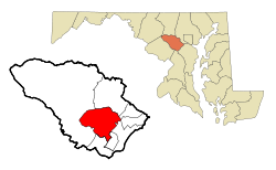
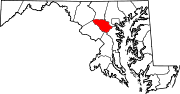
Coordinates: 39°12′13″N 76°51′25″W / 39.20361°N 76.85694°W Country United States State Maryland County Howard Area - Total 27.7 sq mi (71.7 km2) - Land 27.6 sq mi (71.4 km2) - Water 0.1 sq mi (0.3 km2) Elevation 407 ft (124 m) Population (2010)Note that the CDP includes areas not part of the new town. - Total 99,615 - Density 3,202.0/sq mi (1,236.3/km2) Time zone Eastern (EST) (UTC−5) - Summer (DST) EDT (UTC−4) ZIP codes 21044-21046 Area code(s) 410, 443, 301 FIPS code 24-19125 GNIS feature ID 0590002 Columbia is a planned community that consists of ten self-contained villages, located in Howard County, Maryland, United States. It began with the idea that a city could enhance its residents' quality of life. Creator and developer James W. Rouse saw the new community in terms of human values, not just in terms of economics and engineering. Opened in 1967, Columbia was designed to not only eliminate the inconveniences of then-current subdivision design, but also eliminate racial, religious, and income segregation.
Today, Columbia has a population of about 97,200[1] and is the most populous census-designated place in Maryland.[2] By the early 2000s, the town had acquired many of the characteristics of other contemporary U.S. suburbs, such as increasingly large private homes on large parcels and "big box" retail stores accessible mostly by automobile. However, Rouse's ethos remains a strong influence upon the physical and political development of Columbia.
Contents
History
The Rouse Company accumulated over 14,000 acres (57 km2), 10 percent of Howard County (located between Baltimore and Washington), from 140 separate owners. This acquisition was funded by Connecticut General Life Insurance, at an average price of $1,500 per acre ($0.37/m²). In October 1963, the acquisition was revealed to the residents of Howard County, putting to rest rumors about the mysterious purchases. These had included the theory that the site was for a laboratory to study diseases and another that the site was intended to become a giant compost heap.
At this unveiling, James Rouse described Columbia as a planned new city which would avoid the leap-frog and spot development threatening the county. The new city would be complete with jobs, schools, shopping, and medical services, and a range of housing choices. The property taxes from commercial development would cover the additional services with which housing would burden the county. The urban planning process for Columbia included not only planners, but also a convening of a panel of nationally recognized experts in the social sciences, known as the Work Group. Meeting for two days, twice a month, for half a year, the Work Group suggested innovations that the planners should try in education, recreation, religion, and health care, as well as ways of improving social interactions. Open classrooms, the interfaith centers, and the then-novel idea of a Health Maintenance Organization (HMO) with a group practice of medical doctors (the Columbia Medical Plan) sprung from these meetings. Columbia was not incorporated; some governance, however, was to be provided by the Columbia Association, which manages common areas and functions as a homeowners' association with regard to private property. The first manager of the Columbia Association was John Estabrook Slayton, who died in early 1967. The community center in Wilde Lake, the Slayton House, was named after him for the contributions he made to the early planning of Columbia.
The physical plan, with neighborhood and village centers, also were decided upon at these meetings. Columbia's “New Town District” zoning ordinance gives the developer great flexibility about what to put where, without getting approval from the county for each specific project.
The first village to be developed in Columbia was Wilde Lake. The first high school to open in Columbia was Wilde Lake High School, which opened in 1971 as a model school for the nation. Constructed in the open classroom style, it was razed in 1994 and reconstructed on the same site in 1996.
Columbia proper consists only of that territory governed by the Columbia Association, but larger areas are included under its name by the US Postal Service and the census. These include several other communities which predate Columbia, including Simpsonville, Atholton, and in the case of the census, Clarksville and Savage.
Dorsey Hall and Woodlawn are listed on the National Register of Historic Places in 1973.[3]
Master plan
To achieve the goals set forth by the Work Group, Columbia's Master Plan called for a series of ten self-contained villages, around which day-to-day life would revolve. The centerpiece of Columbia would be the Mall in Columbia and man-made Lake Kittamaqundi.
Villages and neighborhoods
The village concept is aimed to provide Columbia a small-town feel (like Easton, Maryland, where James Rouse grew up). Each village comprises several neighborhoods. The village center may contain middle and high schools. All villages have a shopping center, recreational facilities, a community center, a system of bike/walking paths, and homes. Four of the villages have interfaith centers, common worship facilities which are owned and jointly operated by a variety of religious congregations working together.
Most of Columbia's neighborhoods contain single-family homes, townhomes, condominiums and apartments (though some are more exclusive than others). The original plan, following the neighborhood concept of Clarence Perry, would have had all the children of a neighborhood attend the same school, melding neighborhoods into a community and ensuring that all of Columbia's children get the same high-quality education.
- Village – Neighborhoods (in rough order of opening)
- Wilde Lake – Bryant Woods, Faulkner Ridge, Running Brook, The Birches
- Harper's Choice – Longfellow, Swansfield, Hobbit's Glen
- Oakland Mills – Thunder Hill, Talbott Springs, Stevens Forest
- Long Reach – Phelps Luck, Jeffers Hill, Locust Park, Kendall Ridge
- Owen Brown – Dasher Green, Elkhorn, Hopewell
- Hickory Ridge – Clemens Crossing, Hawthorn, Clary's Forest
- Dorsey's Search – Dorsey Hall, Fairway Hills
- Kings Contrivance – Dickinson, Huntington, Macgill's Common
- River Hill – Pheasant Ridge, Pointers Run
- Town Center – Vantage Point, Banneker, Amesbury, Creighton's Run, and Warfield Triangle
Columbia takes its street names from famous works of art and literature: for example, the neighborhood of Hobbit's Glen takes its street names from the work of J. R. R. Tolkien; Running Brook, from the poetry of Robert Frost; and Clemens Crossing, from the work of Mark Twain. The book Oh, you must live in Columbia! chronicles the artistic, poetic, and historical origins of the street and place names in Columbia. [1]
Columbia today
In 2006, Money magazine ranked Columbia (together with Ellicott City, its neighbor to the north) #4 out of the 100 "Best Places to Live" in the United States.[1] In 2008, Columbia and Ellicott City were ranked #8 on this list.[4] In 2010, Columbia and Ellicott City were ranked #2 on this list.
Education and libraries
Columbia's public schools are operated by the Howard County Public School System. As of the 2007–2008 school year, the following high schools served some part of Columbia:[5]
Note that almost all of these schools also serve students from outside Columbia, as is also the case with middle and elementary schools.
There are no conventional four year colleges or universities in Columbia, but several other college level programs have facilities there. Howard Community College is located near the town center, while the University of Phoenix, American Career Institute, Lincoln College of Technology, Loyola College in Maryland and Johns Hopkins University have facilities on the east side of town.
Howard County Library is consistently top rated among the nation’s public library systems according to Hennen's American Public Library Ratings (HAPLR).[6] Two of the six branches of the Howard County public library system are in Columbia, including the Central Branch in Town Center and the East Columbia Branch in Owen Brown.
Health
Medical care is available in the recently renovated Howard County General Hospital, affiliated with Baltimore's famous Johns Hopkins Hospital. The Columbia Medical Plan was the city's largest health maintenance organization (HMO). In more recent years, however, this plan has divided into separate medical groups that simply share the Twin Knolls buildings. Today, there is a Kaiser Permanente facility located in the Columbia Gateway industrial park. There are also a number of clinics, such as the Righttime Medical Care center.
Shopping
The Mall in Columbia is a large regional shopping mall with five anchor department stores (Nordstrom, Lord & Taylor, Sears, Macy's, and JC Penney) and over 200 stores and restaurants. Also containing a 14-screen AMC movie theater, an LL Bean retail store, a Cheesecake Factory restaurant, and a Bank of America, in an outside extension area, the Mall is a societal center for the community and is located in Town Center.
There are several other major shopping centers in the Columbia area, including Snowden Square, Columbia Crossing I and II, Dobbin Center, Gateway Overlook, Ellicott City's Long Gate Shopping Center, and Hanover's Arundel Mills (in neighboring Anne Arundel County).
Columbia's nine "village centers" provide residents with nearby shopping as well, often including supermarkets, gas stations, liquor stores, dry cleaners, restaurants, and hair salons. The village centers are laid out so that individual stores are not visible from the road, unlike traditional strip malls. The arrangement is criticized because it makes it difficult for newcomers and non-residents to know what shopping is available; it is praised for eliminating much of the garishness of roadside America.
The village centers have evolved over time. The Oakland Mills Village Center had a traditional Village Center layout—stores located off a central corridor—until its demolition in the late 1990s. It has since been replaced with a more traditional strip mall. The Kings Contrivance Village Center underwent major construction in 2007 and 2008 when a new Harris Teeter was added to the center, but maintained the original character of stores around a central corridor and plaza.
Economy
Jim Rouse conceived of a city, not a suburban bedroom community, and a large area on the eastern edge was allocated for industrial purposes. The centerpiece of this aspect of the development was a General Electric appliance plant on a 1,125-acre (4.55 km2) site. This plant began operations in 1972 and was closed in 1990, with all but 21 acres (85,000 m2) of the property being sold back to HRD. After toxic waste remediation, one section was redeveloped for big box retail; the remainder became the large Gateway Commerce office complex, still being expanded.[7] There is still a smaller industrial area to the south of this, but by and large East Columbia is dominated by commercial real estate: office, retail, and wholesale. This is somewhat in contrast to the original plan, which saw the Town Center area as the commercial center of Columbia.[citation needed]
The U.S. Federal Government is the source of many jobs for Columbians. Several large U.S. Department of Defense installations and R&D facilities surround Columbia, the largest being the National Security Agency at Fort George G. Meade, and the Applied Physics Laboratory, both pre-dating the establishment of Columbia. Companies which have had research facilities in the area include W. R. Grace and Company and Westvaco. Further afield, many Columbians commute to government and government contractor jobs in the Baltimore and the DC area.[citation needed]
Companies based in Columbia include W. R. Grace and Company,[8][9] Sourcefire, PetMeds, MICROS Systems, Martek Biosciences, Integral Systems, Corporate Office Properties Trust and the consumer research company Arbitron.[citation needed] When MaggieMoo's was an independent company, its headquarters was in the Columbia CDP.[10][9]
Recreation
Recreation has always been an important part of the Columbia concept. The homeowners association, the Columbia Association, known to Columbians as "CA," builds, operates and maintains most of these facilities. CA operates a variety of recreational facilities, including 23 outdoor swimming pools, six indoor pools, two water slides, ice and roller skating rinks, an equestrian center, a sports park with miniature golf, a skateboard park, batting cages, picnic pavilions, clubhouse and playground, three athletic clubs including the 24/7 Supreme Sports Club, numerous indoor and outdoor tennis, basketball, volleyball, squash and racquetball courts, and running tracks. In February, 2006, LifeTime Fitness (a Minnesota company) opened a 24/7 health club at the edge of the Columbia Gateway industrial park. This facility includes 1 outdoor and 2 indoor pools (with water slides), racquetball courts, basketball courts, fitness equipment, and pilates and yoga facilities.
There are three lakes (Lake Kittamaqundi, Lake Elkhorn, and Wilde Lake) surrounded by parkland for sailing, fishing, and boating; 80 miles (130 km) of paths for jogging, strolling and biking; and 148 tot lots and play areas.
Nine village centers, 15 neighborhood centers, and four senior centers provide space for a large variety of community activities. There are a variety of fairs and celebrations throughout the year, including entertainment on the lakefront of Lake Kittamaqundi during the summer and the Columbia Festival of the Arts.
Columbia also has garden plots for rent, under the guidance of the Columbia Gardeners, which has been in existence since the 1970s. There are about 350 garden plots at three sites in Columbia, with each garden rented for a nominal fee (currently $30 per year). (Columbia Flyer, Doug Miller "Turning over a new leaf could be growing concern", May 31, 2007, page 17)
Entertainment / performing arts
In the absence of nightclubs, Columbia relies on local bars to bring in bands. Clyde's (near the Columbia Mall and on Lake Kittamaqundi), Sonoma's (in Owen Brown), along with Nottingham's Tavern and The Green Turtle (near Dobbin Center) regularly bring in groups to perform.
Merriweather Post Pavilion, a well-known outdoor concert venue, attracts many prominent performers. In addition, there are several performing arts organizations that present professional theater: Toby's Dinner Theatre, which has produced the area premieres of Thoroughly Modern Millie, Aida, Titanic, and Ragtime, and will produce the Maryland/Virginia regional premiere of The Producers in 2008 and Rep Stage at Howard Community College.
Transportation
Columbia's initial plan called for a minibus system connecting the village centers on a distinct right-of-way. This was never constructed, though minibuses were operated by the Columbia Association under the name ColumBus. These were eventually taken over by Howard County. Six Howard Transit bus routes now serve Columbia and connect it with its neighboring areas (such as Ellicott City and BWI Airport), while several Maryland Transit Administration (MTA) routes provide access to and from both Washington and Baltimore. MTA weekday commuter bus service connects Columbia to the Washington Metro system. There are no rail stations within Columbia, although the Dorsey MARC Train station is served by Howard Transit buses.
Columbia also has a number of roadways that serve the city. These are: U.S. Route 29, Interstate 95, MD 32, MD 108, MD 100, and MD 175. All of these highways allow Columbia access to nearby Baltimore, Washington, DC, and Annapolis.
Geography
The center of Columbia is located at 39°12.5′N 76°52′W / 39.2083°N 76.867°W. However, its geography is considerably clouded by confusion over its exact limits. On the strictest definition, Columbia consists only of the land governed under covenants by the Columbia Association. This is a considerably smaller area than the census-designated place(CDP) as defined by the United States Census Bureau, which has a total area of 27.7 square miles (72 km2), of which, 27.6 square miles (71 km2) of it is land and 0.1 square miles (0.26 km2) of it (0.36%) is water. This includes a number of older communities which do not lie within the CA's purview, including the Holiday Hills, Diamondback, and Allview subdivisions and the former town of Simpsonville, as well as some land on the east side of Clarksville. These areas are not part of the "new town", and are not directly served by its amenities. Some of these areas are included in Columbia zip codes by the post office, and some are not.
The city lies in the Piedmont region of Maryland, with its eastern edge at the fall line. The climate is that of central Maryland, tending to hot, humid summers and cold but wet winters. The primary landforms in Columbia are rolling hills and stream valleys; Columbia's road network is laid out to follow the terrain, with many winding streets and cul-de-sacs. Elevations range from about 200 to 500 feet (60–150 m) above sea level. Most of Columbia is drained by the Middle Patuxent River and Little Patuxent River. There are three artificial lakes, created by damming of tributary streams during city construction. Along with Symphony Woods, many other stands of mature trees have been maintained in Columbia, including the large Middle Patuxent Environmental Area in the western part of the city between Harper's Choice and River Hill villages, protecting much of the river valley from development.
Demographics
NOTE: The CDP includes considerable areas which are not part of the planned community.
As of the census[11] of 2000, there were 88,254 people, 34,199 households, and 23,118 families residing in the CDP. The population density was 3,202.0 people per square mile (1,236.4/km²). There were 35,281 housing units at an average density of 1,280.0 per square mile (494.3/km²). The racial makeup of the CDP was 66.52% White, 21.47% Black or African American, 0.26% Native American, 7.30% Asian, 0.05% Pacific Islander, 1.63% from other races, and 2.76% from two or more races. 4.12% of the population were Hispanic or Latino of any race.
Historical populations Census Pop. %± 1970 8,815 — 1980 52,518 495.8% 1990 75,883 44.5% 2000 88,254 16.3% 2010 99,615 12.9% There were 34,199 households out of which 35.9% had children under the age of 18 living with them, 53.4% were married couples living together, 11.2% had a female householder with no husband present, and 32.4% were non-families. 25.6% of all households were made up of individuals and 5.1% had someone living alone who was 65 years of age or older. The average household size was 2.54 and the average family size was 3.09.
In the CDP the population was spread out with 26.3% under the age of 18, 6.7% from 18 to 24, 34.1% from 25 to 44, 25.5% from 45 to 64, and 7.5% who were 65 years of age or older. The median age was 36 years. For every 100 females there were 93.1 males. For every 100 females age 18 and over, there were 88.7 males.
According to a 2007 estimate, the median income for a household in the CDP was $94,966, and the median income for a family was $107,210. [9] Males had a median income of $60,498 versus $41,501 for females. The per capita income for the CDP was $32,833. About 3.4% of families and 5.4% of the population were below the poverty line, including 5.7% of those under age 18 and 11.0% of those age 65 or over.
Sister cities
Columbia is a sister city to the planned cities of Cergy-Pontoise, France and Tres Cantos, Spain. Columbia Association organizes a summer exchange program for French and Spanish students enrolled in Howard County Public Schools.
Famous Columbians
- Stephen Amidon, author, whose 2000 novel, The New City, is set in a fictionalized Columbia in the 1970s
- Bob Beaumont (1932-2011), founder of Citicar, an electric automobile manufacturer from 1974 to 1977.[12]
- Michael Benton, U.S. diplomat to Denmark
- Jayson Blair, disgraced former New York Times reporter
- Michael Chabon, Pulitzer Prize winning author
- Frank Cho, creator of Liberty Meadows comic strip
- George Colligan, New York–based jazz pianist
- Cristeta Comerford, White House Executive Chef
- D'Monroe, Broadway and Off-Broadway Actor
- Mary Downing Hahn, award winning author of young adult literature
- Greg Hawkes, keyboardist for new wave band The Cars
- Stephen Hunter, Pulitzer Prize-winning film critic and author
- Ian Jones-Quartey, creator of the webcomic RPG World
- JJ Kincaid, New York City radio personality, got his start DJing at the Columbia Ice Rink.
- Kerry G. Johnson, award winning caricaturist, cartoonist and humorous illustrator
- Laura Lippman, award winning mystery author
- Suzanne Malveaux, CNN Reporter
- Aaron Maybin, American football defensive end for the New York Jets of the National Football League
- Aaron McGruder, animator and cartoonist (The Boondocks)
- Edward Norton, Academy Award–nominated actor and grandson of James Rouse, made his professional debut at age 8 at Toby's Dinner Theatre in the Town Center.
- Randy Pausch, professor of computer science at Carnegie Mellon University, author of The Last Lecture
- Elise Ray, Olympic gymnast
- James W. Rouse, urban planner, real estate developer and philanthropist. Also grandfather of actor Edward Norton
- Christian Siriano, fashion designer and winner of the fourth season of Project Runway (born in Columbia)
- Dave Sitek, guitarist and music producer, best known as a member of the band TV on the Radio
- Linda Tripp, central figure in the Monica Lewinsky scandal
- Terry Virts, astronaut
- Air Commodore Sir Frank Whittle, OM, KBE inventor of the jet engine
- Kenneth Catania, MacArthur Foundation Fellow and Professor of Biology at Vanderbilt University
- Void (band), punk band on Dischord Records
References
- ^ a b Money: "Best Places to Live: Columbia"
- ^ http://www.mdp.state.md.us/msdc/census/cen2000/PL94-171/ByCDP/cdp0090t.pdf
- ^ "National Register Information System". National Register of Historic Places. National Park Service. 2008-04-15. http://nrhp.focus.nps.gov/natreg/docs/All_Data.html.
- ^ "Best Places to Live 2008 – from Money Magazine". CNN. http://money.cnn.com/magazines/moneymag/bplive/2008/.
- ^ "Howard County High School Attendance Area Map". http://www.hcpss.org/boundarylines/map_high.pdf.
- ^ Hennen’s American Public Library Ratings. Hennen’s American Public Library Ratings, Hennen’s American Public Library Ratings (HAPLR), 2010, retrieved October 18, 2010
- ^ "General Electric Company: Former Appliance Park East Facility: Columbia, MD". Environmental Protection Agency. http://www.epa.gov/reg3wcmd/ca/pdf/ge.pdf. Retrieved 2008-10-22.
- ^ "Grace in Maryland." W. R. Grace and Company. Retrieved on June 29, 2011. "Corporate Headquarters & Grace Davison Headquarters W. R. Grace & Co. 7500 Grace Drive Columbia, MD 2104"
- ^ a b "Columbia CDP, Maryland." U.S. Census Bureau. Retrieved on February 26, 2010.
- ^ "Home." MaggieMoo's. January 25, 1999. Retrieved on February 26, 2010.
- ^ "American FactFinder". United States Census Bureau. http://factfinder.census.gov. Retrieved 2008-01-31.
- ^ Bunkley, Nick. "Bob Beaumont, Who Popularized Electric Cars, Dies at 79", The New York Times, October 29, 2011. Accessed October 30, 2011.
Further reading
- Joseph Rocco Mitchell and David L. Stebenne, New City Upon A Hill: A History of Columbia, Maryland (The History Press, 2007)
- Missy Burke, Robin Emrich and Barbara Kellner, Oh, you must live in Columbia: The origins of place names in Columbia, Maryland (2008) [10]
- Barbara Kellner, Columbia – Images of America [11]
External links
- Columbia Association, Inc.
- Columbia Archives
- Columbia Maryland
- 2006 Money Magazine's 4th Best Place to Live in the US
Coordinates: 39°13′N 76°52′W / 39.21°N 76.86°W
- Stephen Amidon talks to Kojo Nnamdi about growing up in Columbia in the 1970s [12]
Education Historic Sites Dorsey Hall · WoodlawnPublic Places Villages Dorsey's Search · Harper's Choice · Hickory Ridge · King's Contrivance · Long Reach · Oakland Mills · Owen Brown · River Hill · Town Center · Wilde LakeMunicipalities and communities of Howard County, Maryland County seat: Ellicott City CDPs Columbia | Elkridge | Ellicott City | Jessup‡ | North Laurel | Savage-Guilford
Other
communitiesAnnapolis Junction | Benson | Clarksville | Cooksville | Daniels | Dayton | Dorsey | Dorsey's Search | Fulton | Glenelg | Glenwood | Guilford | Hanover | Harper's Choice | Henryton Heights | Hickory Ridge | Highland | Hopewell | Ilchester | Kings Contrivance | Linwood | Lisbon | Long Reach | Marriottsville | Oakland Mills | Owen Brown | Paternal Gift Farm | River Hill | Savage | Scaggsville | Simpsonville | Town Center, Columbia | West Friendship | Wilde Lake | Woodbine | Woodstock
Footnotes ‡This populated place also has portions in an adjacent county or counties
Categories:- Populated places established in 1967
- Census-designated places in Maryland
- Columbia, Maryland
- Populated places in Howard County, Maryland
- Planned cities in the United States
- Unincorporated communities in Maryland
- Village – Neighborhoods (in rough order of opening)


Wikimedia Foundation. 2010.