- Jessup, Maryland
Infobox Settlement
official_name = Jessup, Maryland
settlement_type = CDP
nickname =
motto =
imagesize =
image_caption =
image_
imagesize =
image_caption =
image_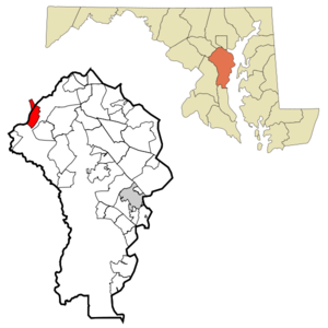
mapsize = 250x200px
map_caption = Location of Jessup, Maryland
mapsize1 =
map_caption1 =subdivision_type = Country
subdivision_name =United States
subdivision_type1 = State
subdivision_name1 =Maryland
subdivision_type2 = Counties
subdivision_name2 = Anne Arundel, Howard
government_footnotes =
government_type =
leader_title =
leader_name =
leader_title1 =
leader_name1 =
established_title =
established_date =unit_pref = Imperial
area_footnotes =
area_magnitude =
area_total_km2 = 11.0
area_land_km2 = 11.0
area_water_km2 = 0.0
area_total_sq_mi = 4.2
area_land_sq_mi = 4.2
area_water_sq_mi = 0.0population_as_of = 2000
population_footnotes =
population_total = 7865
population_density_km2 = 717.4
population_density_sq_mi = 1858.0timezone = Eastern (EST)
utc_offset = -5
timezone_DST = EDT
utc_offset_DST = -4
elevation_footnotes =
elevation_m = 66
elevation_ft = 217
latd = 39 |latm = 8 |lats = 18 |latNS = N
longd = 76 |longm = 46 |longs = 30 |longEW = Wpostal_code_type =
ZIP code
postal_code = 20794
area_code = 240, 301, 410, 443
blank_name = FIPS code
blank_info = 24-42550
blank1_name = GNIS feature ID
blank1_info = 0590560
website =
footnotes =Jessup (pronounced JESS-up) is an
unincorporated town andcensus-designated place in Howard County,Maryland andAnne Arundel County, Maryland . The population was 7,865 at the 2000 census. Thecenter of population of Maryland is located in Jessup. [cite web |url=http://www.census.gov/geo/www/cenpop/statecenters.txt |title=Population and Population Centers by State: 2000 |accessdate=2008-06-26 |publisher=U.S. Census Bureau |year=2000 ] It is most noted as the location of one ofMaryland 's state prison complexes. The community has a little-used stop on the Camden line of the MARCcommuter rail service. The town is referenced several times in theHBO original series, "The Wire".Geography
Jessup is located at coor dms|39|8|18|N|76|46|30|W|city (39.138374, -76.774929)GR|1.
According to the
United States Census Bureau , the CDP has a total area of 4.2 square miles (11.0 km²).None of the area is covered with water.History
The town began as Jessup's Cut, a post village in Howard County on the
Baltimore and Ohio Railroad . The name is generally attributed to Jonathan Jessup, a civil engineer who worked on the Baltimore and Ohio Railroad. The name was shortened in 1863. Into the mid 20th century, the town was called Jessups, then was shortened to Jessup. [cite web |url=http://jiainc.org/history.htm |title=History of Jessup |accessdate=2008-06-25 |publisher=Jessup Improvement Association ] ]Since the mid-19th century, the area has been home to various penal institutions. [cite web |url=http://www.washingtonpost.com/wp-dyn/content/article/2007/03/18/AR2007031800137.html |title=In Surprise Move, Md. Closes Jessup Prison, Transfers Inmates |accessdate=2008-06-25 |last=Helderman |first=Rosalind M. |date=
2007-03-19 |work=The Washington Post |publisher=The Washington Post Company] [cite web |url=http://www.dpscs.state.md.us/locations/prisons.shtml |title=Correctional Facility Locator |accessdate=2008-06-25 |publisher=Maryland Department of Public Safety & Correctional Services ] Inmates today still refer to these jails as "the cut," probably unaware of the origin of the name.Among its notable residents was
Arnold Elzey , a major general in the Confederate army during the American Civil War; he retired to a small farm near Jessup.Demographics
As of the
census GR|2 of 2000, there were 7,865 people, 379 households, and 280 families residing in the CDP. Thepopulation density was 1,858.0 people per square mile (717.9/km²). There were 398 housing units at an average density of 94.0/sq mi (36.3/km²). The racial makeup of the CDP was 67.73% African American, 31.28% White, 1.03% Hispanic or Latino, 0.33% Asian, 0.27% from other races, 0.22% from two or more races, 0.15% Native American, and 0.03% Pacific Islander.There were 379 households out of which 29.6% had children under the age of 18 living with them, 57.5% were married couples living together, 9.5% had a female householder with no husband present, and 26.1% were non-families. 20.1% of all households were made up of individuals and 6.1% had someone living alone who was 65 years of age or older. The average household size was 2.68 and the average family size was 3.04.
In the CDP the population was spread out with 3.2% under the age of 18, 15.9% from 18 to 24, 62.5% from 25 to 44, 16.3% from 45 to 64, and 2.0% who were 65 years of age or older. The median age was 34 years. For every 100 females there were 499.9 males. For every 100 females age 18 and over, there were 539.7 males.
The median income for a household in the CDP was $48,000, and the median income for a family was $55,139. Males had a median income of $26,003 versus $24,950 for females. The
per capita income for the CDP was $19,052. About 5.0% of families and 7.1% of the population were below thepoverty line , including 7.1% of those under age 18 and 4.7% of those age 65 or over.References
External links
Wikimedia Foundation. 2010.