- Oxon Hill-Glassmanor, Maryland
-
Oxon Hill-Glassmanor, Maryland — CDP — Location of Oxon Hill-Glassmanor, Maryland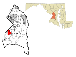
Coordinates: 38°48′9″N 76°58′32″W / 38.8025°N 76.97556°WCoordinates: 38°48′9″N 76°58′32″W / 38.8025°N 76.97556°W Country United States State Maryland County Prince George's Area – Total 9.0 sq mi (23.4 km2) – Land 9.0 sq mi (23.4 km2) – Water 0.0 sq mi (0.0 km2) Population (2000) – Total 35,355 – Density 3,911.9/sq mi (1,510.4/km2) Time zone Eastern (EST) (UTC-5) – Summer (DST) EDT (UTC-4) FIPS code 24-59505 Oxon Hill-Glassmanor is a census-designated place (CDP) in Prince George's County, Maryland. The combination is arbitrary, and in the mind of most local people there are two separate communities: Oxon Hill and Glassmanor. As of the 2000 census, the area had a population of 35,355.
Contents
History of Oxon Hill
Oxon Hill was named for the 18th Century manor home of Thomas Addison (which burned in 1895 but was replaced by another large Georgian-style home called "Oxon Hill Manor," now publicly owned, which has a river view). The community is bisected by the Capital Beltway (I-95/495) and is near the interstate Woodrow Wilson Bridge, whose gridlocked traffic (300,000 vehicles daily) backs-up daily into Oxon Hill until the wider replacement bridge is fully completed in 2008, bringing relief. (Thousands of white-collar commuters working in Northern Virginia's booming economy find that housing is cheaper in Prince George's County.)
Oxon Hill includes many garden apartment communities along with single-family detached homes dating mostly from the 1940s through the 1980s, including the incorporated town Forest Heights. In earlier decades, many residents were scientists from the adjacent U.S. Naval Research Laboratory, but very few are now. Oxon Hill's two principal shopping centers ("Rivertowne" and the much older "Eastover") attract neighborhood customers as well as shoppers from nearby Southeast Washington. Eastover, located at the D.C. state line, is a hub of many bus routes, some of them operating 24 hours a day, and has a Prince George's County Police station.
Geography
Oxon Hill-Glassmanor is located at 38°48′9″N 76°58′32″W / 38.8025°N 76.97556°W (38.802513, -76.975538)[1].
According to the United States Census Bureau, the place has a total area of 9.0 square miles (23 km2), all of it land.
Demographics
Historical populations Census Pop. %± 1990 35,794 — 2000 35,355 −1.2% source:[2] As of the census[3] of 2000, there were 35,355 people, 13,700 households, and 9,069 families residing in the area. The population density was 3,911.9 people per square mile (1,510.0/km²). There were 14,669 housing units at an average density of 1,623.1 per square mile (626.5/km²). The racial makeup of the area was 7.64% White, 86.68% African American, 0.32% Native American, 2.78% Asian, 0.08% Pacific Islander, 0.69% from other races, and 1.80% from two or more races. Hispanic or Latino of any race were 1.68% of the population.
There were 13,700 households out of which 35.1% had children under the age of 18 living with them, 33.2% were married couples living together, 27.1% had a female householder with no husband present, and 33.8% were non-families. 28.0% of all households were made up of individuals and 4.1% had someone living alone who was 65 years of age or older. The average household size was 2.58 and the average family size was 3.14.
In the area the population was spread out with 28.5% under the age of 18, 9.3% from 18 to 24, 32.8% from 25 to 44, 22.8% from 45 to 64, and 6.5% who were 65 years of age or older. The median age was 32 years. For every 100 females there were 84.3 males. For every 100 females age 18 and over, there were 76.9 males.
The median income for a household in the area was $46,483, and the median income for a family was $52,227. Males had a median income of $35,338 versus $34,646 for females. The per capita income for the area was $21,511. About 6.7% of families and 8.8% of the population were below the poverty line, including 12.3% of those under age 18 and 8.2% of those age 65 or over.
References
- ^ "US Gazetteer files: 2010, 2000, and 1990". United States Census Bureau. 2011-02-12. http://www.census.gov/geo/www/gazetteer/gazette.html. Retrieved 2011-04-23.
- ^ "CENSUS OF POPULATION AND HOUSING (1790-2000)". U.S. Census Bureau. http://www.census.gov/prod/www/abs/decennial/index.html. Retrieved 2010-07-18.
- ^ "American FactFinder". United States Census Bureau. http://factfinder.census.gov. Retrieved 2008-01-31.
Categories:- Populated places in Prince George's County, Maryland
- Census-designated places in Maryland
- Baltimore–Washington metropolitan area
- Populated places in Maryland with African American majority populations


Wikimedia Foundation. 2010.