- Marlton, Maryland
-
Marlton, Maryland — CDP — Location of Marlton, Maryland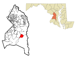
Coordinates: 38°46′0″N 76°47′20″W / 38.766667°N 76.78889°WCoordinates: 38°46′0″N 76°47′20″W / 38.766667°N 76.78889°W Country United States State Maryland County Prince George's Area – Total 6.0 sq mi (15.6 km2) – Land 6.0 sq mi (15.6 km2) – Water 0.0 sq mi (0.0 km2) Elevation 197 ft (60 m) Population (2000) – Total 7,798 – Density 1,295.3/sq mi (500.1/km2) Time zone Eastern (EST) (UTC-5) – Summer (DST) EDT (UTC-4) FIPS code 24-50775 GNIS feature ID 1714754 Marlton is an unincorporated area and census-designated place (CDP) in Prince George's County, Maryland, United States.[1] The population was 7,798 at the 2000 census. The Marlton housing development, at first briefly called "Marlboro Country", grew up along U.S. Route 301 in the 1970s, and is part of the greater Upper Marlboro community. Residents attend Frederick Douglass High School.
Geography
Marlton is located at 38°46′00″N 76°47′20″W / 38.766568°N 76.788922°W (38.766568, -76.788922)[2].
According to the United States Census Bureau, the CDP has a total area of 6.0 square miles (16 km2), all of it land.
Demographics
As of the census[3] of 2000, there were 7,798 people, 2,830 households, and 2,153 families residing in the CDP. The population density was 1,295.3 people per square mile (500.1/km²). There were 2,932 housing units at an average density of 487.0/sq mi (188.0/km²). The racial makeup of the CDP was 39.24% White, 55.49% African American, 0.28% Native American, 1.56% Asian, 0.01% Pacific Islander, 0.82% from other races, and 2.59% from two or more races. Hispanic or Latino of any race were 2.42% of the population.
There were 2,830 households out of which 41.5% had children under the age of 18 living with them, 54.7% were married couples living together, 17.2% had a female householder with no husband present, and 23.9% were non-families. 18.3% of all households were made up of individuals and 2.6% had someone living alone who was 65 years of age or older. The average household size was 2.75 and the average family size was 3.12.
In the CDP the population was spread out with 28.6% under the age of 18, 6.9% from 18 to 24, 35.8% from 25 to 44, 22.8% from 45 to 64, and 5.9% who were 65 years of age or older. The median age was 34 years. For every 100 females there were 92.2 males. For every 100 females age 18 and over, there were 84.8 males.
The median income for a household in the CDP was $73,844, and the median income for a family was $82,936. Males had a median income of $43,659 versus $39,928 for females. The per capita income for the CDP was $28,558. About 1.2% of families and 2.3% of the population were below the poverty line, including 2.3% of those under age 18 and 2.8% of those age 65 or over.
References
- ^ U.S. Geological Survey Geographic Names Information System: Marlton, Maryland
- ^ "US Gazetteer files: 2010, 2000, and 1990". United States Census Bureau. 2011-02-12. http://www.census.gov/geo/www/gazetteer/gazette.html. Retrieved 2011-04-23.
- ^ "American FactFinder". United States Census Bureau. http://factfinder.census.gov. Retrieved 2008-01-31.
Categories:- Populated places in Prince George's County, Maryland
- Census-designated places in Maryland
- Unincorporated communities in Maryland
- Baltimore–Washington metropolitan area
- Populated places in Maryland with African American majority populations


Wikimedia Foundation. 2010.