- Collington, Maryland
-
Collington — Unincorporated area — Location within the state of Maryland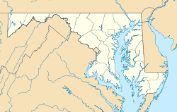
 Collington
Coordinates: 38°58′6″N 76°45′35″W / 38.96833°N 76.75972°WCoordinates: 38°58′6″N 76°45′35″W / 38.96833°N 76.75972°W Country United States State Maryland County Prince George's Time zone Eastern (EST) (UTC-5) – Summer (DST) EDT (UTC-4) ZIP codes FIPS code GNIS feature ID 597266 Collington, Maryland is a now defunct settlement in Prince George's County, Maryland dating from colonial times.[1] Collington has been subsumed by the city of Bowie, Maryland.
Contents
Geography
Collington is located at 38°58'6" North, 76°45'35" West (38.9684441 -76.7596914).[2]
Collington stretched from the area near Holy Trinity Episcopal Church on MD 450 East toward the Belair Mansion, south to where MD 197, also called Collington Road, ends at US 301 and west past Church Road.
History
Originally referred to as "Collington Hundreds", the settlement was more recently known as "Collington". As the City of Bowie has expanded, the term has fallen into largely cultural usage, used in street names such as Collington Road, shopping centers and housing developments.
One of the earliest references to Collington, is in the proceedings of the Council of Maryland from 1696:
"An Accot of the Hundreds in the Severall Counties of the Province Vizt ...
Prince Georges County is divided into Six Hundreds ViztSignificant buildings in Collington
In 1746, Colonial Governor of Maryland, Samuel Ogle built the Belair Mansion and Belair stables, in Collington, establishing his residence and the Belair Stud Farm.[4]
Baruch Duckett built Fairview Plantation around 1800 in Collington. Maryland Governor Oden Bowie was born at Fairview in 1826 and is buried there.[5]
Holy Trinity Episcopal Church was established in Collington in 1836.[6][7]
Transportation
The Baltimore & Potomac Railroad Company had a passenger station at Collington on the Pope's Creek spur of its Southern Maryland Line.[8] Today, a railroad siding is all that remains of this stop although the spur is still in use. It is located at mile post 3.0 on the spur[9] just south of where the spur crosses under Maryland Route 450 near Maryland Route 197.[10]
References
- ^ U.S. Geological Survey Geographic Names Information System: Collington, Maryland
- ^ "US Gazetteer files: 2010, 2000, and 1990". United States Census Bureau. 2011-02-12. http://www.census.gov/geo/www/gazetteer/gazette.html. Retrieved 2011-04-23.
- ^ "Proceedings of the Council of Maryland, 1696/7:1698, Volume 23, Page 23". Maryland State Archives. http://aomol.net/megafile/msa/speccol/sc2900/sc2908/000001/000023/html/am23--23.html. Retrieved 05/04/2007.
- ^ Baltz, Shirley Vlasak (1984). A Chronicle of Belair. Bowie, Maryland: Bowie Heritage Committee. pp. pages 14–19. LCCN 85165028.
- ^ "The Prince George's Hall of Fame". Prince George's County Historical Society. 2003. http://www.pghistory.org/HallofFame. Retrieved 2007-08-16.
- ^ Sprague, William Buell (1859). Annals of the American Pulpit; or Commemorative Notices of Distinguished American Clergymen of Various Denominations From the Early Settlement of the Country to the Close of the Year Eighteen Hundred and Fifty Five, Volume V.. New York: Robert Carter & Brothers. pp. pages 34–38. http://books.google.com/books?id=UwJ9aVWh92kC&printsec=titlepage#PPA34,M1.
- ^ Baltz, Shirley Vlasak (1984). A Chronicle of Belair. Bowie, Maryland: Bowie Heritage Committee. pp. pages 4–9. LCCN 85165028.
- ^ "Sacred Heart Church - The Parish with Colonial Roots - since 1728". Sacred Heart Church. http://www.sacredheartbowie.org/history.php. Retrieved 2007-06-12.
- ^ "CSXT - Popes Creek Subdivision". The Mainline. 2000. Archived from the original on 2007-07-07. http://web.archive.org/web/20070707140432/http://www.mainline.railfan.net/guide/pope.html. Retrieved 2007-06-13.
- ^ Hogan, Reverend John F. (1975). Sacred Heart Chapel 1741-1975: A Monograph on the Foundation and the Development of the old Sacred Heart Church - White Marsh.
Categories:- Unincorporated communities in Maryland
- Bowie, Maryland
- Populated places in Prince George's County, Maryland
- Maryland geography stubs


Wikimedia Foundation. 2010.