- Maryland Route 450
-
Maryland Route 450
Route information Maintained by MDSHA Length: 30.19 mi[1][2] (48.59 km) Major junctions West end: 
 US 1 Alt. in Bladensburg
 MD 201 in Bladensburg
 MD 202 in Bladensburg
 MD 295 in Bladensburg

 I-95 / I-495 in Lanham
 MD 704 in Lanham
 MD 193 in Lanham
 MD 3 in Bowie
 MD 178 in Annapolis

 US 50 / US 301 in Annapolis
 MD 2 in Annapolis
East end: US 50 / US 301 / MD 2 near AnnapolisHighway system Maryland highway system
Interstate • US • State • Minor • Former • Turnpikes←  MD 449
MD 451  →
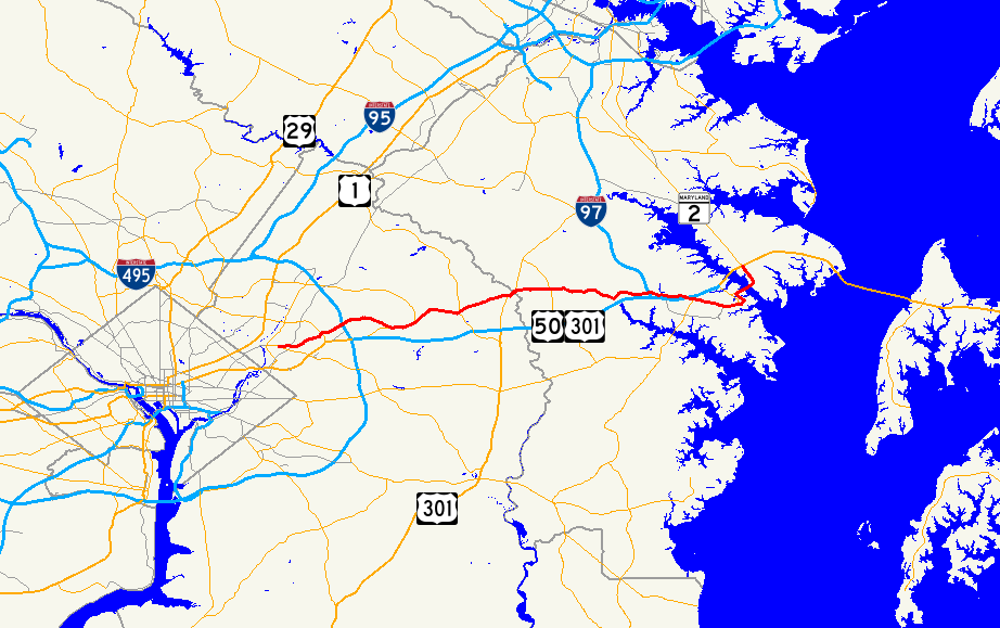
→Maryland Route 450 (MD 450) is a state highway in the U.S. state of Maryland. The state highway runs 30.19 mi (48.59 km) from U.S. Route 1 Alternate (US 1 Alternate) in Bladensburg east to US 50, US 301, and MD 2 near Annapolis. MD 450 is the original alignment of US 50 in Prince George's and Anne Arundel Counties. The state highway was assigned to sections of old US 50 in the 1950s as US 50 was gradually moved to the limited-access John Hanson Highway.
Contents
Route description
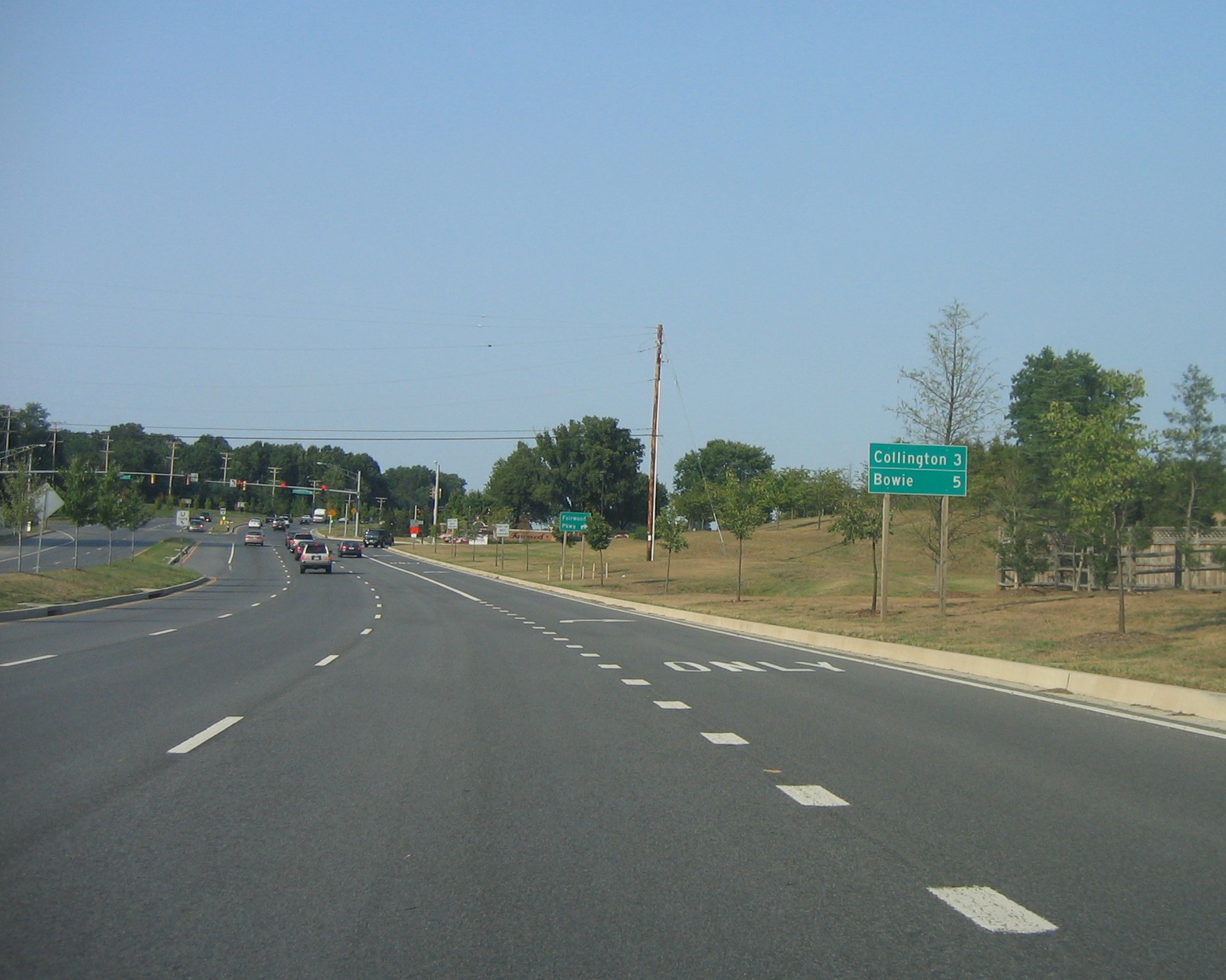
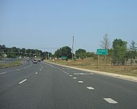 MD 450 eastbound approaching Fairwood Parkway in Prince George's County
MD 450 begins at an intersection with US 1 Alternate in Bladensburg. The state highway heads east as Annapolis Road through Bladensburg, passing through an interchange with MD 201, a wye intersection with MD 202, and an interchange with the Baltimore-Washington Parkway. MD 450 heads into Landover Hills, where the highway meets MD 410 and its interchange with the Capital Beltway, then crosses the Amtrak Northeast Corridor immediately after a partial interchange with MD 564. The state highway continues east through Lanham, where the road intersects MD 704 and MD 193. After crossing CSX's Popes Creek Subdivision, MD 450 crosses MD 197 in Bowie. The state highway joins MD 3 in a concurrency on the east side of Bowie; the two highways cross the Patuxent River together on the Priest Bridge into Anne Arundel County.
Shortly after the bridge, MD 450 separates from MD 3 and heads east as Defense Highway through Crofton, where the highway intersects MD 424. The state highway continues east through a hilly area where the highway passes under I-97. MD 450 continues east into Annapolis, where the highway meets MD 178 adjacent to the Annapolis Mall. After an interchange with US 50 and US 301, the state highway continues into Annapolis as West Street. MD 450 meets MD 2 on the west side of the city then intersects MD 435 and MD 387 at Westgate Circle. The state highway passes through Church Circle, from which the highway continues as College Avenue. After intersecting the southern terminus of MD 70, MD 450 turns north onto King George Street. The state highway follows the edge of the campus of the United States Naval Academy northwest and then northeast after the junction with the other end of MD 435. MD 450 crosses the Severn River on the Naval Academy Bridge and meets MD 648 on the other side. The state highway, now following Governor Ritchie Highway, turns to the northwest before reaching its eastern terminus at an interchange with US 50, US 301, and MD 2.
History
MD 450 is the old alignment of US 50 between Bladensburg and Annapolis. The portion east of downtown Annapolis was also once part of MD 2. MD 450 was assigned to the highway it follows as sections of John Hanson Highway were completed in the 1950s.
Junction list
County Location Mile
[1][2]Destinations Notes Prince George's 14.36 mi (23.11 km)
Bladensburg 0.00
US 1 Alt. (Bladensburg Road/Baltimore Avenue) – Hyattsville, WashingtonWestern terminus of MD 450 0.21 MD 201 south (Kenilworth Avenue) – Cheverly, Washington0.33 48th Street to MD 201 north (Kenilworth Avenue) – Riverdale Park, Greenbelt48th Street south is unsigned MD 769C and old alignment of MD 201 0.42 Edmonston Road north – Edmonston Unsigned MD 769B; former MD 205 0.93 MD 202 east (Landover Road) – Landover, LargoNo direct access between MD 450 east and MD 202 east 1.52 MD 295 (Baltimore–Washington Parkway) – Baltimore, WashingtonLandover Hills 3.44  MD 410 (Veterans Parkway) – Riverdale Park, New Carrollton
Lanham 4.65 I-95 / I-495 (Capital Beltway) – Baltimore, Richmond4.95  MD 564 east (Lanham–Severn Road) – Glenn Dale, Bowie
Eastbound exit and westbound entrance 7.32 MD 704 west (Martin Luther King Jr. Highway) – Glenarden, Seat Pleasant7.87  MD 953 (Glenn Dale Road)
Old alignment of MD 193 8.79 MD 193 (Glenn Dale Boulevard/Enterprise Road) – Glenn Dale, WoodmoreBowie 11.38  MD 197 (Laurel–Bowie Road) – Laurel
14.10 MD 3 south (Robert Crain Highway) – Upper Marlboro, RichmondWest end of concurrency with MD 3 Priest Bridge – Patuxent River Anne Arundel 15.83 mi (25.48 km)
Crofton 14.58 MD 3 north (Robert Crain Highway) – Glen Burnie, BaltimoreEast end of concurrency with MD 3 16.34  MD 424 (Davidsonville Road) – Millersville, Davidsonville
Annapolis 23.63 MD 178 north (Generals Highway) – CrownsvilleMD 450 turns south at this intersection 23.80  US 50 west / US 301 south (John Hanson Highway) to I-97 north / Jennifer Road east – Washington, Richmond, Baltimore
24.09 US 50 east / US 301 north (John Hanson Highway) / Riva Road south – Bay Bridge24.33 MD 2 (Solomons Island Road) – Prince Frederick, Baltimore24.50  MD 393 (Old Solomons Island Road)
Old alignment of MD 2 26.10 
 MD 435 east (Taylor Avenue) / MD 387 south (Spa Road)
Westgate Circle roundabout 26.75 Duke of Gloucester Street east / School Street north – Maryland State House Church Circle traffic circle; MD 450 continues east onto College Avenue 26.92  MD 70 west (Bladen Street)
27.14 King George Street east MD 450 turns west onto King George Street 27.78 MD 435 west (Annapolis Street)MD 450 turns north at this intersection Naval Academy Bridge – Severn River 28.76  MD 648 north (Baltimore–Annapolis Boulevard)
30.19 US 50 / US 301 (Blue Star Memorial Highway) / MD 2 (Governor Ritchie Highway) – Baltimore, Bay Bridge, WashingtonEastern terminus of MD 450 References
- ^ a b "Highway Location Reference: Prince George's County" (PDF). Maryland State Highway Administration. 2008. http://apps.roads.maryland.gov/KeepingCurrent/performTrafficStudies/dataAndStats/hwyLocationRef/2008_hlr_all/co16.pdf. Retrieved 2010-05-03.
- ^ a b "Highway Location Reference: Anne Arundel County" (PDF). Maryland State Highway Administration. 2008. http://apps.roads.maryland.gov/KeepingCurrent/performTrafficStudies/dataAndStats/hwyLocationRef/2008_hlr_all/co02.pdf. Retrieved 2010-05-03.
External links
Roads in Prince George's County, Maryland Maryland State Highways 
U.S. Routes Interstate Highways Roads by name Categories:- State highways in Maryland
- Roads in Prince George's County, Maryland
- Roads in Anne Arundel County, Maryland


Wikimedia Foundation. 2010.