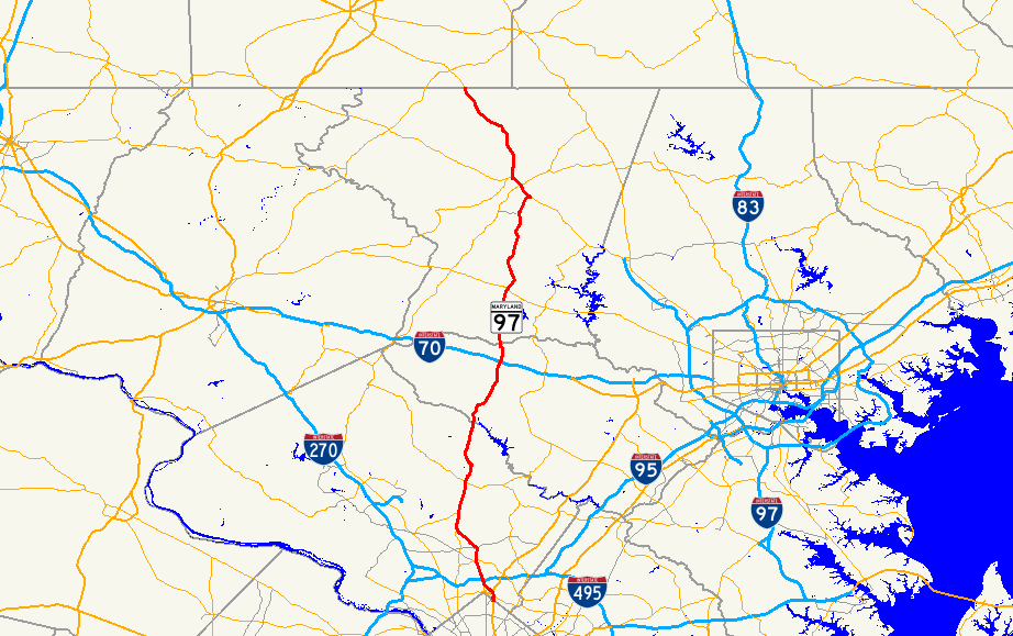
- Maryland Route 97
-
This article describes a Maryland state highway numbered 97. For the Interstate with the same number, see Interstate 97.MD 97 redirects here. For the Brazilian assault rifle, see IMBEL MD97
Maryland Route 97
Georgia Avenue, Roxbury Mills Road, Hoods Mill Road, Old Washington Road, New Washington Road, Littlestown Pike 
Route information Maintained by MDSHA Length: 55.27 mi[1][2][3] (88.95 km) Major junctions South end: 
 US 29 / MD 384 in Silver Spring
 MD 390 near Silver Spring
 I-495 near Silver Spring
 MD 28 in Norbeck
 MD 200 in Aspen Hill

 I-70 / US 40 near Cooksville
 MD 26 in Dorsey Crossroads
 MD 32 in Fenby
 MD 27 in Westminster
North end:  PA 97 near Littlestown, PA
Highway system Maryland highway system
Interstate • US • State • Minor • Former • Turnpikes←  I-97
I-97MD 98  →
→Maryland Route 97 (MD 97) is a state highway in the U.S. state of Maryland. The route runs 55.27 mi (88.95 km) from U.S. Route 29 in Silver Spring, Montgomery County north to the Pennsylvania border in Carroll County, where the road continues into that state as Pennsylvania Route 97. Throughout most of Montgomery County, MD 97 is known as Georgia Avenue, which continues south from the southern terminus along US 29 into Washington, D.C. It is a suburban four- to six-lane divided highway from Silver Spring north to Olney. From here, the route continues as a rural two-lane road north through Brookeville and into Howard County. MD 97 continues through Carroll County where it passes through the county seat of Westminster. The route intersects many major roads, including Interstate 495 (Capital Beltway) north of Silver Spring, Maryland Route 200 (Intercounty Connector) in Aspen Hill, Maryland Route 28 in Norbeck, Interstate 70 and U.S. Route 40 in Cooksville, Maryland Route 26 in Dorsey Crossroads, and Maryland Route 27, Maryland Route 32, and Maryland Route 140 in the Westminster area.
With the creation of the U.S. Highway System in 1926, present-day MD 97 north of Westminster became a part of U.S. Route 140. The designation MD 97 was first used by 1940 for the road running from US 29 in Silver Spring to north of US 40 in Cooksville. An extension of the route by 1960 took it to the Pennsylvania border northwest of Emmitsburg, Frederick County. It replaced Maryland Route 570, which ran from MD 26 to just north of the Carroll-Howard county line, paralled MD 32 between Westminster and Taneytown, and replaced MD 32 from Taneytown to the Pennsylvania border. By 1979, MD 97 was shifted onto its current alignment north of Westminster with the removal of US 140 from the U.S. Highway System; the MD 140 designation was applied to the former MD 97 that ran northwest from Westminster.
Contents
Route description
Maryland Route 97 runs through the Washington, D.C. suburbs in Montgomery County, connecting several communities including Silver Spring, Wheaton, Glenmont, Norbeck, and Olney. It continues north from there into rural areas of Howard and Carroll counties, passing through the Carroll County seat of Westminster, before reaching the Pennsylvania border.[4]
Montgomery County

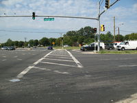
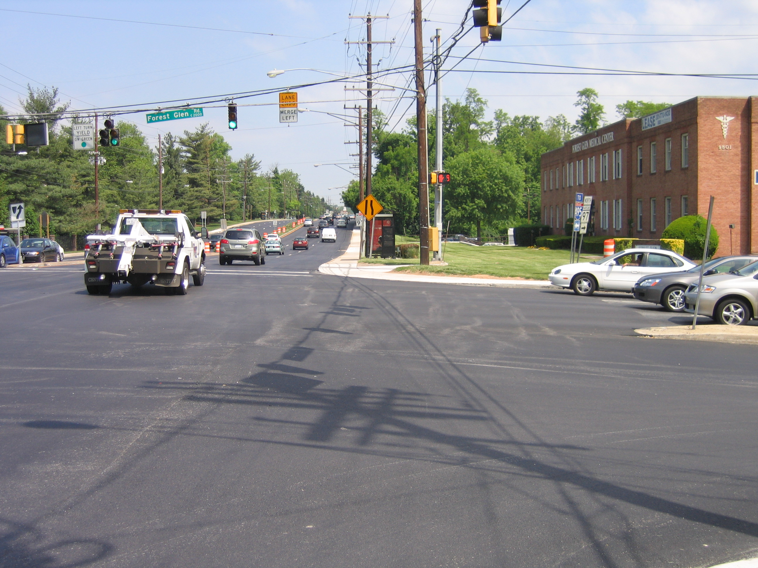
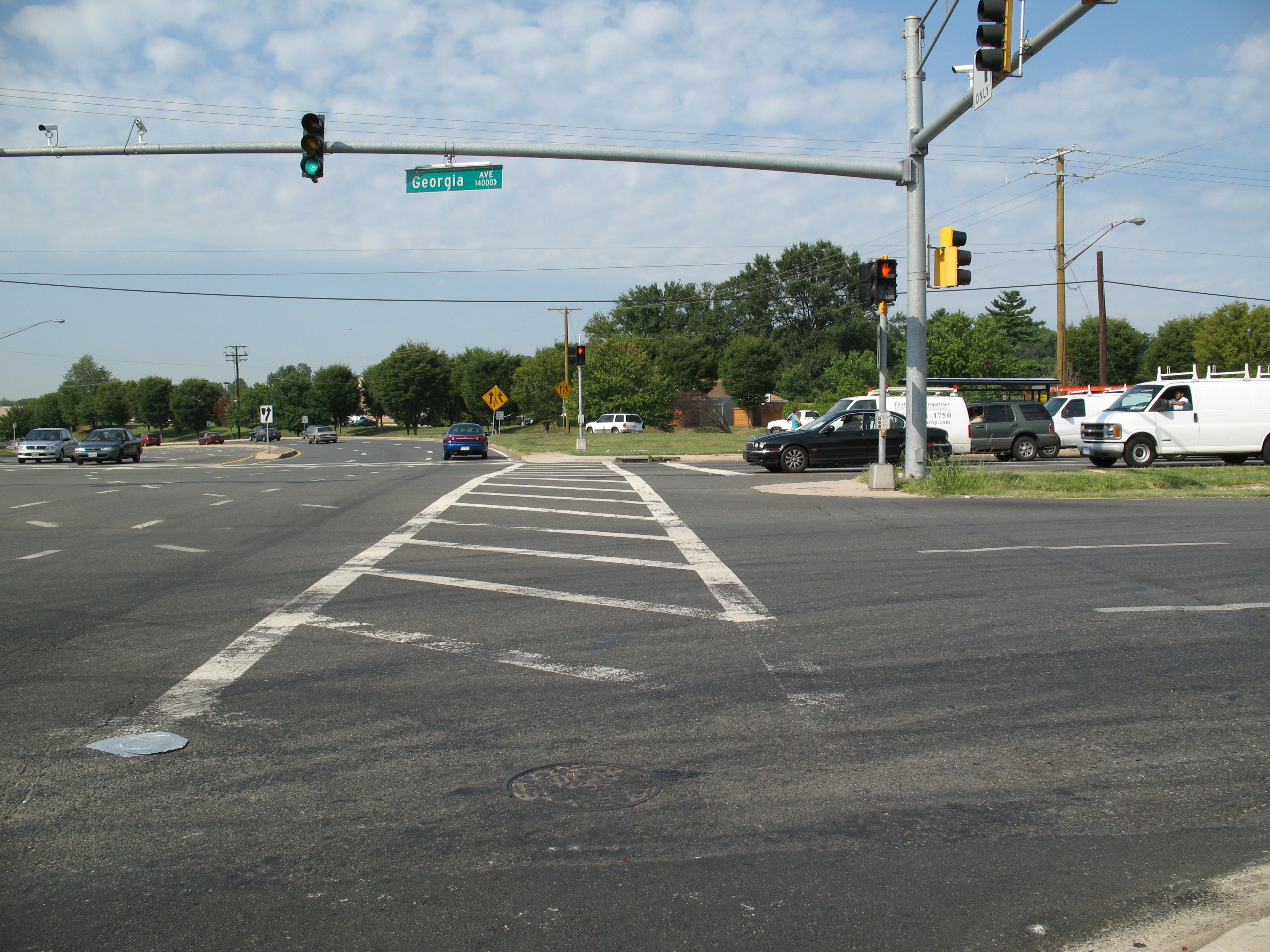
Maryland Route 97 begins at an intersection with U.S. Route 29 and Maryland Route 384 (Colesville Road) in downtown Silver Spring in Montgomery County, heading north on Georgia Avenue, a six-lane divided highway with a 30 mph (48 km/h) speed limit. Washington Metro's Red Line runs below the route at this point.[1][4] From the route’s southern terminus, Georgia Avenue continues south as part of US 29 toward Washington, D.C. MD 97 passes commercial areas of high-rise buildings in Silver Spring before heading into residential neighborhoods. The route intersects the northern terminus of Maryland Route 390 (16th Street), which heads south and becomes 16th Street Northwest upon entering the District of Columbia. It continues north as a six-lane undivided road with reversible lanes through commecial areas before coming to a modified cloverleaf interchange with Interstate 495 (Capital Beltway).[4] Past this interchange, the road becomes a divided highway again and intersects Maryland Route 192 (Forest Glen Road). MD 97 passes more residences as a 35 mph (56 km/h) road that continues toward Wheaton. The road heads into business areas again as it intersects Maryland Route 586 (Veirs Mill Road) near the Westfield Wheaton shopping mall.[1][4] A short distance later, the road crosses Maryland Route 193 (University Boulevard) and continues back into residential areas past that intersection.[1][4] The route heads into a mix of residential and commercial areas as it heads toward Glenmont, where it crosses Randolph Road.[4] A short distance later, MD 97 intersects the southern terminus of Maryland Route 182 (Layhill Road).[1][4]
From here, MD 97 turns northwest through residential neighborhoods, where as a 45 mph (72 km/h) road it passes the Glenmont station terminus of Washington Metro's Red Line, before reaching some businesses near the intersection with the northern terminus of Maryland Route 185 (Connecticut Avenue) in Aspen Hill.[1][4] It turns north again past this intersection and crosses Bel Pre Road.[1][4] After crossing Bel Pre Road, the route heads into wooded neighborhoods before it passes through a mix of businesses and houses.[4] MD 97 crosses Maryland Route 28 (Norbeck Road) in Norbeck, and continues past some residences where it intersects Maryland Route 655A, a short connector that provides access to westbound MD 28. MD 97 enters more wooded areas and narrows to four lanes, interchanging with Maryland Route 200 (Intercounty Connector).[4][5] The route eventually passes parkland and residential areas as it crosses Emory Lane.[1][4] The road approaches Olney and passes by residential neighborhoods before heading into a business district at the intersection with Maryland Route 108 (Olney Sandy Spring Road).[4] After this intersection, the road heads into wooded residential areas as a two-lane undivided road, with the speed limit dropping to 40 mph (64 km/h) and then to 30 mph (48 km/h) as the road enters Brookeville. Upon entering Brookeville, MD 97 becomes High Street and passes more residences. The route makes a left turn onto Market Street and continues through wooded residential areas. It heads out of Brookeville, with the name changing back to Georgia Avenue and the speed limit increasing to 40 mph (64 km/h).[1][4] The road heads into a more rural setting, with areas of farms, woods, and some residences.[4] MD 97 reaches Sunshine, where the speed limit decreases to 30 mph (48 km/h) and the road crosses Maryland Route 650 (New Hampshire Avenue/Damascus Road).[1][4] Past Sunshine, MD 97 resumes through rural areas and enters woodland within Patuxent River State Park, with the speed limit increasing to 50 mph (80 km/h) as it approaches the Patuxent River.[1][4]
In Montgomery County, the daily traffic counts on MD 97 range from a high of 84,140 vehicles at the Capital Beltway north of Silver Spring to a low of 11,130 vehicles at the intersection with MD 108 in Olney in 2007.[1]
Howard County
MD 97 crosses the Patuxent River into Howard County, where it becomes Roxbury Mills Road.[2] It continues north, passing areas of woods and farms along with suburban residential developments.[4] The road passes through the community of Glenwood, where the speed limit drops to 45 mph (72 km/h). Upon leaving Glenwood, the speed limit climbs back to 50 mph (80 km/h) and MD 97 passes through agricultural areas before intersecting Maryland Route 144 (Frederick Road) in Cooksville.[2][4] A short distance later, the route interchanges with Interstate 70 and U.S. Route 40. Past this interchange, MD 97 becomes Hoods Mill Road and passes rural residential areas, intersecting Old Frederick Road.[2][4] From here, the speed limit drops to 40 mph (64 km/h) as the road winds through a mix of woods, farm fields, and residences before crossing the South Branch of the Patapsco River.[2][4]
In Howard County, the daily traffic counts on MD 97 range from a high of 15,711 vehicles at the intersection with MD 144 to a low of 9,061 vehicles at the intersection with Old Frederick Road in 2007.[2]
Carroll County
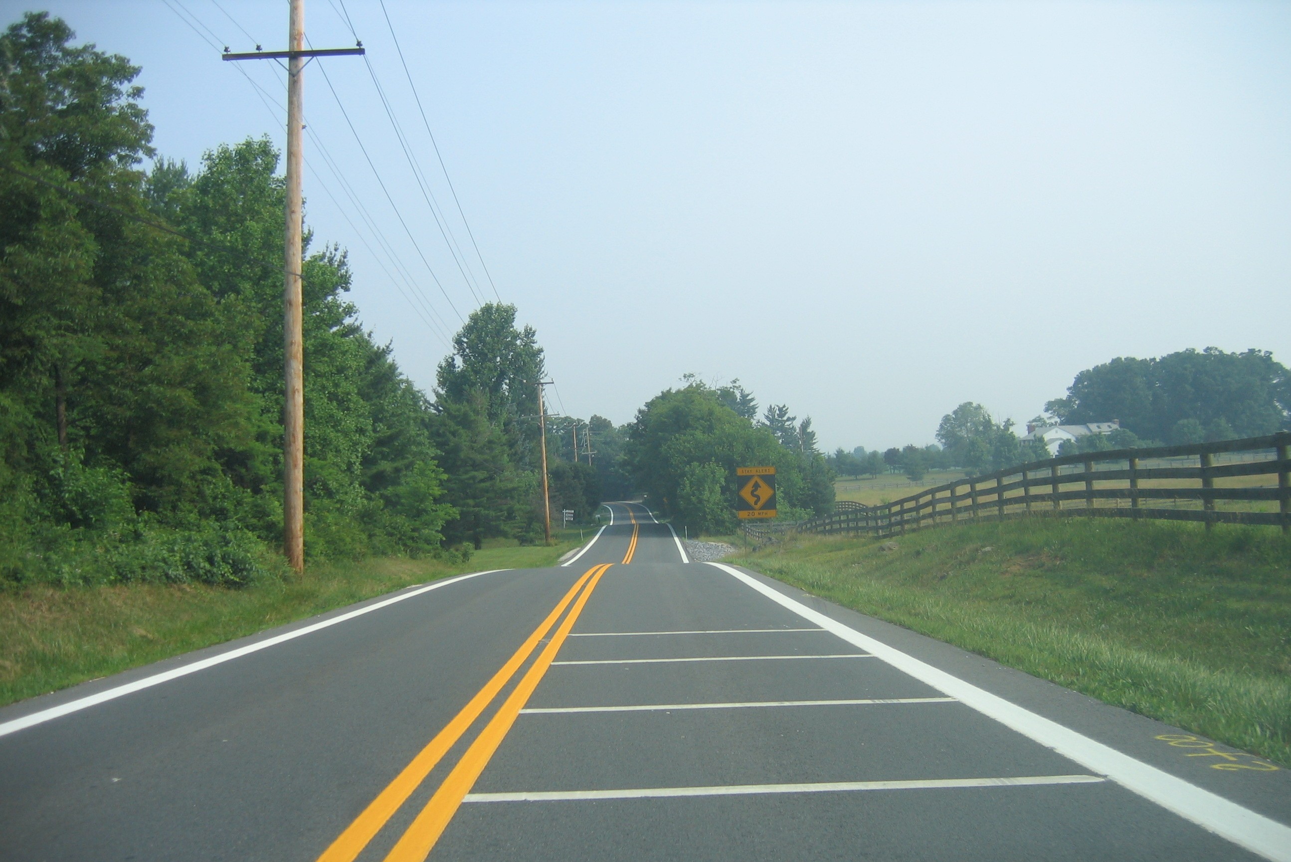
Upon crossing the river, MD 97 enters Carroll County and becomes Old Washington Road.[3] The road crosses CSX's Old Main Line Subdivision railroad and the speed limit drops to 35 mph (56 km/h) as it passes wooded areas with some residences before increasing to 40 mph (64 km/h) again.[3][4] It runs through a mix of woods and farms with some residences along the road.[4] The number of residences increases as the route crosses Streaker Road in Berrett as a 35 mph (56 km/h) road. From here, MD 97 passes more residences as a 40 mph (64 km/h) road before intersecting Maryland Route 850 (Old Liberty Road) at a roundabout; a short distance later, it intersects Maryland Route 26 (Liberty Road) at a folded diamond interchange in Dorsey Crossroads.[3][4] Past MD 26, MD 97 becomes New Washington Road and heads north through a mix of farmland, woodland, and residential neighborhoods, paralleled to the west by Maryland Route 854 (Old Washington Road).[4] The road passes through woodland before intersecting Nicodemus Road, where it continues past farms and woods before crossing Maryland Route 32 (Sykesville Road) in Fenby.[3][4]
Past this intersection, MD 97 passes to the east of Carroll Community College and heads into residential areas as it approaches Westminster, bypassing the center of the town to the east.[4] The route becomes Malcolm Drive past the intersection with Main Street/Old Westminster Road and continues to an intersection with Maryland Route 140 (Baltimore Boulevard). Here, MD 97 makes a left turn to form a concurrency with MD 140 on Baltimore Boulevard, a six-lane divided highway.[3][4] The two routes head through commercial areas on the outskirts of Westminster, passing by the TownMall of Westminster before interchanging with Maryland Route 27 (Manchester Road) at a folded-diamond interchange.[4] Past this interchange, the road passes over the Maryland Midland Railway and passes more businesses. At the Sullivan Road intersection, the road becomes College View Boulevard and a short distance later, MD 97 splits from MD 140 at an interchange near McDaniel College.[3][4]
MD 97 continues north on Littlestown Pike, a two-lane undivided road. The road passes Carroll County Regional Airport before heading into a mix of farmland and residences, with the speed limit increasing to 50 mph (80 km/h). MD 97 intersects the southern terminus of Maryland Route 496 (Bachmans Valley Road), and continues northwest through agricultural and wooded areas with intermittent residences, with the speed limit eventually dropping to 40 mph (64 km/h). It passes through Union Mills, where the speed limit drops to 35 mph (56 km/h) and the road intersects Old Hanover Road. The speed limit rises to 45 mph (72 km/h) upon leaving Union Mills before dropping to 35 mph (56 km/h) again as MD 97 enters Silver Run, a community of residences. Upon leaving this community, the speed limit on the route increases to 50 mph (80 km/h) as it continues through woods and farm fields.[3][4] A short distance later, MD 97 reaches the Pennsylvania border, where it becomes Pennsylvania Route 97 and continues north into Adams County.[4]
In Carroll County, the daily traffic counts on MD 97 range from a high of 58,582 vehicles at the south end of the MD 140 concurrency in Westminster to a low of 8,331 vehicles at the intersection with Blacks Schoolhouse Road just south of the Pennsylvania border in 2007.[3]
History
Following the creation of the U.S. Highway System in 1926, the portion of present-day MD 97 north of Westminster was designated as part of U.S. Route 140, a U.S. Highway that ran from Baltimore to Gettysburg .[6][7] The designation MD 97 was first used by 1940 for the road running from US 29 in Silver Spring to north of US 40 in Cooksville, while the present-day route from MD 26 to just north of the Howard-Carroll county line was designated as Maryland Route 570.[8] MD 97 was extended to the Pennsylvania border northwest of Emmitsburg, Frederick County by 1960, running north from Cooksville to Westminster, replacing MD 570 in its entirety, and continuing northwest from Westminster through Taneytown and Emmitsburg, paralleling a portion of MD 32 to Taneytown and replacing the route past there.[9][10] Also by this time, MD 97 was widened into a divided highway between Silver Spring and Maryland Route 183 (Randolph Road) in Glenmont.[9] The divided highway portion of MD 97 was extended further north to MD 28 by 1975.[10] By 1979, U.S. Route 140 disappeared and MD 97 was moved to its current alignment north of Westminster, with the portion of the route that ran northwest from Westminster becoming a part of MD 140. MD 32 from Westminster to Taneytown became Maryland Route 832 by this time as well.[11] Dualization of MD 97 in Montgomery County was extended further north from MD 28 to MD 108 by the 1990s.[12] There are plans to build an interchange at the route’s intersection with Randolph Road in order to improve movements for automobiles as well as for pedestrians and bicycles accessing the nearby Glenmont Metro station.[13] Another new interchange was built with Maryland Route 200 (Intercounty Connector) north of MD 28 and opened on February 23, 2011.[5]
Junction list
County Location Mile
[1][2][3]Destinations Notes Montgomery Silver Spring 0.00 US 29 (Georgia Avenue/Colesville Road) / MD 384 south (Colesville Road) - Washington D.C.Southern terminus of MD 97 0.91 MD 390 south (16th Street)- Washington D.C.1.10 Seminary Road Former MD 391 1.44  I-495 (Capital Beltway) to I-95 – Baltimore, Northern Virginia
I-495 Interchange 31 1.61  MD 192 west (Forest Glen Road) – Kensington
Wheaton 3.07  MD 586 north (Veirs Mill Road) – Rockville
3.47  MD 193 (University Boulevard) – Kensington, Kemp Mill
Glenmont 4.81  MD 182 north (Layhill Road)
Aspen Hill 7.00  MD 185 south (Connecticut Avenue) – North Kensington
Norbeck 8.82  MD 28 (Norbeck Road) to MD 115 – Rockville, Burtonsville
9.43  MD 200 west (Intercounty Connector) to I-95 to I-270
Hybrid/Modified Cloverleaf Interchange, Access to/from MD-200 Westbound opened February 23, 2011, Access to/from MD-200 Eastbound opened November 22, 2011. MD-200 Exits 9A-B Olney 11.89  MD 108 (Olney Sandy Spring Road) – Laytonsville, Ashton
17.02  MD 650 (New Hampshire Avenue/Damascus Road) – Damascus, Ashton
Howard Cooksville 24.58  MD 144 (Frederick Road) – Lisbon, West Friendship
Former US 40 25.03 I-70 / US 40 – Mount Airy, Ellicott CityI-70/US 40 Interchange 76 25.68 Old Frederick Road east 25.80 Old Frederick Road west Carroll 32.48  MD 850 (Old Liberty Road)
Roundabout, former MD 26 32.67 MD 26 (Liberty Road) – Libertytown, EldersburgInterchange Fenby 39.39 MD 32 (Sykesville Road) – GamberWestminster 42.20 E. Main Street — Old Westminster Pike Former US 140 42.57  MD 140 east (Baltimore Boulevard) – Baltimore
South end of MD 140 overlap 43.93 MD 27 (Manchester Road) – ManchesterInterchange 44.89 MD 140 west (College View Boulevard) – TaneytownInterchange, north end of MD 140 overlap 47.29  MD 496 north (Bachmans Valley Road)
Union Mills 50.70 Old Hanover Road northbound Silver Run 52.49 Mayberry Road East 55.27 PA 97 north (Baltimore Pike) – Littlestown, GettysburgPennsylvania state line, northern terminus of MD 97 1.000 mi = 1.609 km; 1.000 km = 0.621 mi
Concurrency terminus • Closed/Former • Incomplete access • UnopenedReferences
- ^ a b c d e f g h i j k l m "Highway Location Reference: Montgomery County" (PDF). Maryland State Highway Administration. 2009. http://sha.maryland.gov/Location/2009_MONTGOMERY.pdf. Retrieved 2010-10-21.
- ^ a b c d e f g "Highway Location Reference: Howard County" (PDF). Maryland State Highway Administration. 2009. http://sha.maryland.gov/Location/2009_HOWARD.pdf. Retrieved 2010-10-21.
- ^ a b c d e f g h i j "Highway Location Reference: Carroll County" (PDF). Maryland State Highway Administration. 2009. http://sha.maryland.gov/Location/2009_CARROLL.pdf. Retrieved 2010-10-21.
- ^ a b c d e f g h i j k l m n o p q r s t u v w x y z aa ab ac ad ae af Google, Inc. Google Maps – overview of Maryland Route 97 (Map). Cartography by Google, Inc. http://maps.google.com/maps?f=d&source=s_d&saddr=US+29+and+MD+97+silver+spring,+md&daddr=39.189691,-77.064285+to:MD-97%2FOld+Washington+Rd+to:MD+97+and+PA+97+littlestown,+pa&geocode=%3B%3BFexYWQIdAN1o-w%3B&hl=en&mra=dpe&mrcr=0&mrsp=1&sz=11&via=1,2&sll=39.19182,-76.946869&sspn=0.235221,0.439453&ie=UTF8&ll=39.406489,-77.060852&spn=0.938,1.757812&t=h&z=9. Retrieved 2009-05-14.
- ^ a b Liu, Mimi (February 23, 2011). "More than 10,000 vehicles travel on first stretch of the ICC Wednesday morning". The Gazette. http://www.gazette.net/stories/02232011/montnew133326_32547.php. Retrieved February 23, 2011.
- ^ Bureau of Public Roads (1926). United States System of Highways (Map). http://en.wikipedia.org/wiki/Image:1926us.jpg. Retrieved 2009-04-27.
- ^ Maryland State Highway Administration (1927). Map of Maryland (Map). http://www.mdhighwaycentennial.com/images/template/gallery/maps/1927SIDE1.jpg. Retrieved 2009-03-03.
- ^ Maryland State Highway Administration (1940). Map of Maryland (Map). http://www.mdhighwaycentennial.com/images/template/gallery/maps/1940SIDE1.jpg. Retrieved 2009-03-03.
- ^ a b Maryland State Highway Administration (1960). Map of Maryland (Map). http://www.mdhighwaycentennial.com/images/template/gallery/maps/1960SIDE1.jpg. Retrieved 2009-03-03.
- ^ a b Exxon (1975). Delaware, Maryland, Virginia, West Virginia (Map). Cartography by General Drafting.
- ^ Maryland State Highway Administration (1979-1980). Map of Maryland (Map). http://www.mdhighwaycentennial.com/images/template/gallery/maps/1979-80SIDE1.jpg. Retrieved 2009-05-16.
- ^ Rand McNally (1996). United States-Canada-Mexico Road Atlas (Map).
- ^ "At-Grade Intersection Improvement MD Route 97 Georgia Avenue at Randolph Road — Project Details". Federal Highway Administration. http://www.fhwa.dot.gov/construction/accelerated/mdactt/02.cfm#a. Retrieved 2009-05-16.
External links
Roads in Montgomery County, Maryland Maryland State Highways 
U.S. Routes Interstate Highways Roads by name Cabin John Parkway · Clara Barton Parkway · Cherry Hill Road · Connecticut Avenue · Georgia Avenue · Montrose Road · New Hampshire Avenue · Randolph Road · Sligo Creek Parkway · Wisconsin Avenue · 16th StreetCategories:- State highways in Maryland
- Roads in Montgomery County, Maryland
- Roads in Howard County, Maryland
- Roads in Carroll County, Maryland


Wikimedia Foundation. 2010.