- Maryland Route 112
-
Maryland Route 112
Seneca Road 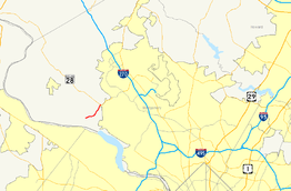
Route information Maintained by MDSHA Length: 2.81 mi[1] (4.52 km) Major junctions West end:  MD 190 near Seneca
East end:  MD 28 in Darnestown
Highway system Maryland highway system
Interstate • US • State • Minor • Former • Turnpikes←  MD 109
US 113  →
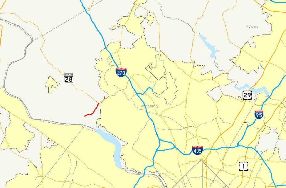
→Maryland Route 112 is a Maryland state highway that goes between MD 28 in Darnestown and MD 190 near Seneca. The entire route is in Montgomery County.
Route description
Maryland Route 112 begins in the west at an intersection with the northern terminus of MD 190 near Seneca. It starts following Seneca Road, carrying a 45-mile-per-hour (72 km/h) speed limit as it travels east-northeast through what eventually becomes a large expanse of residential areas. The scenery along the road is very wooded in the west, which gives way to several agricultural fields in the east with the trees leaving after a short stretch (about one mile). It comes to an end at MD 28 in Darnestown, where several stores rest at its eastern end.[1][2]
Junction list
The entire route is in Montgomery County.
Location Mile
[1]Roads intersected Notes Seneca 0.00 MD 190 east (River Road)Western terminus Darnestown 2.81 MD 28 (Darnestown Road) – FrederickEastern terminus References
- ^ a b c Maryland State Highway Administration (2008). "Highway Location Reference: Montgomery County" (PDF). http://apps.roads.maryland.gov/KeepingCurrent/performTrafficStudies/dataAndStats/hwyLocationRef/2008_hlr_all/co15.pdf. Retrieved 2010-04-21.
- ^ Google, Inc. Google Maps – overview of Maryland Route 112 (Map). Cartography by Google, Inc. http://maps.google.com/maps?f=d&source=s_d&saddr=maryland+112+and+maryland+190&daddr=Maryland+28+%26+Maryland+112,+Darnestown,+Montgomery,+Maryland&geocode=Fc1LVAIdCBNk-yknHn85ATG2iTE8u1Kv5jKJJA%3BFUOrVAIdEZ9k-ykXwxsP9DG2iTHNYctpqtBDVA&hl=en&mra=pe&mrcr=0&sll=39.091233,-77.309675&sspn=0.030444,0.084543&ie=UTF8&ll=39.0911,-77.309675&spn=0.030444,0.084543&t=h&z=14. Retrieved 2010-04-26.
Roads in Montgomery County, Maryland Maryland State Highways 
U.S. Routes Interstate Highways Roads by name Cabin John Parkway · Clara Barton Parkway · Cherry Hill Road · Connecticut Avenue · Georgia Avenue · Montrose Road · New Hampshire Avenue · Randolph Road · Sligo Creek Parkway · Wisconsin Avenue · 16th StreetCategories:- State highways in Maryland
- Roads in Montgomery County, Maryland


Wikimedia Foundation. 2010.