- Maryland Route 355
-
Maryland Route 355
Wisconsin Avenue, Rockville Pike, Frederick Road, Urbana Pike 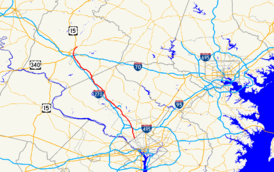
Route information Maintained by MDSHA Length: 36.94 mi[1][2] (59.45 km) Major junctions South end: Wisconsin Avenue at District of Columbia line  I-495 in Bethesda
 MD 28 in Rockville
 I-370 in Gaithersburg
 MD 27 in Germantown
 MD 121 in Clarksburg
 MD 109 in Hyattstown
 MD 80 in Urbana
North end: Market Street in Frederick Highway system Maryland highway system
Interstate • US • State • Minor • Former • Turnpikes←  MD 354
MD 356  →
→Maryland Route 355 is a 36.94-mile (59.45 km) north–south road in western central Maryland in the United States. The southern terminus of the route is at the Washington, D.C. border in Friendship Heights, Montgomery County, where it continues south as Wisconsin Avenue into Washington. The northern terminus is just north of an overpass with Interstate 70 and U.S. Route 40 in the city of Frederick in Frederick County, where the road continues north as Market Street. MD 355 serves as a major thoroughfare through Frederick and Montgomery counties, passing through Bethesda, Rockville, Gaithersburg, Germantown, Urbana, and Frederick, roughly parallel to Interstate 270. The southern portion of the route from the D.C. border to Germantown is a suburban four- to six-lane divided highway lined with many businesses. North of Germantown, the route is predominantly a two lane rural road until it reaches Frederick, where it passes through commercial areas in the southern part of the city.
MD 355 is the original route of U.S. Route 240, which was planned in 1926 to run from Washington, D.C. north to Harrisburg, Pennsylvania; however, the route was designated a part of US 15 north of Frederick. This route served as the primary connector linking Frederick and points west to Washington, D.C. In 1953, a freeway called the Washington National Pike was built for US 240 between Bethesda and Frederick, which became Interstate 70S (now I-270) with the creation of the Interstate Highway System. Meanwhile, the portion of former US 240 north of the freeway’s southern terminus was designated MD 355 by 1960. By 1975, the US 240 designated was removed from the U.S. Highway System, and MD 355 was extended south to the D.C. border. In 2006, the interchange with US 15 at the route’s northern terminus was removed, resulting in MD 355 ending just short of US 15 at a dead end. By 2009, a four lane divided bypass of Urbana for MD 355, funded by private developers, was completed. The same year, the portion of MD 355 north of I-70 was transferred to the city of Frederick and is no longer considered part of the route.
Contents
Route description
Montgomery County
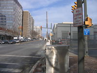 MD 355 (Wisconsin Avenue) at Willard Circle in Friendship Heights.
Maryland Route 355 begins in Friendship Heights, Montgomery County at the intersection with Western Avenue NW and Military Road NW on the border of Washington D.C.. It heads north from this point on Wisconsin Avenue, a six-lane divided highway with a 35 mph (56 km/h) speed limit.[1][3] Wisconsin Avenue continues south into Washington, ending in Georgetown at an intersection with K Street under the Whitehurst Freeway just north of the Potomac River. From the D.C. border, MD 355 heads north through areas of retail and high-rise buildings in Friendship Heights including The Shops at Wisconsin Place that are served by the Red Line of the Washington Metro. Past Friendship Heights, the route continues into wooded residential areas of Somerset before passing the Chevy Chase Country Club on the east side of the road and residential areas of Chevy Chase to the west.[3] It comes to an intersection with Maryland Route 191 (Bradley Boulevard/Bradley Lane).[1] Past this intersection, the speed limit decreases to 25 mph (40 km/h) and MD 355 enters Bethesda, where it heads back into commercial areas with high-rise buildings. In downtown Bethesda, the road intersects Maryland Route 410 (Montgomery Avenue) one-way eastbound and the westbound direction of MD 410 (East West Highway) and Maryland Route 187 (Old Georgetown Road) a short distance further on, near the Bethesda Metro station.[1][3] The road continues through the community and passes by Bethesda Theatre, a 1938 Art Deco cinema. It leaves the downtown area of Bethesda and becomes Rockville Pike at the intersection with Glenbrook Parkway/Woodmont Avenue.[3] From here, the speed limit increases to 35 mph (56 km/h) again and the road passes the Bethesda Naval Hospital, one of the United States' most prominent military hospitals, and the National Institutes of Health, which is home to the United States National Library of Medicine, the world’s largest medical library.[1][3][4]
Past the naval hospital and the NIH, the road intersects Cedar Lane.[1][3] After this intersection, it heads north into wooded areas, passing near residences as well as the Bethesda Meeting House, an 1850 wood-frame church.[3][5] MD 355 continues north through more suburban residential areas before coming to an interchange that provides access to Interstate 495 (Capital Beltway) and the southern terminus of Interstate 270.[1][3] Past this interchange, the speed limit increases to 45 mph (72 km/h) and the road skirts the edge of Rock Creek Park, passing by the Linden Oak at the Grosvenor Lane intersection. MD 355 continues into residential areas of North Bethesda, where the Metro Red Line briefly comes above the surface and parallels the route to the east adjacent to the Grosvenor–Strathmore Metro station before the intersection with Maryland Route 547 (Strathmore Avenue). The speed limit decreases to 40 mph (64 km/h) as the route heads through some residential neighborhoods before entering a commercial area with strip malls and some high-rise buildings where the White Flint Mall, one of the D.C. metropolitan area's largest shopping malls, is located on the east side of the road.[1][3] The road comes to another intersection with MD 187 (Old Georgetown Road) as well as a newly grade-separated interchange at Montrose Parkway.[1] The Metro Red Line draws farther east from MD 355 before it crosses into Rockville, the county seat of Montgomery County. In Rockville, the road passes more commercial development with a railroad line paralleling the road a short distance to the east.[3] The route intersects Maryland Route 911 (First Street)/Wootton Parkway before the speed limit decreases to 30 mph (48 km/h). MD 355 intersects Maryland Route 660 (Dodge Street), which is a short connector to Maryland Route 28 (Veirs Mill Road) that the route intersects a short distance later.
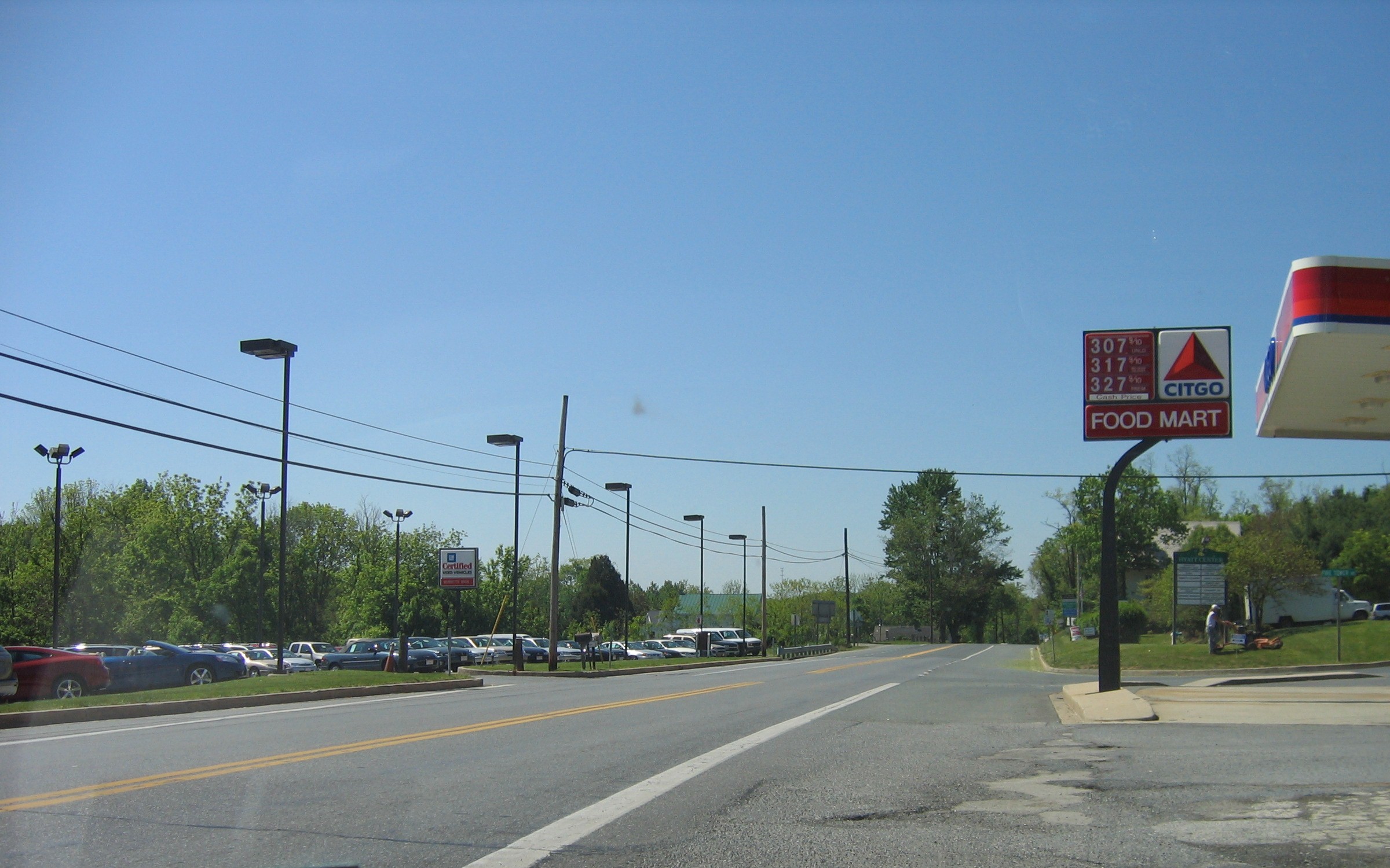
Past this intersection, MD 355 continues into downtown Rockville, where it becomes Hungerford Drive. The road passes by the Rockville train station, which is used by the Metro’s Red line, MARC’s Brunswick Line, and Amtrak’s Capitol Limited.[3] MD 355 heads into more commercial areas with the speed limit increasing to 35 mph (56 km/h). The road passes the Rockville campus of Montgomery College before intersecting Gude Drive. Past this intersection, MD 355 becomes Frederick Road and heads northwest into a mix of commercial and residential areas as a 40 mph (64 km/h) road in Derwood, drawing further away from the railroad tracks. The route leaves Rockville and intersects Shady Grove Road. Past Shady Grove Road, MD 355 interchanges with Interstate 370 and crosses into Gaithersburg.[1][3] Here, the road heads through more commercial areas before heading into residential neighborhoods.[3] It heads into business areas again as it approaches downtown Gaithersburg, where the speed limit drops to 30 mph (48 km/h)before the route interchanges with Maryland Route 117 (Diamond Avenue) and continues northwest past more businesses. MD 355 passes the Lakeforest Mall before intersecting Maryland Route 124 (Montgomery Village Avenue). MD 355 passes more strip malls past this intersection as a 40 mph (64 km/h) road before crossing over Great Seneca Creek and leaving Gaithersburg.[1][3] The route continues northwest into Germantown through residential areas before passing businesses again and intersecting Middlebrook Road.[3] It passes through residential developments, with the speed limit increasing to 45 mph (72 km/h) and the road narrowing to four lanes before it reaches an intersection with Maryland Route 118 (Germantown Road). From here, the road passes more homes and a shopping center prior to crossing Maryland Route 27 (Ridge Road).[1][3]
Past MD 27, the road passes more suburban developments before narrowing to a two-lane undivided road and heading through some woodland with a speed limit of 50 mph (80 km/h). It continues northwest through a mix of rural woodland and suburban development in Clarksburg, with the speed limit dropping to 40 mph (64 km/h) and then to 30 mph (48 km/h) before MD 355 intersects Maryland Route 121 (Clarksburg Road). Past this intersection, the speed limit eventually increases back to 50 mph (80 km/h) and the route passes Little Bennett Regional Park on the east and businesses on the west, running closely parallel to I-270 located to the west.[1][3] The route eventually draws farther east of I-270 and heads through residential neighborhoods and woodland before reaching Hyattstown, where the speed limit drops back to 30 mph (48 km/h). In Hyattstown, MD 355 intersects Maryland Route 109 (Old Hundred Road).[1][3]
In Montgomery County, the daily traffic counts on MD 355 range from a high of 69,331 vehicles at the intersection with Bellevue Drive in Bethesda to a low of 8,021 vehicles at the intersection with Comus Road between Clarksburg and Hyattstown in 2007.[1]
Frederick County
After passing through Hyattstown, MD 355 crosses into Frederick County, where it becomes Urbana Pike. Here, it passes some businesses before intersecting Maryland Route 75 (Green Valley Road).[2][3] Past this intersection, the road continues into a more rural setting consisting of farmland, woods, and some residential areas and businesses.[3] The speed limit increases to 50 mph (80 km/h) on this stretch of MD 355.[2] The route reaches Urbana, where it heads onto a four lane divided bypass to the east of the community, while the former alignment of MD 355 continues through Urbana as Maryland Route 355 Business. MD 355 intersects Maryland Route 80 (Fingerboard Road) and passes through residential areas in the Villages of Urbana subdivision, encountering two roundabouts.[3][6] Upon leaving Urbana, the route returns to its original alignment on a two lane undivided road and the speed limit eventually reaches 50 mph (80 km/h) as it continues north through areas of woods and farms with some rural residences. The road passes Monocacy National Battlefield, the site of the Battle of Monocacy Junction in the American Civil War fought on July 9, 1864. Past the battlefield, the road crosses the Monocacy River and a CSX railroad line.[2][3]
In a short distance, MD 355 heads from rural areas into a commercial district on the outskirts of Frederick. The road widens to four lanes and the speed limit drops to 40 mph (64 km/h) as it passes by the Francis Scott Key Mall and several other businesses. It intersects Maryland Route 85 (Buckeystown Pike), which provides access to and from Interstate 70 and U.S. Route 40. MD 355 passes over I-70/US 40 and ends just north of the overpass, with the road continuing north into Frederick as locally-maintained Market Street.[2][3]
History
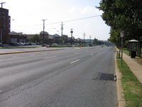
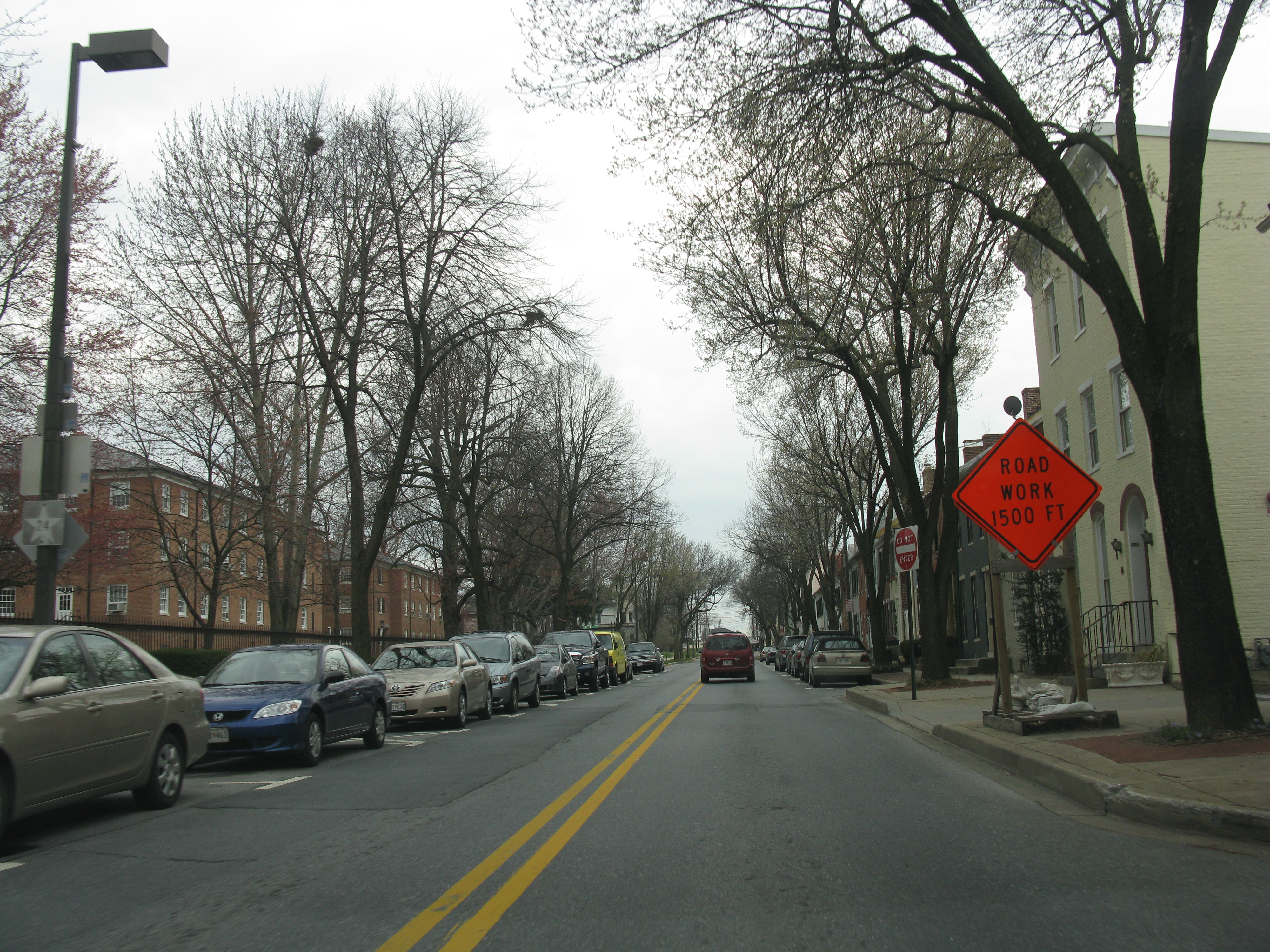
 MD 355 on Market Street in Frederick in 2008, a year before the designation was removed from this portion of road.
The Rockville Pike portion of MD 355 dates back to colonial times and was used as an escape route from Washington during the War of 1812 as well as a route for settlers to travel from Montgomery County to developing areas north and west.[7] In the approved plan for the U.S. Highway System in 1926, U.S. Route 240 was planned to go from Washington, D.C. to Harrisburg, Pennsylvania, running along Wisconsin Avenue and the present-day alignment of Maryland Route 355 between Washington and Frederick, and along US 15 between Frederick and Harrisburg.[8] By 1927, US 240 was designated along the proposed 1926 route south of Frederick with the US 15 designation given to the road north of Frederick.[9] In 1947, plans were made to construct a freeway, the Washington National Pike (now I-270), parallel to US 240.[10] This road was completed in 1953, and the US 240 designation was moved to it.[11] Following the creation of the Interstate Highway System in 1956, Interstate 70S was designated along the US 240 freeway. The bypassed portion of the original US 240, north of the current interchange between I-495 and I-270, was designated as MD 355 by 1960.[12] The US 240 designation was removed from the U.S. Highway System by 1975, with MD 355 being extended south along the former US 240 to the Washington, D.C. border.[13] In 2006, the northern terminus of MD 355 at an interchange with US 15 in Frederick was truncated to a dead end a short distance south of that route.[14]
A four-lane divided bypass of Urbana was constructed for MD 355 in the 2000s. The primary reason for constructing the bypass was to relieve traffic heading through the community brought on by the construction of numerous shopping centers in the area, and the costs for constructing the bypass were entirely paid for by the developers of an area shopping center.[15][16] The proposal for the bypass called for two roundabouts to control traffic.[6] The first portion of the road, which was funded by opened in late 2005 from MD 355 south to a roundabout at Sugarloaf Parkway.[16] On October 30, 2008, construction began to build the connection of the bypass to MD 355 south of MD 80.[17] The realignment of MD 355 onto the bypass was completed by January 2009, with the original alignment becoming Maryland Route 355 Business.[3][18] In 2009, the portion of MD 355 north of the I-70 overpass was transferred to the city of Frederick, with the MD 355 designation officially being removed from this stretch.[2] In 2010, an interchange was completed at Montrose Parkway.[19]
Junction list
County Location Mile
[1][2]Roads intersected Notes Montgomery Friendship Heights 0.00 Western Avenue NW / Wisconsin Avenue south Washington, D.C. border Bethesda 1.14  MD 191 (Bradley Boulevard/Bradley Lane)
1.62  MD 410 east (Montgomery Avenue)
Eastbound direction of MD 410 1.70  MD 187 north (Old Georgetown Road) / MD 410 west (East West Highway)
Westbound direction of MD 410 3.96  I-495 (Capital Beltway) / I-270 north – Baltimore, Silver Spring, Frederick, Northern Virginia
Interchange, I-495 exit 34 North Bethesda 5.27  MD 547 east (Strathmore Avenue)
6.36 MD 187 south (Old Georgetown Road) to I-270 / I-495 westRockville 6.59 Montrose Parkway (MD 927A) Interchange 8.71  MD 911 north (First Street) to MD 28
9.05  MD 660 (Dodge Street)
9.17 MD 28 (Veirs Mill Road) to I-270Gaithersburg 12.68 I-370 west to I-270Interchange, no exit to eastbound I-370, I-370 exit 2 14.38  MD 117 west (West Diamond Avenue)
Interchange, access to and from northbound MD 355 provided by Fulks Corner Avenue 15.43  MD 124 (Montgomery Village Avenue) to I-270
Germantown 18.81  MD 118 south (Germantown Road) to I-270 – Germantown, Montgomery College
19.70 MD 27 (Ridge Road) – Germantown, DamascusClarksburg 22.90 MD 121 south (Clarksburg Road) – BoydsHyattstown 26.45 MD 109 south (Old Hundred Road) to I-270 – Comus, Frederick, WashingtonFrederick 27.07  MD 75 north (Green Valley Road)
Urbana 30.39 MD 80 (Fingerboard Road) to I-270 – Buckeystown, KemptownFrederick 36.61 

 MD 85 (Buckeystown Pike) to I-70 / US 40 / I-270 – Baltimore
36.94 Market Street north – Downtown Frederick References
- ^ a b c d e f g h i j k l m n o p "Highway Location Reference: Montgomery County" (PDF). Maryland State Highway Administration. 2009. http://sha.maryland.gov/Location/2009_MONTGOMERY.pdf. Retrieved 2010-10-21.
- ^ a b c d e f g "Highway Location Reference: Frederick County" (PDF). Maryland State Highway Administration. 2009. http://sha.maryland.gov/Location/2009_FREDERICK.pdf. Retrieved 2010-10-21.
- ^ a b c d e f g h i j k l m n o p q r s t u v w x Google, Inc. Google Maps – overview of Maryland Route 355 (Map). Cartography by Google, Inc. http://maps.google.com/maps?f=d&source=s_d&saddr=wisconsin+avenue+and+western+avenue+friendship+heights,+md&daddr=Hungerford+Dr%2FMD-355+to:N+Frederick+Ave%2FMD-355+to:Frederick+Rd%2FMD-355+to:MD-355%2FUrbana+Pike+to:MD-355%2FUrbana+Pike+to:39.425851,-77.408295+to:wormans+mill+road+%40+39.455,+-77.399&geocode=%3BFfirVAIdALJm-w%3BFUB3VQIdrshl-w%3BFWpRVgIdAEpl-w%3BFbTJVwIdHCVk-w%3BFZPHWAIdJRFj-w%3B%3BFRgJWgIdKPxi-w&hl=en&mra=dpe&mrcr=0&mrsp=6&sz=13&via=1,2,3,4,5,6&sll=39.41564,-77.383747&sspn=0.058617,0.109863&ie=UTF8&ll=39.283294,-77.269592&spn=0.939654,1.757812&t=h&z=9. Retrieved 2009-05-04.
- ^ DeBakey ME (1991). "The National Library of Medicine. Evolution of a premier information center". JAMA 266 (9): 1252–8. doi:10.1001/jama.266.9.1252. PMID 1870251.
- ^ "Bethesda Meeting House". Maryland Historical Trust. http://mht.maryland.gov/nr/NRDetail.aspx?HDID=423&COUNTY=Montgomery&FROM=NRCountyList.aspx?COUNTY=Montgomery. Retrieved 2008-10-29.
- ^ a b Dunne, Patrick (December 29, 2005). "Commercial, school projects take shape in Urbana area". The Gazette. http://www.gazette.net/stories/122905/newmnew161729_31897.shtml. Retrieved 2009-05-06.
- ^ "Chapter I — History" (PDF). Rockville, Maryland. http://www.rockvillemd.gov/rockvillepikeplan/rpcnplan1989-Chapter1.pdf. Retrieved 2009-05-06.
- ^ Bureau of Public Roads (1926). United States System of Highways (Map). http://en.wikipedia.org/wiki/Image:1926us.jpg. Retrieved 2009-04-27.
- ^ Maryland State Highway Administration (1927). Map of Maryland (Map). http://www.mdhighwaycentennial.com/images/template/gallery/maps/1927SIDE1.jpg. Retrieved 2009-03-03.
- ^ "Major transportation milestones in the Baltimore region since 1940" (PDF). Baltimore Metropolitan Council. http://www.baltometro.org/reports/MajorTransMilestones.pdf. Retrieved 2009-04-21.
- ^ "Rodgers Consulting – 50 years of success" (PDF). Rodgers Consulting. http://www.rodgers.com/pdf/Rodgers-Consulting-50-Years-of-Success.pdf. Retrieved 2009-05-06.
- ^ Maryland State Highway Administration (1960). Map of Maryland (Map). http://www.mdhighwaycentennial.com/images/template/gallery/maps/1960SIDE1.jpg. Retrieved 2009-03-03.
- ^ Exxon (1975). Delaware, Maryland, Virginia, West Virginia (Map). Cartography by General Drafting.
- ^ "Highway Location Reference: Frederick County" (PDF). Maryland State Highway Administration. 2006. http://sha.maryland.gov/Location/2006_FREDERICK.pdf. Retrieved 2010-10-21.
- ^ Rigaux, Pamela (June 26, 2006). "Heavy traffic frustrates residents". Frederick News-Post. http://www.fredericknewspost.com/sections/archives/fnp_display.htm?storyid=50061¤t=true. Retrieved 2009-05-07.
- ^ a b McGough, Cailin (March 21, 2008). "Developers: Md. 355 bypass at risk". Frederick News-Post. http://www.fredericknewspost.com/sections/archives/display_detail.htm?StoryID=80247. Retrieved 2009-05-07.
- ^ Mlot, Stephanie (October 30, 2008). "New traffic pattern shifts motorists". Frederick News-Post. http://www.fredericknewspost.com/sections/archives/display_detail.htm?StoryID=89152. Retrieved 2009-05-07.
- ^ Brown, Chris (January 15, 2009). "Village Center construction to finish in March". The Gazette. http://www.gazette.net/stories/01152009/newmnew175643_32477.shtml. Retrieved 2009-05-07.
- ^ "Highway Location Reference: Montgomery County" (PDF). Maryland State Highway Administration. 2010. http://www.roads.maryland.gov/Location/2010_MONTGOMERY.pdf. Retrieved July 2, 2011.
External links
Roads in Montgomery County, Maryland Maryland State Highways 
U.S. Routes Interstate Highways Roads by name Cabin John Parkway · Clara Barton Parkway · Cherry Hill Road · Connecticut Avenue · Georgia Avenue · Montrose Road · New Hampshire Avenue · Randolph Road · Sligo Creek Parkway · Wisconsin Avenue · 16th StreetCategories:- Roads in Frederick County, Maryland
- Roads in Montgomery County, Maryland
- State highways in Maryland


Wikimedia Foundation. 2010.